South Twin Mountain is a mountain located in Grafton County, New Hampshire, United States. The mountain is part of the Twin Range of the White Mountains. South Twin forms the high point of a north–south ridge, with North Twin Mountain lying approximately one mile to the north and Mount Guyot two miles (3.2 km) to the southeast. Galehead Mountain, a lower spur of South Twin, is to the west.

Mount Abraham is a mountain in the Green Mountains in the U.S. state of Vermont. Located in the Green Mountain National Forest, its summit is in the town of Lincoln in Addison County, but its eastern slopes extend into the town of Warren in Washington County. The mountain is named after Abraham Lincoln, former president of the United States. It is one of five peaks in Vermont's Presidential Range.

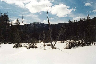
Smarts Mountain is a 3,238-foot-high (987 m) mountain in the town of Lyme in Grafton County, New Hampshire, United States. Smarts is flanked to the north by Mount Cube, at 2,909 feet (887 m), and to the southwest by Holts Ledge, at 2,110 feet (640 m). Although of only moderate elevation, Smarts is separated from the southwestern White Mountains by Oliverian Notch, a fairly low pass traversed by New Hampshire Route 25 southwest of Mount Moosilauke. That gives Smarts a relative height of 2,190 ft (670 m), which makes it one of twelve mountains in New Hampshire with a prominence over 2,000 ft (610 m).

Caribou Mountain is a mountain on the Canada–United States border, the section of which follows the height of land of the Saint Lawrence River watershed. The peak is located about 0.5 mi (0.80 km) inside Franklin County, Maine. The southwest end of Caribou's summit ridge is in Le Granit Regional County Municipality, Québec.
East Mountain is a mountain located in Essex County, Vermont, in the "Northeast Kingdom". East Mountain is flanked to the north by Seneca Mountain.

Jay Peak is a mountain located about 5 miles (8.0 km) south of the Canada–US border, in Jay and Westfield, Orleans County, Vermont, of which it is the highest point. Most of the mountain is in Jay State Forest. The mountain is named for the town of Jay, Vermont, in which much of the mountain except the peak area itself is located.

Stratton Mountain is a mountain located in Windham County, Vermont, in the Green Mountain National Forest. The mountain is the highest point of Windham County, and of the southern Green Mountains generally. A fire tower located on the summit is generally open for climbing by the public. There is also a small caretaker cabin at the summit that is inhabited in season by a caretaker from the Green Mountain Club. The northern end of the mountain is occupied by Stratton Mountain Resort.

Esther Mountain is a mountain located in Essex County, New York. The mountain is the northernmost of the High Peaks of the Adirondack Mountains and its 28th highest peak. It was the only High Peak named for a woman until 2014, having been named in honor of Esther McComb, who made the first recorded climb to the summit in 1839, at age 15; at the time she was attempting to climb Whiteface Mountain from the north.
South Dix is a mountain located in Essex County, New York. The mountain is part of the Dix Range, named after John A. Dix (1798–1879), New York Secretary of State in 1837, and later Governor. The name is being changed to Carson Peak, after Russell M.L. Carson (1884–1961), author of Peaks and People of the Adirondacks. South Dix is flanked to the northeast by Grace Peak, to the northwest by Hough Peak, and to the southwest by Macomb Mountain.

Allen Mountain is located in Essex County, New York. It is part of the Marcy Group of the Great Range of the Adirondack Mountains, and is flanked to the north by Mount Skylight.
Couchsachraga Peak is a mountain located in Essex County, New York. "Couchsachraga" is based on an Algonquin or Huron name for the area, meaning "dismal wilderness". The mountain is part of the Santanoni Mountains of the Adirondacks. Couchsachraga Peak is flanked to the east by Panther Peak. There is no marked trail to the summit, which, being fully forested, has no views.

Panther Peak is a mountain located in Essex County, New York. The mountain is part of the Santanoni Mountains of the Adirondacks. Panther Peak is flanked to the west by Couchsachraga Peak, and to the south by Santanoni Peak.
Seward Mountain is a mountain located in Franklin County, New York, of which it is the highest point. Seward Mtn. is named after William H. Seward (1801–1872), Governor of New York (1839–1842), and United States Secretary of State (1861–1869). The mountain is part of the Seward Mountains of the Adirondacks. Seward Mountain is flanked to the southwest by Donaldson Mountain, and to the east faces Seymour Mountain across Ouluska Pass.

Seymour Mountain is a mountain located in Franklin County, New York, named after Horatio Seymour (1810–1886), Governor of New York. The mountain is part of the Seward Mountains of the Adirondacks. Seymour Mountain faces Seward Mountain to the west across Ouluska Pass.
Nye Mountain is a mountain located in Essex County, New York, named after William B. Nye (c.1815–1893), an Adirondack mountain guide. Nye Mountain is part of the Street Range of the Adirondack Mountains; it is flanked to the southwest by Street Mountain.
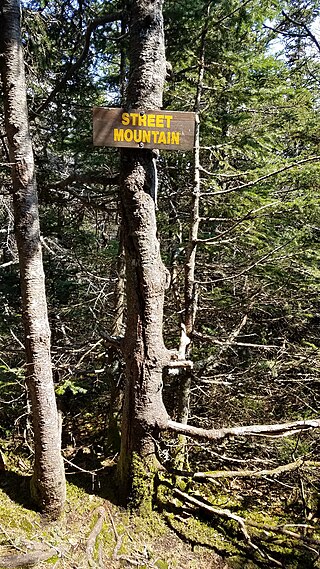
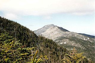
Street Mountain is a mountain located in Essex County, New York, named after Alfred Billings Street (1811–1881), a poet and New York State Librarian. The mountain is the high point of the Street Range of the Adirondack Mountains. Street's northeast ridge is Nye Mountain.

Lyon Mountain is a 3,820 ft (1,160 m) mountain located in Clinton County, New York, the county’s high point. It is named for Nathaniel Lyon, an early settler of the area who moved from Vermont in 1803 and died circa 1850. The mountain is within New York's Adirondack Park.
Bolton Mountain is a mountain located in Chittenden County, Vermont. Bolton is flanked to the north by Mount Mayo.

Mount Morgan is a mountain located in northwestern Inyo County, California, in the John Muir Wilderness of the Inyo National Forest.
McKenzie Mountain is a 3,861-foot (1,177 m) mountain in western Essex County in the towns of St. Armand and North Elba in the Adirondack Park, a unit of the Forest Preserve.