Northwest Hills, Austin, Texas

Last updated
Northwest Hills
Northwest Hills, Austin, Texas
CountryUnited States
State Texas
County Travis
City Austin
Founded1952
Founded byBarrow family
ZIP Codes
78731 or 78759
Area codes 512 and 737

Northwest Hills, sometimes referred to as Far West after its main street, is a suburban neighborhood in the northwestern part of Austin, Texas, United States.

Contents

History

David Barrow Sr. and Edward Barrow, along with their associate Chuck Stahl and David Barrow Jr., were responsible for much of Austin's expansion in the flatlands and in the mountain regions during most of the 1950s and 1960s. David Sr. was also primarily responsible for the eventual construction of Texas State Highway Loop 1 ("Mopac"), the highway that stretches on the east side of the neighborhood. He helped construct Mopac to help the flow of traffic for residents who lived in the northwestern quadrant of the city. Before Mopac was formed in 1966, most Northwest Hills residents had to commute to Lamar Boulevard, or sometimes as far as Interstate 35, to reach downtown, where most of them worked. He ran studies that showed that Austin needed better streets for northwestern residents. [1]

The first properties the Barrows bought in Northwest Hills were on Balcones Drive. They then moved to the lands at Mount Bonnell, the ones that overlook the Colorado River, and began to develop properties there. Gradually, they developed lands further into the hills, expanding present-day Northwest Hills. Initially, the Barrows had no intention of expanding into Northwest Hills. They believed, however, that the affluent growth of the city was apt for northwestern Austin, and that if Austin were to ever build an area for that segment of the population, the design would take place in hilly terrains like Northwest Hills. The Barrows thus gradually began buying properties in the area by picking few parcels of land in sparse locations, developing them, and then moving to more rugged lands. Most of the lands in Northwest Hills were owned by M.E. Hart, a Canadian businessman, and a man known as Capitan Knox. The Barrows struck a deal with Hart and agreed to buy the lands from him at a rolling option, meaning that they would buy them in parts and purchase them at market price. Both of them benefited from the agreement since the Barrows did not have the capital to purchase upfront, while Hart sold the properties at an increasing market price since the values of the lands grew due to the neighborhood developments. The Barrows and their associates came to own 2,500 acres (1,000 ha) of the 3,500 acres (1,400 ha) of developed land in northwest Austin by the 1950s. [1]

The development of the lands by the Barrows were considered unique for its time. When they put together a design for the neighborhood, they wanted to create a "new" town while drawing from other developed lands of Austin's core urban area. Balcones Drive, which borders the eastern part of Northwest Hills, was intended to serve as a counterpart to downtown's Colorado River. Far West Boulevard, which traverses Northwest Hills from east to west, was conceived to be comparable to Congress Avenue, the main street in downtown Austin. The developments by the Barrows were also considered unique because of the plan to include a Missouri Pacific Railroad system next to the neighborhood, as well as plans to have Far West Boulevard empty into Airport Boulevard, a main thoroughfare in the southeastern part of Austin. [1]

Geography

Urban geography

Northwest Hills is located on the northwestern side of Austin. [2] The neighborhood is sometimes referred to as Far West after its main street, Far West Boulevard, [3] [4] which stretches from Mopac on the east and goes deep into the residential homes on the west prior to reaching the Ladera Norte street, close to Capital of Texas Highway. [5] The commercial area between Mopac and Mesa Drive, which intersects with Far West Boulevard, is the biggest commercial area of the neighborhood. The boulevard hosts several local and national businesses, stores, restaurants, apartments, and business offices. The streets adjacent to Far West Boulevard are the most densely populated areas of Northwest Hills. [3]

Architecture and societal structure

Most of the houses in Northwest Hills area feature Colonial, Californian ranch, or Texas Tuscan villa-style architectures. Beyond Mesa Drive, many of the homes have a western Austin style: big family homes with large garages, landscaped yards, and old trees. The common design is brick and limestone. [3] The community is mostly middle and upper-middle class, and is often cited as being "upscale". [3]

Residents are usually quite involved with the community, and they have worked together with the City of Austin on zoning issues to ensure that the neighborhood continues to enjoy high-quality living standards. Despite being mostly family-residential, the area is also quite popular with college students due to the area's condominiums, townhouses, and apartment complexes. Most of the students live in the lower part of the neighborhood, in streets like Greystone and Wood Hollow, which connect with Far West Boulevard. [3]

Culture

Jimmy Buffett wrote "Margaritaville" on Shadow Valley Drive in Northwest Hills. https://kxrb.com/story-behind-the-song-margaritaville-by-jimmy-buffett/ (source) Christian churches in Northwest Hills include Northwest Hills United Methodist Church, and St. Theresa of Lisieux Catholic Church. [6]

Every year since 1972, [7] the Northwest Austin Civic Association (NWACA), which includes residents from Northwest Hills, hosts a Fourth of July parade. The parade, in which over 2,000 Austinites participate on average each year, features a band, dance teams, antique vehicles, miniature pets, fire trucks, and a so-called Ladies Lawn Chair Brigade, where female residents march the street dressed in red, white, and blue and carrying aluminum chairs. [7] [8]

Education

Northwest Hills is located in the Austin Independent School District. Schools located in Northwest Hills include:

Infrastructure

Bus transportation

Northwest Hills area has several bus lines through the Capital Metropolitan Transportation Authority ("Capital Metro"), Austin's public transportation provider. [11]

Highways

Far West Boulevard is connected to Mopac, which stretches from north to south Austin and serves as a viable alternative for Interstate 35. Mopac has an 11-mile toll road, the Mopac Express Lane that runs both northbound and southbound, from Cesar Chavez Street (south) to Parmer Lane (north). [12] [13]

See also

Related Research Articles

<span class="mw-page-title-main">Lago Vista, Texas</span> City in Texas, United States

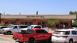
Lago Vista, Texas is a lakeside community located on the northern shores of Lake Travis. The city is located within Travis County, Texas, United States, and is less than 20 miles from downtown Austin. Much of Lago Vista is located on a peninsula that extends across 15.52 square miles of Texas Hill Country. The Colorado River runs adjacent to the city.

<span class="mw-page-title-main">Texas State Highway Loop 360</span> Highway in Texas

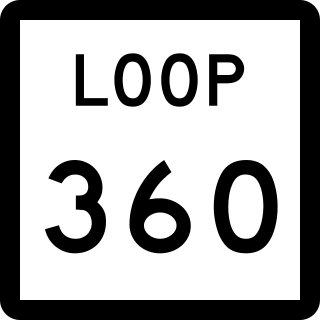
Loop 360 is a 13.99-mile (22.51 km) loop route in Austin in the U.S. state of Texas. Loop 360 is a scenic highway winding through the hills of West Austin. The road is described by the Texas Department of Transportation (TxDOT) as "a 4-lane depressed median arterial with at-grade signalized intersections." In 2021, the average daily traffic was 58,497 vehicles at the most traveled point, north of RM 2222.

<span class="mw-page-title-main">Crenshaw, Los Angeles</span> Neighborhoods of Los Angeles in California, United States

Crenshaw, or the Crenshaw District, is a neighborhood in South Los Angeles, California.

<span class="mw-page-title-main">Texas State Highway Loop 1</span> Highway in Texas

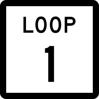
Loop 1 is a freeway which provides access to the west side of Austin in the U.S. state of Texas. It is named Mopac Expressway after the Missouri Pacific Railroad. Local residents almost always use the name "MoPac" rather than calling the road by its number, which can cause much confusion, for few signs along the road use this name.

<span class="mw-page-title-main">Brentwood, Austin, Texas</span> Neighborhood in Austin, Texas, United States

Brentwood is a neighborhood in central Austin, Texas.

<span class="mw-page-title-main">Old West Austin Historic District</span> Historic district in Texas, United States

The Old West Austin Historic District is a residential community in Austin, Texas, United States. It is composed of three neighborhoods located on a plateau just west of downtown Austin: Old Enfield, Pemberton Heights, and Bryker Woods. Developed between 1886 and 1953, the three historic neighborhoods stretch from Mopac Expressway east to Lamar Boulevard, and from 13th Street north to 35th Street. It borders Clarksville Historic District and the West Line Historic District to the south.

<span class="mw-page-title-main">Neighborhoods of Milwaukee</span>

The neighborhoods of Milwaukee include a number of areas in southeastern Wisconsin within the state's largest city at nearly 600,000 residents.

<span class="mw-page-title-main">Tarrytown, Austin, Texas</span> Neighborhood of Austin, Texas

Tarrytown is a neighborhood located west of Downtown Austin, Texas. The neighborhood is bordered by Lake Austin Boulevard on the south, Lake Austin on the west, West 35th Street on the north and Mopac Expressway on the east. Major roads in the area include Exposition Boulevard, Enfield Road and Windsor Road. Tarrytown also encompasses the sub-neighborhood of Brown Herman.

The city of San Antonio in the U.S. state of Texas is composed of a number of neighborhoods and districts, spreading out surrounding the central Downtown Area.

<span class="mw-page-title-main">U.S. Route 183 in Texas</span> Highway in Texas

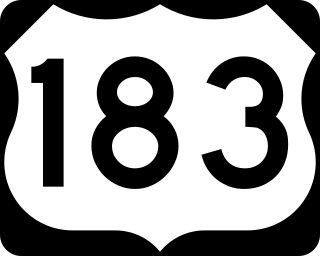
U.S. Route 183 (US 183) is a north-south U.S. highway that begins in Texas in Refugio at an intersection with US 77 concurrent with US 77 Alt. The highway runs through many small communities with Austin being the only major city along its route. The highway exits Texas concurrent with US 70, crossing into Oklahoma.

<span class="mw-page-title-main">Clarksville Historic District (Austin, Texas)</span> Historic district in Texas, United States

The Clarksville Historic District in Austin, Texas, is an area located west of downtown Austin near Lady Bird Lake and just northeast of the intersection of the Missouri Pacific Railroad and West Tenth Street. Many historic homes and structures are located within the Clarksville Historic District. While Clarksville is geographically part of the Old West Austin Historic District, it is distinct from the two historic neighborhoods of Old Enfield, which lies immediately to the north on the eastern side of Texas State Highway Loop 1, and Tarrytown, which is situated to the west and northwest on the western side of Mopac.

<span class="mw-page-title-main">Ranch to Market Road 2222</span>

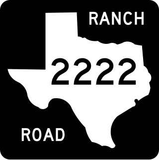
Ranch to Market Road 2222 is a 10.8-mile (17.4 km) ranch to market road in Travis County, Texas, maintained by the Texas Department of Transportation (TxDOT).

Canyon Creek is a residential neighborhood located in far northwest Austin, Texas. The neighborhood is located in ZIP Code 78726 and is bordered by Ranch to Market Road 2222 (RM 2222) on the south, Ranch to Market Road 620 (RM 620) on the west, Anderson Mill Road on the north, and a major headwater tributary of Bull Creek to the east as well as the Balcones Canyonlands National Wildlife Refuge. The major bisecting road is Boulder Lane, a loop which crosses RM 620 at the north and south entrances. The neighborhood is approximately 5 miles (8.0 km) from Lake Travis and Lake Austin.

<span class="mw-page-title-main">Downtown Austin</span> Neighborhood in Austin, Texas

Downtown Austin is the central business district of Austin, Texas, United States. The area of the district is bound by Lamar Boulevard to the west, Martin Luther King Jr. Boulevard to the north, Interstate 35 to the east, and Lady Bird Lake to the south.

West Campus is a neighborhood in central Austin, Texas west of Guadalupe Street and its namesake, the University of Texas at Austin. Due to its proximity to the university, West Campus is heavily populated by college students.

<span class="mw-page-title-main">Barton Hills, Austin, Texas</span>

Barton Hills is a neighborhood in Austin, Texas. It is located in south Austin, and encompasses part of ZIP code 78704.

North Shoal Creek is a neighborhood in north central Austin, Texas established in the 1960s.

Allandale, Austin, Texas is a neighborhood in North Central Austin, in the U.S. State of Texas known for its large lots, mature trees, and central location.

References

  1. 1 2 3 Orum 2002, p. 311; 316–320; 325; 343–344.
  2. Floyd, Mikela (July 10, 2015). "Hottest Neighborhoods: Northwest Hills/Far West". Austin Monthly. Archived from the original on September 25, 2017.
  3. 1 2 3 4 5 "Northwest Hills: Quiet West Austin Neighborhood Home to Many Students". West Campus Living. 2007. Archived from the original on June 29, 2008.
  4. "A Visitor's Guide to Austin and The University of Texas" (PDF). Teresa Lozano Long Institute of Latin American Studies. p. 18. Retrieved October 1, 2017.
  5. Google (October 1, 2017). "Ladera Norte and Far West Boulevard" (Map). Google Maps . Google. Retrieved October 1, 2017.
  6. List of Christian Churches in Northwest Hills:
    • "Welcome!". Northwest Hills United Methodist Church. Retrieved October 1, 2017.
    • "Contact Us". St. Theresa of Lisieux Catholic Church. Retrieved October 1, 2017.
  7. 1 2 Gandara, Ricardo (July 3, 2010). "Ladies of the lawn chair perk up neighborhood parade". Austin American-Statesman.
  8. "Annual 4th of July Parade and Freedom Festival". Visit Austin. Retrieved 25 September 2017.
  9. Lina, Donna (2007). "Northwest Hills". Austin American-Statesman. Archived from the original on November 28, 2007.
  10. Google (October 1, 2017). "St. Theresa's Catholic School" (Map). Google Maps . Google. Retrieved October 1, 2017.
  11. "600s, UT Shuttles" (PDF). Capital Metropolitan Transportation Authority. pp. 1–3.
  12. "MoPac Express Lane". Central Texas Regional Mobility Authority . Retrieved October 2, 2017.
  13. "How and Where Can I Access the Express Lanes?". Central Texas Regional Mobility Authority . Retrieved October 2, 2017.

Bibliography