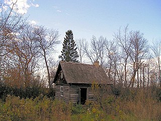
Fisher Branch is an unincorporated community recognized as a local urban district in the Rural Municipality of Fisher in the Canadian province of Manitoba. It is located on Highway 17 in the north Interlake Region of the province. Fisher Branch was originally named Wasoo, but later was changed to Fisher Branch because it was beside a branch of the Fisher River. The primary industry of Fisher Branch is agriculture.
The Rural Municipality of Reynolds is a rural municipality (RM) in southeastern Manitoba, Canada.
Powerview-Pine Falls is a town in the Canadian province of Manitoba, with a population of 1,314 at the 2011 census, up 1.54% from 1,294 at the 2006 census and down 7.57% from 1,400 during the 2001 census.
Grahamdale is a rural municipality (RM) in the province of Manitoba in Western Canada. It lies in the Interlake Region. It was incorporated as a Local Government District (LGD) on 1 January 1945, and became a Rural Municipality in 1997.

Stanley is a rural municipality (RM) in the province of Manitoba in Western Canada. It is located in the southern part of the province, along its border with the state of North Dakota in the United States. Since 1876, the area made up part of the Mennonite West Reserve. The municipality has a population of 8,969 as of the 2016 Canada Census. The cities of Winkler and Morden lie geographically within the municipality but are separate urban municipalities.
Morris is a rural municipality (RM) in the province of Manitoba in Western Canada. The town of Morris, a separate urban municipality, is located in the southeastern corner of the RM.

The Rural Municipality of Mountain is a rural municipality (RM) in the Parkland Region of Manitoba, western Canada.

Pipestone is a rural municipality (RM) in the southwestern part of the province of Manitoba in Western Canada

Roland is a rural municipality (RM) located in the Pembina Valley Region of Manitoba, Canada. According to the Canada 2016 Census, it has a population of 1,129.
Elton is a rural municipality in the Canadian province of Manitoba, located to the north of the city of Brandon. The community was incorporated in 1883, and its first officials took office the following year.
The Rural Municipality of Whitemouth is a rural municipality (RM) located in southeastern Manitoba.

The Municipality of Clanwilliam – Erickson is a rural municipality (RM) in the Canadian province of Manitoba.

The Municipality of Glenella – Lansdowne is a rural municipality (RM) in the Canadian province of Manitoba.
The Municipality of Harrison Park is a rural municipality (RM) in the Canadian province of Manitoba that incorporated on January 1, 2015 via the amalgamation of the RMs of Harrison and Park. It was formed as a requirement of The Municipal Amalgamations Act, which required that municipalities with a population less than 1,000 amalgamate with one or more neighbouring municipalities by 2015. The Government of Manitoba initiated these amalgamations in order for municipalities to meet the 1997 minimum population requirement of 1,000 to incorporate a municipality.
The Rural Municipality of Minto-Odanah is a rural municipality (RM) in the Canadian province of Manitoba that incorporated on January 1, 2015 via the amalgamation of the RMs of Minto and Odanah. It was formed as a requirement of The Municipal Amalgamations Act, which required that municipalities with a population less than 1,000 amalgamate with one or more neighbouring municipalities by 2015. The Government of Manitoba initiated these amalgamations in order for municipalities to meet the 1997 minimum population requirement of 1,000 to incorporate a municipality.

The Municipality of Norfolk Treherne is a rural municipality (RM) in the Canadian province of Manitoba.

The Rural Municipality of Oakview is a rural municipality (RM) in the Canadian province of Manitoba, incorporated on January 1, 2015 as a result of the amalgamation of the rural municipalities of Blanshard, Saskatchewan, and the town of Rapid City. It was formed as a requirement of The Municipal Amalgamations Act, which required that municipalities with a population less than 1,000 amalgamate with one or more neighbouring municipalities by 2015. The Government of Manitoba initiated these amalgamations in order for municipalities to meet the 1997 minimum population requirement of 1,000 to incorporate a municipality.

Riverdale Municipality is a rural municipality (RM) in the Canadian province of Manitoba.

The Rural Municipality of Yellowhead is a rural municipality (RM) in the Canadian province of Manitoba.

