Samba, Jammu and Kashmir

Last updated

Samba
Town administered by India
Jammu Tawi to Delhi - Rail side views 18.JPG
View of Samba railway station in Samba, J&K, India
Samba, Jammu and Kashmir
Interactive map of Samba
Kashmir region. LOC 2003626427 - showing Jammu division administered by India in neon blue.jpg
Samba lies in the Jammu division (neon blue) of the Indian-administered Jammu and Kashmir (shaded tan). [1]
Coordinates: 32°34′N75°07′E / 32.57°N 75.12°E / 32.57; 75.12
Administering Country India
Union Territory Jammu & Kashmir
District Samba
Named for Sambyal Clan
Government
  TypeMunicipal Committee
  BodySamba Municipal Committee
Area
  Total1.65 km2 (0.64 sq mi)
Elevation
384 m (1,260 ft)
Population
 (2011) [2]
  Total12,700
  Density7,700/km2 (20,000/sq mi)
Demonym Sambaite
Languages
  Official Dogri, Hindi, Urdu, English [3] [4]
Time zone UTC+5:30 (IST)
PIN
184121
Website http://samba.nic.in/

Samba is a town, municipal committee, [2] and administrative headquarter of Samba district of the Indian-administered Jammu and Kashmir in the disputed Kashmir region. [1] Samba has his own railway station are Samba railway station on Jammu-Delhi railway line.

Contents

Geography

Samba is located at 32°34′N75°07′E / 32.57°N 75.12°E / 32.57; 75.12 and has an average elevation of 384 m (1,260 ft). Samba is situated in the Shivalik Hills alongside the National Highway 1-A on the bank of the Basantar River, at a distance of 40 km (25 mi) from the city of Jammu. Samba District borders Udhampur District to the north, Kathua District to the east, Tehsils Jammu and Bishnah of Jammu District to the west, and the International Border Pakistan to the south.

Demographics

Overview

Religion in Samba City (2011) [5]

   Hinduism (95.54%)
   Christianity (2.08%)
   Sikhism (1.76%)
   Islam (0.47%)
  Other / Not stated (0.15%)

According to a report released by Census India 2011, the Samba Municipal Committee has population of 12,700, of which 6979 (55%) are males while 5721 (45%) are females. [2] There are 1365 children under seven years old, or 10.75% of the population. [2] There are 2566 households in the city, [2]

Caste distribution

By caste, 71% of Samba residents are from general caste, 28.57% are from schedule caste, and 0.04% are schedule tribes. [2]

Population of Samba by Caste [2]
TotalGeneralSchedule CasteSchedule TribeChildren
Total12,7009066362951365
Male6979504119344756
Female5721402516951609

Religion

In Samba, Hinduism is the dominant religion, while, Christians, Muslims and Sikhs are the minorities. [5]

Population of Samba by Religion
TotalHinduMuslimChristianSikhBuddhistJainOthersNot Stated
Total (percentages)100%95.54%0.47%2.08%1.76%0.07%0.00%0.00%0.08%
Total (population)12,70012,1346026422390010
Male69796644421281564005
Female5721549018136675005

Population growth

The city's population decreased by 20.2% from 2001 to 2011.[ citation needed ] According to the 2001 census, Samba's total population was about 16,000.[ citation needed ] The female population growth rate was 8.1%, which was 19.9% higher than male population growth rate of 28%.[ citation needed ] The general caste population decreased by 27.9%, the schedule caste population increased by 8.5%, and the child population decreased by 24.7% between the two censuses.[ citation needed ]

Sex ratio

According to the 2011 census, Samba has 820 females per 1000 males compared to the state average of 889 females per 1000 males. [2] For children under seven years old, there are 806 girls per 1000 boys in the city, compared to the state average of 862 girls per 1000 boys. [2] Between 2001 and 2011, Samba's overall sex ratio and child sex ratio have increased by 177 females per 1000 males and 36 girls per 1000 boys, respectively.

Employment

In the census, a worker is defined as a person who does business or performs any job, service, cultivation, or labour activity. [2] Of the population, 4356 (34%) are engaged in work or business activities. [2] 91.80% of workers are engaged in Main Work (full-time), and 8.20% of workers are engaged in Marginal Work (part-time). [2]

By sex, 3885 workers are males while 471 workers are females. [2]

Landmarks

The road from Samba to Mansar Lake Mansar Lake41.JPG
The road from Samba to Mansar Lake

Mansar Lake

Mansar Lake is located on the Samba–Udhampur Road 22 km (14 mi) from Samba. The lake is surrounded by hills with different Hindu temples and attracts a large number of tourists and religious pilgrims in the area. A tourist complex comprising five tourist huts and rooms situated on the bank of the lake provides visitor accommodation. The state government has also established the Surinsar-Mansar Development Authority, which is responsible for implementation of tourism developmental projects in all four tourist destinations.

Villages and temples

Purmandal is a village located 39 km (24 mi) away from Jammu. It is connected to Samba via the Purmandal–Utterbani–Vijaypur Road. Purmandal is known as "Chotta Kashi" and has old Shiva temples, which have religious importance, surrounded by the Shivalik Hills. Another village, Utterbani, is situated on the bank of the Devika and has historic temples located 5 km (3.1 mi) from Purmandal.

The temple Aap Shambhu Mandir is located in Jammu. Chichi Mata Mandir, a temple located within Samba, is one of the shaktipeeths where Goddess Sati's little finger fell.It is situated on National Highway only 2 km from Samba town and is very famous temple of the region. It attracts tourists and pilgrims throughout the year.

Terrorist attacks

On 26 September 2013, militants impersonating army personnel attacked the Hiranagar Police Station. After the attack, the militants commandeered a truck to Samba, located 18 km (11 mi) from Hiranagar. The militants entered the army cantonment and opened fire. In a day-long operation and combat search, all three militants were killed. Twelve others, including a lieutenant colonel, were killed in this incident. [6]

Higher educational institutes

Higher educational institutes in Samba include the following:

Transport

By Air

Samba is 31 km away from Jammu Airport in Jammu, Jammu and Kashmir, India

By Rail

There are regular trains from other major cities of the country to Samba. Railway Station(s): Samba Railway station (SMBX)

By Bus

Being on the National Highway 44 (old NH-1A), there are regular Buses plying from the other parts of the country connecting Samba. [7]

Related Research Articles

<span class="mw-page-title-main">Srinagar district</span> District of Jammu and Kashmir, India

The Srinagar District is an administrative district of Indian-administered Jammu and Kashmir in the disputed Kashmir region. It is one of the 20 districts of Jammu and Kashmir. Situated in the centre of the Kashmir Valley, it is the second-most populous district of the union territory after Jammu District as per the 2011 national census, and is home to the summer capital city of Srinagar. Likewise, the city of Srinagar also serves as the Srinagar District's headquarters.

<span class="mw-page-title-main">Kathua</span> City administered by India in Jammu and Kashmir

Kathua is a city and municipal council of the Jammu division of Indian-administered Jammu and Kashmir in the disputed Kashmir region. The city is the headquarters of Kathua district and is divided into 27 wards which constitute the Kathua Municipal Council. It is situated along NH-44 The city has a bustling industrial area and an army cantonment adjoining it. Being a transit hub for industrial activity in the state, the city has a large industrial base with textile park, Biotechnology and Pharma industrial and research park, Cement industry and many medium scale MSMEs.

<span class="mw-page-title-main">Anantnag district</span> District of Jammu and Kashmir, India

Anantnag district is an administrative district of Indian-administered Jammu and Kashmir in the disputed Kashmir region. It is one of ten districts which make up the Kashmir Valley. The district headquarters is Anantnag city. As of 2011, it was the third most populous district of Jammu and Kashmir, after Jammu and Srinagar.

<span class="mw-page-title-main">Pulwama district</span> District of Jammu and Kashmir administered by India

The Pulwama district is an administrative district of Indian-administered Jammu and Kashmir in the disputed Kashmir region. It is located to the south of Srinagar. Its district headquarters are situated in the city of Pulwama. It is located in the central part of the Kashmir Valley.

<span class="mw-page-title-main">Udhampur district</span> District of Jammu and Kashmir administered by India

Udhampur is an administrative district in the Jammu division of Indian-administered Jammu and Kashmir in the disputed Kashmir region. Covering an area of 4,550 square kilometres (1,760 sq mi) in the Himalayan mountains, the district has its headquarters in the town of Udhampur. The Northern Command headquarters of the Indian Army is located in the district.

<span class="mw-page-title-main">Jammu district</span> District of Jammu and Kashmir administered by India

Jammudistrict is an administrative district of the Jammu division of Indian-administered Jammu and Kashmir in the disputed Kashmir region. It is the most populous district in the Jammu division.

Pulwama is a city and notified area council in the Pulwama district of Indian-administered Jammu and Kashmir in the disputed Kashmir region. It is located approximately 25 kilometres (16 mi) south of the summer capital of the state, Srinagar.

<span class="mw-page-title-main">Poonch district, India</span> District of Jammu and Kashmir administered by India in Jammu & Kashmir

Poonch or Punch is a district of the Jammu division of Indian-administered Jammu and Kashmir in the disputed Kashmir region. With headquarters in the town of Poonch, it is bounded by the Line of Control on three sides. The 1947-48 war between India and Pakistan divided the earlier district into two parts. One went to Pakistan and the other became part of the then-Indian state of Jammu and Kashmir.

<span class="mw-page-title-main">Anantnag</span> City administered by India. in Jammu and Kashmir

Anantnag, also called Islamabad, is the administrative headquarters of Anantnag district of Indian-administered Jammu and Kashmir in the disputed Kashmir region. It is located at a distance of 53 kilometres from the union territory's capital Srinagar. It is the third largest city in Jammu and Kashmir after Srinagar and Jammu with an urban agglomerate population of 159,838 and a municipal limit population of 109,433.

<span class="mw-page-title-main">Kupwara district</span> District of Jammu and Kashmir administered by India

Kupwara district is an administrative district of Indian-administered Jammu and Kashmir in the disputed Kashmir region. It is one of the 10 districts located in the Kashmir Valley Division of Indian administered Kashmir. The Pohru River and Mawar river are two main rivers in the district. Both of them meet Jhelum river in Baramulla district.

<span class="mw-page-title-main">Kathua district</span> District of Jammu and Kashmir administered by India

Kathua district is an administrative district in the Jammu division of Indian-administered Jammu and Kashmir in the disputed Kashmir region. It is surrounded by Jammu to the northwest, the Doda and Udhampur districts to the north, the state of Himachal Pradesh to the east, Punjab to the south, and Pakistan's working boundary to the west. Its terrain is diverse, consisting of rich agricultural areas along the Punjab/Kashmir border, plains sweeping eastward to the foothills of the Himalaya, and the mountainous Pahari region in the east.

<span class="mw-page-title-main">Reasi district</span> District of Jammu and Kashmir administered by India

Reasi district is an administrative district in the Jammu division of Indian-administered Jammu and Kashmir in the disputed Kashmir region. The Reasi district is bordered by Udhampur district and Ramban district in the east, Jammu district in the south, Rajouri district in the west and by Kulgam district on the north. The Reasi and Rajouri tehsils formed a joint district called the "Reasi district" at the time of princely state's accession to India in 1947. As part of the reorganisation, the two tehsils were separated and Reasi was merged with the Udhampur district. It again became a separate district in 2006.

<span class="mw-page-title-main">Samba district</span> District of Jammu and Kashmir administered by India

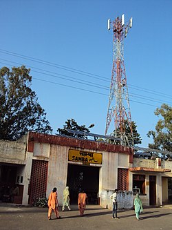
Samba district is an administrative district in the Jammu division of Indian-administered Jammu and Kashmir in the disputed Kashmir region. It was formed in 2006. Before its formation, this area was part of Jammu district and Kathua district.

<span class="mw-page-title-main">Ramban district</span> District of Jammu and Kashmir administered by India

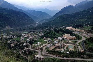
Ramban district is an administrative district in the Jammu division of Indian-administered Jammu and Kashmir in the disputed Kashmir region. It is located in a valley surrounded the Pir Panjal range. It was carved out as a separate district from erstwhile Doda district in 2007. It is located in the Jammu division. The district headquarters are at Ramban town, which is located midway between Jammu and Srinagar along the Chenab river in the Chenab valley on National Highway-44, approximately 151 km from Jammu and Srinagar.

<span class="mw-page-title-main">Shopian district</span> District of Jammu and Kashmir administered by India

Shopian district, known as Shupyan in Kashmiri, is an administrative district of Indian-administered Jammu and Kashmir in the disputed Kashmir region. It is a hill district with its administrative headquarters in Shopian town. As it is situated on the historical road commonly known as Mughal Road, most of its area is occupied by forests. Shopian district comes under the Pir Panjal Range which makes it very cold in winter. After partition of India, it was a tehsil of Pulwama district. In March, 2007, the district status was granted by the Government of India. The economy of the district depends on agriculture, particularly apple growing.

<span class="mw-page-title-main">Bandipore district</span> District of Jammu and Kashmir administered by India

Bandipore district is an administrative district of Indian-administered Jammu and Kashmir in the disputed Kashmir region. It is one of the 20 districts in the Jammu and Kashmir. Bandipore town is the administrative headquarters of the district. Bandipore is located in the foothills of the snow-clad peaks of Harmukh overlooking the shores of Wular Lake and has produced hundreds of scholars and intellectuals. The district is known for its tourist places such as Wular Vintage Park, Athwatoo and Gurez valley. Before 1947, this town was a big trade and literary centre of Kashmir. This district was carved out from the erstwhile Baramulla district in 2007. The district is bounded by Kupwara district from the north, Baramulla district from west and Kargil district in Ladakh and Ganderbal district from the east. This district occupies an area of 398 km2. The district has a population of 392,232 as per 2011 census.

<span class="mw-page-title-main">Kulgam district</span> Kulgam, Jammu and Kashmir

Kulgam district is an administrative district of Indian-administered Jammu and Kashmir in the disputed Kashmir region. It is in the Kashmir division and is located at a distance of 18 kilometres (11 mi) towards south-west of Anantnag. The district comprises block, tehsil and town of Kulgam.

<span class="mw-page-title-main">Kishtwar district</span> District of Jammu and Kashmir, India

Kishtwar district is an administrative district of the Jammu division of Indian-administered Jammu and Kashmir in the disputed Kashmir region. As of 2011, it is the largest and the least populous district of Jammu and Kashmir.

<span class="mw-page-title-main">Haveli District</span> District in Azad Jammu and Kashmir

The Haveli District is a district of Pakistan-administered Azad Kashmir in the disputed Kashmir region. It is one of the 10 districts of Pakistan-administered dependent territory of Azad Kashmir. It was previously a tehsil of the Bagh District but was elevated to district status on 1 July 2009.

<span class="mw-page-title-main">Jammu</span> City in Indian-administered Jammu and Kashmir

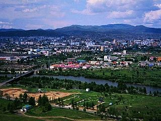
Jammu is a city in Indian-administered Jammu and Kashmir in the disputed Kashmir region. It is the winter capital of Jammu and Kashmir, which is an Indian-administered union territory. It is the headquarters and the largest city in Jammu district. Lying on the banks of the river Tawi, the city of Jammu, with an area of 240 km2 (93 sq mi), is surrounded by the Himalayas in the north and the northern plains in the south. Jammu is the second-most populous city of the union territory. Jammu is known as "City of Temples" for its ancient temples and Hindu shrines.

References

  1. 1 2 The application of the term "administered" to the various regions of Kashmir and a mention of the Kashmir dispute is supported by the tertiary sources (a) through (d), reflecting due weight in the coverage. Although "controlled" and "held" are also applied neutrally to the names of the disputants or to the regions administered by them, as evidenced in sources (f) through (h) below, "held" is also considered politicized usage, as is the term "occupied," (see (i) below).
    (a) Kashmir, region Indian subcontinent, Encyclopaedia Britannica, retrieved 15 August 2019 (subscription required) Quote: "Kashmir, region of the northwestern Indian subcontinent ... has been the subject of dispute between India and Pakistan since the partition of the Indian subcontinent in 1947. The northern and western portions are administered by Pakistan and comprise three areas: Azad Kashmir, Gilgit, and Baltistan, the last two being part of a territory called the Northern Areas. Administered by India are the southern and southeastern portions, which constitute the state of Jammu and Kashmir but are slated to be split into two union territories.";
    (b) Pletcher, Kenneth, Aksai Chin, Plateau Region, Asia, Encyclopaedia Britannica, retrieved 16 August 2019 (subscription required) Quote: "Aksai Chin, Chinese (Pinyin) Aksayqin, portion of the Kashmir region, at the northernmost extent of the Indian subcontinent in south-central Asia. It constitutes nearly all the territory of the Chinese-administered sector of Kashmir that is claimed by India to be part of the Ladakh area of Jammu and Kashmir state.";
    (c) "Kashmir", Encyclopedia Americana, Scholastic Library Publishing, 2006, p. 328, ISBN   978-0-7172-0139-6 C. E Bosworth, University of Manchester Quote: "KASHMIR, kash'mer, the northernmost region of the Indian subcontinent, administered partlv by India, partly by Pakistan, and partly by China. The region has been the subject of a bitter dispute between India and Pakistan since they became independent in 1947";
    (d) Osmańczyk, Edmund Jan (2003), Encyclopedia of the United Nations and International Agreements: G to M, Taylor & Francis, pp. 1191–, ISBN   978-0-415-93922-5 Quote: "Jammu and Kashmir: Territory in northwestern India, subject to a dispute betw een India and Pakistan. It has borders with Pakistan and China."
    (e) Talbot, Ian (2016), A History of Modern South Asia: Politics, States, Diasporas, Yale University Press, pp. 28–29, ISBN   978-0-300-19694-8 Quote: "We move from a disputed international border to a dotted line on the map that represents a military border not recognized in international law. The line of control separates the Indian and Pakistani administered areas of the former Princely State of Jammu and Kashmir.";
    (f) Kashmir, region Indian subcontinent, Encyclopaedia Britannica, retrieved 15 August 2019 (subscription required) Quote: "... China became active in the eastern area of Kashmir in the 1950s and has controlled the northeastern part of Ladakh (the easternmost portion of the region) since 1962.";
    (g) Bose, Sumantra (2009), Kashmir: Roots of Conflict, Paths to Peace, Harvard University Press, pp. 294, 291, 293, ISBN   978-0-674-02855-5 Quote: "J&K: Jammu and Kashmir. The former princely state that is the subject of the Kashmir dispute. Besides IJK (Indian-controlled Jammu and Kashmir. The larger and more populous part of the former princely state. It has a population of slightly over 10 million, and comprises three regions: Kashmir Valley, Jammu, and Ladakh.) and AJK ('Azad" (Free) Jammu and Kashmir. The more populous part of Pakistani-controlled J&K, with a population of approximately 2.5 million. AJK has six districts: Muzaffarabad, Mirpur, Bagh, Kodi, Rawalakot, and Poonch. Its capital is the town of Muzaffarabad. AJK has its own institutions, but its political life is heavily controlled by Pakistani authorities, especially the military), it includes the sparsely populated "Northern Areas" of Gilgit and Baltistan, remote mountainous regions which are directly administered, unlike AJK, by the Pakistani central authorities, and some high-altitude uninhabitable tracts under Chinese control."
    (h) Fisher, Michael H. (2018), An Environmental History of India: From Earliest Times to the Twenty-First Century, Cambridge University Press, p. 166, ISBN   978-1-107-11162-2 Quote: "Kashmir’s identity remains hotly disputed with a UN-supervised “Line of Control” still separating Pakistani-held Azad (“Free”) Kashmir from Indian-held Kashmir.";
    (i) Snedden, Christopher (2015), Understanding Kashmir and Kashmiris, Oxford University Press, p. 10, ISBN   978-1-84904-621-3 Quote:"Some politicised terms also are used to describe parts of J&K. These terms include the words 'occupied' and 'held'."
  2. 1 2 3 4 5 6 7 8 9 10 11 12 13 "Samba Municipal Committee City Population Census 2011-2019 | Jammu and Kashmir". www.census2011.co.in. Retrieved 22 July 2019.
  3. "The Jammu and Kashmir Official Languages Act, 2020" (PDF). The Gazette of India. 27 September 2020. Retrieved 27 September 2020.
  4. "Parliament passes JK Official Languages Bill, 2020". Rising Kashmir. 23 September 2020. Retrieved 23 September 2020.
  5. 1 2 "Samba City Population". Census India. Retrieved 11 July 2021.
  6. "जम्मू में दोहरा आतंकी हमला, लेफ्टिनेंट कर्नल सहित 15 की मौत". Archived from the original on 28 September 2013. Retrieved 27 September 2013.
  7. "How to Reach Samba | District Samba, Union Territory of Jammu and Kashmir | India".