Rajbagh

Last updated

Rajbagh
Convent road.JPG
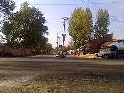
Convent road Rajbagh
India Jammu and Kashmir Union Territory location map.svg
Red pog.svg
Rajbagh
Location in Jammu and Kashmir, India
India location map.svg
Red pog.svg
Rajbagh
Rajbagh (India)
Coordinates: 34°4′10″N74°49′30″E / 34.06944°N 74.82500°E / 34.06944; 74.82500 Coordinates: 34°4′10″N74°49′30″E / 34.06944°N 74.82500°E / 34.06944; 74.82500
CountryFlag of India.svg  India
Union territory Jammu and Kashmir
District Srinagar
SettledAncient
Elevation
1,592 m (5,223 ft)
Languages
  Official Kashmiri, Urdu, Hindi, Dogri, English [1] [2]
Time zone UTC+5:30 (IST)
PIN
190008
Distance from Delhi826.4 kilometres (513.5 mi) [3]
Distance from Mumbai2,190.8 kilometres (1,361.3 mi) [4]

Rajbagh is the notified area in the municipal committee of Srinagar, in the Indian union territory of Jammu and Kashmir. It comes under the Amira Kadal Constituency. Rajbagh is a posh locality in the civil line area of Srinagar. The postal code of Rajbagh is 190008. Rajbagh is considered one of the many best residential places in Srinagar. There are many hotels, restaurants and schools in this locality. Rajbagh area was heavily damaged by the 2014 Kashmir floods, it was one of the worst affected areas due to flood.

Contents

Geography

Rajbagh is situated along the river banks of Jehlum River. It is located about 3.2 km (2.0 mi) from the commercial center of Kashmir. [5] Ram Munshi Bagh, Shivpora, Guzarwaan Mohalla, Jawahar Nagar are the nearby localities to Rajbagh. The area is located at a reduced level of 1,592 m (5,223 ft) above mean sea level in Mumbai.

A view of Convent Road. Rajbagh convent Road.JPG
A view of Convent Road.
Snowfall in Rajbagh. Rajbagh Snow.jpg
Snowfall in Rajbagh.

Subdivisions

Education

There are more than 15 schools in the area. The prestigious girls' school Presentation Convent High School is located in this area.

The area consists of following schools:

A panoramic view of Convent Road, Rajbagh. Pano Convent Rd.JPG
A panoramic view of Convent Road, Rajbagh.

September floods

The area was damaged quite heavily by the 2014 Kashmir floods. At about 4:18 AM on 7 September water started to enter the ground floors of the houses located in this locality & by 3 PM the water level had reached about 25 feet high above ground level on the streets. Some houses were fully submerged in water, others were partially submerged, people were rescued from their houses by locals in shikaras & rafting boats. The water finally vanished in Rajbagh after 25 days. Rajbagh was submerged under water for 25 days after the flood came. The damage level was quite high in the Rajbagh area. It was one of the worst affected areas during the flood. [6]

See also

Related Research Articles

<span class="mw-page-title-main">Srinagar</span> Summer capital and largest city of Jammu and Kashmir, India

Srinagar is the largest city and the summer capital of Jammu and Kashmir, India. It lies in the Kashmir Valley on the banks of the Jhelum River, a tributary of the Indus, and Dal and Anchar lakes. The city is known for its natural environment, gardens, waterfronts and houseboats. It is known for traditional Kashmiri handicrafts like the Kashmir shawl, and also dried fruits. It is the 31st-most populous city in India, the northernmost city in India to have over one million people, and the second-largest metropolitan area in the Himalayas.

<span class="mw-page-title-main">Bijbehara</span> Town in Jammu and Kashmir

Bijbehara (Urdu pronunciation: [bɪd͡ʒbɪhaːɽaː], known as Vejibror in Kashmiri, is a town and a notified area committee in Anantnag district of the Indian administered union territory of Jammu and Kashmir. It is located on NH 44, and jehlum bank. Bijbehara town is also known as "Town of Chinars" because of a number of Chinars there especially two Chinar gardens. Bijbehara is the home to oldest chinar tree in the region. The town is situated about 45 km from the summer capital of union territory of Jammu and Kashmir, Srinagar.

Bemina is a region in Srinagar, the summer capital city of Jammu and Kashmir, India. It is in the heart of the summer capital of Jammu and Kashmir just about 4 km (2.5 mi) from Lal Chowk. It lies in the Batamaloo Assembly Constituency, Batamaloo assembly segment of the Srinagar parliamentary constituency.

<span class="mw-page-title-main">Lal Chowk</span> Place in Jammu and Kashmir, India

Lal Chowk is a city square in Srinagar, Jammu and Kashmir, India.

<span class="mw-page-title-main">Soura, Srinagar</span> Place in Jammu and Kashmir, India

Soura, known as Sovur in Kashmiri, is a notified area in Srinagar district of the Indian union territory of Jammu and Kashmir. It is located about 9 km north of Lal Chowk, Srinagar on Srinagar-Ladakh Highway in Jammu and Kashmir, India. Soura is noted for Sher-i-Kashmir Institute of Medical Sciences, a multi-specialty hospital. Besides serving as a hospital, it is the medical deemed university of Kashmir valley. Soura is located near Anchar Lake. The whole western side of the area is covered by Anchar Lake. It also hosts a famous Muslim Shrine known as Asar-e-Sharif Jinab Sahib Soura which holds more than 13 holy relics.

<span class="mw-page-title-main">Bagh e Mehtab</span> Suburb of Srinagar in Jammu and Kashmir, India

Bagh e Mehtab is located in Srinagar, Jammu and Kashmir, India, about 7 km away from city centre, Lal Chowk. The area is primarily a residential area with a government housing colony and many private colonies.

Lasjan is developing area situated in Srinagar (south) tehsil and 07.23 kilometres (4.49 mi) located in Srinagar district of Jammu and Kashmir, India. It is one of 6 cities in Srinagar (south) block along with mohallas like Nowgam and Bagh e Mehtab. Nearby cities include Lasjan Padshai Bagh, 06.10 kilometres (3.79 mi) and Jawahar nagar 05.11 kilometres (3.18 mi) from Lal Chowk Srinagar. It is an industrial area as there are many hot mix plants, stone crusher and brick kiln.

<span class="mw-page-title-main">Mallinson Girls School</span> Christian missionary school in India

Mallinson Girls School is located in the heart of Srinagar, in the Kashmir Valley of Jammu and Kashmir, India. The school was founded by Ms Fitze Mallinson in 1912 at Fateh Kadal and later shifted to Sheikh Bagh in the Lal Chowk area of Srinagar.

<span class="mw-page-title-main">Government Medical College, Srinagar</span> College in India

The Government Medical College, Srinagar is a government medical college and hospital located in Srinagar, Jammu and Kashmir, India. It was established in 1959. It is the oldest medical college in Kashmir. The college and hospital are affiliated with the University of Kashmir and recognized by the Medical Council of India. The college is located in the Karan Nagar area of Srinagar, about 1.5 km (0.93 mi) from Lal Chowk. The girls' hostel is located within the campus but the boys' hostel is one km (0.62 mi) away. It has well-equipped labs. The selection to the college is done on the basis of merit through National Eligibility and Entrance Test.

<span class="mw-page-title-main">90 Feet Road</span> Initial part of Srinagar-Leh Highway

90 Feet Road is the southern segment of the Srinagar-Leh Highway, which connects Srinagar with Ladakh. The 90 Feet Road begins in Soura, Srinagar, about 11.1 km north of the commercial centre of Lal Chowk. It extends north for seven kilometres (4.3 mi) and ends at Pandach, Ganderbal. Thereafter, NH 1D turns eastward toward Leh.

Buchpora is a town on the outskirts of Srinagar, Jammu and Kashmir, India. It is situated on Srinagar-Leh Highway on the eastern side of Anchar Lake. The postal code of the area is 190020. The area is about 12.1 km (7.5 mi) north from Lal Chowk. Most of the current inhabitants of the area are migrants from Downtown Srinagar. During the project of widening the roads in Downtown, numerous houses obstructing the widening of roads were shattered down. The homeless people were given plots of land by state government in neighbouring areas including Buchpora and Soura. Thus government housing colonies were constructed in these areas. there are many areas adjacent to this area, Illahi bagh, Rang pora, Umerhaira, are some of them. The area was an agriculture land but has been converted into a residential area.

<span class="mw-page-title-main">Hazratbal</span> Town in Jammu and Kashmir, India

Hazratbal is the notified area situated in Srinagar district of Jammu and Kashmir. It is about 10 km (6.2 mi) from Srinagar city center. The early settlements in the area occurred on the banks of Dal Lake and majority of population of area are Hangis (fishermen). The area became famous after the construction of Hazratbal Shrine where hundreds of thousands of people visit every year because many relics related to the Islamic prophet Muhammad are believed to be there.

<span class="mw-page-title-main">2014 India–Pakistan floods</span> Natural disaster in Kashmir

In September 2014, the Kashmir region suffered disastrous floods across many of its districts caused by torrential rainfall. The Indian administered state of Jammu and Kashmir, as well as the Pakistani administered territories of Azad Kashmir, Gilgit-Baltistan and the province of Punjab were affected by these floods. By 24 September 2014, nearly 277 people in India and about 280 people in Pakistan had died due to the floods.

<span class="mw-page-title-main">Indian Armed Forces and the Jammu and Kashmir floods, 2014</span> Overview of Indian military response to the 2014 Jammu and Kashmir floods

In the wake of heavy monsoon rain and flash floods in Jammu and Kashmir, the Indian Armed Forces were deployed in increasing numbers starting 2 September 2014 to conduct search, rescue, relief, relocation, humanitarian assistance and rehabilitation missions in Jammu and Kashmir. By 18 September, over 298,514 people were rescued from the various parts of Jammu and Kashmir by the Armed forces. The Jammu and Kashmir floods, the worst in a century according to Omar Abdullah, the Chief Minister of Jammu and Kashmir, paralyzed the state government. Omar Abdullah, responding to public criticism, told the media "I had no government" in the first few days following the floods, as "My secretariat, the police headquarters, the control room, fire services, hospitals, all the infrastructure was underwater." Adding "I had no cell phone and no connectivity. I am now starting to track down ministers and officers." The Jammu and Kashmir floods of 2014 have been blamed on heavy rainfall, about 8 inches (200mm) on 4 September alone, on climate change, unplanned and uncontrolled development, encroachment of river banks, lakes, ponds, and massive loss of wet lands, absence of local government flood forecasting system, and poor governance. The Armed Forces humanitarian assistance mission in response to the floods was named Mission Sahayata (assistances). Northern Command's humanitarian assistance to Civil authorities was named 'Operation Megh Rahat'. The Indian Army, Air Force, and the Navy, committed large resources to the assistance mission including over 30,000 troops, 15 engineer task forces, 84 Indian Air Force and Army Aviation Corps fixed wing transport aircraft and helicopters, naval commandos and rescue specialists, and Base Hospital, four field hospitals, over 106 medical detachments. "Operation Megh Rahat", ended on 19 September 2014, but "Operation Sadbhavna", the relief and medical assistance support, according to government press release, will continue in "close synergy with the civil administration and the police".

<span class="mw-page-title-main">Lal Bazar</span> Locality in Jammu and Kashmir, India

Lal Bazar is a locality in the municipal committee of Srinagar in the Indian administered union territory of Jammu and Kashmir. It comes under the Zadibal constituency of the Srinagar Legislative Assembly. Lal Bazar is a well known posh area in the upper downtown area of Srinagar. The Pincode of Lal Bazar is 190011 & 190023. Considered amongst the best residential areas in Srinagar the area has many amenities such as major banks and schools along with University of Kashmir,NIT Srinagar, Institute of Technology, University of Kashmir, Zakura Campus, Sher - i - Kashmir Institute of Medical Sciences close by, roughly 2 km from Lal Bazar.

Downtown, popularly known as Shahar-e-Khaas, is the largest and the most densely populated area of the city of Srinagar in the union territory of Jammu and Kashmir, India. The area is mostly located on the banks of Jhelum river about five km (3.1 mi) from city center. The area is considered as the core point in the city as the first inhabitants of the Srinagar lived there. In general, the whole area to the north of city centre Lal Chowk is considered a part of downtown although some areas hold high significance. The Jamia Masjid, Srinagar and many other shrines are located here, which makes it the central spiritual, religious, political and moral center of whole Kashmir.

Karan Nagar is the notified area and the town in the city of Srinagar in the Indian administered union territory of Jammu and Kashmir. A portion of Karan Nagar in the name of Deewan Bagh was the first declared civil colony in 1942 by the former princely state government of Jammu and Kashmir. It is a posh locality of Srinagar city. The famous SMHS hospital and Government Medical College is located here. It is located about 2 km (1.2 mi) from the commercial center of Kashmir, Lal Chowk.

Sonwar Bagh, sometimes referred to as Sonwar, is a residential area in Badami Bagh Cantonment on the outskirts of Srinagar city, in Srinagar district, Jammu and Kashmir, India. It is gradually becoming more commercial, as many schools, hotels and restaurants have been established there.

Indira Nagar is a residential area in the city of Srinagar in the Indian union territory of Jammu and Kashmir. It used to be a lake before but now only few hundred meters of the lake is left.

Jawahar Nagar is the notified area in the municipal committee of Srinagar, in the Indian administered union territory of Jammu and Kashmir. It comes under the Amira Kadal Constituency. Jawahar Nagar is a posh locality in the civil line area of Srinagar. The postal code of Jawahar Nagar is 190008. Jawahar Nagar is considered one of the many best residential places in Srinagar. The airport is located at a distance of 9.3 km (5.8 mi). Jawahar Nagar area was heavily damaged by the 2014 Kashmir floods, it was one of the worst affected areas due to flood. There are two Branches of Jammu and Kashmir Bank, one of which is exclusively for women. There are multiple gymnasiums, mosques and shops in the area.

References

  1. "The Jammu and Kashmir Official Languages Act, 2020" (PDF). The Gazette of India. 27 September 2020. Retrieved 27 September 2020.
  2. "Parliament passes JK Official Languages Bill, 2020". Rising Kashmir. 23 September 2020. Retrieved 23 September 2020.
  3. "Distance between Rajbag and New Delhi" . Retrieved 10 December 2014.
  4. "Distance between Rajbag and Mumbai" . Retrieved 10 December 2014.
  5. "distance between rajbag and lal chowk" . Retrieved 10 December 2014.
  6. "Boats Still Being used in Srinagar's Posh Rajbagh Area". The Indian Express. 2 October 2014. Retrieved 29 October 2014.