Scheduled monuments in Bath and North East Somerset

Last updated

Bath and North East Somerset shown within Somerset and England Bath and North East Somerset UK locator map.svg
Bath and North East Somerset shown within Somerset and England

Bath and North East Somerset (commonly referred to as BANES or B&NES) is a unitary authority created on 1 April 1996, following the abolition of the County of Avon, which had existed since 1974. [1] Part of the ceremonial county of Somerset, Bath and North East Somerset occupies an area of 220 square miles (570 km2), two-thirds of which is green belt. [2] It stretches from the outskirts of Bristol, south into the Mendip Hills and east to the southern Cotswold Hills and Wiltshire border. [2] The city of Bath is the principal settlement in the district, but BANES also covers Keynsham, Midsomer Norton, Radstock and the Chew Valley. The area has a population of 170,000, about half of whom live in Bath, making it 12 times more densely populated than the rest of the area. [2]
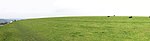
Contents

A scheduled monument is a nationally important archaeological site or monument which is given legal protection by being placed on a list (or "schedule") by the Secretary of State for Culture, Media and Sport; Historic England takes the leading role in identifying such sites. The legislation governing this is the Ancient Monuments and Archaeological Areas Act 1979. The term "monument" can apply to the whole range of archaeological sites, and they are not always visible above ground. Such sites have to have been deliberately constructed by human activity. They range from prehistoric standing stones and burial sites, through Roman remains and medieval structures such as castles and monasteries, to later structures such as industrial sites and buildings constructed for the World Wars or the Cold War. [3]

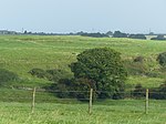
There are 58 scheduled monuments in Bath and North East Somerset. [4] Some of the oldest are Neolithic, including the Stanton Drew stone circles and several tumuli. The Great Circle at Stanton Drew is one of the largest Neolithic monuments ever built, and the second largest stone circle in Britain (after Avebury). The date of construction is not known but is thought to be between 3000 and 2000 BCE, which places it in the Late Neolithic to Early Bronze Age. [5] There are also several Iron Age hillforts such as Maes Knoll, [6] which was later incorporated into the medieval Wansdyke defensive earthwork, several sections of which are included in this list. [7] The Romano-British period is represented with several sites, most notably the Roman Baths [8] and city walls in Bath. [9] More recent sites include several bridges which date from the Middle Ages to the 18th-century Palladian bridge in Prior Park Landscape Garden. [10] [4] Dundas Aqueduct, built in 1805 [11] to carry the Kennet and Avon Canal, is the most recent site in the list. The monuments are listed below using the names given in the English Heritage data sheets.

Map all coordinates using: OpenStreetMap

Monuments

See also

Notes

  1. The date given is the date used by Historic England as significant for the initial building or that of an important part in the structure's description.
  2. Sometimes known as OSGB36, the grid reference is based on the British national grid reference system used by the Ordnance Survey.
  3. The "List Entry Number" is a unique number assigned to each listed building and scheduled monument by Historic England.

Related Research Articles

<span class="mw-page-title-main">Bath and North East Somerset</span> District in England

Bath and North East Somerset (B&NES) is a unitary authority district in Somerset, South West England. Bath and North East Somerset Council was created on 1 April 1996 following the abolition of the county of Avon. It is part of the ceremonial county of Somerset.

<span class="mw-page-title-main">Solsbury Hill</span> Iron Age hillfort in Somerset, England

Little Solsbury Hill is a small flat-topped hill and the site of an Iron Age hill fort, above the village of Batheaston in Somerset, England. The hill rises to 625 feet (191 m) above the River Avon, which is just over 1 mile (2 km) to the south, and gives views of the city of Bath and the surrounding area. It is within the Cotswolds Area of Outstanding Natural Beauty.

<span class="mw-page-title-main">Stanton Drew stone circles</span> Neolithic henge in Somerset, England

The Stanton Drew stone circles are just outside the village of Stanton Drew in the English county of Somerset. The largest stone circle is the Great Circle, 113 metres (371 ft) in diameter and the second largest stone circle in Britain ; it is considered to be one of the largest Neolithic monuments to have been built. The date of construction is not known, but is thought to be between 3000 and 2000 BCE, which places it in the Late Neolithic to Early Bronze Age. It was made a scheduled monument in 1982.

<span class="mw-page-title-main">Norton Malreward</span> Village and civil parish in Somerset, England

Norton Malreward is a small Somerset village and civil parish 4 miles (6.4 km) south of Bristol, England at the northern edge of the Chew Valley. In 1895 Norton Malreward was combined with the neighbouring hamlet of Norton Hawkfield into a single parish, which has a population of 246.

<span class="mw-page-title-main">High Littleton</span> Village in Somerset, England

High Littleton is a village and civil parish in Somerset, England, about 1.2 miles (1.9 km) north of Paulton and 7.5 miles (12 km) south-west of Bath. The parish includes the small village of Hallatrow and the hamlets of White Cross, Greyfield and Mearns; the northeastern part of High Littleton village is known as Rotcombe.

<span class="mw-page-title-main">Marksbury</span> Human settlement in England

Marksbury is a small village and civil parish on the eastern edge of the affluent Chew Valley in Somerset, about 4 miles (6.4 km) from Keynsham and 7 miles (11.3 km) from Bath on the A39 where it meets the A368. The parish, which includes the villages of Hunstrete and Stanton Prior, has a population of 397.

<span class="mw-page-title-main">Dolebury Warren</span> Hillfort in North Somerset

Dolebury Warren is a 90.6 hectares biological Site of Special Scientific Interest (SSSI) and ancient monument near the villages of Churchill and Rowberrow in North Somerset, part of South West England. It is owned by the National Trust, who acquired the freehold in 1983, and managed by the Avon Wildlife Trust.

<span class="mw-page-title-main">Stoney Littleton Long Barrow</span> Neolithic chambered tomb in England

The Stoney Littleton Long Barrow is a Neolithic chambered tomb with multiple burial chambers, located near the village of Wellow in the English county of Somerset. It is an example of the Cotswold-Severn Group and was scheduled as an ancient monument in 1882. It was one of the initial monuments included when the Ancient Monuments Protection Act 1882 became law.

<span class="mw-page-title-main">Scheduled monuments in Taunton Deane</span>

Taunton Deane was a local government district with borough status in Somerset, England. It merged with West Somerset to form Somerset West and Taunton on 1 April 2019. Its council was based in Taunton. The district was formed on 1 April 1974, under the Local Government Act 1972, by a merger of the Municipal Borough of Taunton, Wellington Urban District, Taunton Rural District, and Wellington Rural District. Taunton Deane was granted borough status in 1975, enabling the mayoralty of Taunton to be continued, when other districts did not have mayors. The district was given the name of an alternate form of the Taunton Deane Hundred.

<span class="mw-page-title-main">Scheduled monuments in Mendip</span>

Mendip is a local government district of Somerset in England. The Mendip district covers a largely rural area of 285 square miles (738 km2) ranging from the Mendip Hills through on to the Somerset Levels. It has a population of approximately 110,000. The administrative centre of the district is Shepton Mallet but the largest town is Frome.

<span class="mw-page-title-main">Scheduled monuments in Somerset</span> Nationally important sites in Somerset, England

There are over 670 scheduled monuments in the ceremonial county of Somerset in South West England. The county consists of a non-metropolitan county, administered by Somerset Council. The two administratively independent unitary authorities, which were established on 1 April 1996 following the breakup of the county of Avon, are North Somerset and Bath and North East Somerset. These unitary authorities include areas that were once part of Somerset before the creation of Avon in 1974.

West Somerset was a local government district in the English county of Somerset. It merged with Taunton Deane to form Somerset West and Taunton on 1 April 2019.

West Somerset was a local government district located in the English county of Somerset. It merged with Taunton Deane to form Somerset West and Taunton on 1 April 2019.

References

  1. "The Avon (Structural Change) Order 1995". Her Majesty's Stationery Office (HMSO). Archived from the original on 30 January 2008. Retrieved 9 December 2007.
  2. 1 2 3 "About the area". Bath and North East Somerset Council. Archived from the original on 4 November 2007. Retrieved 30 December 2007.
  3. "Scheduled Monuments". English Heritage . Retrieved 9 September 2014.
  4. 1 2 3 4 5 6 7 8 "List of Scheduled Monuments". Bath and North East Somerset. Retrieved 9 September 2014.
  5. Oswin, John; Richards, John; Sermon, Richard. "Stanton Drew 2010 Geophysical survey and other archaeological investigations" (PDF). Bath and North East Somerset Council. p. 63. Retrieved 21 August 2014.
  6. Historic England. "Maes Knoll (201029)". Research records (formerly PastScape). Retrieved 24 March 2011.
  7. "Wansdyke Project 21". Wansdyke Project 21. Retrieved 7 September 2014.
  8. "The Roman Baths". Bath and North East Somerset Council. Retrieved 7 September 2014.
  9. Creighton, Oliver Hamilton and Robert Higham. (2005) Medieval Town Walls: an Archaeology and Social History of Urban Defence. Stroud, UK: Tempus. ISBN   978-0-7524-1445-4.
  10. 1 2 Historic England. "Palladian Bridge in grounds of Prior Park (443307)". Images of England . Archived from the original on 18 October 2012.
  11. 1 2 Historic England. "Dundas Aqueduct (1215193)". National Heritage List for England. Retrieved 10 September 2006.
  12. Creighton, Oliver; Higham, Robert (2005). Medieval Town Walls: An Archaeology and Social History of Defence. The History Press. p. 60. ISBN   978-0752414454.
  13. Creighton, Oliver; Higham, Robert (2005). Medieval Town Walls: An Archaeology and Social History of Defence. The History Press. p. 36. ISBN   978-0752414454.
  14. Davenport, Peter (1998). Medieval Bath Uncovered. The History Press. pp. 91–92. ISBN   978-0752419657.
  15. Historic England. "Slight univallate hillfort called Bathampton Camp (1002480)". National Heritage List for England . Retrieved 22 July 2014.
  16. Historic England. "Multi-span bridge called Bathford Bridge (1004515)". National Heritage List for England. Retrieved 26 July 2014.
  17. Historic England. "Bowl barrow 150 m NNW of Abbey Farm (1002474)". National Heritage List for England. Retrieved 25 July 2014.
  18. Historic England. "Beacon Barrow (202989)". Research records (formerly PastScape). Retrieved 25 July 2014.
  19. Historic England. "Bowl barrow 90 m south-west of Bicknell Farm (1008294)". National Heritage List for England. Retrieved 27 July 2014.
  20. Historic England. "Bowl barrow 400 m west of Bellevue House (1008183)". National Heritage List for England. Retrieved 27 July 2014.
  21. Historic England. "Bridge over River Chew (1129649)". National Heritage List for England. Retrieved 9 May 2006.
  22. "Stanton Drew". Bitton Families. Retrieved 11 December 2013.
  23. Historic England. "Camerton Romano-British town and associated Prehistoric and early medieval monuments (1013881)". National Heritage List for England. Retrieved 27 July 2014.
  24. Scott, Shane (1995). The hidden places of Somerset. Aldermaston: Travel Publishing Ltd. p. 22. ISBN   1-902007-01-8.
  25. Havinden, Michael (1981). The Somerset Landscape. The making of the English landscape. London: Hodder and Stoughton Ltd. p. 69. ISBN   0-340-20116-9.
  26. Historic England. "Camerton Roman Town (200496)". Research records (formerly PastScape). Retrieved 28 July 2014.
  27. 1 2 William Page, ed. (1906). "Romano-British Somerset: Part 3, Other Locations". A History of the County of Somerset: Volume 1. Institute of Historical Research. Retrieved 28 July 2014.
  28. Historic England. "Chewton Pack Horse Bridge (1384604)". National Heritage List for England. Retrieved 27 July 2014.
  29. Historic England. "Churchyard cross in the churchyard about 38 metres south west of tower of Church of St. Andrew (1135956)". National Heritage List for England. Retrieved 27 July 2014.
  30. Historic England. "Road Bridge over the River Chew (1115377)". National Heritage List for England. Retrieved 26 July 2014.
  31. Historic England. "Culverhay Castle (204528)". Research records (formerly PastScape). Retrieved 28 July 2014.
  32. Dunning, Robert (1995). Somerset Castles. Tiverton: Somerset Books. p. 37. ISBN   978-0-86183-278-1.
  33. Historic England. "Pickwick Farm (197885)". Research records (formerly PastScape). Retrieved 9 September 2014.
  34. Cragg, Roger (1997). Wales and West Central England: Wales and West Central England, 2nd Edition. Thomas Telford. ISBN   0-7277-2576-9.
  35. "Dundas Aqueduct". Kennet & Avon Canal. Archived from the original on 12 August 2014. Retrieved 10 September 2006.
  36. Historic England. "East Gate (1394942)". National Heritage List for England. Retrieved 28 July 2014.
  37. "Fairy Toot" . Retrieved 12 May 2006.
  38. Richards, John. "Hautville's Quoit and other archaeological investigations at Stanton Drew, 2012" (PDF). Bath and Camerton Archaeological Society. Archived from the original (PDF) on 23 February 2014. Retrieved 7 February 2014.
  39. Dymond, Charles William (1877). "The megalithic antiquities at Stanton Drew". Journal of the British Archaeological Association. 33 (3): 297–307. doi:10.1080/00681288.1877.11888044.
  40. Historic England. "Standing stone called Hautville's Quoit (1002475)". National Heritage List for England. Retrieved 11 December 2013.
  41. Strong, Gordon (2008). Stanton Drew and its ancient stone circles. Wooden Books. p. 22. ISBN   978-1-904263-73-9.
  42. Burl, Aubrey (1993). From Carnac to Callanish: Prehistoric Stone Rows of Britain, Ireland and Brittany . Yale University Press. p.  187. ISBN   978-0-300-05575-7. Stanton Drew Hauteville Quoit.
  43. Greenwood, Charles (1977). Famous houses of the West Country. Bath: Kingsmead Press. pp. 40–43. ISBN   978-0-901571-87-8.
  44. Historic England. "Iford Bridge (1115316)". National Heritage List for England. Retrieved 28 July 2014.
  45. "Houses of Augustinian canons: The abbey of Keynsham". Somerset Victoria County History . British History Online. 1911. pp. 129–132. Retrieved 19 July 2009.
  46. Historic England. "Keynsham Abbey pier base in the garden of No.3 (1384576)". National Heritage List for England. Retrieved 19 July 2009.
  47. Historic England. "Keynsham Abbey, remains to the south of No.3 (1384577)". National Heritage List for England. Retrieved 19 July 2009.
  48. Historic England. "Lansdown Camp (203737)". Research records (formerly PastScape). Retrieved 27 July 2014.
  49. "Lansdown Camp". The Megalithic Portal. Retrieved 27 July 2014.
  50. Bull, Larry. "On Stanton Drew, Avebury and Stonehenge". University of the West of England. Retrieved 1 December 2013.
  51. Pollard, Joshua (2008). "Chapter 4 Neolithic and Early Bronze Age". In Webster, C.J. (ed.). The Archaeology of South West England (PDF). Somerset County Council. pp. 75–102. ISBN   978-0-86183-392-4. Archived from the original (PDF) on 2 December 2013. Retrieved 12 December 2013.
  52. Historic England. "Two stone circles and two stone avenues at Stanton Drew, east of Court Farm (1007911)". National Heritage List for England. Retrieved 11 December 2013.
  53. Historic England. "Burledge Hillfort (197270)". Research records (formerly PastScape). Retrieved 22 December 2010.
  54. "Mendip Hills An Archaeological Survey of the Area of Outstanding Natural Beauty" (PDF). Somerset County Council Archeological Projects. Retrieved 16 January 2011.
  55. ApSimon, A. M. (1955). Archaeological Notes (PDF) (Report). University of Bristol Spelaeological Society. Retrieved 22 December 2010.
  56. Historic England. "Large univallate hillfort with a bowl barrow and pillow mounds 970 m west of The Bungalow (1004677)". National Heritage List for England. Retrieved 27 July 2014.
  57. Historic England. "Lock-up (1288263)". National Heritage List for England. Retrieved 18 July 2010.
  58. "Maes Knoll". Megalithic Portal. Retrieved 25 July 2010.
  59. Pettifer, Adrian (2002). English Castles: A Guide by Counties. Boydell Press. p. 222. ISBN   978-0851157825.
  60. Historic England. "St Loes Castle (201108)". Research records (formerly PastScape). Retrieved 28 July 2014.
  61. "Stowey Castle, Stowey Sutton". Gatehouse gazetteer of the medieval fortifications and castles of England and Wales. Retrieved 25 April 2006.
  62. 1 2 "A Landscape Character Assessment" (PDF). Rural Landscapes. Bath and North East Somerset Council. Retrieved 9 September 2014.
  63. Historic England. "Prior Park (1000144)". National Heritage List for England. Retrieved 25 July 2014.
  64. Historic England. "Part of the linear boundary known as the Wansdyke 425 m south of New Barn Farm (1003066)". National Heritage List for England. Retrieved 22 July 2014.
  65. Historic England. "West Wansdyke (1066087)". Research records (formerly PastScape). Retrieved 9 September 2014.
  66. Historic England. "Part of the linear boundary known as the Wansdyke 585 m north of Tuckingmill Farm (1007004)". National Heritage List for England. Retrieved 26 July 2014.
  67. Historic England. "Part of the linear boundary known as the Wansdyke 530 m north west of Park Farm (1007008)". National Heritage List for England. Retrieved 27 July 2014.
  68. Historic England. "Part of a Roman road 565 m north of Abbey Farm (1005421)". National Heritage List for England. Retrieved 27 July 2014.
  69. Historic England. "Monument No. 1166109". Research records (formerly PastScape). Retrieved 27 July 2014.
  70. Historic England. "Queen Charlton village cross (1015510)". National Heritage List for England. Retrieved 10 August 2014.
  71. Brown, Graham. "Richmont Castle, East Harptree: An Analytical Earthwork Survey, English Heritage Research Department Report No. 73" (PDF). English Heritage. Archived from the original (PDF) on 12 August 2014. Retrieved 28 July 2014.
  72. "City of Bath World Heritage Site Management Plan". Bath and North East Somerset. Archived from the original on 14 June 2007. Retrieved 1 November 2007.
  73. "The Roman Baths". TimeTravel Britain. Retrieved 1 November 2007.
  74. "The Roman Baths". BirminghamUk.com. Retrieved 1 November 2007.
  75. Historic England. "Roman camp 405 m west of The Bungalow (1005422)". National Heritage List for England. Retrieved 27 July 2014.
  76. Historic England. "Lansdown Camp (203719)". Research records (formerly PastScape). Retrieved 27 July 2014.
  77. Historic England. "Roman Well (Grade II) (1384575)". National Heritage List for England. Retrieved 1 January 2012.
  78. "Keynsham Heritage Trust". Keynsham Heritage Trust. Archived from the original on 26 March 2011. Retrieved 25 April 2010.
  79. Historic England. "Monument No. 203043". Research records (formerly PastScape). Retrieved 28 July 2014.
  80. Hungley, Richard (2008). The Recovery of Roman Britain 1586–1906 : A Colony So Fertile. Oxford University Press. p. 169. ISBN   9780191553196.
  81. "Roman villa at Upper Hayes". Heritage at Risk Register. English Heritage. Retrieved 28 October 2015.
  82. Historic England. "Monument No. 205009". Research records (formerly PastScape). Retrieved 9 September 2014.
  83. Mason, Edmund J. & Mason, Doreen (1982). Avon Villages. Robert Hale Ltd. ISBN   0-7091-9585-0.
  84. "Local History". Bristol and Bath Railway Path. Retrieved 10 September 2011.
  85. "Sir Bevil Grenville's Monument". English Heritage. Retrieved 20 July 2009.
  86. Dowden, W.A. "Little Solsbury Hill Camp. Report on Excavations of 1955 and 1956" (PDF). Proceedings of the University of Bristol Speleological Society. 18 (1): 18–29.
  87. Dowden, W.A. "Little Solsbury Hill Camp. Report on Excavations of 1958" (PDF). Proceedings of the University of Bristol Speleological Society. 9 (3): 177–182.
  88. Historic England. "Solsbury Hill (203323)". Research records (formerly PastScape). Retrieved 8 June 2014.
  89. Tratman, E.K. "Little Solsbury Hill Camp" (PDF). Bath and Camerton Archaeological Society. Archived from the original (PDF) on 14 July 2014. Retrieved 8 June 2014.
  90. Ciceran, Marissa. "General History of Hillforts". Istrianet. Retrieved 8 June 2014.
  91. Historic England. "Slight univallate hillfort 125 m west of Tunley Farm (1004525)". National Heritage List for England. Retrieved 27 July 2014.
  92. "Stantonbury Hill". Wansdyke Project 21.
  93. Historic England. "Stantonbury camp and adjacent sections of Wansdyke (1002487)". National Heritage List for England. Retrieved 22 July 2014.
  94. "Study of Stanton Drew stone circle reveals new secrets". BBC. Retrieved 1 December 2013.
  95. Historic England. "Stone cove at Stanton Drew 25 m south west of St Mary's Church (1007916)". National Heritage List for England. Retrieved 11 December 2013.
  96. Scott, Shane (1995). The hidden places of Somerset. Aldermaston: Travel Publishing Ltd. p. 16. ISBN   1-902007-01-8.
  97. Dunn, Richard (2004). Nempnett Thrubwell:Barrows, Names and Manors. Nempnett Books. pp. 33–62. ISBN   0-9548614-0-X.
  98. McIntosh, Jane (2009). Handbook of Life in Prehistoric Europe. Oxford University Press. p. 266. ISBN   978-0-19-538476-5.
  99. "History and research: Stanton Drew circles and cove". Portico. English Heritage. Retrieved 12 December 2013.
  100. David, Andrew (28 April 1998). "Stanton Drew". PAST the Newsletter of the Prehistoric Society. 71 (1851): 584. Bibcode:1905Natur..71..584L. doi: 10.1038/071584a0 . S2CID   4059455 . Retrieved 1 December 2013.
  101. "Stanton Drew Stone Circles". English Heritage Archeometry. Archived from the original on 20 August 2006. Retrieved 8 July 2006.
  102. "Rising Main and Sewage Pumping Station, Chew Magna, North East Somerset. Phase 1: Trial pits and boreholes. An Archaeological Watching Brief" (PDF). ContextOne. Archived from the original (PDF) on 20 August 2007. Retrieved 19 September 2007.
  103. Historic England. "Tun Bridge (1129627)". National Heritage List for England. Retrieved 9 May 2006.
  104. Historic England. "Monument No. 203734". Research records (formerly PastScape). Retrieved 18 October 2014.
  105. Historic England. "Ubley Manor House (197418)". Research records (formerly PastScape). Retrieved 28 July 2014.
  106. "Ubley Manor House (remains of)". Heritage Gateway. English Heritage. Retrieved 28 July 2014.