List of scheduled monuments in North Somerset

Last updated

North Somerset shown within Somerset and England North Somerset UK locator map.svg
North Somerset shown within Somerset and England

North Somerset is a unitary authority area in England. Its area covers part of the ceremonial county of Somerset but it is administered independently of the non-metropolitan county. Its administrative headquarters is in the town hall in Weston-super-Mare. North Somerset borders the local government areas of Bristol, Bath and North East Somerset, Mendip and Sedgemoor. North Somerset contains the parliamentary constituencies of Weston-super-Mare and North Somerset.

Contents

A scheduled monument is a nationally important archaeological site or monument which is given legal protection by being placed on a list (or "schedule") by the Secretary of State for Culture, Media and Sport; English Heritage takes the leading role in identifying such sites. The legislation governing this is the Ancient Monuments and Archaeological Areas Act 1979. The term "monument" can apply to the whole range of archaeological sites, and they are not always visible above ground. Such sites have to have been deliberately constructed by human activity. They range from prehistoric standing stones and burial sites, through Roman remains and medieval structures such as castles and monasteries, to later structures such as industrial sites and buildings constructed for the World Wars or the Cold War. [1]

There are 68 scheduled monuments in North Somerset. The oldest site Aveline's Hole, a cave in which bones from the Mesolithic have been identified making it the earliest scientifically dated cemetery in Britain. [2] There are also multiple Neolithic tumuli. There are also several Iron Age hillforts, such as the one at Worlebury Camp. Dolebury Warren, another Iron Age hillfort, was reused as a medieval rabbit warren. The Romano-British period is represented with sites including villas. Sites from the Middle Ages include motte-and-bailey castles, such as Locking Castle, and church crosses. There are also several deserted medieval settlements. Woodspring Priory is a former Augustinian priory founded in the early 13th century. [3] More recent sites date from the Industrial Revolution and include the Elms colliery and glassworks in Nailsea. The most recent monuments are two Palmerstonian gun batteries, built in the 1860s, on the island of Steep Holm. [4] The monuments are listed below using the titles given in the English Heritage data sheets.

Map all coordinates using: OpenStreetMap

Monuments

See also

Notes

  1. The date given is the date used by Historic England as significant for the initial building or that of an important part in the structure's description.
  2. Sometimes known as OSGB36, the grid reference is based on the British national grid reference system used by the Ordnance Survey.
  3. The "List Entry Number" is a unique number assigned to each listed building and scheduled monument by Historic England.

Related Research Articles

<span class="mw-page-title-main">Wraxall, Somerset</span> Human settlement in England

Wraxall is a village in North Somerset, England, about 6 miles (10 km) west of Bristol. Until 1811 the parish of the same name also included Nailsea and Flax Bourton. The village is now within the parish of Wraxall and Failand.

<span class="mw-page-title-main">Dunkery Hill</span> Summit of Dunkery Hill

Dunkery Beacon at the summit of Dunkery Hill is the highest point on Exmoor and in Somerset, England. It is also the highest point in southern England outside of Dartmoor.

<span class="mw-page-title-main">Cadbury Camp</span> Iron Age hillfort in Somerset, England

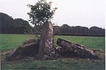
Cadbury Camp is an Iron Age hill fort in Somerset, England, near the village of Tickenham. It is a scheduled monument. Although primarily known as a fort during the Iron Age it is likely, from artefacts, including a bronze spear or axe head, discovered at the site, that it was first used in the Bronze Age and still occupied through the Roman era into the sub-Roman period when the area became part of a Celtic kingdom. The name may mean "Fort of Cador" - Cado(r) being possibly the regional king or warlord controlling Somerset, Bristol, and South Gloucestershire, in the middle to late 5th century. Cador has been associated with Arthurian England, though the only evidence for this is the reference in the Life of St. Carantoc to Arthur and Cador ruling from Dindraithou and having the power over western Somerset to grant Carantoc's plea to build a church at Carhampton. Geoffrey of Monmouth invented the title 'Duke of Cornwall' for Cador in his misleading History of the Kings of Britain.

<span class="mw-page-title-main">Dolebury Warren</span> Hillfort in North Somerset

Dolebury Warren is a 90.6 hectares biological Site of Special Scientific Interest (SSSI) and ancient monument near the villages of Churchill and Rowberrow in North Somerset, part of South West England. It is owned by the National Trust, who acquired the freehold in 1983, and managed by the Avon Wildlife Trust.

<span class="mw-page-title-main">Priddy Circles</span>

Priddy Circles are a linear arrangement of four circular earthwork enclosures near the village of Priddy on the Mendip Hills in Somerset, England. The circles have been listed as Scheduled Ancient Monuments, and described as 'probable Neolithic ritual or ceremonial monuments similar to a henge'.

<span class="mw-page-title-main">Cleeve Toot</span> Iron Age hillfort in Somerset, England

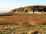
Cleeve Toot is an Iron Age univallate hillfort above Goblin Combe, Cleeve, Somerset, England. It is a Scheduled Ancient Monument.

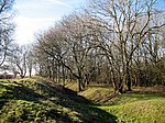
Backwell Hillfort is an Iron Age hill fort situated approximately 1.1 miles (1.8 km) from Backwell in the North Somerset district of Somerset, England. The hill fort was first discovered in 1933 with two of the three sides of the fort protected by a large ditch and a bank. In 1956, the site was nearly completely destroyed by quarrying at Coles Quarry, which ceased production in the 1970's.

<span class="mw-page-title-main">Scheduled monuments in Bath and North East Somerset</span>

Bath and North East Somerset is a unitary authority created on 1 April 1996, following the abolition of the County of Avon, which had existed since 1974. Part of the ceremonial county of Somerset, Bath and North East Somerset occupies an area of 220 square miles (570 km2), two-thirds of which is green belt. It stretches from the outskirts of Bristol, south into the Mendip Hills and east to the southern Cotswold Hills and Wiltshire border. The city of Bath is the principal settlement in the district, but BANES also covers Keynsham, Midsomer Norton, Radstock and the Chew Valley. The area has a population of 170,000, about half of whom live in Bath, making it 12 times more densely populated than the rest of the area.

<span class="mw-page-title-main">Scheduled monuments in Taunton Deane</span>

Taunton Deane was a local government district with borough status in Somerset, England. It merged with West Somerset to form Somerset West and Taunton on 1 April 2019. Its council was based in Taunton. The district was formed on 1 April 1974, under the Local Government Act 1972, by a merger of the Municipal Borough of Taunton, Wellington Urban District, Taunton Rural District, and Wellington Rural District. Taunton Deane was granted borough status in 1975, enabling the mayoralty of Taunton to be continued, when other districts did not have mayors. The district was given the name of an alternate form of the Taunton Deane Hundred.

<span class="mw-page-title-main">Scheduled monuments in Mendip</span>

Mendip is a local government district of Somerset in England. The Mendip district covers a largely rural area of 285 square miles (738 km2) ranging from the Mendip Hills through on to the Somerset Levels. It has a population of approximately 110,000. The administrative centre of the district is Shepton Mallet but the largest town is Frome.

<span class="mw-page-title-main">Scheduled monuments in Somerset</span> Nationally important sites in Somerset, England

There are over 670 scheduled monuments in the ceremonial county of Somerset in South West England. The county consists of a non-metropolitan county, administered by Somerset Council. The two administratively independent unitary authorities, which were established on 1 April 1996 following the breakup of the county of Avon, are North Somerset and Bath and North East Somerset. These unitary authorities include areas that were once part of Somerset before the creation of Avon in 1974.

West Somerset was a local government district in the English county of Somerset. It merged with Taunton Deane to form Somerset West and Taunton on 1 April 2019.

West Somerset was a local government district located in the English county of Somerset. It merged with Taunton Deane to form Somerset West and Taunton on 1 April 2019.

References

  1. "Scheduled Monuments". English Heritage. Retrieved 9 September 2014.
  2. 1 2 "Earliest British cemetery dated". BBC. 23 September 2003. Retrieved 5 January 2010.
  3. William Page, ed. (1911). "Houses of Augustinian canons: The priory of Worspring". A History of the County of Somerset: Volume 2. Institute of Historical Research. Retrieved 15 October 2015.
  4. 1 2 Worrall, D. H.; Surtees, P. R. (1984). "Flat Holm  – an account of its history and ecology". South Glamorgan County Council: 18–19.{{cite journal}}: Cite journal requires |journal= (help)
  5. Witcombe, Richard (2009). Who was Aveline anyway?: Mendip's Cave Names Explained (2nd ed.). Priddy: Wessex Cave Club. pp. 10–11. ISBN   978-0-9500433-6-4.
  6. Cunliffe, Barry (2012). Britain Begins. Oxford, UK: Oxford University Press. p. 125. ISBN   978-0-19-960933-8.
  7. "Archaeological Aerial Survey in the Northern Mendip Hills: A Highlight Report for the National Mapping Programme" (PDF). English Heritage. p. 32. Retrieved 29 January 2011.
  8. Historic England. "Banwell Camp (194460)". Research records (formerly PastScape). Retrieved 29 January 2011.
  9. "Mendip Hills". English Heritage. Retrieved 15 January 2011.
  10. "Mendip Hills". English Heritage. Retrieved 29 January 2011.
  11. Historic England. "Bell barrow 650 m south-west of Uphill Farm (1011130)". National Heritage List for England . Retrieved 6 December 2014.
  12. Historic England. "Bowl barrow 90 m south-west of Bicknell Farm (1008294)". National Heritage List for England. Retrieved 6 December 2014.
  13. Historic England. "Bowl barrow 170 m east of Poplar Farm (1008297)". National Heritage List for England. Retrieved 6 December 2014.
  14. Historic England. "Bowl barrow 230 m NNE of Quarry Farm: part of the Redhill round barrow cemetery (1011129)". National Heritage List for England. Retrieved 6 December 2014.
  15. Historic England. "Bowl barrow 300 m NNE of Quarry Farm: part of the Redhill round barrow cemetery (1011128)". National Heritage List for England. Retrieved 6 December 2014.
  16. Historic England. "Bowl barrow 420 m ENE of Quarry Farm: part of the Redhill round barrow cemetery (1011126)". National Heritage List for England. Retrieved 6 December 2014.
  17. Historic England. "Bowl barrow on Shiplate Slait (1009883)". National Heritage List for England. Retrieved 7 December 2014.
  18. Historic England. "Cadbury Camp (195367)". Research records (formerly PastScape). Retrieved 21 December 2013.
  19. Historic England. "Cadbury Camp, a small multivalate hillfort on Cadbury Hill (1008295)". National Heritage List for England. Retrieved 21 December 2013.
  20. "The Iron Age past of Cadbury Camp". National Trust. Retrieved 21 December 2013.
  21. "Long Ashton". Bath and Avon Family History Society. Retrieved 16 September 2014.
  22. Historic England. "Chapel, Immediately South of Lower Court Farmhouse (1129041)". National Heritage List for England. Retrieved 7 December 2014.
  23. Historic England. "Churchyard cross in St Andrew's churchyard (1016202)". National Heritage List for England. Retrieved 7 December 2014.
  24. Historic England. "Churchyard cross in St Bridget's churchyard, Chelvey (1015507)". National Heritage List for England. Retrieved 21 August 2014.
  25. Historic England. "Churchyard cross in St Andrew's churchyard (1015506)". National Heritage List for England. Retrieved 21 August 2014.
  26. Historic England. "Churchyard cross in All Saints churchyard (1015509)". National Heritage List for England. Retrieved 21 August 2014.
  27. Historic England. "Monument No. 192733". Research records (formerly PastScape). Retrieved 7 December 2014.
  28. Historic England. "Churchyard cross in St John The Evangelist's churchyard (1015515)". National Heritage List for England. Retrieved 7 December 2014.
  29. Historic England. "Churchyard cross in St Mary and St Peter's churchyard (1015875)". National Heritage List for England. Retrieved 7 December 2014.
  30. Historic England. "Churchyard cross in St Michael's churchyard (1015512)". National Heritage List for England. Retrieved 22 August 2014.
  31. Historic England. "Cross in St Lawrence's churchyard (1016198)". National Heritage List for England. Retrieved 7 December 2014.
  32. Historic England. "Congresbury village cross (1015505)". National Heritage List for England. Retrieved 7 December 2014.
  33. Historic England. "Deserted medieval farmstead 420 m south of Gout House Farm (1011133)". National Heritage List for England. Retrieved 7 December 2014.
  34. Historic England. "Deserted medieval farmstead and part of a Romano-British field system 400 m north of Fenswood Farm (1011979)". National Heritage List for England. Retrieved 7 December 2014.
  35. Historic England. "Deserted medieval settlement 300 m ESE of Wraxall House (1011259)". National Heritage List for England. Retrieved 7 December 2014.
  36. "Acquisitions Up to December 2011". National Trust. Archived from the original (PDF) on 14 July 2014. Retrieved 4 January 2015.
  37. "Mendip Hills. Things to see and do". National Trust. Retrieved 21 December 2013.
  38. Historic England. "Dolebury Camp: a large univallate hillfort and associated and later earthworks on Dolebury Warren (1008184)". National Heritage List for England. Retrieved 22 August 2014.
  39. Historic England. "Duck decoy, 250 m south of Black Rock Villas (1015949)". National Heritage List for England. Retrieved 7 December 2014.
  40. "Middle Engine Pit, Nailsea". Avon Industrial Buildings Trust. Retrieved 21 August 2014.
  41. "Heritage at Risk". Bristol Post. 11 July 2008. Archived from the original on 26 August 2014. Retrieved 21 August 2014.
  42. "Elms Colliery, Nailsea - North Somerset (UA)". Heritage at Risk. English Heritage. Retrieved 28 October 2015.
  43. Historic England. "Iron Age defended settlement 400 m south of Manor Farm (1018267)". National Heritage List for England. Retrieved 7 December 2014.
  44. Historic England. "Cadbury Hill Camp (195114)". Research records (formerly PastScape). Retrieved 22 March 2011.
  45. Rahtz, P (1992). Cadbury Congresbury 1968-73: a late Roman/Post-Roman Hilltop settlement in Somerset. BAR/BS 223
  46. Historic England. "Littleton gunpowder works at Powdermill Farm (1019452)". National Heritage List for England. Retrieved 7 December 2014.
  47. Historic England. "Long barrow on Redhill (1008289)". National Heritage List for England. Retrieved 7 December 2014.
  48. Historic England. "Long barrow 350 m south-west of Cornerpool Farm (1008291)". National Heritage List for England. Retrieved 7 December 2014.
  49. Historic England. "Moated site at Nye Farm (1011132)". National Heritage List for England. Retrieved 7 December 2014.
  50. Historic England. "Manorial settlement at Weston Manor (1007913)". National Heritage List for England. Retrieved 7 December 2014.
  51. Historic England. "Minor Romano-British villa 650 m north-east of Hewish Farm (1011262)". National Heritage List for England. Retrieved 7 December 2014.
  52. Historic England. "Locking Castle (1008301)". National Heritage List for England. Retrieved 23 July 2011.
  53. Historic England. "Locking Castle (192672)". Research records (formerly PastScape). Retrieved 22 July 2011.
  54. Dunning, Robert (1995). Somerset Castles. Tiverton: Somerset Books. pp. 39–40. ISBN   978-0-86183-278-1.
  55. Historic England. "Motte and bailey castle 650 m NNW of Sandpoint Farm (1008114)". National Heritage List for England. Retrieved 16 September 2014.
  56. Prior, Stuart (2006). The Norman Art of War: a Few Well-Positioned Castles. Stroud, UK: Tempus. p. 71. ISBN   0752436511.
  57. "YCCCART 2011 / Y9: North Somerset HER 2011/205, Castle Batch, Worle" (PDF). Yatton, Congresbury, Claverham and Cleeve Archaeological Research Team. Retrieved 9 January 2013.
  58. "Nailsea Glass". Nailsea Parish Family History and OPC Page. Retrieved 1 July 2010.
  59. Smith, Andrew F. (2004). "The Nailsea Glassworks, Nailsea, North Somerset A Study of the History, Archaeology, Technology and the Human Story". Archaeology Data Service (ADS). Retrieved 1 July 2010.
  60. Historic England. "Nailsea Glassworks (1021462)". National Heritage List for England. Retrieved 10 December 2014.
  61. Historic England. "Oval barrow on Felton Hill 100 m east of The Round House (1008300)". National Heritage List for England. Retrieved 10 December 2014.
  62. Historic England. "Parts of a minor Romano-British villa and later medieval barn 545 m south east of St Mary's Well (1007001)". National Heritage List for England. Retrieved 10 December 2014.
  63. Historic England. "Gatcombe Settlement (197955)". Research records (formerly PastScape). Retrieved 30 April 2011.
  64. Smisson; The Gatcombe Environs Research Team, RPM. "Extract from Gatcombe Roman Settlement Geophysical Surveys 2009/2010 Second Progress Report North of the Railway" (PDF). Yatton, Congresbury, Claverham and Cleeve Archaeological Research Team. Retrieved 5 January 2015.
  65. Historic England. "Romano-British villa, Banwell (1013434)". National Heritage List for England. Retrieved 21 August 2014.
  66. Historic England. "Shrunken medieval village of Christon and associated field system 200 m north of Manor Farm (1008186)". National Heritage List for England. Retrieved 10 December 2014.
  67. Historic England. "Burrington Camp (194391)". Research records (formerly PastScape). Retrieved 16 March 2011.
  68. "Mendip Hills An Archaeological Survey of the Area of Outstanding Natural Beauty" (PDF). Somerset County Council Archaeological Projects. Retrieved 16 January 2011.
  69. Historic England. "Slight univallate hillfort 150 m east of Cleeve Court (1011263)". National Heritage List for England. Retrieved 3 January 2015.
  70. Everden, Shirley (August 2009). "Enclosure At Chelvey Batch, Broadfield Down Earthwork Survey" (PDF). Retrieved 4 January 2015.
  71. Russet, Vince, ed. (2007). "Four Enclosures on Broadfield Down, North Somerset" (PDF). Yatton, Congresbury, Claverham, and Cleeve Archaeological Research Team. YCCCART: 4. Retrieved 4 January 2015.
  72. Historic England. "Wain's hillfort (192815)". Research records (formerly PastScape). Retrieved 6 March 2011.
  73. Historic England. "Conygar (195214)". Research records (formerly PastScape). Retrieved 6 March 2011.
  74. Historic England. "Slight univallate hillfort, two avenues, saucer barrow, regular aggregate field system and associated earthworks on Walton Common (1007917)". National Heritage List for England. Retrieved 3 January 2015.
  75. Historic England. "Slight univallate hillfort and associated settlement remains 300 m north-east of Cleeve Court (1011264)". National Heritage List for England. Retrieved 3 January 2015.
  76. "Stokeleigh Camp Hillfort". Hillfort in England in Somerset. Megalithic Portal. Retrieved 26 December 2010.
  77. "Stokeleigh Camp". Roman-Britain.org. Archived from the original on 3 July 2011. Retrieved 29 January 2011.
  78. Haldane, J.W. (1966). "Stokeleigh Camp, Somerset" (PDF). Proceedings of the University of Bristol Spelæological Society. Bristol: University of Bristol Spelæological Society. 11 (1): 31–38. Retrieved 30 January 2011.
  79. "Stokeleigh Camp". English Heritage. Retrieved 30 January 2011.
  80. "Where I Live: Bristol". BBC. October 2004. Retrieved 26 December 2010.
  81. Historic England. "Fairy Toot (198102)". Research records (formerly PastScape). Retrieved 2 April 2011.
  82. Dunn, Richard (2004). Nempnett Thrubwell:Barrows, Names and Manors. Nempnett Books. pp. 33–62. ISBN   0-9548614-0-X.
  83. Historic England. "Two bowl barrows 400 m north-east of Quarry Farm: part of the Redhill round barrow cemetery (1011127)". National Heritage List for England. Retrieved 3 January 2015.
  84. Historic England. "Two bowl barrows on Shiplate Slait (1008112)". National Heritage List for England. Retrieved 3 January 2015.
  85. Historic England. "Two confluent bowl barrows on Felton Hill (1008361)". National Heritage List for England. Retrieved 3 January 2015.
  86. Historic England. "Village cross (1129775)". National Heritage List for England . Retrieved 18 January 2010.
  87. Russett, Vince. "Gradiometry & Resistivity Surveys at Woodspring Priory" (PDF). Yatton, Congresbury, Claverham and Cleeve Archaeological Research Team. Retrieved 15 July 2014.
  88. Historic England. "Church of the Blessed Virgin Mary (1057100)". National Heritage List for England. Retrieved 19 October 2007.
  89. "Worlebury Camp". Roman-Britain.org. Archived from the original on 13 June 2010. Retrieved 5 October 2010.
  90. "Advice on Potential Landscape/Seascape and Visual Impacts of a Severn Barrage" (PDF). Land Use Consultants. Archived from the original (PDF) on 5 June 2014. Retrieved 4 January 2015.
  91. "Weston woods LNR". Natural England. Retrieved 4 January 2015.