
Adams County is a county located in the U.S. state of Colorado. As of the 2020 census, the population was 519,572. The county seat is Brighton. The county is named for Alva Adams, an early Governor of the State of Colorado in 1887–1889. Adams County is part of the Denver–Aurora–Lakewood, CO Metropolitan Statistical Area.

Arapahoe County is a county located in the U.S. state of Colorado. As of the 2020 census, its population was 655,070, making it the third-most populous county in Colorado. The county seat is Littleton, and the most populous city is Aurora. The county was named for the Arapaho Native American tribe, who once lived in the region.
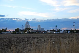
The Town of Bennett is a Statutory Town located in Adams and Arapahoe counties, Colorado, United States. The town population was 2,862 at the 2020 United States Census with 2,443 residing in Adams County and 419 residing in Arapahoe County. Bennett is a part of the Denver-Aurora-Lakewood, CO Metropolitan Statistical Area and the Front Range Urban Corridor.

The City of Commerce City is a home rule municipality located in Adams County, Colorado, United States. The city population was 62,418 at the 2020 United States Census, a 35.95% increase since the 2010 United States Census. Commerce City is the 18th most populous municipality in Colorado. Commerce City is located north of Denver and is a part of the Denver–Aurora–Lakewood, CO Metropolitan Statistical Area and the Front Range Urban Corridor. Commerce City is a mixed residential and industrial community that is known for an oil refinery with a capacity of 90,000 barrels per day (14,000 m3/d), operated by Suncor. Dick's Sporting Goods Park, a soccer stadium in Commerce City, hosts the Colorado Rapids of Major League Soccer.

The City of Sheridan is a home rule municipality located in Arapahoe County, Colorado, United States. Sheridan is a part of the Denver–Aurora–Lakewood, CO Metropolitan Statistical Area. The population was 5,664 at the 2010 census.

The Territory of Jefferson was an extralegal and unrecognized United States territory that existed from October 24, 1859 until the creation of the Colorado Territory on February 28, 1861. The Jefferson Territory, named for Founding Father and United States president Thomas Jefferson, included land officially part of the Kansas Territory, the Nebraska Territory, the New Mexico Territory, the Utah Territory, and the Washington Territory, but the area was remote from the governments of those five territories.
Carbonate County was a county of the state of Colorado that existed for only two days in 1879. Carbonate County was created by renaming Lake County, Colorado.

Littleton is a home rule municipality city located in Arapahoe, Douglas, and Jefferson counties, Colorado, United States. Littleton is the county seat of Arapahoe County and is a part of the Denver–Aurora–Lakewood, CO Metropolitan Statistical Area. The city population was 45,652 at the 2020 United States Census, ranking as the 20th most populous municipality in the State of Colorado.
Jefferson County was a county of the extralegal United States Territory of Jefferson that existed from November 28, 1859, until February 28, 1861. Its territory covered a broad swath surrounding the region of the Pike's Peak Gold Rush, and was a functioning democratically elected government until the organization of the Territory of Colorado in 1861. At that time, the successor Jefferson County was permanently created, taking its name from its predecessor and incorporating the heart of its territory.
Arapahoe County was a county of Kansas Territory in the United States that existed from August 25, 1855, until Kansas's admission into the Union on January 29, 1861.
Montana County was a county of the United States Territory of Kansas that existed from February 2, 1859 to January 29, 1861, when Kansas joined the Union as a state.
Arapahoe County was a county of the extralegal United States Territory of Jefferson that existed from November 28, 1859, until February 28, 1861. The county name was also spelled Arapaho County, Arapahoe County, Arrapahoe County, and Arappahoe County. The county seat was Denver City.
Cheyenne County was a county of the extralegal United States Territory of Jefferson that existed from November 28, 1859, until February 28, 1861.
Jackson County was a county of the extralegal United States Territory of Jefferson that existed from November 28, 1859, until February 28, 1861.
Mountain County was a county of the extralegal United States Territory of Jefferson that existed from November 28, 1859, until February 28, 1861.
North County was a county of the extralegal United States Territory of Jefferson that existed from November 28, 1859, until February 28, 1861.
Park County was a county of the extralegal United States Territory of Jefferson that existed from November 28, 1859, until February 28, 1861.
St. Vrain's County was a county of the extralegal United States Territory of Jefferson that existed from November 28, 1859, until February 28, 1861.
