
Staffordshire is a landlocked ceremonial county in the West Midlands of England. It borders Cheshire to the north-west, Derbyshire and Leicestershire to the east, Warwickshire to the south-east, the West Midlands county and Worcestershire to the south, and Shropshire to the west. The largest settlement is the city of Stoke-on-Trent, and the county town is Stafford.

Uttoxeter is a market town and civil parish in the East Staffordshire borough of Staffordshire, England. It is near to the Derbyshire county border.

Burton upon Trent, also known as Burton-on-Trent or simply Burton, is a market town in the borough of East Staffordshire in the county of Staffordshire, England, close to the border with Derbyshire. In 2021, it had a population of 76,270. The demonym for residents of the town is Burtonian. Burton is located 11 miles (18 km) south-west of Derby, 27 miles (43 km) north-west of Leicester, 28 miles (45 km) west-south-west of Nottingham and 20 miles (32 km) south of the southern entrance to the Peak District National Park.

Rugeley is a market town and civil parish in the Cannock Chase District, in Staffordshire, England. It lies on the north-eastern edge of Cannock Chase next to the River Trent; it is situated 8 miles (13 km) north of Lichfield, 10 miles (16 km) south-east of Stafford, 5 miles (8.0 km) north-east of Hednesford and 11 miles (18 km) south-west of Uttoxeter. At the 2021 Census, the population was 26,156.
Mickleover is a town in the unitary authority of Derby, in Derbyshire, England. It is 2 miles (3.2 km) west of Derby, 10 miles (16 km) northeast of Burton upon Trent, 19 miles (31 km) west of Nottingham, 13 miles (21 km) southeast of Ashbourne and 12 miles (19 km) northeast of Uttoxeter.

Alrewas is a village and civil parish in the Lichfield District of Staffordshire, England.
Blythe Bridge is a village in Staffordshire, England, south-east of Stoke-on-Trent.

Shenstone is a village and civil parish in The Lichfield District, Staffordshire, England, located between Lichfield and Sutton Coldfield. The parish also contains the village of Stonnall.
Egginton is a village and civil parish in the local government district of South Derbyshire, England. The population of the civil parish as of the 2011 census was 574.
Great Haywood is a village in central Staffordshire, England, just off the A51 and about 4.5 miles (7.2 km) northwest of Rugeley and 7.1 miles (11.4 km) southeast of the county town of Stafford. Population details taken at the 2011 census can be found under Colwich.
Hatton is a village and civil parish in South Derbyshire, England. It is 5 miles (8.0 km) north of Burton upon Trent, 10 miles (16 km) south-west of Derby and 24 miles (39 km) south-east of Stoke-on-Trent. The population of the civil parish as of the 2011 census was 2,785. It adjoins Tutbury to the south.
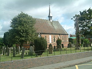
Fradley is a village and civil parish, in the Lichfield district, in the county of Staffordshire, England. In 1881 the parish had a population of 380.

Marchington is a small village in East Staffordshire, England. It lies between the towns of Burton upon Trent and Uttoxeter. Marchington has a small community-run shop, a first school, two churches and two pubs. The population of the village was 1,127 at the 2001 census, increasing to 2,017 at the 2011 census.

Branston is a village and civil parish in Staffordshire, England. At the 2001 census, the population was 6,540, increasing to 6,749 at the 2011 Census.

Rushall is a suburb in the Metropolitan Borough of Walsall in the West Midlands, England. It is centred on the main road between Walsall and Lichfield. It is mentioned in the Domesday Book but has mostly developed since the 1920s. Rushall was historically a part of the county of Staffordshire before it was incorporated with much of the old Aldridge-Brownhills Urban District into the modern-day Walsall district.

Misterton is a village and civil parish in the Bassetlaw district of Nottinghamshire, England. The parish population at the 2011 census was 2,140, and has risen to 2,191 residents in the 2021 census.
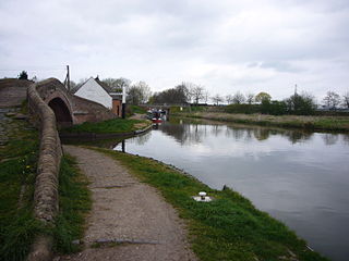
Colwich is a civil parish and village in Staffordshire, England. It is situated off the A51 road, about 3 miles (5 km) north-west of Rugeley and 7 miles (11 km) south-east of Stafford. It lies principally on the north-east bank of the River Trent, near Wolseley Bridge and just north of The Chase. The parish comprises about 2,862 hectares (28.62 km2) of land in the villages and hamlets of Colwich, Great Haywood, Little Haywood, Moreton, Bishton and Wolseley Bridge.
Horninglow is a suburb of Burton upon Trent, in the East Staffordshire district, in the county of Staffordshire, England. Horninglow lies to the north west of Burton, and is linked to the town centre by the A511. It forms part of the civil parish of Horninglow and Eton.

Weston is a village and civil parish. within the English county of Staffordshire. The parish is in the local authority of Stafford.

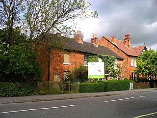
The Heath is a village in the East Staffordshire borough of Staffordshire, England. It is close to the border with Derbyshire. The village adjoins the town of Uttoxeter and the villages of Bramshall and Spath.
