Description
The canal separates the island of Wittenburg, built in the 17th century, from the former islands of Oostenburg and Oostenburgereiland. The Wittenburgervaart runs parallel to the Kattenburgervaart (to the west) from the Nieuwe Vaart to the end of the Dijksgracht. On the south side, the Oostenburgerdwarsvaart, which separates Oostenburg from Oostenburgereiland, leads to the Oostenburgervaart canal.
The Kattenburgervaart is a short canal in Amsterdam that runs through the Oostelijke Eilanden. The canal separates the island of Wittenburg, which was built in the 17th century, from the island of Kattenburg. The Kattenburgervaart runs parallel to the Wittenburgervaart from the Nieuwe Vaart to the Dijksgracht.

The Nieuwe Vaart or Nieuwevaart is a 17th-century canal in Amsterdam that runs from the center to Amsterdam-Oost.
The Dijksgracht is a canal in the center of Amsterdam, on Oostenburg island, one of the three Oostelijke Eilanden . It is also the name of the adjacent street.
Two bridges cross the canal:
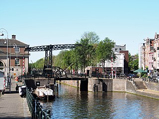
- The historical Oesjesduiker (bridge number 114) at the Nieuwe Vaart, between the Wittenburgergracht and Oostenburgergracht streets that form part of the so-called Eilandboulevard. This is a low fixed bridge, where all small boats can sail underneath.
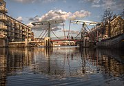
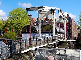
- The Ezelsbrug (no. 1904), a drawbridge built in the last part of the 20th century for pedestrians and bicycles, between Wittenburg and Oostenburg.
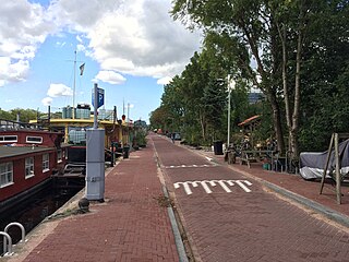
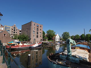
On the north side on the banks of Wittenburg at the Fortuinstraat is a marina of the water sports clubs Albatros and De Oostvaarders. In addition, there are a few houseboats on the Windrooskade.
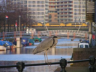
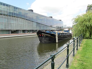
In 2012, the artwork Tire Boat (1972) by Robert Jasper Grootveld, was placed on stilts in the water on the south side at the Oostenburgerdwarsstraat next to the Ezelsbrug.

Robert Jasper Grootveld was a Dutch artist, best known for his events on the Spui in Amsterdam. Grootveld's 'happenings' were a forerunner of the Provo movement, which he later joined.
The launch in 1892 of a ship built on the Oostenburgervoorstraat. To the left are warehouses on Wittenburg.
The Ezelsbrug in 2013. In the background the Dijksgracht and the railway embankment it is named after.
The Tire boat in 2013

The Singel is a canal in Amsterdam which encircled the city in the Middle Ages. It served as a moat around the city until 1585, when Amsterdam expanded beyond the Singel. The canal runs from the IJ bay, near the Central Station, to the Muntplein square, where it meets the Amstel river. It is now the inner-most canal in Amsterdam's semicircular ring of canals.
The Keizersgracht is a canal in Amsterdam, the Netherlands. It is the second of the three main Amsterdam canals that together form the Grachtengordel, or canal belt, and lies between the inner Herengracht and outer Prinsengracht.

Westelijke Eilanden are three islands in the Centrum district of Amsterdam: Bickerseiland, Prinseneiland and Realeneiland. They are located to the south of the IJ and the Zeeheldenbuurt, to the north of the railway line between Central Station and Amsterdam-Sloterdijk, to the west of the Westerdok and to the east of the Planciusbuurt on the Westerkanaal. The Westelijke Eilanden form the core of the Golden Reael area, which also includes the adjacent Westerdok island, the Haarlemmerbuurt and the Planciusbuurt.
The Kadijken, also known as Kadijkseiland or Kadijkenbuurt, is a neighbourhood to the north of Artis zoo in the centre of Amsterdam. The name "Kadijken" is the plural form of Kadijk and refers to the two main streets that traverse the neighbourhood, Hoogte Kadijk and Laagte Kadijk.

The Vlaardingervaart or Vlaardingse Vaart is a canal in the municipality of Midden-Delfland in the Dutch province of South Holland, between the Gaag in Schipluiden and Vlaardingen, where through the Oude Haven the water is connected to the Nieuwe Maas.
The Nieuwe Herengracht is a canal in Centrum district of Amsterdam. The canal is an extension of the Herengracht that runs between the Amstel and the Scharrebiersluis (lock) leading to the Schippersgracht from the Entrepotdok. It is in the Plantage neighborhood in the eastern part of the Grachtengordel.

The Nieuwe Keizersgracht is a canal in Amsterdam, part of the eastern Grachtengordel.

The Entrepotdok, formerly Nieuwe Rapenburgergracht, is a canal in Amsterdam, and a street and row of former warehouses with the same name along the northeast side of the canal, now converted to apartments. It runs between the Kadijksplein and Sarphatistraat, and is parallel to Hoogte Kadijk, Laagte Kadijk, Plantage Doklaan and Natura Artis Magistra zoo. It is the largest inhabited warehouse complex in Amsterdam.

The Entrepotdoksluis is a bridge in Amsterdam-Centrum that crosses a lock by the same name.
The Geldersekade is a canal and a street in Amsterdam that connects the Nieuwmarkt with the Prins Hendrikkade. The Geldersekade is in the easternmost part of De Wallen, the red light district, and borders Chinatown.

The Oudeschans, or Oude Schans, originally the Nieuwe Gracht, is a wide canal in the eastern part of the inner city of Amsterdam.

The Plantage Muidergracht is a canal and street in the Plantage neighborhood of Amsterdam. On and along the Plantage Muidergracht, near Roeterseiland, are some of the buildings of the University of Amsterdam, originally built for courses or subfaculties of physics, chemistry, biology, environmental science and mathematics, but now used by other faculties.
The Prinseneilandsgracht is a canal in the Centrum district of Amsterdam. It runs between Prinseneiland, an artificial island, to the east and the mainland to the west. Until after World War II (1939–45) the canal was bordered almost exclusively by warehouses and factories.
The Bickersgracht is a canal in Amsterdam that runs between the Westelijke Eilanden, and a street on one of these islands, Bickerseiland.
The Oostenburgervaart is a canal in the center of Oostenburg island, one of the Oostelijke Eilanden in Amsterdam.
The Schippersgracht is a canal and street in the Centrum district of Amsterdam that runs from the Rapenburgerplein to the Prins Hendrikkade.
This page is based on this
Wikipedia article Text is available under the
CC BY-SA 4.0 license; additional terms may apply.
Images, videos and audio are available under their respective licenses.