
Saskia van Uylenburgh was the wife of painter Rembrandt van Rijn. In the course of her life, she was his model for some of his paintings, drawings, and etchings. She was the daughter of Rombertus Uylenburg, the mayor as well as the justice of the Court of Friesland.
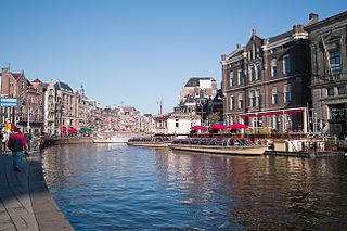
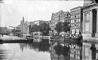
The Rokin is a canal and major street in the centre of Amsterdam. The street runs from Muntplein square to Dam square. The Rokin canal used to run from Muntplein square to Dam Square, but in 1936, the part between Spui square and Dam Square was filled in. Canal boats are now moored on the remaining part of the water, from the Amstel to Grimburgwal.

The Munttoren or Munt is a tower in Amsterdam, Netherlands. It stands on the busy Muntplein square, where the Amstel river and the Singel canal meet, near the flower market and the eastern end of the Kalverstraat shopping street.

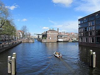
The Singel is one of the canals of Amsterdam. The Singel encircled Amsterdam in the Middle Ages, serving as a moat around the city until 1585, when Amsterdam expanded beyond the Singel. The canal runs from the IJ bay, near the Central Station, to the Muntplein square, where it meets the Amstel river. It is now the inner-most canal in Amsterdam's semicircular ring of canals.

The Jodenbreestraat is a street in the centre of Amsterdam, which connects the Sint Antoniesluis sluice gates to the Mr. Visserplein traffic circle. North of the sluice gates, the street continues on to Nieuwmarkt square as the Sint Antoniesbreestraat. The Mozes en Aäronkerk church stands at the southern end of the street. Directly behind the Jodenbreestraat is Waterlooplein square with its daily flea market.
The Sint Antoniesbreestraat is a street in the centre of Amsterdam in the Netherlands. The street runs south from Nieuwmarkt square to the Sint Antoniesluis sluice gates, where it continues as the Jodenbreestraat. The Sint Antoniesbreestraat is primarily a shopping street with a variety of specialty shops. At the corner of Sint Antoniesbreestraat and Hoogstraat is an entry to the Nieuwmarkt stop of the Amsterdam Metro system.

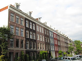
Amsterdam, capital of the Netherlands, has more than 100 kilometers (62 mi) of grachten (canals), about 90 islands and 1,500 bridges. The three main canals, dug in the 17th century during the Dutch Golden Age, form concentric belts around the city, known as the Grachtengordel. Alongside the main canals are 1550 monumental buildings. The 17th-century canal ring area, including the Prinsengracht, Keizersgracht, Herengracht and Jordaan, were listed as UNESCO World Heritage Site in 2010, contributing to Amsterdam's fame as the "Venice of the North".

The Amsterdam City Archives preserves documents pertaining to the history of Amsterdam and provides information about the city. With archives covering a shelf-length of about 50 kilometres, the Amsterdam City Archives is the largest municipal archive in the world.
De Pijp is a neighbourhood of Amsterdam, Netherlands. It is located directly south of Amsterdam's city centre and it is part of the borough Amsterdam-Zuid, in a part of the city known as the Old South. It is served by De Pijp metro station. Most streets in De Pijp are named after Dutch painters, like Jan Steen, Frans Hals, Ruysdael and Vincent van Gogh. The three districts composing the area are Oude Pijp, Nieuwe Pijp and Diamantbuurt.
The Jodenbuurt is a neighbourhood of Amsterdam, Netherlands. For centuries before World War II, it was the center of the Dutch Jews of Amsterdam — hence, its name. It is best known as the birthplace of Baruch Spinoza, the home of Rembrandt, and the Jewish ghetto of Nazi occupation of the Netherlands.

Rivierenbuurt is a neighbourhood of Amsterdam, Netherlands. The neighbourhood is situated in the eastern part of the borough of Amsterdam-Zuid, bordered by the river Amstel to the east, the Boerenwetering canal in the west, the Amstelkanaal in the north and the A10 motorway in the south. In 2013, the Rivierenbuurt had approximately 28,400 residents.

The Waag is a 15th-century building on Nieuwmarkt square in Amsterdam. It was originally a city gate and part of the walls of Amsterdam. Later it served as a guildhall, museum, fire station and anatomical theatre, among other things.

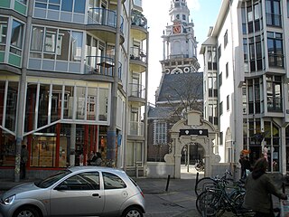
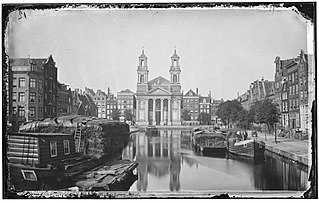
The Moses and Aaron Church in the Waterlooplein neighborhood of Amsterdam, the Netherlands, is officially the Roman Catholic Church of St. Anthony of Padua. Originally a clandestine church, it was operated by Franciscan priests at a house on Jodenbreestraat, where the wall tablets of Moses and Aaron hung on the wall. In 1970, the present church was designated as a Cultural Heritage Monument of the Netherlands.

The Maupoleum (1971–1994) was a building on Amsterdam's Jodenbreestraat. Built in 1971, it acquired a reputation for being unattractive before being demolished in 1994.
The Nieuwe Herengracht is a canal in Centrum district of Amsterdam. The canal is an extension of the Herengracht that runs between the Amstel and the Scharrebiersluis (lock) leading to the Schippersgracht from the Entrepotdok. It is in the Plantage neighborhood in the eastern part of the Grachtengordel.

The Grimburgwal is a small canal and street in the center of Amsterdam.
The Leprozengracht was a canal in Amsterdam that defined one side of the Vlooienburg island. Leprozengracht and the connected Houtgracht canal were filled in 1882 to form the Waterlooplein.
The Houtgracht was a canal in Amsterdam that defined one side of Vlooienburg island. Houtgracht and the connected Leprozengracht canal were filled in 1882 to form the Waterlooplein.
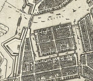
Vlooienburg or Vloonburg was a filled-in island in the Amstel river on the site of the Stopera in Amsterdam. In the seventeenth century, a lively migrant neighborhood emerged here with timber traders, Jewish merchants from the Mediterrean, kosher shopkeepers, and craftsmen, etc. The island formed the core area of Amsterdam's Jewish Quarter until the destruction in the twentieth century.
The following is an alphabetical list of articles related to Amsterdam. Amsterdam is the capital city of the Netherlands.


