
The Prinsengracht is a 3.2-kilometer (2.0 mi)-long canal that runs parallel to the Keizersgracht in the center of Amsterdam. The canal, named after the Prince of Orange, is the fourth of the four main canals belonging to the canal belt.

The Basilica of Saint Nicholas is located in the Old Centre district of Amsterdam, Netherlands, very close to Amsterdam's main railway station. It is the city's primary Roman Catholic church.

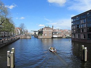
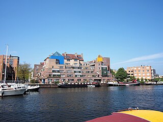
Amsterdam, capital of the Netherlands, has more than 100 kilometers (62 mi) of grachten (canals), about 90 islands and 1,500 bridges. The three main canals, dug in the 17th century during the Dutch Golden Age, form concentric belts around the city, known as the Grachtengordel. Alongside the main canals are 1550 monumental buildings. The 17th-century canal ring area, including the Prinsengracht, Keizersgracht, Herengracht and Jordaan, were listed as UNESCO World Heritage Site in 2010, contributing to Amsterdam's fame as the "Venice of the North".

The Nieuwezijds Voorburgwal is a street in the centre of Amsterdam. The street runs north-south without intersecting major streets other than the intersection with Raadhuisstraat at its halfway point, right behind the Royal Palace. On the eastern side it has a number of alleys connecting to Kalverstraat and Nieuwendijk.

Schinkelbuurt is a little neighborhood of Amsterdam, Netherlands. It is located directly south of Amsterdam's city centre and it is part of the borough Amsterdam-Zuid, in the part of the city known as the Old South.
The Kadijken, also known as Kadijkseiland or Kadijkenbuurt, is a neighbourhood to the north of Artis zoo in the centre of Amsterdam. The name "Kadijken" is the plural form of Kadijk and refers to the two main streets that traverse the neighbourhood, Hoogte Kadijk and Laagte Kadijk.

Kloveniersburgwal is an Amsterdam canal flowing south from Nieuwmarkt to the Amstel River on the edge of the medieval city, lying east of the dam in the centre of Amsterdam.

The Shipping House is a building on the western tip of the Waalseiland near Amsterdam harbour that is one of the top 100 Dutch heritage sites and generally regarded as the first true example of the Amsterdam School, a style characterised by "expressive dynamism, lavish ornamentation and colourful embellishments". It is situated on the Prins Hendrikkade and was erected on the spot where Cornelis Houtman's first trip to the East Indies had begun in 1595. The first part was built 1913 - 1916 ; the second part was built 1926 -1928. Originally, it was the headquarters of six leading Amsterdam shipping companies: the Netherlands Steamship Company (SMN), the Royal Packet Navigation Company (KPM), the Java-China-Japan Line (JCJL) and the Royal Dutch Steamboat Company (KNSM) with subsidiary New Rhine Navigation Company (NRM) and acquired in 1912 Royal West India Mail Service (KWIM).

The Lauriergracht is one of the canals of Amsterdam, located in the Jordaan, west of the Grachtengordel.
The Nieuwe Herengracht is a canal in Centrum district of Amsterdam. The canal is an extension of the Herengracht that runs between the Amstel and the Scharrebiersluis (lock) leading to the Schippersgracht from the Entrepotdok. It is in the Plantage neighborhood in the eastern part of the Grachtengordel.

The Nieuwe Vaart or Nieuwevaart is a 17th-century canal in Amsterdam that runs from the center to Amsterdam-Oost.
The Kromme Waal is a street in Amsterdam between the Prins Hendrikkade and the Oude Waal. From Kraansluis to Waalseilandbrug, the street forms the western quay of the Waalseilandsgracht, the old inner harbor of Amsterdam between the Montelbaanstoren and the IJ.
The Geldersekade is a canal and a street in Amsterdam that connects the Nieuwmarkt with the Prins Hendrikkade. The Geldersekade is in the easternmost part of De Wallen, the red light district, and borders Chinatown.

The Oudeschans, or Oude Schans, originally the Nieuwe Gracht, is a wide canal in the eastern part of the inner city of Amsterdam.
The Waalseilandsgracht, or Waalseilandgracht, is a short, wide canal in the east part of the inner city of Amsterdam.

The Plantage Muidergracht is a canal and street in the Plantage neighborhood of Amsterdam. On and along the Plantage Muidergracht, near Roeterseiland, are some of the buildings of the University of Amsterdam, originally built for courses or subfaculties of physics, chemistry, biology, environmental science and mathematics, but now used by other faculties.
The Wittenburgervaart is a short canal in Amsterdam, between the Oostelijke Eilanden.
Martelaarsgracht is a street and former canal in Amsterdam, the Netherlands.

The Vijzelgracht is a street and former canal in Amsterdam. The Vijzelgracht is adjacent to the Grachtengordel and is an extension of one of the most important city radii for public transport and normal traffic. This through route leads via Vijzelstraat, Rokin, Dam Square and Damrak to Central Station. To the south of Vijzelgracht, the Nieuwe Vijzelstraat connects to Weteringschans.

Prins Hendrikkade is a major street in the centre of Amsterdam. It passes Amsterdam Central Station, intersects the Damrak at the mouth of the Amstel river, and forms the southern end of the IJtunnel across the IJ bay. The street formed the northern edge and outer harbour of the city until the 19th century. It was named after Prince Henry of the Netherlands, youngest son of King William II, following Henry's death in 1879.


