
Amsterdam, capital of the Netherlands, has more than one hundred kilometers of grachten (canals), about 90 islands and 1,500 bridges. The three main canals, dug in the 17th century during the Dutch Golden Age, form concentric belts around the city, known as the Grachtengordel. Alongside the main canals are 1550 monumental buildings. The 17th-century canal ring area, including the Prinsengracht, Keizersgracht, Herengracht and Jordaan, were listed as UNESCO World Heritage Site in 2010, contributing to Amsterdam's fame as the "Venice of the North".
The Jodenbuurt is a neighborhood of Amsterdam, Netherlands. For centuries before World War II, it was the center of the Jews of Amsterdam — hence, its name. It is best known as the birthplace of Baruch Spinoza, the home of Rembrandt, and the Jewish ghetto of Nazi occupation of the Netherlands.
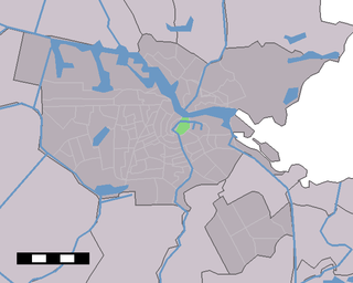
Lastage is a neighborhood in the Centrum borough of Amsterdam, Netherlands. It is located between the Geldersekade and Oudeschans canals, just east of old medieval city. Today, the neighbourhood is also known as Nieuwmarktbuurt due to the fact that the Nieuwmarkt is comprised in the area; it is protected as a heritage site.
Uilenburg is a neighborhood of Amsterdam, Netherlands.
The Nieuwe Herengracht is a canal in Centrum district of Amsterdam. The canal is an extension of the Herengracht that runs between the Amstel and the Scharrebiersluis (lock) leading to the Schippersgracht from the Entrepotdok. It is in the Plantage neighborhood in the eastern part of the Grachtengordel.

The Nieuwe Prinsengracht is a canal in the Plantage neighborhood of Amsterdam, an extension of the Prinsengracht in the eastern Grachtengordel.

The Entrepotdok, formerly Nieuwe Rapenburgergracht, is a canal in Amsterdam, and a street and row of former warehouses with the same name along the northeast side of the canal. They were constructed between 1708 and 1829, used for storage, squatted in the 1990s and are now converted into apartments. Entrepotdok is the largest inhabited warehouse complex in Amsterdam. The canal runs between the Kadijksplein and Sarphatistraat, and is parallel to Hoogte Kadijk, Laagte Kadijk, Plantage Doklaan and Natura Artis Magistra zoo.

The Kromboomssloot, or Krom Boomssloot, is a canal in the Lastage (Nieuwmarktbuurt) neighborhood in the center of Amsterdam. It provides a transverse navigation from the Rechtboomssloot and was previously called Dwarsboomssloot. As the names indicate, the Rechtboomssloot is completely straight, while there is a curve in the Kromboomssloot.

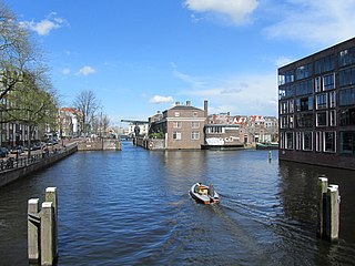
The Oudeschans, or Oude Schans, originally the Nieuwe Gracht, is a wide canal in the eastern part of the inner city of Amsterdam.
The Uilenburgergracht is a secondary canal in Amsterdam, the Netherlands. It is located east of the Amsterdam-Centrum district, in the Lastage neighborhood.

The Rapenburgwal is a secondary canal in Amsterdam in the east of the Amsterdam-Centrum district, in the Lastage neighborhood.
The Waalseilandsgracht,or Waalseilandgracht, is a short, wide canal in the east part of the inner city of Amsterdam.

The Zoutkeetsgracht is a canal to the west of the center of Amsterdam.
The Nieuwe Achtergracht is a canal in Amsterdam in the east of the Grachtengordel in the Amsterdam-Centrum district. It runs parallel to the Nieuwe Prinsengracht and connects the Onbekendegracht with the Plantage Muidergracht. The canal is crossed by Weesperstraat and Roetersstraat.
The Prinseneilandsgracht is a canal in the Centrum district of Amsterdam. It runs between Prinseneiland, an artificial island, to the east and the mainland to the west. Until after World War II (1939–45) the canal was bordered almost exclusively by warehouses and factories.
The Leprozengracht was a canal in Amsterdam that defined one side of the Vlooyenburg island. Leprozengracht and the connected Houtgracht canal were filled in 1882 to form the Waterlooplein.

The Houtgracht was a canal in Amsterdam that defined one side of Vlooyenburg island. Houtgracht and the connected Leprozengracht canal were filled in 1882 to form the Waterlooplein.

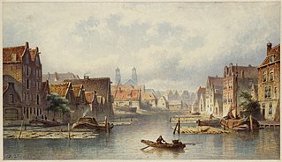
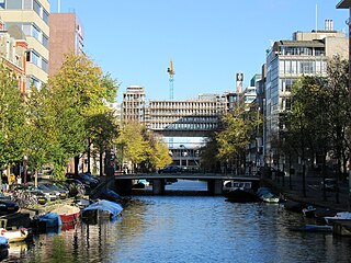
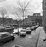
The Markengracht was a canal in Amsterdam. For many years it was at the heart of the slums of the poor Jewish neighborhood. It was filled in 1968 as part of a complete rehabilitation of the area combined with construction of the IJtunnel, opened on 30 October 1968. It is now the site of a complex of new residential buildings.

The Nieuwezijds Achterburgwal is a former street and canal in Amsterdam, the Netherlands. From around 1380 to 1450 it was part of the town's defenses. The canal was filled in in 1866, and is now Spuistraat.

The Vijzelgracht is a street and former canal in Amsterdam. The Vijzelgracht is adjacent to the Grachtengordel and is an extension of one of the most important city radii for public transport and normal traffic. This through route leads via Vijzelstraat, Rokin, Dam Square and Damrak to Central Station. To the south of Vijzelgracht, the Nieuwe Vijzelstraat connects to Weteringschans.


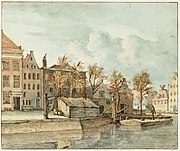


_Markengracht.jpg)