
The Staten Island Railway (SIR) is a rapid transit line in the New York City borough of Staten Island. It is owned by the Staten Island Rapid Transit Operating Authority (SIRTOA), a subsidiary of the Metropolitan Transportation Authority, and operated by the New York City Transit Authority Department of Subways. SIR operates 24 hours a day, seven days a week, providing local service between St. George and Tottenville, along the east side of the island. There is currently only one line on the island, and there is no direct rail link between the SIR and the New York City Subway system, but SIR riders do receive a free transfer to New York City Transit bus and subway lines, and the line is included on official New York City Subway maps. Commuters on the railway typically use the Staten Island Ferry to reach Manhattan; the line is accessible from within the Ferry Terminal, and most of its trains connect with the ferry.
New York State Route 440 (NY 440) is a state highway located entirely on Staten Island in New York City. The route acts as a connector between the two segments of New Jersey Route 440, running from the Staten Island community of Richmond Valley in the south to Port Richmond in the north. NY 440 is connected to the two New Jersey segments by the Outerbridge Crossing to the south and the Bayonne Bridge to the north. It is one of several signed New York State routes that are not connected to any others in the state, and one of only two NYS routes that is the middle section of another state's highway bearing the same number. Much of NY 440 is a limited-access highway. From the Korean War Veterans Parkway to Interstate 278 (I-278), it is known as the West Shore Expressway. North of I-278, it is named the Dr. Martin Luther King Jr. Expressway. NY 440 is the southernmost state route in the state of New York.
Prince's Bay is the name of a neighborhood located on the South Shore of New York City's borough of Staten Island. Prince's Bay is bordered to the north by Huguenot, to the south by the Raritan Bay, and to the west by Pleasant Plains. The neighborhood is represented in the New York State Senate by Andrew Lanza, in the New York State Assembly by Michael Reilly, and in the New York City Council by Joe Borelli.
Mid-Island is frequently applied to a series of neighborhoods within the New York City borough of Staten Island.
West Shore refers to the section of the New York City borough of Staten Island that borders the Arthur Kill, between the Staten Island Expressway and the Fresh Kills. The Arthur Kill shoreline north of the expressway—most commonly called Port Ivory—is considered part of the North Shore, while the land along the Arthur Kill south of Fresh Kills is generally included within the South Shore.
Huguenot is a neighborhood on the South Shore of Staten Island, New York City. Originally named "Bloomingview", it was later named for the Huguenots, led by Daniel Perrin, who settled in the area during the late 17th and early 18th centuries to escape religious persecution. Huguenot is bordered by Arden Heights to the north, Woodrow to the west, Prince's Bay to the south, and Annadale to the east. The neighborhood is represented in the New York City Council by Joe Borelli, who was born and raised there. Huguenot is represented in the New York State Senate by Andrew Lanza and in the New York State Assembly by Michael Reilly.

Bay Terrace is the name of a neighborhood, centered around the street of the same name, on the East Shore of Staten Island, one of the five boroughs of New York City. It is represented in the New York City Council by Joe Borelli.

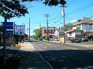
Travis is a residential and industrial neighborhood in west-central Staten Island, one of the five boroughs of New York City.

Bulls Head is a neighborhood in west-central Staten Island, one of the five boroughs of New York City. It is bordered by New Springville to the south, Bloomfield to the west, Willowbrook to the east, Graniteville to the north, and Westerleigh to the north.
Arden Heights is a name increasingly applied to the western part of Annadale, a neighborhood located on the South Shore of Staten Island, New York, USA. The name "Arden Heights" is found on most maps of New York City, including Hagstrom's.
Woodrow is a neighborhood located on the South Shore of Staten Island, New York, United States. The neighborhood is represented in the New York State Senate by Andrew Lanza, in the New York State Assembly by Michael Reilly, and in the New York City Council by Joe Borelli.

Randall Manor is a neighborhood on the North Shore of Staten Island, one of the five boroughs of New York City, United States. The neighborhood is bound by Bard Avenue to the West, Henderson Avenue to the North, Forest Avenue to the South, and Lafayette Avenue to the East.
Heartland Village is a residential development located close to the geographic center of Staten Island, one of the five boroughs of New York City, USA. The name is also often used to denote the immediately surrounding area.
Staten Island light rail proposals refer to two projects in the New York City borough of Staten Island. These proposals are among the several light rail projects that have been floated in New York City in recent years. Neither proposal was funded in the Metropolitan Transportation Authority's 2015–2019 Capital Plan, but $4 million was allocated to a study for it.

Manor Heights is a neighborhood located in Staten Island, New York City. Manor comes from the fact that the neighborhood is adjacent to Manor Road, a major thoroughfare in the North Shore of Staten Island, and Heights due to the area's sudden elevation within its boundaries. The neighborhood's loose boundaries include the areas south of the Staten Island Expressway, north of Brielle Avenue, which is the location of Susan E. Wagner High School, to the west of Manor Road, and to the east of Bradley Avenue.
Arlington is a neighborhood on the North Shore of Staten Island in New York City. It is a subsection of the Mariners' Harbor neighborhood, located north of the North Shore Branch, and west of Harbor Road. Arlington was given its name by Civil War veteran and resident Moses Henry Leman, in recognition of Arlington National Cemetery.
Chelsea is a small neighborhood located on the West Shore of Staten Island in New York City. It is bordered on the north by South Avenue, on the east by the William T. Davis Wildlife Refuge, on the south by Meredith Avenue, and on the west by the Arthur Kill.

Father Capodanno Boulevard, formerly Seaside Boulevard, is the primary north-south artery that runs through the Arrochar, South Beach, Ocean Breeze, Midland Beach, and New Dorp Beach neighborhoods of the New York City borough of Staten Island. The boulevard runs parallel to the South Beach Boardwalk and its public park.

Arthur Kill Road is a major northeast-southwest artery along the South-West Shore of the New York City borough of Staten Island. It is 8.54 miles (13.74 km) long, and runs through the neighborhoods of Tottenville, Richmond Valley, Charleston, Rossville, Woodrow, Huguenot, Arden Heights, Annadale, Eltingville, Greenridge, Great Kills, and Richmondtown.

The Travis Branch is a branch of the Staten Island Railway in New York City, that operates from Arlington Yard to Fresh Kills, which is used for freight transportation along the West Shore, Staten Island.

