Clifton, Staten Island

Last updated
A view over Clifton with Verrazzano-Narrows Bridge in the background. Clifton Staten Island.JPG
A view over Clifton with Verrazzano-Narrows Bridge in the background.
Clifton, Staten Island
Location in New York City

Clifton is a neighborhood on the North Shore of Staten Island in New York City, United States. It is an older waterfront neighborhood, facing Upper New York Bay on the east. It is bordered on the north by Stapleton, on the south by Rosebank, on the southwest by Concord, and on the west by Van Duzer Street.

Contents

History

The name "Clifton" for the area dates to 1817, when a town by the name, larger in area than the present neighborhood, was laid out along the waterfront. In its early history, much of the surrounding land was owned by the Vanderbilt family. As a young man, Cornelius Vanderbilt established ferry service from the waterfront to Manhattan at the foot of present Vanderbilt Avenue. Bayley Seton Hospital, north of Vanderbilt Avenue, was formerly the United States Public Health Service Hospital and housed the original headquarters of the National Institutes of Health (now located in Bethesda, Maryland).

In the 1840s, the Townsend family built a huge home that had turrets so it was called the Townsend Castle. It was located at what is now Townsend Avenue and Tompkins Avenue. In the 1870s, many roads and large homes were built near the water. The area has many Victorian houses left from the late 1800s in the area from Vanderbilt to Norwood Avenues.

In the 1880s, much of Staten Island was still very rural. Adjacent to the "village of Clifton," for example, was "a low range of grass hills" on which were pastured 438 goats by a Frenchman named Paul Chaulmier who provided goat's milk to wealthy New Yorkers. [1]

In 1900, the Fox Hills Golf Club encompassed the entire area of where the Park Hill Apartments are now. There was a big clubhouse on Vanderbilt Avenue. Many tournaments were held there until 1935, when it closed. The land was taken over by the government and used for military barracks during World War II. By the 1950s, it evolved into a middle-class, multi-ethnic community of civil employees including firemen, teachers, and doctors.

The Park Hill Apartments, located on Vanderbilt Avenue and on Park Hill Avenue, were initially developed in the 1960s as a private apartment complex to which many people from the other boroughs of NYC moved after the opening of the Verrazzano-Narrows Bridge. By the late 1960s, however, people realized that it was relatively inexpensive to move to Staten Island and purchase a home or rent an apartment in smaller buildings, which resulted in a loss of the emerging middle-class population it initially attracted. Park Hill remained privately owned but became federally subsidized low-income housing complex, and became the site of steadily increasing crime and drug abuse beginning in the early-1970s.

By the late 1980s, it had gained the nickname of "Crack Hill" due to the many arrests for possession and/or sale of crack cocaine that were taking place in and around the development and the adjacent Fox Hills Apartments to the south. Crime in this area has dramatically decreased since the late 1990s. Community activists are addressing the ongoing conflict between Liberian and African-American youth, primarily between the ages of 10–14. The community organizations run after-school programs to help keep the youth occupied in a productive way. This helps curb gang and street violence. The community tension that occurs in Park Hill is based on poverty and unemployment.

In the 1990s, the neighborhood became the center for an immigrant community from Liberia and West Africa around Targee Street. The residences in the neighborhood are mostly one-family houses, but the last decade has seen the development of many attached homes and duplexes.

Community

Demographics

Clifton residents wait to fill fuel cans after Hurricane Sandy. Willow Av gas can line Sandy jeh.jpg
Clifton residents wait to fill fuel cans after Hurricane Sandy.

Park Hill has been a predominantly black neighborhood for a while. However, there is a growing Asian and Hispanic population in the area. Census tract 4 has seen the second-highest growth rate in the Asian population of any census tract on Staten Island (with the highest growth rate being tract 231 in Mariners' Harbor). East of Tompkins Avenue, the White population increases noticeably.

Over the years 2000–2003, Clifton's unemployment rate increased by 3.2 percentage points, and average wages declined by 8.7 percent, the only Staten Island zip code that experienced a decline. Hundreds of local jobs in the health care and social assistance fields were lost in the downsizing of Bayley Seton Hospital, which had been a major employer of neighborhood residents.

The bulk of the Park Hill neighborhood was built in the 1960s in keeping with New York City's plan for urban renewal projects. It consists of 15 acres (61,000 m2) of 6-story brick apartment buildings. The individual apartments contained within are quite large, with many having 2 or three bedrooms. As ownership has passed into private hands, upkeep on the apartments has dwindled, leaving many of them in a state of disrepair.

The average price of a private house in Park Hill increased from 2002 ($159,254) to 2007 ($321,426). The Clifton neighborhood consists mostly of one-family houses; however, in the past decade many duplexes and attached houses have been developed on property previously zoned for commercial use.

Liberian community

A Liberian grocery in the midst of "Little Liberia", Targee Street. Liberian grocery Targee ave Staten Island 2008 03.JPG
A Liberian grocery in the midst of "Little Liberia", Targee Street.

Park Hill/Clifton (along with nearby Stapleton) has the largest Liberian population of any city outside Africa, [2] with an estimated 6,000 – 8,000 strong community of direct immigrants in 2007. [3]

History and context

Beginning in the late 1970s, a small number of Liberians, whose nation was founded by freed American slaves in the 1840s, settled in Staten Island. The First Liberian Civil War (1989-1997) led to a flight of Liberian immigrants, fleeing ethnic struggles between the Kru, Gola and Grebo communities, corrupt government, and political strife.

In the late 1980s and early 1990s, Liberian immigrants in huge numbers fled Liberia, mostly trapped in the limbo of refugee camps on the borders of Guinea and Cote d'Ivoire. The United States government, always highly involved in Liberian affairs, began to offer refugee status (Temporary Protected Status-TPS) [4] to displaced Liberians, especially those who had family in the United States.

The Liberian community in Clifton has been involved in a string of government lobbying campaigns since the 1990s to extend the "deferred enforced departure" (DED) status, which since the Presidency of Bill Clinton has had to be deferred on a yearly basis by presidential order for immigrants who fled the Liberian war without immigration visas. Clifton-based community groups like the Staten Island Liberian Community Association (SILCA) have become politically active in defending the estimated 3,600 Liberians across the country who are on DED status. [5]

This new wave of immigration settled near the first small handful of Staten Island Liberians in the Park Hill Projects (now private apartments). As the Liberian civil war intensified, more immigrants followed, creating a vibrant community with African restaurants and businesses, and others working and building businesses across the area, notably in the Nostrand Avenue area of Brooklyn. The wife of soccer star (and former Liberian presidential candidate) George Weah owns a business in Brooklyn and lives in Staten Island. In recent years, Liberian families have been settling in nearby New Jersey, with a large community in the Trenton, New Jersey area. The area has become a regular stop for Liberian politicians and leaders visiting the United States. Local Liberian civic groups organize Liberian-American involvement in their homeland, and promote a variety of charitable missions in West Africa.

Social issues

Park Hill apartment complex, southeast corner. Park Hill apartments Staten Island NY 03 2008.JPG
Park Hill apartment complex, southeast corner.

The troubles of the Liberian Civil War period have been carried into the diaspora as well. There are thought to be dozens of former child soldiers living in the Park Hill area. These former child soldiers are often unwilling to talk about past experiences and fear judgment (or prosecution) for wartime deeds. Because of the large population of Liberians in the neighborhood, the Liberian Truth and Reconciliation Commission established after the civil war sent a representative to Clifton to collect testimony from Liberian nationals who experienced the Liberian Civil War and who currently reside in the neighborhood. [6]

While there are successful business leaders in the community, the vast majority of Staten Island's Liberian immigrants are employed in low-wage service or medical fields. Many of the current residents of Park Hill are struggling with illiteracy, difficulty in finding employment, and poverty. Liberian immigrants in Park Hill also suffer from the legacy of poverty and violence in the wider community in which they live. While crime in the area has improved over the last 20 years, the reputation of Park Hill for gang and drug violence has afflicted some Liberian youth, already victimized by the Civil War. Liberian youths arrested while being refugee-status visa holders face deportation back to their homeland. Friction between the Liberians and some in the local African-American community, over jobs, housing, and culture, has also been a source of tension for an already troubled community. [7]

Public health

Park Hill has environmental issues in regards to pollution and litter. The community's public school system plays a large role in environmental protection including park cleanup, lake maintenance, and litter removal. Eibs Pond, part of a 17-acre (69,000 m2) wetland adjacent to the Park Hill community, was recently restored by the current students of PS 57.

Education

Clifton is served by the intermediate school I.S.49 and the elementary school P.S.57.

Transportation

A view from the Staten Island Railway platform in Clifton, looking towards the Narrows. Clifton SIRT platform.jpg
A view from the Staten Island Railway platform in Clifton, looking towards the Narrows.

Staten Island Railway's Clifton station is three stops from the Staten Island Ferry at St. George. Clifton is also served by the S51 and S81 buses along Bay Street, the S52 and S78 buses along Tompkins Avenue, the S74 and S84 buses along Targee Street/Van Duzer Street, and the S76 and S86 buses along Vanderbilt Avenue. Starting in August 2018, express bus service to and from Manhattan is also provided by the SIM30 route. [8]

Due to increased traffic congestion in Clifton, the Staten Island Transportation Task Force and Co-Chairs New York City Department of Transportation (DOT) Commissioner Iris Weinshall and Department of City Planning (DCP) Director Amanda Burden have acted to relieve the congestion in the area. The placement of more "Stop" and "Yield" signs in the neighborhood is another pertinent goal.[ citation needed ]

Notable people

See also

Related Research Articles

<span class="mw-page-title-main">New Dorp, Staten Island</span> Neighborhood of Staten Island in New York City

New Dorp is a neighborhood on the East Shore of Staten Island, New York City, United States. New Dorp is bounded by Mill Road on the southeast, Tysens Lane on the southwest, Amboy and Richmond Roads on the northwest, and Bancroft Avenue on the northeast. It is adjacent to Oakwood to the southwest, Todt Hill to the northwest, Dongan Hills and Grant City, and Midland Beach and Miller Field to the southeast. New Dorp Beach, bordering to the east, is often listed on maps as a separate neighborhood from Mill Road to the shore of Lower New York Bay, but is generally considered to be a part of New Dorp.

St. George is a neighborhood on the northeastern tip of Staten Island in New York City, along the waterfront where the Kill Van Kull enters Upper New York Bay. It is the most densely developed neighborhood on Staten Island, and the location of the administrative center for the borough and for the coterminous Richmond County. The St. George Terminal, serving the Staten Island Ferry and the Staten Island Railway, is also located here. St. George is bordered on the south by the neighborhood of Tompkinsville and on the west by the neighborhood of New Brighton.

<span class="mw-page-title-main">Stapleton, Staten Island</span> Neighborhood of Staten Island in New York City

Stapleton is a neighborhood in northeastern Staten Island in New York City, United States. It is located along the waterfront of Upper New York Bay, roughly bounded on the north by Tompkinsville at Grant Street, on the south by Clifton at Vanderbilt Avenue, and on the west by St. Paul's Avenue and Van Duzer Street, which form the border with the community of Grymes Hill.

<span class="mw-page-title-main">Port Richmond, Staten Island</span> Neighborhood of Staten Island in New York City

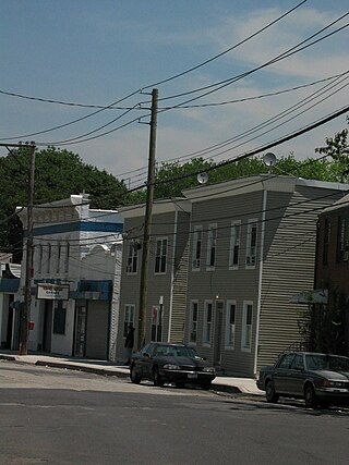
Port Richmond is a neighborhood situated on the North Shore of Staten Island, a borough of New York City. Port Richmond is bounded by Kill van Kull on the north, Clove Road on the east, Forest Avenue on the south, and the Bayonne Bridge on the west. It is adjacent to West New Brighton to the east, Westerleigh to the south, and Elm Park and Mariners Harbor to the west.

<span class="mw-page-title-main">New Brighton, Staten Island</span> Neighborhood of Staten Island in New York City

New Brighton is a neighborhood located on the North Shore of Staten Island in New York City. The neighborhood comprises an older industrial and residential harbor front area along the Kill Van Kull west of St. George. New Brighton is bounded by Kill Van Kull on the north, Jersey Street on the east, Brighton and Castleton Avenues to the south, and Lafayette Avenue and Snug Harbor Cultural Center to the west. It is adjacent to St. George to the east, Tompkinsville to the south, and West New Brighton to the west.

<span class="mw-page-title-main">West New Brighton, Staten Island</span> Neighborhood of Staten Island in New York City

West New Brighton is a neighborhood of Staten Island, New York City, situated in the central area of North Shore. The neighborhood is bordered by New Brighton to the east, Port Richmond to the west, the waters of the Kill Van Kull to the north, and the communities of Sunnyside and Castleton Corners to the south.

<span class="mw-page-title-main">North Shore, Staten Island</span> Area in New York City

The term North Shore is frequently applied to a series of neighborhoods within the New York City borough of Staten Island.

<span class="mw-page-title-main">South Beach, Staten Island</span> Neighborhood of Staten Island in New York City

South Beach is a neighborhood on the East Shore of Staten Island, New York City, situated directly south of the Verrazzano-Narrows Bridge. South Beach is bounded by New York Bay on the southeast, Seaview Avenue on the southwest, Laconia Avenue on the northwest, Reid and McClean Avenues on the north, and Lily Pond Avenue on the northeast. It is adjacent to Midland Beach to the southwest, Dongan Hills and Old Town/Concord to the northwest, and Fort Wadsworth and Rosebank to the northeast.

<span class="mw-page-title-main">Oakwood, Staten Island</span> Neighborhood in New York City

Oakwood is a neighborhood located in east central Staten Island, New York City, near the South Shore. It is bordered by Tysens Lane (north); the Atlantic Ocean (east); Great Kills Park (south); Kensico Street, and Clarke Avenue (west).

<span class="mw-page-title-main">Sunnyside, Staten Island</span> Neighborhood of Staten Island in New York City

Sunnyside is the name of a neighborhood in the Mid-Island region of the New York City borough of Staten Island.

<span class="mw-page-title-main">Rosebank, Staten Island</span> Neighborhood in Staten Island, New York, U.S.

Rosebank is a neighborhood in northeastern Staten Island, one of New York City's five boroughs. It borders Clifton to the north, Arrochar to the south, and the Upper New York Bay to the east.

<span class="mw-page-title-main">Concord, Staten Island</span> Neighborhood in New York City

Concord is a neighborhood located in the borough of Staten Island in New York City, New York, United States.

Grymes Hill is a 374 feet (114 m) tall hill formed of serpentine rock on Staten Island, New York. It is the second highest natural point on the island and in the five boroughs of New York City. The neighborhood of the same name encompasses an area of 0.894 square miles (2.32 km2) and has a population of 8,263 people. The hill also includes parts of the Silver Lake neighborhood. The area includes part of ZIP Codes 10301 and 10304.

Vanderbilt Avenue is the name of three thoroughfares in the New York City boroughs of Brooklyn, Manhattan, and Staten Island. They were named after Cornelius Vanderbilt (1794–1877), the builder of Grand Central Terminal in Midtown Manhattan.

<span class="mw-page-title-main">New York City ethnic enclaves</span> Ethnic group in New York City

Since its founding in 1625 by Dutch traders as New Amsterdam, New York City has been a major destination for immigrants of many nationalities who have formed ethnic enclaves, neighborhoods dominated by one ethnicity. Freed African American slaves also moved to New York City in the Great Migration and the later Second Great Migration and formed ethnic enclaves. These neighborhoods are set apart from the main city by differences such as food, goods for sale, or even language. Ethnic enclaves provide inhabitants security in work and social opportunities, but limit economic opportunities, do not encourage the development of English speaking, and keep immigrants in their own culture.

Liberian Americans are an ethnic group of Americans of full or partial Liberian ancestry. This can include Liberians who are descendants of Americo-Liberian people in America. The first wave of Liberians to the United States, after the slavery period, was after of the First Liberian Civil War in the 1990s and, then, after the Second Liberian Civil War in the early 2000s.

Arlington is a neighborhood on the North Shore of Staten Island in New York City. It is a subsection of the Mariners' Harbor neighborhood, located north of the North Shore Branch, and west of Harbor Road. Arlington was given its name by Civil War veteran and resident Moses Henry Leman, in recognition of Arlington National Cemetery.

<span class="mw-page-title-main">Richmond Road (Staten Island)</span> Street in Staten Island, New York

Richmond Road is a major north-south artery along the East Shore of the New York City borough of Staten Island. It is approximately 4.93 miles (7.93 km) long, and runs through the neighborhoods of Concord, Grymes Hill, Emerson Hill, Grasmere, Old Town, Dongan Hills, Grant City, Todt Hill, New Dorp, Egbertville, Lighthouse Hill, and Richmondtown.

Tompkins Avenue is a main artery in northeastern Staten Island New York City. It connects southern Tompkinsville in the north to northern Arrochar in the south, passing through the Fort Wadsworth, Rosebank, Shore Acres, Clifton, and Stapleton neighborhoods. It is mostly a residential street, though it also has commercial districts.

The following is an alphabetical list of articles related to New York City. New York City is a city in the United States state of New York.

References

  1. Anonymous (1885-09-19). "A Goat Farm". Knowersville Enterprise. Retrieved 2020-07-23.
  2. New York City Commission on Human Rights: Staten Island Office Archived 2008-12-01 at the Wayback Machine . The actual text says "outside Liberia". As other sources document well over a million Liberians were living in refugee camps within West Africa during the first decade of the 21st century, "largest outside Africa" seems more accurate.
  3. Figures are estimates. The OECD estimates just over 28,000 Liberian born people live in the United States. http://www.oecd.org/dataoecd/18/23/34792376.xls Archived June 17, 2009, at the Wayback Machine
  4. Fact Sheet: Liberians Provided Deferred Enforced Departure (DED) Archived 2012-02-12 at the Wayback Machine , Department of Homeland Security. September 12, 2007. Press release on 2007 deferment of status hearings for Liberian refugees in the United States until 2009.
  5. Ryan, Rich (2009-03-21). "Staten Island's Liberian Community Rejoices at Extension". Staten Island Advance. Retrieved 2013-06-19.
  6. Barry, Ellen (2007-09-18). "From Staten Island Haven, Liberians Reveal War's Scars". The New York Times. Retrieved 2013-06-19.
  7. "Staten Island Bus Map" (PDF). Metropolitan Transportation Authority. January 2020. Retrieved December 1, 2020.
  8. "Frederick Law Olmsted left his mark on Island landscape". silive. March 27, 2011. Retrieved November 22, 2019.

Further reading

40°37′12″N74°04′41″W / 40.620°N 74.078°W / 40.620; -74.078