This article needs additional citations for verification .(February 2013) |

New Springville is a neighborhood in Staten Island, one of the five boroughs of New York City, USA.
This article needs additional citations for verification .(February 2013) |
New Springville is a neighborhood in Staten Island, one of the five boroughs of New York City, USA.
Located near the island's geographical center, the neighborhood was founded in 1680 in Karle's Neck, [1] so it was later named Karle's Neck Village. [2] By the early 19th century, the community included a dock (on Richmond Creek) and several freshwater springs, leading to its being renamed first Springville, then later New Springville.
New Springville remained largely rural until 1964, when the E. J. Korvette department store chain opened an outlet on the site of a former chicken farm. This was also the year the Verrazzano Narrows Bridge opened, greatly increasing population growth to the whole island. This was followed, in 1973, by the opening of the Staten Island Mall on the grounds of what had been a little-used airport, which changed the character of the neighborhood completely; soon adjacent land was converted to business (mostly retail) use as well. Since then, New Springville has emerged as a commercial and administrative core, rivaling St. George. New Springville has also become a major public transportation hub, second in size on Staten Island only to that of the St. George ferry terminal; six city bus routes serve the area, including one going to Brooklyn, with the terminal at the Staten Island Mall on the Marsh Avenue side (the S79). The Yukon Bus Depot was opened in the early 1980s and can accommodate 380 buses.
The neighborhood is also known for its mafia presence. Some instances:
In addition to its explosive development as a business district, New Springville also experienced massive residential growth during the latter third of the 20th century, with thousands of single-family homes being built there, along with apartment and condominium complexes near the Staten Island Mall. [4] In recent years, a new educational complex has been under construction near these apartments and condominiums. Completed is P.S. 58 (Space Shuttle Columbia School), an elementary school, and new intermediate and high schools have been completed.
The 19th-century LaTourette House was listed on the National Register of Historic Places in 1982. [5]
Although New Springville is a major transportation hub and is well served relative to many other parts of Staten Island, it still has transportation problems. The S44 , S59 , S61 and S79 routes serve the area, [6] but have no late-night service. [7] There are also six express bus routes: The SIM4, SIM4C, SIM4X, SIM8, SIM8X and SIM31. [6] Until 1995, New Springville had late-night bus service on the S59 route. As of June 28,2010 [update] , however, there are no overnight buses in New Springville, the closest bus routes to New Springville during the overnight hours are the S74 bus on Arthur Kill Road at the Eltingville Transit Center to the south, and the S62 on Victory Boulevard to the north. Both of these routes are very far from the residential portion of New Springville, with the S74 and S62 being located in Eltingville and Bulls Head, respectively. [6] [7]
New Springville is served by six schools, two of which are expeditionary learning schools:
According to the 2010 census, [8] the demographics of New Springville were 68% non-Hispanic White, 2% Black, 16% Asian, and 1% Multiracial. Hispanics or Latinos of any race made up 13% of the population. The neighborhood consists of the census tracts 277.02, 277.04, 277.05, and 277.06.
The median household income was estimated to be $66,931. 7.2% of the population lived below the poverty line, making it an average Staten Island community [9]

Todt Hill is a 401-foot-tall (122 m) hill formed of serpentine rock on Staten Island, New York. It is the highest natural point in the five boroughs of New York City and the highest elevation on the entire Atlantic coastal plain from Florida to Cape Cod. The summit of the ridge is largely covered in woodlands as part of the Staten Island Greenbelt, although much of the surrounding area is developed and residential. It is considered one of the most exclusive and most expensive areas of Staten Island.

Staten Island Mall is a shopping mall in New Springville, Staten Island, New York City, opened in 1973. It is the only indoor shopping mall in the borough. It is the largest retail center on the island and is the site of the island's third-largest public transit hub after the St. George Terminal and Eltingville Transit Center, with numerous bus routes that connect to the periphery of the mall area. It is the second largest shopping center in New York City. The mall features Primark, JCPenney, and Macy's, in addition to an 11-screen dine-in AMC Theatres.
Prince's Bay is the name of a neighborhood located on the South Shore of New York City's borough of Staten Island. Prince's Bay is bordered to the north by Huguenot, to the south by the Raritan Bay, and to the west by Pleasant Plains. The neighborhood is represented in the New York State Senate by Andrew Lanza, in the New York State Assembly by Michael Reilly, and in the New York City Council by Joe Borelli.

Dongan Hills is a neighborhood located within the New York City borough of Staten Island. It is on the Island's East Shore. Dongan Hills is bounded by Laconia Avenue on the southeast, Jefferson Avenue on the southwest, Richmond Road on the northwest, and Old Town Road to the north. It is adjacent to New Dorp and Grant City to the southwest, Todt Hill to the northwest, Old Town/Concord to the northeast, and South Beach and Midland Beach to the southeast.

Eltingville is a neighborhood in the Staten Island borough of New York City, United States. It is located on Staten Island's South Shore, immediately to the south of Great Kills and north of Annadale. The main commercial area of Eltingville extends down Richmond Avenue, with offshoots heading north on Amboy Road and Hylan Boulevard. Eltingville is represented in the New York State Senate by Andrew Lanza, in the New York State Assembly by Michael Reilly, and in the New York City Council by Joe Borelli.
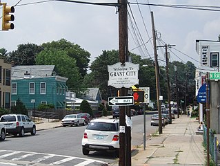
Grant City is the name of a neighborhood located on the East Shore of Staten Island, New York City.
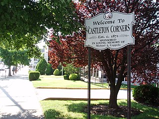
Castleton Corners is an upscale neighborhood of Staten Island, one of the five boroughs of New York City. It is bounded by Westerleigh in the West, West Brighton in the East, Port Richmond by the North, and Todt Hill/Emerson Hill to the South/Southeast. Castleton Corners is in a region of the island often referred to as the North Shore, Staten Island.

Bulls Head is a neighborhood in west-central Staten Island, one of the five boroughs of New York City. It is bordered by New Springville to the south, Bloomfield to the west, Willowbrook to the east, Graniteville to the north, and Westerleigh to the north.
Willowbrook is a neighborhood in Staten Island, one of the five boroughs of New York City. It is located in the region of the island usually referred to as Mid-Island, immediately to the south of Port Richmond, to the west of Meiers Corners and Westerleigh, to the north of New Springville, and to the east of Bulls Head.

Woodrow is a neighborhood located on the South Shore of Staten Island, New York, United States. The neighborhood is represented in the New York State Senate by Andrew Lanza, in the New York State Assembly by Michael Reilly, and in the New York City Council by Joe Borelli.

Concord is a neighborhood located in the borough of Staten Island in New York City, New York, United States.
Egbertville is the name of a neighborhood located immediately inland from, but classifiable within, the East Shore of the borough of Staten Island in New York City. Originally named Stony Brook as the island's first county seat, then renamed after a family that owned a farm there in the 18th century, Egbertville was known for a time as Morgan's Corner, from 1838. Soon after this, many Irish families arrived in the area, leading to its being referred to by such names as Tipperary Corners, New Dublin, and Young Ireland.

Eltingville Transit Center is a park and ride transit center that is located in Eltingville, Staten Island. It is located at the intersection of Arthur Kill Road and Richmond Avenue, at the end of the Korean War Veterans Parkway. The transit center was completed in 2004. Amenities include schedules, maps, free parking, and vending machines for soda, snacks, and MetroCards. The center is halfway between the Eltingville Staten Island Railway station and the Staten Island Mall, another transit center, including the adjacent Yukon Depot.
Heartland Village is a residential development located close to the geographic center of Staten Island, one of the five boroughs of New York City, USA. The name is also often used to denote the immediately surrounding area.

Richmond Avenue is a major north-south thoroughfare on Staten Island, New York. Measuring approximately 7.0 miles (11.3 km), the road runs from the South Shore community of Eltingville to the North Shore community of Graniteville.

The S79 Select Bus Service constitutes a bus route in Staten Island and Brooklyn, New York, running primarily on Richmond Avenue, Hylan Boulevard, and Narrows Road in Staten Island, and 92nd Street, Fourth Avenue, 86th Street, and Fort Hamilton Parkway in Brooklyn. It is based at the Yukon Depot.

Old Town is a neighborhood in the New York City borough of Staten Island, located on its East Shore. Old Town was established in August 1661 as part of New Netherland, and was the first permanent European settlement on Staten Island. Originally described as "Oude Dorpe", much of its original territory makes up what is present-day South Beach, with parts of Midland Beach and Dongan Hills. The area was settled by a group of Dutch, Walloon and French Protestants (Huguenots) led by Walloon Pierre Billiou.

Arthur Kill Road is a major northeast-southwest artery along the South-West Shore of the New York City borough of Staten Island. It is 8.54 miles (13.74 km) long, and runs through the neighborhoods of Tottenville, Richmond Valley, Charleston, Rossville, Woodrow, Huguenot, Arden Heights, Annadale, Eltingville, Greenridge, Great Kills, and Richmondtown.

The S59 and S89 constitute a public transit line in the U.S. states of New York and New Jersey. The S59 runs wholly in New York City, between Port Richmond and either Eltingville or Tottenville in Staten Island, largely running on Richmond Avenue. The S89 makes limited stops along Richmond Avenue, running from Bayonne, New Jersey, to Eltingville, Staten Island, New York. They are both based out of the Yukon Depot.
Karle's Neck: A late 1600 name for the long stretch of farm and marshland in the present New Springville area.
Springville — Sometimes called New Springville, this is the farming section of the Island. It occupies a portion of the Island known as Karle's Neck and was in 1836 called Karle's Neck Village.
What propelled [the shooter...], the police say, was the word of his 18-year-old daughter that she had been groped by its owner, Salvatore Sciandra, while working at the store as a cashier. Whether this charge has merit remains unclear. A Sciandra family spokesman denied it, maintaining that the young woman was being nudged out of her job because receipts and cash were not adding up at her register.
