
Richmondtown is a neighborhood in the Mid-Island section of Staten Island, New York City. It is bounded by Arthur Kill Road on the northwest, Richmond Road on the north, Amboy Road on the east and southeast, and the United Hebrew and Ocean View cemeteries on the southwest.

Todt Hill is a 401-foot-tall (122 m) hill formed of serpentine rock on Staten Island, New York. It is the highest natural point in the five boroughs of New York City and the highest elevation on the entire Atlantic coastal plain from Florida to Cape Cod. The summit of the ridge is largely covered in woodlands as part of the Staten Island Greenbelt, although much of the surrounding area is developed and residential. It is considered one of the most exclusive and most expensive areas of Staten Island.

Richmond Creek is a major stream in Staten Island, a borough of New York City in the United States. Its upper drainage basin includes the remote forested hills in the center of the island. It empties into the Fresh Kills.

The term East Shore is frequently applied to a series of neighborhoods along the Lower New York Bay and the Raritan Bay and within New York City's borough of Staten Island.

Dongan Hills is a neighborhood located within the New York City borough of Staten Island. It is on the Island's East Shore. Dongan Hills is bounded by Laconia Avenue on the southeast, Jefferson Avenue on the southwest, Richmond Road on the northwest, and Old Town Road to the north. It is adjacent to New Dorp and Grant City to the southwest, Todt Hill to the northwest, Old Town/Concord to the northeast, and South Beach and Midland Beach to the southeast.
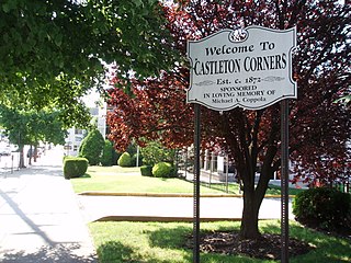
Castleton Corners is an upscale neighborhood of Staten Island, one of the five boroughs of New York City. It is in a region of the island often referred to as the North Shore, Staten Island.
Westerleigh is a residential neighborhood in the northwestern part of Staten Island in New York City.

Bulls Head is a neighborhood in west-central Staten Island, one of the five boroughs of New York City. It is bordered by New Springville to the south, Bloomfield to the west, Willowbrook to the east, Graniteville to the north, and Westerleigh to the north.
Willowbrook is a neighborhood in Staten Island, one of the five boroughs of New York City. It is located in the region of the island usually referred to as Mid-Island, immediately to the south of Port Richmond, to the west of Meiers Corners and Westerleigh, to the north of New Springville, and to the east of Bulls Head.
Egbertville is the name of a neighborhood located immediately inland from, but classifiable within, the East Shore of the borough of Staten Island in New York City. Named after a family that owned a farm there in the 18th century, Egbertville was known for a time as Morgan's Corner, from 1838; soon after this, many Irish families arrived in the area, leading to its being referred to by such names as Tipperary Corners, New Dublin, and Young Ireland.

Lookout Place or Fort Hill was an American Revolutionary War British garrison, or earthen mound-fortress roughly 44 feet square at the top of La Tourette Hill in Historic Richmondtown, Staten Island, New York. The redoubt was constructed in 1776 by British Regulars during the occupation of Richmond County. General William Howe planned his successful capture of New York City while encamped on the Island, along with 30,000 British and Hessian soldiers joining to suppress the rebellion after the arrival of his brother Admiral Richard Howe. The fort overlooked a fresh water spring about 200 feet directly below, the Old Mill Road, Fresh Kills which is a tributary of Richmond Creek, St. Andrews Church and the town of Richmond, then referred to as Cuckoldstown, in the valley just below La Tourette Hill.

The Britton Cottage, formerly known as the Cubberly House, is a house in the Historic Richmond Town museum complex in the neighborhood of Richmondtown, Staten Island, in New York City. The oldest section of the cottage dates to 1671, with additions in the mid-18th century. It is constructed of stone and timberframe components. The house was originally located at the intersection of New Dorp Lane and Cedar Grove Avenue in the New Dorp Beach section of Staten Island, but was moved to its current location in 1967 when it was threatened with demolition.
The John Bennett House was built in 1839 with an addition built in 1854, was built as part of a real estate development near the Third County Courthouse in Historic Richmondtown, Staten Island, New York. This Greek Revival style residence was home to shipping merchant John Bennett and his family from c.1848-1917. The building later served as a restaurant. A seasonal cafe and restaurant is located in the cellar bakery and is accessible from Richmond Road.

Old Town is a neighborhood in the New York City borough of Staten Island, located on its East Shore. Old Town was established in August 1661 as part of New Netherland, and was the first permanent European settlement on Staten Island. Originally described as "Oude Dorpe", much of its original territory makes up what is present-day South Beach, with parts of Midland Beach and Dongan Hills. The area was settled by a group of Dutch, Walloon and French Protestants (Huguenots) led by Walloon Pierre Billiou.
Arlington is a neighborhood on the North Shore of Staten Island, in New York City. It is a subsection of the Mariners' Harbor neighborhood, located north of the North Shore Rail Line ROW, and west of Harbor Road. Arlington was given its name by Civil War veteran and resident Moses Henry Leman, in recognition of Arlington National Cemetery.
Richmond Road is a major north-south artery along the East Shore of the New York City borough of Staten Island. It is approximately 4.93 miles (7.93 km) long, and runs through the neighborhoods of Concord, Grymes Hill, Emerson Hill, Grasmere, Old Town, Dongan Hills, Grant City, Todt Hill, New Dorp, Egbertville, Lighthouse Hill, and Richmondtown.

The Church of St. Patrick is a parish church under the authority of the Roman Catholic Archdiocese of New York, located in Richmondtown, Staten Island, New York City.
Middletown was a town in Richmond County, New York. It was incorporated in 1860 from parts of Southfield and Castleton. At the time, it included the most populous part of the village of Edgewater and the hilly ridges of the interior, Grymes Hill and Todt Hill among others.
Richmond Engine Co. 1 is volunteer fire department located in the Richmondtown neighborhood of Staten Island, New York City, New York that works in cooperation with the New York City Fire Department.