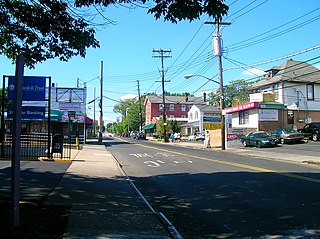
Arrochar is a neighborhood in northeastern Staten Island in New York City in the United States. It is located directly inland of Fort Wadsworth and South Beach, on the east side of Hylan Boulevard south of the Staten Island Expressway; the community of Grasmere borders it on the west. It is today primarily a neighborhood of one- and two-family homes and small businesses.

Richmond Creek is a major stream in Staten Island, New York City. Its upper drainage basin includes the remote forested hills in the center of the island. It empties into the Fresh Kills.

West New Brighton is a neighborhood of Staten Island, New York City, situated along the central North Shore. The neighborhood borders New Brighton to the east, Port Richmond to the west, the waters of the Kill Van Kull to the north, and the communities of Sunnyside and Castleton Corners to the south.

The term North Shore is frequently applied to a series of neighborhoods within the New York City borough of Staten Island.
Mid-Island is frequently applied to a series of neighborhoods within the New York City borough of Staten Island.

Oakwood is a neighborhood located in east central Staten Island, New York City, near the South Shore. It is bordered by Tysens Lane (north); the Atlantic Ocean (east); Great Kills Park (south); Kensico Street, and Clarke Avenue (west).
Huguenot is a neighborhood on the South Shore of Staten Island, New York City. Originally named "Bloomingview", it was later named for the Huguenots, led by Daniel Perrin, who settled in the area during the late 17th and early 18th centuries to escape religious persecution. Huguenot is bordered by Arden Heights to the north, Woodrow to the west, Prince's Bay to the south, and Annadale to the east. The neighborhood is represented in the New York City Council by Joe Borelli, who was born and raised there. Huguenot is represented in the New York State Senate by Andrew Lanza and in the New York State Assembly by Michael Reilly
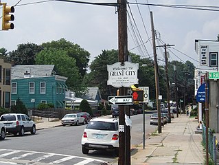
Grant City is the name of a neighborhood located on the East Shore of Staten Island, New York City.
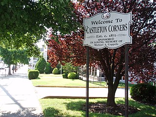
Castleton Corners is an upscale neighborhood of Staten Island, one of the five boroughs of New York City. It is in a region of the island often referred to as the North Shore, Staten Island.
Westerleigh is a residential neighborhood in the northwestern part of Staten Island in New York City.

Bulls Head is a neighborhood in west-central Staten Island, one of the five boroughs of New York City. It is bordered by New Springville to the south, Bloomfield to the west, Willowbrook to the east, Graniteville to the north, and Westerleigh to the north.
Willowbrook is a neighborhood in Staten Island, one of the five boroughs of New York City. It is located in the region of the island usually referred to as Mid-Island, immediately to the south of Port Richmond, to the west of Meiers Corners and Westerleigh, to the north of New Springville, and to the east of Bulls Head.
Arden Heights is a name increasingly applied to the western part of Annadale, a neighborhood located on the South Shore of Staten Island, New York, USA. The name "Arden Heights" is found on most maps of New York City, including Hagstrom's.
Shore Acres is a neighborhood of Staten Island, one of the five boroughs of New York City. It is situated along the Upper New York Bay, just north of Fort Wadsworth and south of Rosebank. Shore Acres is generally considered to be bounded by Bay Street on the west, the Upper New York Bay on the east, Nautilus Street on the north, and Arthur Von Briesen Park on the south.

Brighton Heights is a neighborhood in New York City's borough of Staten Island.

Livingston is a name sometimes applied to the northeastern portion of West Brighton, a neighborhood located on the North Shore of the New York City borough of Staten Island.
Heartland Village is a residential development located close to the geographic center of Staten Island, one of the five boroughs of New York City, USA. The name is also often used to denote the immediately surrounding area.

Manor Heights is a neighborhood located in Staten Island, New York City. Manor comes from the fact that the neighborhood is adjacent to Manor Road, a major thoroughfare in the North Shore of Staten Island, and Heights due to the area's sudden elevation within its boundaries. The neighborhood's loose boundaries include the areas south of the Staten Island Expressway, north of Brielle Avenue, which is the location of Susan E. Wagner High School, to the west of Manor Road, and to the east of Bradley Avenue.

Old Place is a neighborhood located in the northwestern section of Staten Island. The neighborhood is located south of Arlington, and west of Mariners Harbor. It is part of Community Board 1.

The Special Hillsides Preservation District was created in 1987 by the City of New York to preserve the hilly terrains of the North Shore of Staten Island. The district maintains different planning rules to the rest of the City to account for the geological and bio diversity of the area. The district's goals are to reduce hillside erosion, landslides, and excessive storm-water runoff by conserving vegetation and protecting natural terrain; preserve hillsides with unique aesthetic value; protect areas of outstanding natural beauty; and protect neighborhood character.
