New York State Route 440 (NY 440) is a state highway located entirely on Staten Island in New York City. The route acts as a connector between the two segments of New Jersey Route 440, running from the Staten Island community of Richmond Valley in the south to Port Richmond in the north. NY 440 is connected to the two New Jersey segments by the Outerbridge Crossing to the south and the Bayonne Bridge to the north. It is one of several signed New York State routes that are not connected to any others in the state, and one of only two NYS routes that is the middle section of another state's highway bearing the same number. Much of NY 440 is a limited-access highway. From the Korean War Veterans Parkway to Interstate 278 (I-278), it is known as the West Shore Expressway. North of I-278, it is named the Dr. Martin Luther King Jr. Expressway. NY 440 is the southernmost state route in the state of New York.

The South Shore is a geographical term applied to the area in the New York City borough of Staten Island, south and east of the island's ridge of hills along the waterfront and adjacent areas from the Narrows to the mouth of the Arthur Kill. Many observers prefer to restrict its scope to the neighborhoods located between the shoreline of Raritan Bay on one side and Richmond Creek and Fresh Kills on the other, thus encompassing the neighborhoods of Great Kills to Tottenville only. Those who use this narrower definition of the "South Shore" prefer the term "East Shore" for the communities that lie along Lower New York Bay, and inland for approximately 2 to 2½ miles, from Bay Terrace and Richmondtown to as far north as Grasmere and Concord. The South Shore is represented in the New York City Council by Joe Borelli.
Prince's Bay is the name of a neighborhood located on the South Shore of New York City's borough of Staten Island. Prince's Bay is bordered to the north by Huguenot, to the south by the Raritan Bay, and to the west by Pleasant Plains. The neighborhood is represented in the New York State Senate by Andrew Lanza, in the New York State Assembly by Michael Reilly, and in the New York City Council by Joe Borelli.
West Shore refers to the section of the New York City borough of Staten Island that borders the Arthur Kill, between the Staten Island Expressway and the Fresh Kills. The Arthur Kill shoreline north of the expressway—most commonly called Port Ivory—is considered part of the North Shore, while the land along the Arthur Kill south of Fresh Kills is generally included within the South Shore.
The Korean War Veterans Parkway is a parkway that traverses the South Shore of Staten Island, New York, in the United States. It begins at the Outerbridge Crossing toll plaza and runs from southwest to northeast to a merge with Drumgoole Road in the island's Greenridge section. The parkway is designated New York State Route 909C (NY 909C), an unsigned reference route, which continues northeast along Drumgoole Road for a short distance to its end at an intersection with Richmond Avenue. The westernmost 0.38 miles (0.61 km) of the parkway overlaps with NY 440.
Lemon Creek is a stream located on the South Shore of Staten Island in New York City. It is one of the few remaining ground-level creeks in New York City.

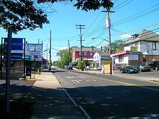
Eltingville is a neighborhood in the Staten Island borough of New York City, United States. It is located on Staten Island's South Shore, immediately to the south of Great Kills and north of Annadale. The main commercial area of Eltingville extends down Richmond Avenue, with offshoots heading north on Amboy Road and Hylan Boulevard. Eltingville is represented in the New York State Senate by Andrew Lanza, in the New York State Assembly by Michael Reilly, and in the New York City Council by Joe Borelli.

Annadale is a middle-class neighborhood on the South Shore of the borough of Staten Island in New York City.
Huguenot is a neighborhood on the South Shore of Staten Island, New York City. Originally named "Bloomingview", it was later named for the Huguenots, led by Daniel Perrin, who settled in the area during the late 17th and early 18th centuries to escape religious persecution. Huguenot is bordered by Arden Heights to the north, Woodrow to the west, Prince's Bay to the south, and Annadale to the east. The neighborhood is represented in the New York City Council by Joe Borelli, who was born and raised there. Huguenot is represented in the New York State Senate by Andrew Lanza and in the New York State Assembly by Michael Reilly.

Pleasant Plains is a neighborhood located on Staten Island, New York City, New York. It is bordered by Woodrow to the north, the Lower New York Bay to the south, Richmond Valley to the west, and Prince's Bay to the east. The neighborhood is represented in the New York City Council by Joe Borelli.
New Springville is a neighborhood in Staten Island, one of the five boroughs of New York City, USA.
Arden Heights is a name increasingly applied to the western part of Annadale, a neighborhood located on the South Shore of Staten Island, New York, USA. The name "Arden Heights" is found on most maps of New York City, including Hagstrom's.
Woodrow is a neighborhood located on the South Shore of Staten Island, New York, United States. The neighborhood is represented in the New York State Senate by Andrew Lanza, in the New York State Assembly by Michael Reilly, and in the New York City Council by Joe Borelli.

Eltingville Transit Center is a park and ride transit center that is located in Eltingville, Staten Island. It is located at the intersection of Arthur Kill Road and Richmond Avenue, at the end of the Korean War Veterans Parkway. The transit center was completed in 2004. Amenities include schedules, maps, free parking, and vending machines for soda, snacks, and MetroCards. The center is halfway between the Eltingville Staten Island Railway station and the Staten Island Mall, another transit center, including the adjacent Yukon Depot.

Richmond Avenue is a major north-south thoroughfare on Staten Island, New York. Measuring approximately 7.0 miles (11.3 km), the road runs from the South Shore community of Eltingville to the North Shore community of Graniteville.

Vincent M. Ignizio is an American politician and former member and Minority Leader of the New York City Council representing Staten Island's 51st district. Before being elected to the City Council, he was a member of the New York State Assembly.

Bloomingdale Park is a 138-acre (56 ha) park on the South Shore of Staten Island. It is located in the Prince's Bay neighborhood, and is bounded on the north by Ramona Avenue, on the west by Bloomingdale Road, on the east by Lenevar Avenue, and on the south by Drumgoole Road West and the Korean War Veterans Parkway. It is nearly bisected by Maguire Avenue, but the avenue's two spurs into the park from the north and south do not meet in the middle.

Staten Island Community Board 3 is a local government unit of the city of New York, encompassing the Staten Island neighborhoods of Annadale, Arden Heights, Bay Terrace, Charleston, Eltingville, Great Kills, Greenridge, Huguenot, Pleasant Plains, Prince's Bay, Richmond Valley, Rossville, Tottenville and Woodrow.

Arthur Kill Road is a major northeast-southwest artery along the South-West Shore of the New York City borough of Staten Island. It is 8.54 miles (13.74 km) long, and runs through the neighborhoods of Tottenville, Richmond Valley, Charleston, Rossville, Woodrow, Huguenot, Arden Heights, Annadale, Eltingville, Greenridge, Great Kills, and Richmondtown.

