
Todt Hill is a 401-foot-tall (122 m) hill formed of serpentine rock on Staten Island, New York. It is the highest natural point in the five boroughs of New York City and the highest elevation on the entire Atlantic coastal plain from Florida to Cape Cod. The summit of the ridge is largely covered in woodlands as part of the Staten Island Greenbelt, although much of the surrounding area is developed and residential. It is considered one of the most exclusive and most expensive areas of Staten Island.

Castleton is a former town in the U.S. state of New York. It was located in the northeastern part of Staten Island prior to the incorporation of Staten Island into New York City in 1898. It had a total area of 3880 acres (15.7 km2) and was bounded by Upper New York Bay on the east and the Kill Van Kull on the north.

The term East Shore is frequently applied to a series of neighborhoods along the Lower New York Bay and the Raritan Bay and within New York City's borough of Staten Island.

The term North Shore is frequently applied to a series of neighborhoods within the New York City borough of Staten Island.
Mid-Island is frequently applied to a series of neighborhoods within the New York City borough of Staten Island.

Sunnyside is the name of a neighborhood in the Mid-Island region of the New York City borough of Staten Island.
Westerleigh is a residential neighborhood in the north-western part of Staten Island in New York City.

Bulls Head is a neighborhood in west-central Staten Island, one of the five boroughs of New York City. It is bordered by New Springville to the south, Bloomfield to the west, Willowbrook to the east, Graniteville to the north, and Westerleigh to the north.
Willowbrook is a neighborhood in Staten Island, one of the five boroughs of New York City. It is located in the region of the island usually referred to as Mid-Island, immediately to the south of Port Richmond, to the west of Meiers Corners and Westerleigh, to the north of New Springville, and to the east of Bulls Head.
Meiers Corners is a neighborhood on Staten Island, one of the five boroughs of New York City, United States.

Randall Manor is a neighborhood on the North Shore of Staten Island, one of the five boroughs of New York City, United States. The neighborhood is bound by Bard Avenue to the West, Henderson Avenue to the North, Forest Avenue to the South, and Lafayette Avenue to the East. It used to be part of Elliottville.

Brighton Heights is a neighborhood in New York City's borough of Staten Island.

James Steven Oddo is an American attorney and politician who served as the Borough President of Staten Island from 2014 to 2021. Oddo had previously served as a member of the New York City Council, representing the 50th district from 1999 to 2013. He is currently serving as the Commissioner for the New York City Department of Buildings under Mayor Eric Adams.

Manor Heights is a neighborhood located in Staten Island, New York City. Manor comes from the fact that the neighborhood is adjacent to Manor Road, a major thoroughfare in the North Shore of Staten Island, and Heights due to the area's sudden elevation within its boundaries. The neighborhood's loose boundaries include the areas south of the Staten Island Expressway, north of Brielle Avenue, which is the location of Susan E. Wagner High School, to the west of Manor Road, and to the east of Bradley Avenue.
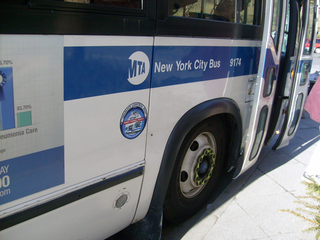
MTA Regional Bus Operations operates local and express buses serving New York City in the United States out of 29 bus depots. These depots are located in all five boroughs of the city, plus one located in nearby Yonkers in Westchester County. 21 of these depots serve MTA New York City Transit (NYCT)'s bus operations, while the remaining eight serve the MTA Bus Company These facilities perform regular maintenance, cleaning, and painting of buses, as well as collection of revenue from bus fareboxes. Several of these depots were once car barns for streetcars, while others were built much later and have only served buses. Employees of the depots are represented by local divisions of the Transport Workers Union of America (TWU), particularly the TWU Local 100 or of the Amalgamated Transit Union (ATU)'s Local's 726 for all depots in Staten Island, 1056 for Casey Stengel, Jamaica, and Queens Village Depots, 1179 for JFK & Far Rockaway Depots, and 1181 for Spring Creek Depot.

Staten Island Community Board 1 is a local government unit of New York City, encompassing the Staten Island neighborhoods of Arlington, northern Castleton Corners, Clifton Concord, Elm Park, Fort Wadsworth, northern Graniteville, Grymes Hill, Livingston, Mariners' Harbor, northern Meiers Corners, New Brighton, Port Ivory, Port Richmond, Randall Manor, Rosebank, Staten Island, St. George, Shore Acres, Silver Lake, Stapleton, Sunnyside, Tompkinsville, West New Brighton, Westerleigh, and northern Willowbrook. Community Board 1 is essentially the entire area of Staten Island north of the Staten Island Expressway.
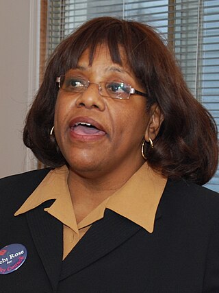
Deborah Rose is a New York City politician. She was the Council member for the 49th district of the New York City Council. She is a Democrat and was the first African American elected to higher office from Staten Island.
The Church of St. Teresa of the Infant Jesus is a parish church in the Roman Catholic Archdiocese of New York, located at 1634 Victory Boulevard, Castleton Corners, Staten Island, New York City. The church was built in 1953 on the designs of the prolific architect Robert J. Reiley for $224,000. The church has a co-educational parochial school.

The SIM1, SIM1C, SIM7,SIM10, and SIM11 bus routes constitute a public transit line in Staten Island and Manhattan, New York. The routes all operate on Richmond Avenue and Hylan Boulevard on Staten Island, but go to three separate terminals in Manhattan. The SIM1 goes to 6th Avenue & Houston Street, the SIM7 goes to 6th Avenue & 14th Street, the SIM1C and SIM10 go to Central Park South & 6th Avenue, and the SIM11 goes to 57th Street & 3rd Avenue. The SIM1, SIM7, SIM10, and SIM11 operate during the rush hour only. The SIM1C operates 24 hours per day, but does not run in the peak direction during rush hours.


