Butlerville, Ohio | |
---|---|
Coordinates: 39°18′06″N84°05′25″W / 39.30167°N 84.09028°W | |
Country | United States |
State | Ohio |
County | Warren |
Area | |
• Total | 0.11 sq mi (0.28 km2) |
• Land | 0.11 sq mi (0.28 km2) |
• Water | 0.00 sq mi (0.00 km2) |
Elevation | 860 ft (260 m) |
Population (2020) | |
• Total | 155 |
• Density | 1,422.02/sq mi (548.23/km2) |
Time zone | UTC-5 (Eastern (EST)) |
• Summer (DST) | UTC-4 (EDT) |
ZIP code | 45162 |
Area code | 513 |
FIPS code | 39-10674 [3] |
GNIS feature ID | 2397513 [2] |
Butlerville is a village in central Harlan Township, Warren County, Ohio, United States, located in the southwestern part of the state. The population was 155 at the 2020 census.
The village is in the Little Miami Local School District. Telephone service is provided through the Butlerville exchange and mail is delivered through the Pleasant Plain post office.
Butlerville was platted in 1838 when a new turnpike was extended to that point. [4] The village was named for its founder, Abram B. Butler. [4] Butlerville incorporated as a village in 1851. [5] A post office was established at Butlerville in 1833, and remained in operation until 1905. [6]
According to the United States Census Bureau, the village has a total area of 0.11 square miles (0.28 km2), all land. [7]
Census | Pop. | Note | %± |
---|---|---|---|
1850 | 208 | — | |
1870 | 191 | — | |
1880 | 167 | −12.6% | |
1890 | 125 | −25.1% | |
1900 | 125 | 0.0% | |
1910 | 96 | −23.2% | |
1920 | 97 | 1.0% | |
1930 | 68 | −29.9% | |
1940 | 93 | 36.8% | |
1950 | 152 | 63.4% | |
1960 | 224 | 47.4% | |
1970 | 204 | −8.9% | |
1980 | 223 | 9.3% | |
1990 | 188 | −15.7% | |
2000 | 231 | 22.9% | |
2010 | 163 | −29.4% | |
2020 | 155 | −4.9% | |
U.S. Decennial Census [8] |
As of the census [9] of 2010, there were 163 people, 56 households, and 41 families living in the village. The population density was 1,481.8 inhabitants per square mile (572.1/km2). There were 60 housing units at an average density of 545.5 per square mile (210.6/km2). The racial makeup of the village was 99.4% White and 0.6% African American. Hispanic or Latino of any race were 0.6% of the population.
There were 56 households, of which 41.1% had children under the age of 18 living with them, 58.9% were married couples living together, 8.9% had a female householder with no husband present, 5.4% had a male householder with no wife present, and 26.8% were non-families. 17.9% of all households were made up of individuals, and 1.8% had someone living alone who was 65 years of age or older. The average household size was 2.91 and the average family size was 3.27.
The median age in the village was 33.3 years. 29.4% of residents were under the age of 18; 9.8% were between the ages of 18 and 24; 26.9% were from 25 to 44; 26.4% were from 45 to 64; and 7.4% were 65 years of age or older. The gender makeup of the village was 50.9% male and 49.1% female.
As of the census [3] of 2000, there were 231 people, 80 households, and 69 families living in the village. The population density was 1,563.5 inhabitants per square mile (603.7/km2). There were 84 housing units at an average density of 568.5 per square mile (219.5/km2). The racial makeup of the village was 98.70% White, and 1.30% from two or more races.
There were 80 households, out of which 42.5% had children under the age of 18 living with them, 68.8% were married couples living together, 10.0% had a female householder with no husband present, and 13.8% were non-families. 13.8% of all households were made up of individuals, and 3.8% had someone living alone who was 65 years of age or older. The average household size was 2.89 and the average family size was 3.16.
In the village, the population was spread out, with 27.3% under the age of 18, 12.1% from 18 to 24, 31.6% from 25 to 44, 21.2% from 45 to 64, and 7.8% who were 65 years of age or older. The median age was 34 years. For every 100 females there were 110.0 males. For every 100 females age 18 and over, there were 104.9 males.
The median income for a household in the village was $46,458, and the median income for a family was $47,083. Males had a median income of $32,813 versus $25,417 for females. The per capita income for the village was $15,916. None of the families and 0.9% of the population were living below the poverty line.
Ithaca is a village in Darke County, Ohio, United States. The population was 81 at the 2020 census.
Lyons is a village in Fulton County, Ohio, United States. The population was 602 at the 2020 census.
Addyston is a village in Miami Township, Hamilton County, Ohio, United States. Located along the Ohio River, it is a western suburb of the neighboring city of Cincinnati. The population was 927 at the 2020 census.
Freeport is a village in southwestern Harrison County, Ohio, United States. The population was 321 at the 2020 census.
Sebring is a village in southwestern Mahoning County, Ohio, United States. The population was 4,191 as of the 2020 census. It is part of the Youngstown–Warren metropolitan area.
Shawnee is a village in Perry County, Ohio, United States. The population was 505 at the 2020 census. It is 9 miles (14 km) south of the county seat of New Lexington.
Cloverdale is a village in Perry Township, Putnam County, Ohio, United States. The population was 170 at the 2020 census.
Kalida is a village in Putnam County, Ohio, United States. The population was 1,455 at the 2020 census.
Miller City is a village in Putnam County, Ohio, United States. The population was 134 at the 2020 census.
Ottoville is a village in Putnam County, Ohio, in the United States. The population was 966 at the 2020 census.
Orangeville is a village in eastern Trumbull County, Ohio, United States, along the state line with Pennsylvania. The population was 174 at the 2020 census. It is part of the Youngstown–Warren metropolitan area.
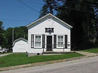
Corwin is a village in Wayne Township, Warren County, Ohio, United States. The population was 484 at the 2020 census.
Harveysburg is a village in Massie Township, Warren County, Ohio, United States. The population was 554 at the 2020 census. It is best known as the home of the Ohio Renaissance Festival.
Maineville is a village in Warren County, Ohio, United States. The population was 1,405 at the 2020 census.
Pleasant Plain is a village in Harlan Township, Warren County, Ohio, United States. The population was 129 at the 2020 census.
South Lebanon is a city located in Union and Hamilton Townships in central Warren County in the southwestern part of the U.S. state of Ohio. The population was 6,384 at the 2020 census.
Waynesville is a village in Wayne Township, Warren County, Ohio, United States. The population was 2,669 at the 2020 census. It is named for General "Mad" Anthony Wayne. The village, located at the crossroads of U.S. Route 42 and State Route 73, is known for its antique stores and its annual sauerkraut festival. Caesar Creek State Park is located 5 miles (8.0 km) east of the village.
Blanchester is a village in Clinton and Warren counties in the U.S. state of Ohio. The population was 4,224 at the 2020 census. Blanchester is part of the Wilmington, Ohio Micropolitan Statistical Area, which is also included in the Cincinnati-Wilmington-Maysville, OH-KY-IN Combined Statistical Area.
Washingtonville is a village in northern Columbiana and southern Mahoning counties in the U.S. state of Ohio. The population was 712 at the 2020 census. Southern Washingtonville is included in the Salem micropolitan area, while northern Washingtonville is part of the Youngstown–Warren metropolitan area.
Burkettsville is a village in Darke and Mercer counties in the U.S. state of Ohio. The population was 272 at the 2020 census.