Corwin, Ohio

Last updated

Corwin, Ohio
Corwin Council House and Jail.jpg
Corwin Council House and Jail
OHMap-doton-Corwin.png
Location of Corwin, Ohio
Map of Warren County Ohio Highlighting Corwin Village.png
Location of Corwin in Warren County
Coordinates: 39°31′32″N84°03′56″W / 39.52556°N 84.06556°W / 39.52556; -84.06556
Country United States
State Ohio
County Warren
Area
[1]
  Total0.33 sq mi (0.85 km2)
  Land0.33 sq mi (0.85 km2)
  Water0.00 sq mi (0.00 km2)
Elevation
[2]
840 ft (260 m)
Population
 (2020)
  Total484
  Density1,471.12/sq mi (567.57/km2)
Time zone UTC-5 (Eastern (EST))
  Summer (DST) UTC-4 (EDT)
ZIP code
45068
Area code 513
FIPS code 39-18840 [3]
GNIS feature ID2398632 [2]

Corwin is a village in Wayne Township, Warren County, Ohio, United States. The population was 484 at the 2020 census.

Contents

History

Corwin began as a depot on the Little Miami Railroad. [4] A post office called Corwin was established in 1898, and remained in operation until 1918. [5] The village is named for Thomas Corwin, 15th Governor of Ohio. [6]

Geography

According to the United States Census Bureau, the village has a total area of 0.35 square miles (0.91 km2), all land. [7]

Demographics

Historical population
CensusPop.Note
1870 135
1880 18839.3%
1900 131
1910 14611.5%
1920 136−6.8%
1930 1381.5%
1940 16318.1%
1950 326100.0%
1960 44737.1%
1970 346−22.6%
1980 276−20.2%
1990 225−18.5%
2000 25613.8%
2010 42164.5%
2020 48415.0%
U.S. Decennial Census [8]

2010 census

As of the census [9] of 2010, there were 421 people, 177 households, and 131 families living in the village. The population density was 1,202.9 inhabitants per square mile (464.4/km2). There were 190 housing units at an average density of 542.9 per square mile (209.6/km2). The racial makeup of the village was 98.8% White and 1.2% from other races. Hispanic or Latino of any race were 1.9% of the population.

There were 177 households, of which 31.1% had children under the age of 18 living with them, 62.7% were married couples living together, 6.8% had a female householder with no husband present, 4.5% had a male householder with no wife present, and 26.0% were non-families. 20.9% of all households were made up of individuals, and 8.5% had someone living alone who was 65 years of age or older. The average household size was 2.38 and the average family size was 2.76.

The median age in the village was 42.6 years. 21.1% of residents were under the age of 18; 6% were between the ages of 18 and 24; 27.2% were from 25 to 44; 28.1% were from 45 to 64; and 17.8% were 65 years of age or older. The gender makeup of the village was 53.9% male and 46.1% female.

2000 census

As of the census [3] of 2000, there were 256 people, 100 households, and 83 families living in the village. The population density was 855.6 inhabitants per square mile (330.3/km2). There were 111 housing units at an average density of 371.0 per square mile (143.2/km2). The racial makeup of the village was 99.61% White and 0.39% Asian.

There were 100 households, out of which 30.0% had children under the age of 18 living with them, 70.0% were married couples living together, 7.0% had a female householder with no husband present, and 17.0% were non-families. 16.0% of all households were made up of individuals, and 4.0% had someone living alone who was 65 years of age or older. The average household size was 2.56 and the average family size was 2.81.

In the village, the population was spread out, with 20.7% under the age of 18, 6.3% from 18 to 24, 35.5% from 25 to 44, 25.0% from 45 to 64, and 12.5% who were 65 years of age or older. The median age was 37 years. For every 100 females there were 100.0 males. For every 100 females age 18 and over, there were 99.0 males.

The median income for a household in the village was $51,875, and the median income for a family was $50,000. Males had a median income of $28,625 versus $20,833 for females. The per capita income for the village was $18,414. About 6.8% of families and 11.2% of the population were below the poverty line, including 16.3% of those under the age of eighteen and none of those 65 or over.

Public services

All of the village is in the Wayne Local School District. Mail is delivered through the Waynesville post office and telephone service is provided through the Waynesville exchange.

Related Research Articles

<span class="mw-page-title-main">Waynesville, Illinois</span> Village in Illinois, United States

Waynesville is a village in DeWitt County, Illinois, United States. The population was 381 at the 2020 census.

<span class="mw-page-title-main">Palestine, Ohio</span> Village in Ohio, United States

Palestine is a village in Darke County, Ohio, United States. The population was 180 at the 2020 census.

<span class="mw-page-title-main">Cleves, Ohio</span> City in Ohio, United States

Cleves is a village in Miami Township, Hamilton County, Ohio, United States. Located along the Ohio River, it is a western suburb of Cincinnati. The population was 3,414 at the 2020 census.

<span class="mw-page-title-main">Gann, Ohio</span> Village in Ohio, United States

Brinkhaven, once known as Mount Holly and Gann, is a village in Knox County, Ohio, United States. The population was 114 at the 2020 census.

<span class="mw-page-title-main">Sebring, Ohio</span> Village in Ohio, United States

Sebring is a village in southwestern Mahoning County, Ohio, United States. The population was 4,191 as of the 2020 census. It is part of the Youngstown–Warren metropolitan area.

<span class="mw-page-title-main">Darbyville, Ohio</span> Village in Ohio, United States

Darbyville is a village in Pickaway County, Ohio, United States. The population was 186 at the 2020 census.

<span class="mw-page-title-main">Cloverdale, Ohio</span> Village in Ohio, United States

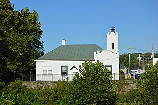
Cloverdale is a village in Perry Township, Putnam County, Ohio, United States. The population was 170 at the 2020 census.

<span class="mw-page-title-main">Kalida, Ohio</span> Village in Ohio, United States

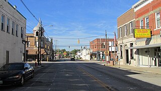
Kalida is a village in Putnam County, Ohio, United States. The population was 1,455 at the 2020 census.

<span class="mw-page-title-main">Miller City, Ohio</span> Village in Ohio, United States

Miller City is a village in Putnam County, Ohio, United States. The population was 134 at the 2020 census.

<span class="mw-page-title-main">Limaville, Ohio</span> Census-designated place in Ohio, United States

Limaville is a census-designated place (CDP) and former village in Stark County, Ohio, United States. The population was 151 at the 2020 census. It is part of the Canton–Massillon Metropolitan Statistical Area.

<span class="mw-page-title-main">Orangeville, Ohio</span> Village in Ohio, United States

Orangeville is a village in eastern Trumbull County, Ohio, United States, along the state line with Pennsylvania. The population was 174 at the 2020 census. It is part of the Youngstown–Warren metropolitan area.

<span class="mw-page-title-main">Butlerville, Ohio</span> Village in Ohio, United States

Butlerville is a village in central Harlan Township, Warren County, Ohio, United States, located in the southwestern part of the state. The population was 155 at the 2020 census.

<span class="mw-page-title-main">Harveysburg, Ohio</span> Village in Ohio, United States

Harveysburg is a village in Massie Township, Warren County, Ohio, United States. The population was 554 at the 2020 census. It is best known as the home of the Ohio Renaissance Festival.

<span class="mw-page-title-main">Maineville, Ohio</span> Village in Ohio, United States

Maineville is a village in Warren County, Ohio, United States. The population was 1,405 at the 2020 census.

<span class="mw-page-title-main">Morrow, Ohio</span> Village in Ohio, United States

Morrow is a village in Salem Township, Warren County, Ohio, United States. The population was 2,049 at the 2020 census.

<span class="mw-page-title-main">Pleasant Plain, Ohio</span> Village in Ohio, United States

Pleasant Plain is a village in Harlan Township, Warren County, Ohio, United States. The population was 129 at the 2020 census.

<span class="mw-page-title-main">South Lebanon, Ohio</span> City in Ohio, United States

South Lebanon is a city located in Union and Hamilton Townships in central Warren County in the southwestern part of the U.S. state of Ohio. The population was 6,384 at the 2020 census.

<span class="mw-page-title-main">Waynesville, Ohio</span> Village in Ohio, United States

Waynesville is a village in Wayne Township, Warren County, Ohio, United States. The population was 2,669 at the 2020 census. It is named for General "Mad" Anthony Wayne. The village, located at the crossroads of U.S. Route 42 and State Route 73, is known for its antique stores and its annual sauerkraut festival. Caesar Creek State Park is located 5 miles (8.0 km) east of the village.

<span class="mw-page-title-main">Blanchester, Ohio</span> Village in Ohio, United States

Blanchester is a village in Clinton and Warren counties in the U.S. state of Ohio. The population was 4,224 at the 2020 census. Blanchester is part of the Wilmington, Ohio Micropolitan Statistical Area, which is also included in the Cincinnati-Wilmington-Maysville, OH-KY-IN Combined Statistical Area.

<span class="mw-page-title-main">Verona, Ohio</span> Village in Ohio, United States

Verona is a village in Montgomery and Preble counties in the U.S. state of Ohio. The population was 403 at the 2020 census. It is part of the Dayton Metropolitan Statistical Area.

References

  1. "ArcGIS REST Services Directory". United States Census Bureau. Retrieved September 20, 2022.
  2. 1 2 U.S. Geological Survey Geographic Names Information System: Corwin, Ohio
  3. 1 2 "U.S. Census website". United States Census Bureau . Retrieved January 31, 2008.
  4. "Warren County, Ohio Place Names". Warren County Genealogical Society. Archived from the original on March 13, 2018. Retrieved March 13, 2018.
  5. "Warren County". Jim Forte Postal History. Archived from the original on January 22, 2016. Retrieved March 2, 2015.
  6. Gannett, Henry (1905). The Origin of Certain Place Names in the United States. Genealogical Publishing Com. p. 93. ISBN   978-0-8063-0544-8.
  7. "US Gazetteer files 2010". United States Census Bureau. Archived from the original on July 2, 2012. Retrieved January 6, 2013.
  8. "Census of Population and Housing". Census.gov. Retrieved June 4, 2015.
  9. "U.S. Census website". United States Census Bureau . Retrieved January 6, 2013.