
Kragujevac is the fourth largest city in Serbia and the administrative centre of the Šumadija District. It is the historical centre of the geographical region of Šumadija in central Serbia, and is situated on the banks of the Lepenica River. According to the 2022 census, City of Kragujevac has 171,186 inhabitants.

Mladenovac is a municipality of the city of Belgrade. According to the 2022 census results, the municipality has a population of 48,683 inhabitants, while the urban area has 22,346 inhabitants.
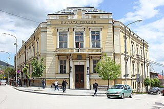
The Bor District is one of nine administrative districts of Southern and Eastern Serbia. It has a population of 101,100 inhabitants, according to the 2022 census results. The administrative center of the Bor district is the city of Bor and the judicial one, due to tradition, Negotin. This district is the easternmost district of Serbia and contains the Serbian panhandle that extends into the Romanian border.

The North Bačka District is one of seven administrative districts of the autonomous province of Vojvodina, Serbia. It lies in the Bačka geographical region. According to the 2022 census results, it has a population of 160,163 inhabitants. The administrative center of the district is the city of Subotica.

The Central Banat District is one of seven administrative districts of the autonomous province of Vojvodina, Serbia. It lies in the geographical region of Banat. According to the 2022 census results, it has a population of 157,711 inhabitants. The administrative center is the city of Zrenjanin.

The South Banat District is one of seven administrative districts of the autonomous province of Vojvodina, Serbia. The administrative center of the district is the city of Pančevo. The district lies in the region of Banat. According to the 2011 census results, it has a population of 260,244 inhabitants.
The Srem District is one of seven administrative districts of the autonomous province of Vojvodina, Serbia. It lies in the geographical regions of Syrmia and Mačva. According to the 2022 census results, it has a population of 282,547 inhabitants. The administrative center is the city of Sremska Mitrovica.

The Mačva District is one of eight administrative districts of Šumadija and Western Serbia. It expands in the western parts of Serbia, in the geographical regions of Mačva, Podrinje, Posavina, and Pocerina. According to the 2011 census results, it has a population of 298,931 inhabitants. The administrative center of the Mačva district is the city of Šabac.

The Kolubara District is one of eight administrative districts of Šumadija and Western Serbia. It occupies the central part of western Serbia. According to the 2011 census results, it has a population of 174,513 inhabitants. The administrative center of the Kolubara District is Valjevo, on the banks of the Kolubara River.

The Podunavlje District is one of nine administrative districts of Southern and Eastern Serbia. The district's name refers to its location by—specifically, to the south of—the Danube river. It expands across the central parts of Serbia. According to the 2011 census results, it has a population of 199,395 inhabitants. The administrative center is the city of Smederevo.

The Pomoravlje District is one of eight administrative districts of Šumadija and Western Serbia. It expands to the central parts of Serbia. According to the 2011 census results, it has a population of 214,536 inhabitants. The administrative center is the city of Jagodina.

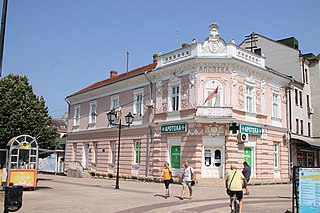
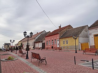
The Zlatibor District is one of eight administrative districts of Šumadija and Western Serbia. It is located in the western, mountainous part of Serbia. The district was named after the mountainous region of Zlatibor.
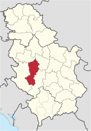
The Moravica District is one of eight administrative districts of Šumadija and Western Serbia. It is located in the central and southwestern parts of Serbia. The name Moravica derives from the river Moravica, which forms the West Morava, both passing through the district. As of the 2022 census, the district has a population of 189,281 inhabitants. The administrative center of the Moravica district is the city of Čačak.

The Raška District is one of eight administrative districts of Šumadija and Western Serbia. It expands to the southwestern part of the country. As of the 2022 census, the district has a population of 296,532 inhabitants. The administrative center of the Raška district is Kraljevo.

The Rasina District is one of eight administrative districts of Šumadija and Western Serbia. It expands to the central parts of Serbia. According to the 2011 census results, it has a population of 241,999 inhabitants. The administrative center of the Rasina District is Kruševac.

The Nišava District is one of nine administrative districts of Southern and Eastern Serbia. It expands to the southeastern parts of Serbia. According to the 2022 census results, it has a population of 343,950 inhabitants. The administrative center of the district is the city of Niš. After South Bačka, it is the second largest District in Serbia.
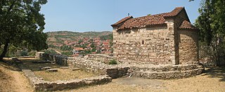
The Toplica District is an administrative district in southern Serbia, named after the river Toplica. As of the 2022 census, the district has a population of 77,341 inhabitants, making it the smallest district by population in Serbia. Its administrative center is the city of Prokuplje.

The Pirot District is one of nine administrative districts of Southern and Eastern Serbia. It expands to the southeastern part of Serbia. According to the 2022 census results, it has a population of 76,700 inhabitants. The administrative center is the city of Pirot.

The Jablanica District is one of nine administrative districts of Southern and Eastern Serbia. It expands in the southeastern parts of Serbia. As of the 2022 census, the district has a population of 184,502 inhabitants. The administrative center of the district is the city of Leskovac.
The Pčinja District is one of the nine administrative districts of Southern and Eastern Serbia. It covers the southern part of Serbia, bordering Kosovo, along with Bulgaria and North Macedonia. Its administrative center is the city of Vranje.


