2018 Haiti earthquake

Last updated

2018 Haiti earthquake
2018 Haiti earthquake shakemap.jpg
Haiti relief location map.jpg
Bullseye1.png
UTC  time2018-10-07 00:11:49
ISC  event 612859723
USGS-ANSS ComCat
Local dateOctober 6, 2018 (2018-10-06)
Local time19:11:49 (UTC−05:00)
Magnitude5.9 Mww
Depth24.0 km (15 mi)
Epicenter 20°02′28″N72°58′30″W / 20.041°N 72.975°W / 20.041; -72.975 Coordinates: 20°02′28″N72°58′30″W / 20.041°N 72.975°W / 20.041; -72.975
Areas affectedHaiti, Dominican Republic
Max. intensity VI (Strong)
TsunamiNo
Aftershocks2
Casualties
  • 18 dead
  • 548 injured [1]

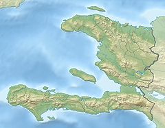
On October 6, 2018, at approximately 8:11 p.m, a magnitude 5.9 earthquake struck 19 kilometers northwest of Port-de-Paix, Haiti. [2] The earthquake damaged structures and killed 18 people. [1]

Contents

The earthquake was the strongest to hit Haiti since January 12, 2010, [3] not including the aftershocks of the 2010 earthquake, and the shaking was felt as far away as Port-au-Prince. [4]

Tectonic setting

Haiti lies at the boundary between the Caribbean Plate and North American Plate. Movement across this boundary is partitioned across several major structures. The major left-lateral strike slip fault zones of the Septentrional-Oriente fault zone and the Enriquillo–Plantain Garden fault zone together accommodate the lateral component of this movement. North of Haiti, the overall deformation is transpressional in nature and an additional structure, the North Hispaniola Fault, a major thrust zone, takes up the component of convergence at a rate of 5 mm per year. [5]

Damage

The earthquake caused part of a school to collapse in Gros-Morne, [6] damaged the façade of the Paroisse St. Michel A De Plaisance church in Plaisance, [7] caused a cultural center to collapse in Gros-Morne, [8] damaged a holding cell at the Police Nationale d'Haiti Commissariat de Port-de-Paix in Port-de-Paix, [9] allowing several detainees to escape, [8] caused an auditorium to collapse in Gros-Morne, [4] damaged several classrooms at San Gabriel National School in Gros-Morne, [6] and destroyed houses in the communes of Chansolme,[ citation needed ] Gros-Morne, [10] Plaisance, [7] and Port-de-Paix as well as on the island of Tortuga. [10]

Overall, a total of 2,102 houses were destroyed, and a further 15,932 were damaged. [1]

Casualties

The earthquake killed 18 people and 548 people were injured. [1] Nine of the deaths occurred in Port-de-Paix, seven in Gros-Morne and one in Saint-Louis du Nord. [11]

Response

President Jovenel Moïse instructed residents to stay calm and stated that authorities would be responding to those who need help. [12]

Prime Minister Jean-Henry Céant said that a cabinet had been created to help organize the emergency response. [13]

The day after the earthquake, President Moïse visited Port-de-Paix de oversee the recovery efforts. [14]

Aftershocks

There have been two aftershocks since the initial earthquake struck. A magnitude 5.2 event occurred nearly 20 hours after the mainshock, with another magnitude 4.2 event happening about 5 hours later. [11]

In the first 8 months of 2018, there were 26 earthquakes between the magnitudes of 2.9 and 4.6 recorded. [8]

See also

Related Research Articles

<span class="mw-page-title-main">Earthquake</span> Sudden movement of the Earths crust

An earthquake is the shaking of the surface of the Earth resulting from a sudden release of energy in the Earth's lithosphere that creates seismic waves. Earthquakes can range in intensity, from those that are so weak that they cannot be felt, to those violent enough to propel objects and people into the air, damage critical infrastructure, and wreak destruction across entire cities. The seismic activity of an area is the frequency, type, and size of earthquakes experienced over a particular time period. The seismicity at a particular location in the Earth is the average rate of seismic energy release per unit volume. The word tremor is also used for non-earthquake seismic rumbling.

<span class="mw-page-title-main">Earthquake swarm</span> Series of localized seismic events within a short time period

In seismology, an earthquake swarm is a sequence of seismic events occurring in a local area within a relatively short period of time. The length of time used to define a swarm varies, but may be days, months, or years. Such an energy release is different from the situation when a major earthquake is followed by a series of aftershocks: in earthquake swarms, no single earthquake in the sequence is obviously the main shock. In particular, a cluster of aftershocks occurring after a mainshock is not a swarm.

<span class="mw-page-title-main">1983 Borah Peak earthquake</span> Earthquake in Idaho, United States

The 1983 Borah Peak earthquake occurred on October 28, at 8:06:09 a.m. MDT in the western United States, in the Lost River Range at Borah Peak in central Idaho.

The 2009 Swan Islands earthquake occurred on May 28 at 02:24:45 AM local time with a moment magnitude of 7.3 and a maximum Mercalli intensity of VII. The epicenter was located in the Caribbean Sea, 64 kilometres (40 mi) northeast of the island of Roatán, 19 miles northeast of Port Royal, Isla de Bahias, 15 miles northwest of Isla Barbaretta, and 130 kilometres (81 mi) north-northeast of La Ceiba. Three aftershocks followed the earthquake within magnitude 4 range.

<span class="mw-page-title-main">2010 Haiti earthquake</span> Magnitude 7.0 Mw earthquake

A catastrophic magnitude 7.0 Mw earthquake struck Haiti at 16:53 local time on Tuesday, 12 January 2010. The epicenter was near the town of Léogâne, Ouest department, approximately 25 kilometres (16 mi) west of Port-au-Prince, Haiti's capital.

<span class="mw-page-title-main">2010 Baja California earthquake</span> Earthquake in Mexico

The 2010 Baja California earthquake occurred on April 4 with a moment magnitude of 7.2 and a maximum Mercalli intensity of VII. The shock originated at 15:40:41 local time south of Guadalupe Victoria, Baja California, Mexico.

The 2010 Canterbury earthquake struck the South Island of New Zealand with a moment magnitude of 7.1 at 4:35 am local time on 4 September, and had a maximum perceived intensity of X (Extreme) on the Mercalli intensity scale. Some damaging aftershocks followed the main event, the strongest of which was a magnitude 6.3 shock known as the Christchurch earthquake that occurred nearly six months later on 22 February 2011. Because this aftershock was centred very close to Christchurch, it was much more destructive and resulted in the deaths of 185 people.

<span class="mw-page-title-main">June 2011 Christchurch earthquake</span> June 2011 earthquake in New Zealand

The June 2011 Christchurch earthquake was a shallow magnitude 6.0 Mw earthquake that occurred on 13 June 2011 at 14:20 NZST. It was centred at a depth of 7 km (4.3 mi), about 5 km (3 mi) south-east of Christchurch, which had previously been devastated by a magnitude 6.2 MW earthquake in February 2011. The June quake was preceded by a magnitude 5.9 ML tremor that struck the region at a slightly deeper 8.9 km (5.5 mi). The United States Geological Survey reported a magnitude of 6.0 Mw and a depth of 9 km (5.6 mi).

<span class="mw-page-title-main">2011 Virginia earthquake</span> Earthquake in Virginia, U.S.

On August 23, 2011, a magnitude 5.8 earthquake hit the Piedmont region of the U.S. state of Virginia at 1:51:04 p.m. EDT. The epicenter, in Louisa County, was 38 mi (61 km) northwest of Richmond and 5 mi (8 km) south-southwest of the town of Mineral. It was an intraplate earthquake with a maximum perceived intensity of VIII (Severe) on the Mercalli intensity scale. Several aftershocks, ranging up to 4.5 Mw in magnitude, occurred after the main tremor.

<span class="mw-page-title-main">2014 Orkney earthquake</span> Magnitude 5.5 earthquake near Orkney, Klerksdorp, South Africa

The 2014 Orkney earthquake occurred at 12:22:33 SAST on 5 August, with the epicentre near Orkney, a gold mining town in the Klerksdorp district in the North West province of South Africa. The shock was assigned a magnitude of 5.5 on the Richter scale by the Council for Geoscience (CGS) in South Africa, making it the biggest earthquake in South Africa since the 1969 Tulbagh earthquake, which had a magnitude of 6.3 on the Richter scale. The United States Geological Survey (USGS) estimated a focal depth of 5.0 km (3.1 mi). The CGS reported 84 aftershocks on 5 August and 31 aftershocks on 6 August, with a magnitude of 1.0 to 3.8 on the Richter scale. According to the CGS, the earthquake is the biggest mining-related earthquake in South African history.

<span class="mw-page-title-main">2018 Hawaii earthquake</span> 6.9-magnitude earthquake in Hawaii

On May 4, 2018, an earthquake with a magnitude of Mw 6.9 struck Hawaii island in the Hawaii archipelago at around 12:33 p.m. local time. The earthquake's epicenter was near the south flank of Kīlauea, which has been the site of seismic and volcanic activity since late April of that year. According to the United States Geological Survey the quake was related to the new lava outbreaks at the volcano, and it resulted in the Hilina Slump moving about two feet. It was the largest earthquake to affect Hawaii since the 1975 earthquake, which affected the same region, killing two people and injuring another 28.

<span class="mw-page-title-main">2018 Osaka earthquake</span> Earthquake in Japan

On 18 June 2018, around 7:58 a.m. Japan Standard Time, an earthquake measuring 5.6 Mw on the moment magnitude scale struck in northern Osaka Prefecture, Japan. The earthquake's epicenter was near Takatsuki and occurred at a depth of approximately 13 kilometres (8.1 mi). The Japan Meteorological Agency reported a magnitude of 6.1 Mj and an intensity of 6 lower on the shindo scale.

<span class="mw-page-title-main">August 2018 Venezuela earthquake</span> Earthquake affecting South America and the Caribbean

On August 21, 2018 a magnitude 7.3 earthquake struck just off the northern coast of Venezuela, near Cariaco, Sucre. The earthquake is thought to be the largest in the country since the 1900 San Narciso earthquake. It prompted evacuations in Caracas, and caused shaking in Colombia, Guyana, Brazil, Grenada, Dominica, Barbados, St. Vincent and the Grenadines, St. Lucia, and Trinidad and Tobago, the last of which also suffered damage and brief phone and power outages from about 100 miles away. A tsunami was not expected, though the Pacific Tsunami Warning Center warned of wave potential, and an alert had been broadcast for tsunami waves along coastlines. In terms of damage, concrete fell from the unfinished Tower of David skyscraper, blocking the sidewalk and closing traffic.

<span class="mw-page-title-main">2018 Ionian Sea earthquake</span>

A strong earthquake measuring magnitude Mw 6.8 occurred in the Ionian Sea near the coasts of Greece during the night between 25 and 26 October 2018 at 22:54:51 UTC. Sea level changes were predicted, and a tsunami advisory was issued. Reports of sea level change of up to 20 centimeters were reported in Greece and Italy.

At 7:09 AM MDT on March 18, 2020, a 5.7 magnitude earthquake hit Salt Lake City, Utah, United States, with an epicenter 6 km (3.7 mi) north-northeast of Magna, Utah, beneath the site of the planned Utah Inland Port. It was the first major earthquake to occur within the Salt Lake Valley since the city was founded, the state's strongest earthquake since the 1992 St. George earthquake, and the first earthquake of comparable magnitude to occur near Salt Lake City since 1962, when a magnitude 5.0 earthquake struck a similar location in Magna.

<span class="mw-page-title-main">2021 Haiti earthquake</span> 7.2-magnitude earthquake in Tiburon Peninsula, Haiti

At 08:29:09 EDT on 14 August 2021, a magnitude 7.2 earthquake struck the Tiburon Peninsula in the Caribbean nation of Haiti. It had a 10-kilometre-deep (6.2 mi) hypocenter near Petit-Trou-de-Nippes, approximately 150 kilometres (93 mi) west of the capital, Port-au-Prince. Tsunami warnings were briefly issued for the Haitian coast. At least 2,248 people were confirmed killed as of 1 September 2021 and more than 12,200 injured, mostly in the Sud Department. An estimated 650,000 people were in need of assistance. At least 137,500 buildings were damaged or destroyed.

An earthquake struck approximately 53 kilometres SSE of the town of Mansfield, in the Victorian Alps of Australia on 22 September 2021, at 09:15 local time. The earthquake measured 5.9 on the moment magnitude scale. The earthquake caused minor structural damage in parts of Melbourne and left one person injured. The earthquake was also felt in New South Wales, Australian Capital Territory, South Australia and Tasmania. The earthquake was substantially stronger than the 1989 Newcastle earthquake that measured 5.6 and killed 13 people.

<span class="mw-page-title-main">2021 Arkalochori earthquake</span> Earthquake in Crete, Greece

A moment magnitude 6.0 earthquake struck the island of Crete in Greece at a depth of 6 km on 27 September 2021. The epicenter of the earthquake was located southeast of Heraklion. The quake killed one person, injured 36 and damaged over 5,000 old buildings on the island.

The 1992 Joshua Tree earthquake occurred at 9:50:25 p.m. PDT on April 22 in Southern California. The magnitude 6.2 earthquake struck under the Little San Bernadino Mountains, near the town of Joshua Tree, California. Though no deaths were reported, the earthquake caused 32 injuries. A maximum Mercalli intensity of VII was observed in Joshua Tree and caused light to moderate damage. The event preceded the Landers and Big Bear earthquakes by two months but is now recognized as the beginning of a series of major earthquakes that culminated in two events on June 28, 1992.

References

  1. 1 2 3 4 United Nations Office for the Coordination of Humanitarian Affairs (October 20, 2018). "Haiti: 2018 earthquake Situation report No.4" (PDF). Retrieved October 28, 2018.
  2. "Earthquake Event Page". USGS. October 7, 2018. Retrieved October 7, 2018.
  3. Evans, Natalie (October 7, 2018). "Magnitude 5.9 earthquake strikes Haiti causing injuries". Mirror. Retrieved October 7, 2018.
  4. 1 2 Mackie, Thomas (October 7, 2018). "Haiti earthquake: Port-au-Prince SHAKES as 5.8 magnitude quake rocks ring of fire island | World | News | Express.co.uk". Express. Retrieved October 7, 2018.
  5. Calais E.; Mazabraud Y.; de Lépinay B.M.; Mann P.; Mattioli G.; Jansma P. (2002). "Strain partitioning and fault slip rates in the northeastern Caribbean from GPS measurements". Geophysical Research Letters. 29 (18): 3–1–3–4. Bibcode:2002GeoRL..29.1856C. doi: 10.1029/2002GL015397 .
  6. 1 2 "Strong aftershock rattles north Haiti day after deadly quake". The Washington Post. October 7, 2018. Archived from the original on October 7, 2018. Retrieved October 7, 2018.
  7. 1 2 "Haiti earthquake: Magnitude 5.9 quake strikes near Port-de-Paix, causing injuries". Financial Express. October 7, 2018. Retrieved October 7, 2018.
  8. 1 2 3 Charles, Jacqueline; Madan, Monique O. (October 6, 2018). "Deaths and injuries confirmed in Haiti earthquake". Miami Herald. Retrieved October 7, 2018.
  9. "Deaths confirmed in Haiti earthquake; no doctors at hospital | Miami Herald". Miami Herald . Archived from the original on October 7, 2018.
  10. 1 2 "M5.9 quake shakes northern Haiti". The Washington Post. October 6, 2018. Archived from the original on October 7, 2018. Retrieved October 7, 2018.
  11. 1 2 United Nations Office for the Coordination of Humanitarian Affairs (October 9, 2018). "Haiti: 2018 earthquake Situation report No.3" (PDF). Retrieved October 10, 2018.
  12. "At Least 11 Dead In Haiti Earthquake: Officials". NDTV. October 7, 2018. Retrieved October 7, 2018.
  13. Almasy, Steve; Cullinane, Susannah; Mazloumsaki, Sara; Silva Fernandez, Daniel (October 7, 2018). "Magnitude 5.9 earthquake hits northern Haiti". CNN. Retrieved October 7, 2018.
  14. Dominguez, Claudia; Yan, Holly (October 7, 2018). "Another deadly earthquake in Haiti kills at least 12 people". CNN. Retrieved October 7, 2018.