2024 East Sepik earthquake

Last updated

2024 East Sepik earthquake
Papua New Guinea relief location map.jpg
Bullseye1.png
UTC  time2024-03-23 20:22:04
ISC  event 637096014
USGS-ANSS ComCat
Local date24 March 2024
Local time06:22
Magnitude6.9 Mw
Depth40.2 km (25 mi)
Epicenter 4°08′20″S143°09′32″E / 4.139°S 143.159°E / -4.139; 143.159
Type Oblique-slip
Areas affected East Sepik Province, Papua New Guinea
Max. intensity MMI VIII (Severe)
Casualties5 killed, 2+ injured

On 24 March 2024, a Mw 6.9 earthquake occurred in the East Sepik Province of Papua New Guinea, [1] killing five people. [2]

Contents

Tectonic setting

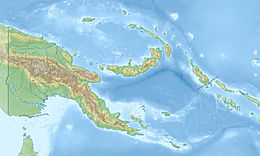
The island of New Guinea lies within the complex zone of collision between the Australian and Pacific Plates. Within this overall setting, the active tectonics of northern Papua New Guinea is dominated by the effects of continuing collision between the Huon–Finisterre island arc terrane with the edge of the Australian continental margin. The overall shortening is focused into two zones of thrust faulting, the Ramu–Markham fault zone, which forms the southwestern boundary of the Huon–Finisterre terrane, and the Highlands Thrust Belt, which lies further southwest and deforms the Australian margin. [3]

In April 2023, a magnitude 7.1 earthquake 21 km (13 mi) southeast of the March 2024 event killed eight people. [4] [5]

Earthquake

The earthquake occurred at 06:22:04 PGT (20:22 UTC), with an epicenter located 4 km (2.5 mi) north of Chambri Lake, or 38 km (24 mi) east-northeast of Ambunti. It also had a hypocenter 40.2 km (25.0 mi) deep. It had a maximum Modified Mercalli intensity of VIII (Severe), and according to the PAGER service of the United States Geological Survey, shaking of intensities VI-VII (Strong-Very Strong) was felt by an estimated 436,000 residents in East Sepik and Sandaun Provinces. [1] Tremors were also felt in Madang Province [2] and in Goroka, Eastern Highlands Province. [6]

Impact

ShakeMap created by the USGS The Shakemap of 2024 East Sepik earthquake.pdf
ShakeMap created by the USGS

The earthquake killed five people, injured two others [7] [2] and destroyed around 1,000 homes. [8] East Sepik provincial police commander Christopher Tamari warned that the death toll could rise as emergency teams were trying to reach remote areas. [9] Two of the deaths occurred in Angoram [7] and another died in Gawi. [10] Many more unconfirmed fatalities were reported in remote villages near the epicenter. [11] At the time of the earthquake, the province was affected by severe flooding along the Sepik River, which exacerbated damage and casualties from the earthquake. Most houses in the area were made of wood and thatched roofing. [12] Many residents were unable to flee when the earthquake struck, as the inundation reached the chest level in some areas. In the village of Sotmeri, which was experiencing major flooding at the time of the earthquake, all 45 houses collapsed, [13] killing a three-year-old child who drowned after being pinned down by debris when their residence collapsed into floodwaters, [10] while 50 houses were destroyed in the neighbouring village of Korogu. [13] Fishermen out in the water said that waves started building up in rivers when the earthquake struck. [13]

At Kamanibit village in Angoram District, 39 houses collapsed and were submerged beneath floodwaters, [14] while another 11 houses collapsed in the nearby village of Jikinumbu, killing a seven-year-old girl and her mother. [12] Thirty-five houses collapsed in Kawarari. [15] In Yenjimangua, seven houses were destroyed while in Niaurange, eight houses collapsed into floodwaters. [16] A landslide occurred in Yangoru-Saussia District, burying several gardens. [17] In Maprik District, six casualties were recorded from Maprik town and two from Yangoru. [13] A high school in the district was also damaged, while in Wewak, two oxygen cylinders at the Boram General Hospital exploded during the earthquake. A bridge connecting the town to the Papua New Guinea Defence Force garrison at Moem Barracks also collapsed. [12]

Allan Bird, the governor of East Sepik, said that the earthquake had “damaged most parts of the province”, [12] with the worst affected areas being Angoram, Wosera-Gawi and Ambunti-Dreikikier Districts, as well as areas along the Sepik River and wetlands. [18] The International Organization for Migration estimated that the earthquake and preceding floods displaced about 10,000 people and affected 400,000 others in East Sepik and Highlands Region, and left more than 1,000 houses destroyed. [19] Eighty-six schools in Ambunti, Wosera-Gawi and Angoram suspended classes indefinitely due to the effects of the earthquake and floods. [20]

Aftermath

A state of emergency was declared in East Sepik Province on 25 March due to the effects of the earthquake as well as the preceding floods. [6] while the provincial government released 200 thousand kina in relief funds, to be augmented later with five million kina. [18] Prime Minister James Marape later announced that the national government would allocate 500 million kina (US$132 million) towards disaster relief. [2] The Second Battalion of the Papua New Guinea Defence Forces' Royal Pacific Islands Regiment based in Moem Barracks was ordered by the defence ministry to mobilize its assets to help in disaster response. [21] A civilian helicopter was deployed to Wewak to assist in relief operations, to be augmented a military helicopter. [22] Governor Bird requested assistance from the US embassy in Port Moresby for the purchase and delivery of 5,000 water filters and buckets. Samaritan Aviation, [23] USAID, the International Organization for Migration and Vodafone also provided assistance to affected communities. [24] The US released a combined total of 3.45 million kina ($900,000) for humanitarian aid for victims of the earthquake and the preceding floods. [25] A donation drive was launched by students and faculty at the Papua New Guinea University of Technology in Lae. [26]

On 29 March, Defence Minister Billy Joseph visited Wewak to look into the disaster response. He also announced the deployment of a C-27 aircraft by the Australian Government to the city carrying humanitarian aid, [27] which arrived on 30 March. [28] On 30 and 31 March, Marape visited East Sepik and other areas affected by the earthquake and the preceding floods. He estimated that the combined total damages from the disasters had cost 221 million kina. [29]

See also

Related Research Articles

<span class="mw-page-title-main">Wewak</span> Place in East Sepik Province, Papua New Guinea

Wewak is the capital of the East Sepik province of Papua New Guinea. It is on the northern coast of the island of New Guinea. It is the largest town between Madang and Jayapura. It is the see city (seat) of the Roman Catholic Diocese of Wewak.

<span class="mw-page-title-main">East Sepik Province</span> Province of Papua New Guinea

East Sepik is a province in Papua New Guinea. Its capital is Wewak. East Sepik has an estimated population of 433,481 people and is 43,426 km square in size.

<span class="mw-page-title-main">Huon Peninsula</span> Peninsula on the island of New Guinea

Huon Peninsula is a large rugged peninsula on the island of New Guinea in Morobe Province, eastern Papua New Guinea. It is named after French explorer Jean-Michel Huon de Kermadec. The peninsula is dominated by the steep Saruwaged and Finisterre and Cromwell Mountains. The nearest large town is the Morobe provincial capital Lae to the south, while settlements on the north coast include the former German town of Finschhafen, the district capital of Wasu, Malalamai and Saidor with its World War II era Saidor Airport.

The 1998 Papua New Guinea earthquake occurred on July 17 with a moment magnitude of 7.0 and a maximum Mercalli intensity of VIII (Severe). The event occurred on a reverse fault near the north coast region of Papua New Guinea, 25 kilometers (16 mi) from the coast near Aitape, and caused a large undersea landslide which caused a tsunami that hit the coast, killing between at least 2,183 and 2,700 people and injuring thousands.

<span class="mw-page-title-main">Districts of Papua New Guinea</span> Second-level administrative division

This page is a list of districts of Papua New Guinea.

Maprik District is a district of East Sepik Province in Papua New Guinea. It is one of the six administrative districts that make up the province. It is about two and half hours drive from the provincial capital of Wewak. It's considered as the economic hub of the Sepik region as Maprik Town services not only the people of Maprk but other Districts such as, Yangoru Sausia, Wosera Gawi, Ambunti Drekikier and Aitape Lumi in West Sepik Province. The current Political Head of the district is Hon. Gabriel lenny Kapris, MP. There are 5 local level governments that made up the district.

Cherubim Alfred Dambui, was a Papua New Guinea politician and Roman Catholic bishop. Dambui became the first Sepik to be ordained a Catholic priest in 1974 and served as the first premier of East Sepik Province beginning in 1976. Dambui also served as the auxiliary bishop of the Roman Catholic Archdiocese of Port Moresby, Papua New Guinea.

<span class="mw-page-title-main">Sepik</span> River on New Guinea

The Sepik is the longest river on the island of New Guinea, and the second largest in Oceania by discharge volume after the Fly River. The majority of the river flows through the Papua New Guinea (PNG) provinces of Sandaun and East Sepik, with a small section flowing through the Indonesian province of Papua.

This is a list of members of the National Parliament of Papua New Guinea from 2012 to 2017, as elected at the 2012 election.

Pagwi is a village and township on the Sepik River in Gawi Rural LLG of East Sepik Province, Papua New Guinea, north-east of Ambunti. Linked by road to Wewak, about 4 or 5 hours away on the coast, the Chambri Lakes are nearby to the south. It contains little more than some dilapidated government buildings and a few basic guesthouses such as Yamanumbo Guesthouse. Pagwi Council House is described as "hardly impressive", but its "handsomely carved posts inside" are noted. There have been numerous land disputes and conflicts in the area.

<span class="mw-page-title-main">Cyclone Ita</span> 2014 Australian cyclone

Severe Tropical Cyclone Ita was the strongest tropical cyclone in the Australian region by central pressure since George in 2007, and by wind speed since Monica in 2006. The system was first identified over the Solomon Islands as a tropical low on 1 April 2014, and gradually moved westward, eventually reaching cyclone intensity on 5 April. On 10 April, Ita intensified rapidly into a powerful Category 5 system on the Australian Scale, but it weakened to a Category 4 system in the hours immediately preceding landfall the following day. At the time of landfall at Cape Flattery at 12 April 22:00 (UTC+10), the cyclone's Dvorak intensity was approximately T5.0, consistent with a weak Category 4 system, and considerably lower than the T6.5 observed when the system was at its peak intensity. Meteorologists noted the system had, at that time, begun an eyewall replacement cycle; as a result, the system was considerably less powerful than various intensity scales had predicted. As a result, Ita's impact on terrain was lessened.

Ezekiel Anisi was a Papua New Guinean politician. He was a member of the National Parliament of Papua New Guinea from August until October 2012, when he was unseated by the National Court, and from a December 2013 by-election until his death, representing the electorate of Ambunti-Dreikikir Open in East Sepik Province. He was the youngest MP in Papua New Guinea.

<span class="mw-page-title-main">2018 Papua New Guinea earthquake</span> Earthquake affecting Papua New Guinea

The Papua New Guinea earthquake was a magnitude 7.5 earthquake that occurred in the Hela Province of Papua New Guinea on 26 February 2018, at 3:44 a.m. local time. The earthquake's epicenter was 10 kilometres (6.2 mi) west of the town of Komo. The maximum felt intensity was IX (Violent) on the Mercalli intensity scale. A total of 160 people were killed and many others were injured. An aftershock of M6.0 killed 11 people on 4 March, while another aftershock of M6.7 occurred at 00:13 local time on 7 March, killing at least 25 more. A 6.3 aftershock killed another 4 people on 7 April, more than a month after the first tremors hit the area.

<span class="mw-page-title-main">Marienberg languages</span> Torricelli language branch of Papua New Guinea

The Marienberg or Marienberg Hills languages are a branch of the Torricelli language family. They are spoken in a mountainous stretch of region located between the towns of Wewak and Angoram in the Marienberg Hills of East Sepik Province, Papua New Guinea.

The 1993 Finisterre Range earthquakes began on October 13 with a Mw  6.9 mainshock, followed by Mw  6.5 and 6.7 earthquakes. These earthquakes struck beneath the Finisterre Range, north of Markham Valley in Morobe Province, Papua New Guinea. The complex earthquake sequence seriously damaged many villages in the rural Eastern Papua New Guinea region, generating landslides and killing at least 60 people.

<span class="mw-page-title-main">2002 Sandaun earthquake</span> Earthquake in Papua New Guinea

On September 9, 2002, a magnitude 7.6 earthquake struck off the coast of Wewak, Sandaun Province, Papua New Guinea. The shallow reverse earthquake triggered a local tsunami measuring 5 meters high. The disaster resulted in at least 6 deaths, 70 injuries and building damage.

On 11 September 2022, an earthquake of moment magnitude 7.6–7.7 struck Papua New Guinea, in the northern part of Morobe Province. The normal faulting earthquake occurred with a hypocenter depth of 116.0 km (72.1 mi) beneath the Finisterre Range. A maximum perceived Modified Mercalli intensity of VIII (Severe) was estimated. Shaking was widely felt across the country and even in neighbouring Indonesia. At least 21 people died and 42 were injured, mostly due to landslides.

A magnitude 7.1 earthquake struck 38.3 km (23.8 mi) east-southeast of Ambunti in East Sepik Province, Papua New Guinea on 3 April 2023.

Events in the year 2024 in Papua New Guinea.

References

  1. 1 2 National Earthquake Information Center (23 March 2024). "M 6.9 - 38 km ENE of Ambunti, Papua New Guinea". United States Geological Survey . Retrieved 23 March 2024.
  2. 1 2 3 4 Kero, Gynnie (25 March 2024). "Quake hits ESP". The National. Retrieved 25 March 2024.
  3. Abers, G.A.; McCaffrey, R. (1994). "Active arc-continent collision: Earthquakes, gravity anomalies, and fault kinematics in the Huon-Finisterre collision zone, Papua New Guinea". Tectonics. 13 (2): 227–245. Bibcode:1994Tecto..13..227A. doi:10.1029/93TC02940.
  4. "A child among eight dead in PNG's East Sepik 7.3 magnitude earthquake". Papua New Guinea Today. 4 April 2023. Retrieved 6 April 2023.
  5. "Quake hits Sepik hard". The National. 14 April 2023. Retrieved 16 April 2023.
  6. 1 2 Kero, Gynnie (26 March 2024). "Emergency in ESP". The National. Retrieved 26 March 2024.
  7. 1 2 "Three dead, 93 houses collapsed after 7.0 magnitude earthquake strikes East Sepik". Islands Business. 25 March 2024. Retrieved 25 March 2024.
  8. "Five Dead, 1,000 Homes Destroyed in Papua New Guinea Earthquake". Voice of America. Agence France-Presse. 25 March 2024. Retrieved 25 March 2024.
  9. "At least five dead, 1,000 homes destroyed in Papua New Guinea earthquake". Al-Arabiya. Retrieved 25 March 2024.
  10. 1 2 Mark, Dorothy (24 March 2024). "Double disaster for Sepik river people". Papua New Guinea Post-Courier. Retrieved 24 March 2024.
  11. "'We have no clean drinking water' in quake hit area, says volunteer". Asia Pacific Report. 26 March 2024. Retrieved 26 March 2024.
  12. 1 2 3 4 "Several dead, 1,000 homes destroyed in Papua New Guinea earthquake". Al Jazeera. Retrieved 25 March 2024.
  13. 1 2 3 4 Yanei, Majeleen (26 March 2024). "Quake hits at heart of river people". The National. Retrieved 26 March 2024.
  14. Doug Dingwall; Caroline Tiriman; Theckla Gunga; Belinda Kora (25 March 2024). "Three people reported dead, 1,000 homes destroyed after earthquake hits PNG's East Sepik province". Australia: ABC News. Retrieved 25 March 2024.
  15. "Mamari wants fair distribution". The National. 8 April 2024. Retrieved 8 April 2024.
  16. Gwangilo, Phoebe (26 March 2024). "No clean water at quake hit area: Volunteer". Papua New Guinea Post-Courier. Retrieved 26 March 2024.
  17. "Villages hit by earthquake still awaiting relief supplies". The National. 4 April 2024. Retrieved 4 April 2024.
  18. 1 2 Gwangilo, Phoebe (26 March 2024). "East Sepik State of Emergency: Implement emergency plan, says Torovi". Papua New Guinea Post-Courier. Retrieved 26 March 2024.
  19. Nero, Hannah (5 April 2024). "K3mil for East Sepik disaster relief". The National. Retrieved 5 April 2024.
  20. Yanei, Majeleen (5 April 2024). "86 schools suspend classes". The National. Retrieved 7 April 2024.
  21. "Papua New Guinea earthquake: 3 reportedly dead after 6.9 shake in Sepik". Radio New Zealand. 25 March 2024. Retrieved 25 March 2024.
  22. Zarriga, Miriam (25 March 2024). "Update on government response to natural disasters". Papua New Guinea-Post Courier. Retrieved 25 March 2024.
  23. "East Sepik needs help says governor - '1000 homes lost' in PNG earthquake". Radio New Zealand. 25 March 2024. Retrieved 25 March 2024.
  24. "Firm, IOM help with disaster relief in Sepik". The National. 2 April 2024. Retrieved 2 April 2024.
  25. Zarriga, Miriam (3 April 2024). "U.S. support in disaster relief acknowledged". Papua New Guinea-Post Courier. Retrieved 3 April 2024.
  26. "Donation drives for disaster victims". The National. 10 April 2024. Retrieved 10 April 2024.
  27. Zarraga, Miriam (29 March 2024). "East Sepik earthquake disaster response update". Papua New Guinea Post-Courier. Retrieved 29 March 2024.
  28. Gwangilo, Phoebe (2 April 2024). "Aust govt offers help". Papua New Guinea Post-Courier. Retrieved 2 April 2024.
  29. "Funds released: Disaster bill at K200 million, says PM". Papua New Guinea-Post Courier. 3 April 2024. Retrieved 3 April 2024.