5th federal electoral district of Chiapas

Last updated

Chiapas's 5th
Flag of Mexico.svg
Electoral district of the
Chamber of Deputies of Mexico
Incumbent
Member Emilio Ramón Ramírez Guzmán
Party Morena
Congress 66th (2024–2027)
District
State Chiapas
Head town San Cristóbal de las Casas
Covers Chamula, San Cristóbal de las Casas (part), San Juan Cancuc, Tenejapa, Zinacantán
Region Third
Precincts138
Population447,249
IndigenousYes
Federal electoral districts of Chiapas since 2022 Federal Electoral Districts of Chiapas (since 2022).png
Federal electoral districts of Chiapas since 2022
Chiapas under the 2017-2022 districting scheme Mapa Electoral Federal de Chiapas (2017-2022).png
Chiapas under the 2017–2022 districting scheme
2005-2017 5th district shaded blue Chiapas Distrito 05.svg
2005–2017 5th district shaded blue

The 5th federal electoral district of Chiapas (Spanish : Distrito electoral federal 05 de Chiapas) is one of the 300 electoral districts into which Mexico is divided for elections to the federal Chamber of Deputies and one of 13 such districts in the state of Chiapas. [1]

Contents

It elects one deputy to the lower house of Congress for each three-year legislative period by means of the first-past-the-post system. Votes cast in the district also count towards the calculation of proportional representation ("plurinominal") deputies elected from the third region. [2] [3]

The current member for the district, elected in the 2024 general election, is Emilio Ramón Ramírez Guzmán of the National Regeneration Movement (Morena). [4] [5]

District territory

Under the National Electoral Institute's 2022 districting plan, which will be used for the 2024, 2027 and 2030 federal elections, [6] Chiapas's 5th district covers 138 electoral precincts (secciones electorales) across five municipalities in the central region of the state: [7] [8]

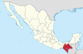
The district's head town (cabecera distrital), where results from individual polling stations are gathered together and tallied, is the city of San Cristóbal de Las Casas. The district reported a population of 447,249 in the 2020 Census; [1] with Indigenous and Afrodescendent inhabitants accounting for over 69% of its population, it is classified by the National Electoral Institute (INE) as an indigenous district. [7] [b]

Previous districting schemes

Evolution of electoral district numbers
197219781996200520172022
Chiapas6912121313
Chamber of Deputies196300
Sources: [1] [9] [10] [11]

2005–2017

Between 2017 and 2022, in addition to the five it comprises in the 2022 plan, the district also covered the municipality of San Lucas. The head town was at San Cristóbal de Las Casas. [12]

2005–2017

In 2005–2017, the 5th district was located in the Chiapas Highlands north-western portion of the state and covered the municipalities of

1996–2005

Between 1996 and 2005, the district had a slightly different configuration. It covered the following municipalities:

1978–1996

The districting scheme in force from 1978 to 1996 was the result of the 1977 electoral reforms, which increased the number of single-member seats in the Chamber of Deputies from 196 to 300. Under that plan, Chiapas's seat allocation rose from six to nine. [15] The 5th district had its head town at Tapachula and it covered eight municipalities. [16]

Deputies returned to Congress

Flag of Mexico.svg National parties
Current
PAN Party (Mexico).svg PAN
PRI Party (Mexico).svg PRI
PT Party (Mexico).svg PT
PVE Party (Mexico).svg PVEM
Logo Partido Movimiento Ciudadano (Mexico).svg MC
Morena logo (alt).svg Morena
Defunct or local only
Logo del Partido Laborista Mexicano.svg PLM
Logo Partido Nacional Revolucionario.svg PNR
Logo Partido de la Revolucion Mexicana.svg PRM
Logo del Partido Populista (Mexico).png PP
Emblema PPS.svg PPS
PARM logo (Mexico) (1954-1994).svg PARM
PFCRN Logo.png PFCRN
CON logo (Mexico).svg Convergencia
PNA Party (Mexico).svg PANAL
PSD logo (Mexico).svg PSD
Partido Encuentro Social (Mexico).svg PES
Logo Encuentro Solidario.svg PES
PRD logo (Mexico).svg PRD
Fifth federal electoral district of Chiapas
ElectionDeputyPartyTermLegislature
1976 Gonzalo Esponda Zebadúa [17] PRI Party (Mexico).svg 1976–1979 50th Congress
1979 Jaime Coutiño Esquinca [18] PRI Party (Mexico).svg 1979–1982 51st Congress
1982 Faustino Roos Mazo [19] PRI Party (Mexico).svg 1982–1985 52nd Congress
1985 Antonio Melgar Aranda [20] PRI Party (Mexico).svg 1985–1988 53rd Congress
1988 César Ricardo Naumann Escobar [21] PRI Party (Mexico).svg 1988–1991 54th Congress
1991 José Antonio Aguilar Bodegas [22] PRI Party (Mexico).svg 1991–1994 55th Congress
1994 Hildiberto Ochoa Samayos [23] PRI Party (Mexico).svg 1994–1997 56th Congress
1997 Gilberto Velasco Rodríguez [24] PRI Party (Mexico).svg 1997–2000 57th Congress
2000 Nicolás Lorenzo Álvarez Martínez [25] PRI Party (Mexico).svg 2000–2003 58th Congress
2003 Florencio Collazo Gómez [26] PRI Party (Mexico).svg 2003–2006 59th Congress
2006 Jorge Mario Lescieur Talavera [27] PRI Party (Mexico).svg 2006–2009 60th Congress
2009 Sergio Lobato García [28] PRI Party (Mexico).svg 2009–2012 61st Congress
2012 Luis Gómez Gómez [29] PRI Party (Mexico).svg 2012–2015 62nd Congress
2015 María Soledad Sandoval Martínez [30] PRI Party (Mexico).svg 2015–2018 63rd Congress
2018 Clementina Marta Dekker Gómez [31] Worker's Party logo (Mexico).svg 2018–2021 64th Congress
2021 Yeimi Aguilar Cifuentes [32] PRI Party (Mexico).svg 2021–2024 65th Congress
2024 [4] Emilio Ramón Ramírez Guzmán [5] Morena logo (alt).svg 2024–2027 66th Congress

Notes

  1. The remainder of San Cristóbal de Las Casas is assigned to the 11th district.
  2. The INE deems any local or federal electoral district where Indigenous or Afrodescendent inhabitants number 40% or more of the population to be an indigenous district. [1]

References

  1. 1 2 3 4 "Memoria de la Distritación Nacional 2021–2023" (PDF). INE. p. 228. Archived from the original (PDF) on 28 May 2024. Retrieved 21 August 2024.
  2. "How Mexico Elects Its Leaders – The Rules". Mexico Solidarity Project. 31 January 2024. Retrieved 20 July 2024.
  3. "Circunscripciones" (PDF). ayuda.ine.mx. INE . Retrieved 20 July 2024.
  4. 1 2 "Chiapas Distrito 5. San Cristóbal de Las Casas". Cómputos Distritales 2024. INE . Retrieved 27 June 2024.
  5. 1 2 "Perfil: Dip. Emilio Ramón Ramírez Guzmán, LXVI Legislatura". Sistema de Información Legislativa (SIL). SEGOB . Retrieved 3 September 2024.
  6. De la Rosa, Yared (20 February 2023). "Nueva distritación electoral le quita diputados a la CDMX y le agrega a Nuevo León". Forbes México. Retrieved 29 May 2024.
  7. 1 2 "Cartografía electoral federal 2023". Diario de Chiapas. 6 March 2023. Retrieved 10 July 2024.
  8. "Acuerdo del Consejo General del Instituto Nacional Electoral por el que se aprueba el proyecto de la demarcación territorial de los trescientos distritos electorales federales uninominales". Diario Oficial de la Federación . INE. 20 February 2023. Retrieved 19 May 2025.
  9. González Casanova, Pablo (1993). Las Elecciones en México: evolución y perspectivas (3 ed.). Siglo XXI. p. 219. ISBN   9789682313219 . Retrieved 19 May 2025.
  10. Baños Martínez, Marco Antonio; Palacios Mora, Celia (2014). "Evolución territorial de los distritos electorales federales uninominales, 1977–2010" [Territorial evolution of the federal uninominal electoral districts, 1977–2010]. Investigaciones Geográficas (84). Mexico City: Instituto de Geografía, UNAM: 92. doi: 10.14350/rig.34063 . Retrieved 19 May 2025.
  11. "Acuerdo del Consejo General del Instituto Nacional Electoral por el que se aprueba la demarcación territorial de los 300 distritos electorales federales uninominales" (PDF). Repositorio Documental. INE. 15 March 2017. Retrieved 19 May 2025.
  12. "Chiapas: Descriptivo de la distritacion federal, marzo 2017" (PDF). Cartografía. INE. March 2017. Retrieved 10 July 2024.
  13. "Condensado de Chiapas" (PDF). IFE. Archived from the original (PDF) on 19 November 2008. Retrieved 10 November 2008.
  14. "Distritación de 1996 de Chiapas" (PDF). IFE. Archived from the original (PDF) on 18 November 2008. Retrieved 10 November 2008.
  15. González Casanova, Pablo (1993). Las Elecciones en México: evolución y perspectivas (3 ed.). Siglo XXI. p. 219. ISBN   9789682313219 . Retrieved 25 July 2024.
  16. "Chiapas". División del Territorio de la República en 300 Distritos Electorales Uninominales para Elecciones Federales. Diario Oficial de la Federación. 29 May 1978. p. 13. Retrieved 25 July 2024. The link provides a list of the constituent municipalities.
  17. "Legislatura 50" (PDF). Cámara de Diputados . Retrieved 24 July 2024.
  18. "Legislatura 51" (PDF). Cámara de Diputados . Retrieved 24 July 2024.
  19. "Legislatura 52" (PDF). Cámara de Diputados . Retrieved 24 July 2024.
  20. "Legislatura 53" (PDF). Cámara de Diputados . Retrieved 24 July 2024.
  21. "Legislatura 54" (PDF). Cámara de Diputados . Retrieved 24 July 2024.
  22. "Legislatura 55" (PDF). Cámara de Diputados . Retrieved 24 July 2024.
  23. "Legislatura 56" (PDF). Cámara de Diputados . Retrieved 24 July 2024.
  24. "Legislatura 57" (PDF). Cámara de Diputados . Retrieved 24 July 2024.
  25. "Perfil: Dip. Nicolás Lorenzo Álvarez Martínez, LVIII Legislatura". Sistema de Información Legislativa (SIL). SEGOB . Retrieved 25 July 2024.
  26. "Perfil: Dip. Florencio Collazo Gómez, LIX Legislatura". Sistema de Información Legislativa (SIL). SEGOB . Retrieved 10 July 2024.
  27. "Perfil: Dip. Jorge Mario Lescieur Talavera, LX Legislature". Sistema de Información Legislativa (SIL). SEGOB . Retrieved 10 July 2024.
  28. "Perfil: Dip. Sergio Lobato García, LXI Legislatura". Sistema de Información Legislativa (SIL). SEGOB . Retrieved 10 July 2024.
  29. "Perfil: Dip. Luis Gómez Gómez, LXII Legislatura". Sistema de Información Legislativa (SIL). SEGOB . Retrieved 10 July 2024.
  30. "Perfil: Dip. María Soledad Sandoval Martínez, LXIII Legislatura". Sistema de Información Legislativa (SIL). SEGOB . Retrieved 10 July 2024.
  31. "Perfil: Dip. Clementina Marta Dekker Gómez, LXIV Legislatura". Sistema de Información Legislativa (SIL). SEGOB . Retrieved 10 July 2024.
  32. "Perfil: Dip. Yeimi Yazmín Aguilar Cifuentes, LXV Legislatura". Sistema de Información Legislativa (SIL). SEGOB . Retrieved 10 July 2024.

16°44′N92°38′W / 16.733°N 92.633°W / 16.733; -92.633