Chiapas Highlands

Last updated
Chiapas Highlands
Central Highlands of Chiapas
Chiapas Plateau
Alrededores de san cristobal.JPG
Chiapas Highlands above San Cristóbal de las Casas
Highest point
Elevation 2,880 m (9,450 ft)  OOjs UI icon edit-ltr-progressive.svg
Coordinates 16°43′00″N92°37′00″W / 16.7167°N 92.6167°W / 16.7167; -92.6167
Naming
Native nameLos Altos de Chiapas (Spanish)
Geography
Mexico relief location map.jpg
Red triangle with thick white border.svg
Chiapas Highlands
CountryMexico
StateChiapas

The Chiapas Highlands, also known as the Central Highlands of Chiapas or Chiapas Plateau (Spanish: Los Altos de Chiapas), is a geographic, sociocultural and administrative region located in Chiapas, the southernmost state of Mexico.

Contents

Geography

The Chiapas Highlands are in the central part of the state of Chiapas. They are part of the Central American highlands, which run from the Isthmus of Tehuantepec in Mexico to central Nicaragua. [1] The Chiapas Highlands comprise a limestone mass with extrusive volcanic rocks at the highest peaks, covering over 11,000 km2. They extend 160 km along a northwest–southeast axis, and 70 km at the widest. [2] The elevation varies from 300 to 2,898 meters above the sea level. [3]

The northern and eastern slopes of the Central Highlands are drained by the Usumacinta River, which empties northwards into the Gulf of Mexico. The Chiapas Depression lies south of the Central Highlands. The Chiapas Depression and southern slopes of the Chiapas Highlands are drained by the Grijalva River, which also empties northwards into the Gulf of Mexico. The limestone of the plateau is easily eroded by water, creating a karst landscape with many sinkholes, sinkhole lakes, caverns, and underground drainage.

The Chiapas Depression separates the Central Highlands from the Sierra Madre de Chiapas, which runs east and west through the southern part of Chiapas and extending west into Oaxaca and eastwards into Guatemala and El Salvador. The Sierra Madre de Chiapas forms the divide between the basins of the Grijalva and Usumacinta rivers and those that drain southwards into the Pacific Ocean. [1]

San Cristóbal de las Casas is the largest city in the highlands. Other towns include Comitán and Ocosingo.

Climate

San Cristóbal de las Casas, a city in the Chiapas highlands has a mild subtropical highland climate (Köppen climate classification Cwb) moderated by its altitude. [4] The dry season, which runs from November to April is cool with a January average of 12.3 °C (54.1 °F). Owing to its altitude and the relative aridity of the dry season, San Cristóbal de las Casas has a fairly high diurnal temperature range and nighttime temperatures are cool. Extended periods of frosts are rare, occurring only 2–3 days per year in December to February. Humidity is high (around 78%), even during the winter months, and fog or mist is quite common during the winter months, occurring 13–17 days per month with fog. Usually, this clears off during the day. The wet season, which runs from May to October is warmer, with a June average of 17.0 °C (62.6 °F) and precipitation is significantly higher during these months. Fog is less common during this time. Average annual precipitation is 1,084.7 millimetres (42.7 in) most of it concentrated in the wet season. The wettest month recorded was September 1998 when 525.8 millimetres (20.7 in) of precipitation was recorded, and the wettest day recorded was on October 4, 2005 with105 millimetres (4.1 in). Extremes range from a low of −8.5 °C (16.7 °F) to 35.8 °C (96.4 °F).

Flora and fauna

The higher elevations are covered by pine forests, with Mexican yellow pine (Pinus oocarpa) and smooth-bark Mexican pine (Pinus pseudostrobus). Pine–oak forests include Mexican yellow pine and smooth-bark Mexican pine with Quercus peduncularis and other species of oaks. [5]

montane cloud forests are found on the windward north- and east-facing slopes with high year-round rainfall. Predominant trees include oaks, majagua ( Trichospermum mexicanum ), American sweetgum (Liquidambar styraciflua) and alder (Alnus sp.). [5]

Lower-elevation forests include areas of tropical evergreen forest, with big-leaf mahogany (Swietenia macrophylla), Spanish cedar (Cedrela odorata) and Santa Maria hardwood ( Calophyllum brasiliense ), and dry forests in the southwest, which lies in the mountains' drier rain shadow. [5]

Municipalities

The Chiapaneca regional government recognizes the highlands as a socioeconomic region called "altos Tsotsil-Tsetsal" that is formed by 17 municipalities. Culturally, the region is subdivided in Tsotsil and Tsetsal. Spanish is the main language spoken in San Cristobal, however in all of the rural municipalities the main language spoken is either Tsotsil or Tsetsal. In fact, Tsotsil is the lingua franca in the region and is spoken amongst many indigenous of other denominations and some Latinos.

Economy

The seasonal pattern of rain is ideal for the cultivation of maize and beans which are the staple food for most local indigenous people. However, at high elevations in Tierra Fria production only reaches subsistence levels. On the flanks of the highlands between an altitude of 4,000 and 5,500 ft coffee can be produced. Coffee constitutes a major crop and unlike beans and maize it is sold for cash. [6] Other cash crops are also produced within the region such as cabbage in Chamula or Mandarins in Tenejapa, but their importance is null compared with coffee. [7] Cattle and sheep are other commercial enterprises. [6] [8]

Producers (usually indigenous) also face hardships when trying to commercialize their produce, as described by Brown [8] it is a usual practice for intermediaries also known as coyotes (usually ladinos) to charge producers a high fee to transport their harvest from their community to the cabezera municipal (head of county) or San Cristobal to be sold. In that same way, products sold directly in the communities tend to be more expensive than when sold in San Cristobal. As a result, some indigenous coffee producing communities have self organize in to coffee cooperatives offering an alternative to independent indigenous producers to commercialize their product. [8]

Marginalization

Economic activity in Los Altos is constrained by a high degree of marginalization. The region's total population is 601,190 distributed in 1,182 villages of which only two have more than 15,000 inhabitants. The vast majority of people live in communities with less than 2,500 inhabitants. In fact there are more than 900 communities with less than 500 inhabitants. [9] The largest population center is San Cristobal de las Casas with 158, 000 inhabitants. This city is the regional economic and political center of the region. [10] San Cristobal or 'Jovel' (in Tsotsil) was founded in 1528 as "Ciudad Real" by Spanish conquerors as the capital of the province and the headquarters of Hispanic control in the highlands. In colonial times the Chiapanecan region was a marginal territory due to its lack of precious metals and its long distance to the main commerce routes or the sea making it an unattractive region for Spanish conquers to settle in. [11] In Los Altos the social order was composed of extreme castes, the majority of the inhabitants were impoverished Indians while few Spanish concentrated the social and economic power. [11]

Ethnic segregation was and still is at the core of the economic system. Since colonial times and until recently Los Altos indigenous population has provided a steady flow of labor to other regions and to the non indigenous living within the region. San Cristobal was described as a "parasitic city that used its political, administrative, and religious powers to strip the Indians of the fruits of their labors." [11] The city was key in establishing an exploitation system in the region. At the center of the exploitation system there are long term ethnic divisions where mestizos (person of Hispanic culture from outside of Los Altos), ladinos (Person of Hispanic culture from within Los Altos historically San Cristobal) and indigenas (people from indigenous descent most of them are Tsotsiles or Tsetsales) have a place. [8] [6] [12] [13] Brown, (1993) talks extensively about the inequalities that the system has created for indigenous peoples and how despite the efforts of the Mexican government those inequalities still persist.

Government intervention

Starting in the 1940s the Instituto Nacional Indigenista (INI) run a program aimed at "integrating" the indigenous people to the modern world. The public policy was known as indigenismo. Acculturation took place through the training of promotores -indigenous instructors- that taught Spanish, hygiene[ citation needed ] and cultural norms to indigenous communities. Another important component of the program was to introduce much needed infrastructure like roads, schools health clinics and commerce to the communities since as pointed out by Lewis, [10] during the 1950s modern infrastructure was virtually non existent outside of San Cristobal. Despite many difficulties and the use of controversial approaches, the program created a rudimentary highway system in which some of the communities are connected by all weather roads while most have access through dirt roads that are unusable during the rainy season or no road at all. [8] [3] As a consequence bringing products to the communities can be a difficult task.

See also

Related Research Articles

<span class="mw-page-title-main">Chiapas</span> State of Mexico

Chiapas, officially the Free and Sovereign State of Chiapas, is one of the states that make up the 32 federal entities of Mexico. It comprises 124 municipalities as of September 2017 and its capital and largest city is Tuxtla Gutiérrez. Other important population centers in Chiapas include Ocosingo, Tapachula, San Cristóbal de las Casas, Comitán, and Arriaga. Chiapas is the southernmost state in Mexico, and it borders the states of Oaxaca to the west, Veracruz to the northwest, and Tabasco to the north, and the Petén, Quiché, Huehuetenango, and San Marcos departments of Guatemala to the east and southeast. Chiapas has a significant coastline on the Pacific Ocean to the southwest.

<span class="mw-page-title-main">San Cristóbal de las Casas</span> City and municipality in Chiapas, Mexico

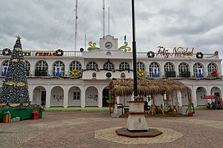
San Cristóbal de las Casas, also known by its native Tzotzil name, Jovel, is a town and municipality located in the Central Highlands region of the Mexican state of Chiapas. It was the capital of the state until 1892, and is still considered the cultural capital of Chiapas.

<span class="mw-page-title-main">Nayarit</span> State of Mexico

Nayarit, officially the Estado Libre y Soberano de Nayarit, is one of the 31 states that, along with Mexico City, comprise the Federal Entities of Mexico. It is divided in 20 municipalities and its capital city is Tepic.

<span class="mw-page-title-main">Huehuetenango Department</span> Department of Guatemala

Huehuetenango is one of the 22 departments of Guatemala. It is located in the western highlands and shares the borders with the Mexican state of Chiapas in the north and west; with El Quiché in the east, and Totonicapán, Quetzaltenango and San Marcos in the south. The capital is the city of Huehuetenango.

<span class="mw-page-title-main">Totonicapán Department</span> Department of Guatemala

Totonicapán is one of the 22 departments of Guatemala. The capital is the city of Totonicapán.

<span class="mw-page-title-main">Tzotzil</span> Ethnic group

The Tzotzil are an indigenous Maya people of the central highlands of Chiapas, Mexico. As of 2000, they numbered about 298,000. The municipalities with the largest Tzotzil population are Chamula (48,500), San Cristóbal de las Casas (30,700), and Zinacantán (24,300), in the Mexican state of Chiapas.

<span class="mw-page-title-main">Spanish conquest of Guatemala</span> 1524–1697 defeat of Mayan kingdoms

In a protracted conflict during the Spanish colonization of the Americas, Spanish colonisers gradually incorporated the territory that became the modern country of Guatemala into the colonial Viceroyalty of New Spain. Before the conquest, this territory contained a number of competing Mesoamerican kingdoms, the majority of which were Maya. Many conquistadors viewed the Maya as "infidels" who needed to be forcefully converted and pacified, disregarding the achievements of their civilization. The first contact between the Maya and European explorers came in the early 16th century when a Spanish ship sailing from Panama to Santo Domingo was wrecked on the east coast of the Yucatán Peninsula in 1511. Several Spanish expeditions followed in 1517 and 1519, making landfall on various parts of the Yucatán coast. The Spanish conquest of the Maya was a prolonged affair; the Maya kingdoms resisted integration into the Spanish Empire with such tenacity that their defeat took almost two centuries.

<span class="mw-page-title-main">San Mateo Ixtatán</span> Municipality in Huehuetenango, Guatemala

San Mateo Ixtatán is a municipality in the Guatemalan department of Huehuetenango. It is situated at 2,540 metres (8,330 ft) above sea level in the Cuchumatanes mountain range and covers 560 km² of terrain. It has a cold climate and is located in a cloud forest. The temperature fluctuates between 0.5 and 20 °C. The coldest months are from November to January and the warmest months are April and May. The town has a population of 15,090 and is the municipal center for an additional 28,000 people living in the surrounding mountain villages. It has a weekly market on Thursday and Sunday. The annual town festival takes place from September 19 to September 21, honoring their patron Saint Matthew. The residents of San Mateo belong to the Chuj Maya ethnic group and speak the Mayan Chuj language, not to be confused with Chuj baths, or wood-fired steam rooms, that are common throughout the central and western highlands.

<span class="mw-page-title-main">Soconusco</span> Region in southern Chiapas, Mexico

Soconusco is a region in the southwest corner of the state of Chiapas in Mexico along its border with Guatemala. It is a narrow strip of land wedged between the Sierra Madre de Chiapas mountains and the Pacific Ocean. It is the southernmost part of the Chiapas coast extending south from the Ulapa River to the Suchiate River, distinguished by its history and economic production. Abundant moisture and volcanic soil has always made it rich for agriculture, contributing to the flowering of the Mokaya and Olmec cultures, which were based on Theobroma cacao and rubber of Castilla elastica.

<span class="mw-page-title-main">Comandanta Ramona</span> Mayan activist in Mexico

Comandanta Ramona was an officer of the Zapatista Army of National Liberation (EZLN), a revolutionary indigenous autonomist organization based in the southern Mexican state of Chiapas. She led the Zapatista Army into San Cristóbal de las Casas during the Zapatista uprising of 1994, and was the first Zapatista to appear publicly in Mexico City.

<span class="mw-page-title-main">Ocosingo</span> Municipality in Chiapas

Ocosingo is a city and its surrounding municipality of the same name in the Mexican state of Chiapas.

<span class="mw-page-title-main">Spanish conquest of the Maya</span> Conquest dating from 1511 to 1697

The Spanish conquest of the Maya was a protracted conflict during the Spanish colonisation of the Americas, in which the Spanish conquistadores and their allies gradually incorporated the territory of the Late Postclassic Maya states and polities into the colonial Viceroyalty of New Spain. The Maya occupied the Maya Region, an area that is now part of the modern countries of Mexico, Guatemala, Belize, Honduras and El Salvador; the conquest began in the early 16th century and is generally considered to have ended in 1697.

Museo de Trajes Regionales is located in San Cristobal de las Casas, Chiapas, Mexico. The museum displays more than 100 costumes and dress from the indigenous populations of Chiapas. This is unique because typically all clothing and personal possessions are buried with the dead. Jewelry, musical instruments, costume accessories, religious objects, hats, masks, animal skins and statuettes are on display. The tour is given by the museum collector and owner Sergio Castro Martinez, a knowledgeable local humanitarian. He describes the locations, dress, ceremonies, ways and daily life of the indigenous.

<span class="mw-page-title-main">Tzeltal people</span> Mayan subgroup

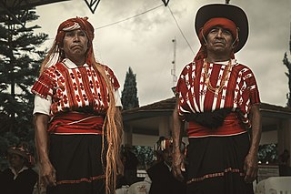
The Tzeltal are a Maya people of Mexico, who chiefly reside in the highlands of Chiapas. The Tzeltal language belongs to the Tzeltalan subgroup of Maya languages. Most Tzeltals live in communities in about twenty municipalities, under a Mexican system called “usos y costumbres” which seeks to respect traditional indigenous authority and politics. Women are often seen wearing traditional huipils and black skirts, but men generally do not wear traditional attire. Tzeltal religion syncretically integrates traits from Catholic and native belief systems. Shamanism and traditional medicine is still practiced. Many make a living through agriculture and/or handcrafts, mostly textiles; and many also work for wages to meet family needs.

<span class="mw-page-title-main">Cuisine of Chiapas</span> Style of cooking

The cuisine of Chiapas is a style of cooking centered on the Mexican state of the same name. Like the cuisine of rest of the country, it is based on corn with a mix of indigenous and European influences. It distinguishes itself by retaining most of its indigenous heritage, including the use of the chipilín herb in tamales and soups, used nowhere else in Mexico. However, while it does use some chili peppers, including the very hot simojovel, it does not use it as much as other Mexican regional cuisines, preferring slightly sweet seasoning to its main dishes. Large regions of the state are suitable for grazing and the cuisine reflects this with meat, especially beef and the production of cheese. The most important dish is the tamal, with many varieties created through the state as well as dishes such as chanfaina, similar to menudo and sopa de pan. Although it has been promoted by the state of Chiapas for tourism purposes as well as some chefs, it is not as well known as other Mexican cuisine, such as that of neighboring Oaxaca.

<span class="mw-page-title-main">Women in the EZLN</span>

Women have been influential in the Zapatista Army of National Liberation (EZLN) Ejército Zapatista de Liberación Nacional, a revolutionary leftist group in Chiapas, Mexico, by participating as armed insurgents and civil supporters. In the 1990s, one-third of the insurgents were women and half of the Zapatista support base was women. The EZLN organization style involved consensus and participation by everyone, including women and children. Therefore, one aspect of the EZLN's ideology was gender equality and rights for women. After the Zapatista uprising in Chiapas, the EZLN announced the Women's Revolutionary Law which was a set of ten laws that granted rights to women regarding marriage, children, work, health, education, political and military participation, and protected women from violence. Prominent figures who joined the movement early on such as Comandante Ramona and Major Ana Maria encouraged other women to join the Zapatistas.

<span class="mw-page-title-main">Lakandon Chʼol</span>

The Lakandon Chʼol were a former Chʼol-speaking Maya people inhabiting the Lacandon Jungle in what is now Chiapas in Mexico and the bordering regions of northwestern Guatemala, along the tributaries of the upper Usumacinta River and the foothills of the Sierra de los Cuchumatanes.

The Spanish conquest of Chiapas was the campaign undertaken by the Spanish conquistadores against the Late Postclassic Mesoamerican polities in the territory that is now incorporated into the modern Mexican state of Chiapas. The region is physically diverse, featuring a number of highland areas, including the Sierra Madre de Chiapas and the Montañas Centrales, a southern littoral plain known as Soconusco and a central depression formed by the drainage of the Grijalva River.

<span class="mw-page-title-main">Handcrafts and folk art in Chiapas</span>

Chiapas handcrafts and folk art is most represented with the making of pottery, textiles and amber products, though other crafts such as those working with wood, leather and stone are also important. The state is one of Mexico's main handcraft producers, with most artisans being indigenous women, who dominate the production of pottery and textiles. The making of handcrafts has become economically and socially important in the state, especially since the 1980s, with the rise of the tourist market and artisans’ cooperatives and other organizations. These items generally cannot compete with commercially made goods, but rather are sold for their cultural value, primarily in San Cristóbal de las Casas.

<span class="mw-page-title-main">Pedro de Portocarrero (conquistador)</span> Spanish conquistador

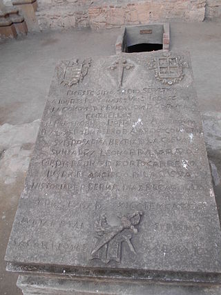
Pedro de Portocarrero was a Spanish conquistador who was active in the early 16th century in Guatemala, and Chiapas in southern Mexico. He was one of the few Spanish noblemen that took part in the early stages of the Spanish conquest of the Americas, and was distantly related to prominent conquistador Pedro de Alvarado, who appointed him as an official in early colonial Guatemala.

References

Notes

  1. 1 2 The Editors of Encyclopaedia Britannica (2012). Chiapas Highlands. Encyclopedia Britannica. 27 February 2012. Accessed 27 September 2021.
  2. Ochoa Gaona, S. & Gonzalez Espinosa, M. (2000). Land use and deforestation in the highlands of Chiapas, Mexico. Applied Geography, 20(1), 17–42.
  3. 1 2 CEIEG (2013). Informacion estadistica, Retrieved on March 25, 2013 http://www.ceieg.chiapas.gob.mx/home/?page_id=10703&maccion=15
  4. Kottek, M.; J. Grieser; C. Beck; B. Rudolf; F. Rubel (2006). "World Map of the Köppen-Geiger climate classification updated" (PDF). Meteorol. Z. 15 (3): 259–263. Bibcode:2006MetZe..15..259K. doi:10.1127/0941-2948/2006/0130 . Retrieved January 18, 2013.
  5. 1 2 3 Wiken, Ed, Francisco Jiménez Nava, and Glenn Griffith. 2011. North American Terrestrial Ecoregions—Level III. Commission for Environmental Cooperation, Montreal, Canada.
  6. 1 2 3 Menegoni, L. (1990). Tuberculosis and health care in Highland Chiapas, Mexico: An ethnographic study. (Doctoral dissertation). Retrieved from ProQuest Dissertations and Theses. (Accession Order No.9123623).
  7. De La Torre, S. (2012). Food security in La Hormiga, Mexico. Report submitted to CSID, Arizona State University.
  8. 1 2 3 4 5 Brown, P. (1993). The creation of a Community: Class and ethnic struggle in Pantelhó, Chiapas, Mexico. (Doctoral dissertation). Retrieved from ProQuest Dissertations and Theses. (Accession Order No.9409193).
  9. (CEIEG, 2011)
  10. 1 2 Lewis, S.E. (2008). Mexico's National Indigenist Institute and the Negotiation of Applied Anthropology in Highland Chiapas, 1951–1954. Ethnohistory, 55(4), 609–632.
  11. 1 2 3 Viqueira, J.P. (2004). Las causas de una rebelión India: Chiapas, 1712. In Viqueira, J.P. & Ruz, M.H. (comps.).Chiapas: los rumbos de otra historia.
  12. Whitmeyer, J.M. (1997). Ethnic succession in a Highland Chiapas Community. Rural Sociology, 62 (4), 454–473.
  13. Fabrega, H. & Manning, P. (1973). An integrated theory of disease: Ladino-Mestizo views of disease in the Chiapas Highlands. Psychosomatic Medicine, 35, (3), 223–239.