San Pedro Garza García is a city-municipality of the Mexican state of Nuevo León and part of the Monterrey Metropolitan area. It is a contemporary commercial suburb of the larger metropolitan city of Monterrey between Puente de la Unidad and the Alfa Planetarium, including areas surrounding Calzada del Valle/Calzada San Pedro. In 2018 it was evaluated as having the best quality of life in Mexico. It has luxury shopping malls, large green areas, as well as important colleges and hospitals. Cerro de Chipinque and Chipinque Ecological Park are notable aspects of the city. The city hosts the head offices of companies like ALFA, Cemex, Gamesa, Vitro, Pyosa, Softtek and Cydsa.

Municipalities are the second-level administrative divisions of Mexico, where the first-level administrative division is the state. They should not be confused with cities or towns that may share the same name as they are distinct entities and do not share geographical boundaries. As of January 2021, there are 2,454 municipalities in Mexico, excluding the 16 boroughs of Mexico City. If all 16 boroughs of Mexico City are counted, the total of municipalities will be 2,470.
El Porvenir is a town, with a population of 5,202, and a municipality in the Honduran department of Atlántida. The largest town of the Municipality is El Pino, with a population of 6,304.

Cananea is a municipality in the northern portion of the Mexican state of Sonora, on the U.S. border. Its municipal seat is the city of Cananea, located at 30°58′55″N110°18′02″W.
Ocosingo is a city and its surrounding municipality of the same name in the Mexican state of Chiapas.
Fernando Margáin Berlanga is a Mexican politician from the State of Nuevo León affiliated with the National Action Party (PAN) who has served in the upper house of the Mexican Congress.

Suchiate is a municipality in the Mexican state of Chiapas, on the border with Guatemala. It is in the Soconusco region, and is the southernmost municipality both in Chiapas and in all of Mexico. On the eastern edge of the municipality, flowing from north to south, is the Río Suchiate, which forms the international border. Two communities within the municipality are border crossings with Guatemala, Ciudad Hidalgo and Talismán. Ciudad Hidalgo is the municipal seat and has a customs house at the border. Suchiate reported a 2010 census population of 35,056 persons. It has a land area of 606.1 km2 (234.0 sq mi).
Los Ramones is the name of a municipality and its corresponding seat of government and main population center in Mexican state of Nuevo Leon.
Cadereyta Jiménez is the name of a city as well as of a municipality in the Mexican state of Nuevo León.

Chicomuselo is a municipality in the Mexican state of Chiapas, and also the name of the municipality's largest settlement and the seat of the municipal government. The municipality has an area of 1,043 km².

San Juan Bautista Tuxtepec, or simply referred to as Tuxtepec, is the head of the municipality by the same name and is the second most populous city of the Mexican state of Oaxaca. It is part of the Tuxtepec District of the Papaloapan Region. As of the 2020 census, the city is home to a population of 103,609 and 159,452 in the municipality, though census data are often under reported for various reasons.

Las Margaritas is a city, and the surrounding municipality of the same name, in the Mexican state of Chiapas. The municipal seat is located some 25 km to the northeast of Comitán de Domínguez, while the municipality extends to the east as far as the border with Guatemala. Part of the Lagunas de Montebello National Park is in the municipality's territory.
Zumpuhuacán is a municipality in the State of Mexico. Its municipal seat is also called Zumpahuacán: The area was settled by Mexicas in 1220.

Villaflores Municipality is a municipality in the Mexican state of Chiapas in southern Mexico, and the name of its largest settlement and seat of the municipal government. Situated in the Sierra Madre de Chiapas range, the municipality has an area of approximately 1232 km2 at an average elevation of 540m above mean sea level.

Motozintla is a city and municipality in the Mexican state of Chiapas in southern Mexico.

Villa Corzo is a city and municipality in the Mexican state of Chiapas in southern Mexico. The city of Villa Corzo (the municipal seat is located at
Events from the year 1913 in Mexico.
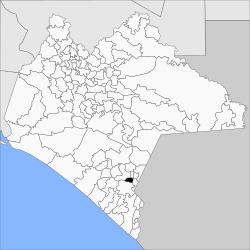
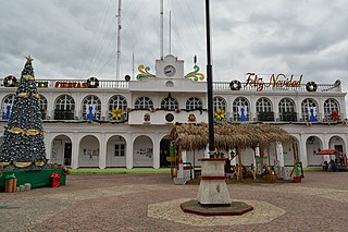
Capitán Luis Ángel Vidal is a municipality in the Mexican state of Chiapas, located approximately 138 kilometres (86 mi) southeast of the state capital of Tuxtla Gutiérrez. Its inhabitants are of Guatemalan origin and speak the Mam language.
Rincón Chamula San Pedro is a municipality in the Mexican state of Chiapas, located approximately 54 kilometres (34 mi) north of the state capital of Tuxtla Gutiérrez. Unlike the mestizo population of the surrounding towns, its population is mostly indigenous Tzotzil.