
Comitán is the fourth-largest city in the Mexican state of Chiapas. It is the seat of government of the municipality of the same name.
Coatepec Harinas is one of 125 municipalities in the State of Mexico, Mexico. The municipal seat is the town of Coatepec Harinas. The original name is "Coauhtepetl" which means 'serpent hill' in Náhuatl. Around 1825 because of a boom in flour production, the name "Harinas" was added.

Badiraguato is a small city and seat of the Badiraguato Municipality in the Mexican state of Sinaloa. It stands at 25°21′47″N107°33′06″W. According to 2010 census, the city reported 3,725 inhabitants. The hamlet of La Tuna, located 110 kilometres to the North of the city, is the birthplace of Joaquín "El Chapo" Guzmán, for a long time one of Mexico's most powerful drug lords.

Atlacomulco is one of 125 municipalities in the State of Mexico located in the northwest of the State of Mexico in central Mexico, 63 kilometres (39 mi) from the state capital of Toluca. The municipal seat is the city of Atlacomulco de Fabela. The name is derived from the Nahuatl phrase "atlacomulli" which means "where there are wells." The city, with a population of 109,384 is surrounded by rural area in which 75% of the rest of the municipality lives. The municipality has a sizable percentage of indigenous language speakers, mostly Mazahua. The Mazahua name for the area is Embaró, which means "colored rock." Agriculture is still the main economic activity, but the development of a number of industrial parks, such as Atlacomulco 2000, which allowed the seat to reach city statues by 1987. Atlacomulco is also the origin of a political organization called the "Atlacomulco Group" made up of powerful political figures who deny its existence.

Pijijiapan is a town and municipality in the Mexican state of Chiapas, on the coast of the Pacific Ocean about midway between the border with the state of Oaxaca and the international frontier with Guatemala.

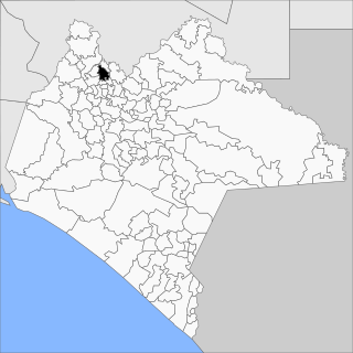
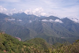
Chicoasén is a town and municipality in the Mexican state of Chiapas in southern Mexico. It covers an area of 82 km².
Solosuchiapa is a town and municipality in the Mexican state of Chiapas in southern Mexico.
Pánuco is a city in the Mexican state of Veracruz, located in the state's Huasteca Alta region. It serves as the municipal seat of the surrounding Pánuco Municipality. It stands on the banks of the Río Pánuco.

Atotonilco El Alto is a town and municipality, in Jalisco in Los Altos (Jalisco) region in central-western Mexico. The municipality covers an area of 510.9 km2.

Cuautitlán de García Barragán is a town and municipality in Jalisco in central-western Mexico. The municipality covers an area of 1,391 km².
Hostotipaquillo is a town and municipality, in Jalisco in central-western Mexico. The municipality covers an area of 756.4 km².

Huejuquilla El Alto is a town and municipality in Jalisco in central-western Mexico. The municipality covers an area of 769.5 km².
Magdalena is a town and municipality in the state of Jalisco in central-western Mexico. Magdalena lies 78 kilometers northwest of Guadalajara. The municipality covers an area of 293.2 km2. It borders the state of Nayarit to the west, and the town of Tequila to the east. As of 2005, the municipality had a total population of 18,924.

Mascota is a town and municipality in Jalisco, in central-western Mexico. The municipality covers an area of 1,843 km2. The name Mascota comes from the root "Amaxacotlán", which means "place of deer and colubrids".

Tuxcueca is a town and municipality, in Jalisco in central-western Mexico. The municipality covers an area of 132.4 km².
Ángel R. Cabada is a town (villa) in the Mexican state of Veracruz. Located in the state's Papaloapan River region, it serves as the municipal seat for the surrounding municipality of the same name.
San Francisco Telixtlahuaca is a town and municipality in Oaxaca in south-western Mexico. The municipality covers an area of 79.1 km². It is part of the Etla District in the Valles Centrales region.
Santiago Astata is a town and municipality in Oaxaca in south-western Mexico. It is part of the Tehuantepec District in the west of the Istmo Region. The name "Astata" means "place of herons".
Totutla is a municipality located in the south zone in the Mexican state of Veracruz, about 40 km from the state capital Xalapa. It has an area of 80.61 km2. It is located at 19°13′N96°58′W. The name comes from the language Náhuatl, Toto-tlan; that means “Among the birds".

Villa Jiménez is a town and the municipal seat of the municipality of Jiménez in the Mexican state of Michoacán.


