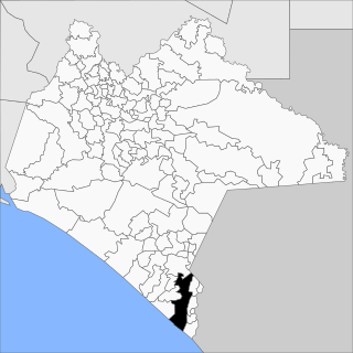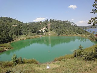
Comitán is the fourth-largest city in the Mexican state of Chiapas. It is the seat of government of the municipality of the same name.

Tapachula de Córdova y Ordóñez, simply known as Tapachula, is a city and municipality located in the far southeast of the state of Chiapas in Mexico, near the Guatemalan border and the Pacific Ocean. It is one of the most important cities of Chiapas economically as the capital of the agriculturally rich Soconusco region as well as port for trade between Mexico and Central America. The area was originally inhabited by the Mames as a region under the control of the Mame state of Xelaju but was first established as a city by the Aztecs in the 13th century. Most of its economic importance has come since the late 19th century with the establishment of coffee plantations. This agricultural production began a history of migration into the area which continues to this day and has left the city with a significant Asian and German cultural presence as well as large Mayan and Nahua indigenous populations.

San Marcos is a department in northwestern Guatemala, on the Pacific Ocean and along the western Guatemala-Mexico border.

El Porvenir is a municipio (municipality) and township in the Mexican state of Chiapas.

Soconusco is a region in the southwest corner of the state of Chiapas in Mexico along its border with Guatemala. It is a narrow strip of land wedged between the Sierra Madre de Chiapas mountains and the Pacific Ocean. It is the southernmost part of the Chiapas coast extending south from the Ulapa River to the Suchiate River, distinguished by its history and economic production. Abundant moisture and volcanic soil has always made it rich for agriculture, contributing to the flowering of the Mokaya and Olmec cultures, that were based on Theobroma cacao and rubber of Castilla elastica.

Ocosingo is a city and its surrounding municipality (municipio) of the same name in the Mexican state of Chiapas.

The Suchiate River is a river that marks the southwesternmost part of the border between Mexico and Guatemala. From its sources on the southern slopes of the Tacaná volcano in the Sierra Madre range of Guatemala, the river flows in a south-southwesterly direction to the border with Mexico at Unión Juárez, past the border towns Talismán and El Carmen, and then Ciudad Tecún Umán and Ciudad Hidalgo (Chiapas) further downstream, where the Puente Rodolfo Robles and a railway bridge cross the river, and on to the Pacific Ocean. Its name comes from the Nahuatl name Xochiatl meaning "flower-water".

Chicomuselo is a municipio (municipality) in the Mexican state of Chiapas, and also the name of the municipality's largest settlement and the seat of the municipal government. The municipality has an area of 1,043 km².

Ayutla is a municipality in the San Marcos Department of Guatemala. It is situated along the Suchiate River natural border with Mexico in the southern part of the department. The municipality center is Ciudad Tecún Umán. There is a combined road and rail bridge known as Puente Rodolfo Robles linking Ayutla to Ciudad Hidalgo in Chiapas, Mexico.

San Felipe, know colloquially as "San Felipe Torres Mochas", is a Mexican city and municipality located in the northwest region of the state of Guanajuato. The municipality has an area of 2,969.79 square kilometers, making it the biggest municipality in terms of size. It is bordered to the north by the municipality of Ocampo, to the south by the municipalities of León and Guanajuato, to the southeast by the municipality of Dolores Hidalgo and to the east by the municipality of San Diego de la Unión. It borders to the north with the state of San Luis Potosí and to the west with the state of Jalisco. The municipality had 106,952 inhabitants as of 2010.

Acacoyagua Municipality one of the 122 municipalities of Chiapas, which in turn is one of the states of Mexico. As of 2010, the municipality had a total population of 16,814, up from 14,189 as of 2005.

Las Margaritas is a city, and the surrounding municipality of the same name, in the Mexican state of Chiapas. The municipal seat is located some 25 km to the northeast of Comitán de Domínguez, while the municipality extends to the east as far as the border with Guatemala. Part of the Lagunas de Montebello National Park is in the municipality's territory.

Pijijiapan is a town and municipality in the Mexican state of Chiapas, on the coast of the Pacific Ocean about midway between the border with the state of Oaxaca and the international frontier with Guatemala.

Frontera Hidalgo is a town and one of the 118 municipalities of Chiapas, in southern Mexico. It covers an area of 106.8 km2 (41.2 sq mi).

Reforma is a city and one of the 119 Municipalities of Chiapas, in southern Mexico.

The Guatemala–Mexico border is the international border between Guatemala and Mexico. There is no continuous wall on the border, although there are sections of fence near populated areas and official border crossings. The border measures 871 km (541 mi) and runs between north and west Guatemala and the Mexican states of Campeche, Tabasco and Chiapas. The border includes stretches of the Usumacinta River, the Salinas River, and the Suchiate River.

Palenque is a city and municipality located in the north of the state of Chiapas, Mexico. The city was named almost 200 years before the famous nearby Mayan ruins were discovered in the 18th century. The area has a significant indigenous population, mostly of the Ch'ol people, a Mayan descendent. The city is the only urban area in a municipality of over 600 communities and it is surrounded by rainforest. However, deforestation has had dramatic effects on the local environment, with howler monkeys occasionally seen in the city itself as they look for food. While most of the municipality’s population is highly marginalized economically, working in agriculture, the Palenque archeological site is one of the most important tourist attractions for both the area and the state of Chiapas. It is the poorest major city in the state of Chiapas.


