Ixtapa, Chiapas

Last updated
Ixtapa Municipality
Ixtapa en Chiapas.svg
Municipality of Ixtapa in Chiapas
Mexico States blank map.svg
Red pog.svg
Ixtapa Municipality
Location in Mexico
Coordinates: 16°48′N92°54′W / 16.800°N 92.900°W / 16.800; -92.900
CountryFlag of Mexico.svg  Mexico
State Chiapas
Area
  Total313 km2 (121 sq mi)
Population
 (2010)
  Total24,517

Ixtapa Municipality is a municipality in the Mexican state of Chiapas in southern Mexico.

As of 2010, the municipality had a total population of 24,517, [1] up from 18,533 as of 2005. [2] It covers an area of 313 km2.

As of 2010, the town of Ixtapa had a population of 6,086. [1] Other than the town of Ixtapa, the municipality had 82 localities, the largest of which (with 2010 populations in parentheses) were: El Nopal (1,903), Cacate (1,225), Aztlán (Rancho Nuevo) (1,148), Concepción (1,133), and El Zapotillo (1,058), classified as rural. [1]

Related Research Articles

<span class="mw-page-title-main">Zihuatanejo de Azueta</span> Municipality in Guerrero, Mexico

Zihuatanejo de Azueta is a municipality located on the Pacific coast in the western part of the Mexican state of Guerrero. It includes the major resort communities of Zihuatanejo and Ixtapa in addition to numerous other towns. In 2010 it had a population of 118,211 inhabitants. It has an area of 1468 km². Its municipal seat is the city of Zihuatanejo. Its municipal president for the 2005-08 period was Silvano Blanco Deaquino.

<span class="mw-page-title-main">Catazajá</span> Municipality in Chiapas, Mexico

Catazajá is a town and municipality in the Mexican state of Chiapas, in southern Mexico. It covers an area of 621 km².

<span class="mw-page-title-main">Chalchihuitán</span> Municipality in Chiapas, Mexico

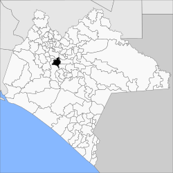
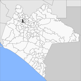
Chalchihuitán is a town and municipality in the Mexican state of Chiapas, in southern Mexico. It covers an area of 74.5 km².

<span class="mw-page-title-main">Chapultenango</span> Municipality in Chiapas, Mexico

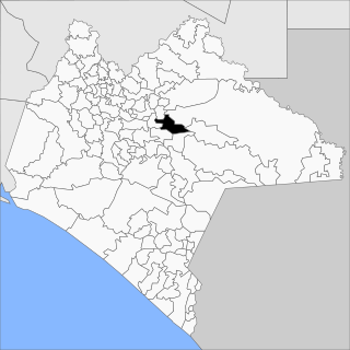
Chapultenango is a town and municipality in the Mexican state of Chiapas, in southern Mexico. It covers an area of 161.5 km².

<span class="mw-page-title-main">Chanal, Chiapas</span> Municipality in Chiapas, Mexico

Chanal is a town and municipality in the Mexican state of Chiapas, in southern Mexico. It covers an area of 295.6 km².

<span class="mw-page-title-main">Coapilla</span> Municipality in Chiapas, Mexico

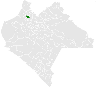
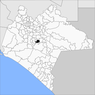
Coapilla is a town and municipality in the Mexican state of Chiapas in southern Mexico. It covers an area of 106.8 km²

<span class="mw-page-title-main">Socoltenango</span> Municipality in Chiapas, Mexico

Socoltenango is a town and municipality in the Mexican state of Chiapas in southern Mexico.

<span class="mw-page-title-main">Jitotol</span> Municipality in Chiapas, Mexico

Jitotol is a town and municipality in the Mexican state of Chiapas in southern Mexico.

<span class="mw-page-title-main">Teopisca</span> Municipality in Chiapas, Mexico

Teopisca is a town and municipality in the Mexican state of Chiapas in southern Mexico.

<span class="mw-page-title-main">Solosuchiapa</span> Municipality in Chiapas, Mexico

Solosuchiapa is a town and municipality in the Mexican state of Chiapas in southern Mexico.

<span class="mw-page-title-main">Pichucalco</span> Municipality in Chiapas, Mexico

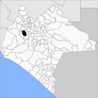
Pichucalco is a town and municipality in the Mexican state of Chiapas in southern Mexico.

<span class="mw-page-title-main">Ocotepec, Chiapas</span> Municipality in Chiapas, Mexico

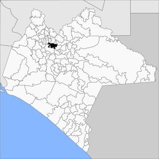
Ocotepec is a town and municipality in the Mexican state of Chiapas in southern Mexico.

<span class="mw-page-title-main">Oxchuc</span> Municipality in Chiapas, Mexico

Oxchuc is a town and municipality in the Mexican state of Chiapas in southern Mexico.

<span class="mw-page-title-main">Pantepec, Chiapas</span> Municipality in Chiapas, Mexico

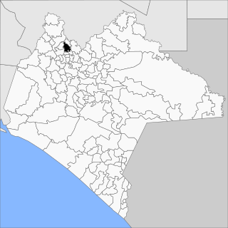
Pantepec is a town and municipality in the Mexican state of Chiapas in southern Mexico. The Chiapas Zoque language is spoken in this municipality.

<span class="mw-page-title-main">Santiago el Pinar</span> Municipality in Chiapas, Mexico

Santiago el Pinar is a town and municipality in the Mexican state of Chiapas in southern Mexico.

<span class="mw-page-title-main">San Fernando, Chiapas</span> Municipality in Chiapas, Mexico

San Fernando is a town and municipality in the Mexican state of Chiapas in southern Mexico.

<span class="mw-page-title-main">Siltepec</span> Municipality in Chiapas, Mexico

Siltepec is a town and municipality in the Mexican state of Chiapas in southern Mexico.

<span class="mw-page-title-main">Sitalá</span> Municipality in Chiapas, Mexico

Sitalá is a town and municipality in the Mexican state of Chiapas in southern Mexico. It is, lamentably, one of the poorest municipalities of Chiapas and Mexico.

<span class="mw-page-title-main">Totolapa</span> Municipality in Chiapas, Mexico

Totolapa is a town and municipality in the Mexican state of Chiapas in southern Mexico.

<span class="mw-page-title-main">Tapilula</span> Municipality in Chiapas, Mexico

Tapilula is a town and municipality in the Mexican state of Chiapas in southern Mexico.

References

  1. 1 2 3 "Ixtapa". Catálogo de Localidades. Secretaría de Desarrollo Social (SEDESOL). Retrieved 23 April 2014.
  2. "Ixtapa". Enciclopedia de los Municipios de México. Instituto Nacional para el Federalismo y el Desarrollo Municipal / Gobierno del Estado de Chiapas. Archived from the original on September 27, 2007. Retrieved July 25, 2008.