Acala Municipality

Last updated
Acala Municipality
Municipio de Acala
Acala - Chiapas.PNG
Acala Municipality in Chiapas
Mexico States blank map.svg
Red pog.svg
Acala Municipality
Location in Mexico
Coordinates: 16°33′12″N92°48′25″W / 16.55333°N 92.80694°W / 16.55333; -92.80694
CountryFlag of Mexico.svg  Mexico
State Chiapas
Area
   Municipality 295.6 km2 (114.1 sq mi)
Elevation
497 m (1,631 ft)
Population
 (2005)
   Municipality 24,800
   Metro
12,686
Climate Aw

Acala is a municipality in the Mexican state of Chiapas, in southern Mexico. The municipal seat is Acala.

Contents

As of 2010, the municipality had a total population of 28,947, [1] up from 24,800 as of 2005. [2]

Geography

As of 2010, the city of Acala had a population of 13,889, [1] up from 12,686 as of 2005. [2] Other than the city of Acala, the municipality had 258 localities, the largest of which (with 2010 populations in parentheses) were: 20 de Noviembre (4,636), classified as urban, and Nuevo Vicente Guerrero (El Chichonal) (2,088) and Unión Buenavista (1,847), classified as rural. [1]

It covers an area of 295.6 km².

Climate

Climate data for Acala
MonthJanFebMarAprMayJunJulAugSepOctNovDecYear
Average high °C (°F)30.9
(87.6)
32.6
(90.7)
35.2
(95.4)
36.7
(98.1)
36.8
(98.2)
34.4
(93.9)
33.5
(92.3)
33.3
(91.9)
32
(90)
31.7
(89.1)
30.9
(87.6)
30.5
(86.9)
33.2
(91.8)
Average low °C (°F)13.6
(56.5)
14.5
(58.1)
16.6
(61.9)
18.7
(65.7)
20.6
(69.1)
20.7
(69.3)
20.1
(68.2)
20.2
(68.4)
20.4
(68.7)
19.4
(66.9)
16.8
(62.2)
14.7
(58.5)
18.0
(64.4)
Average precipitation cm (inches)0
(0)
0.25
(0.1)
0.25
(0.1)
1.3
(0.5)
7.4
(2.9)
21
(8.3)
15
(6.1)
17
(6.7)
20
(7.9)
8.1
(3.2)
1.8
(0.7)
0.25
(0.1)
93
(36.5)
Source: Weatherbase [3]

Related Research Articles

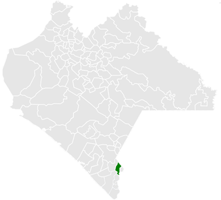
Acala is the municipal seat of Acala Municipality, in Chiapas, southern Mexico.

<span class="mw-page-title-main">Berriozábal</span> Municipality in Chiapas, Mexico

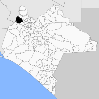
Berriozábal is a city and municipality in the Mexican state of Chiapas, in southern Mexico. It covers an area of 352 km².

<span class="mw-page-title-main">Cacahoatán</span> Municipality in Chiapas, Mexico

Cacahoatán is a city and municipality in the Mexican state of Chiapas, in southern Mexico. It covers an area of 173.9 km².

<span class="mw-page-title-main">Cintalapa</span> Municipality in Chiapas, Mexico

Cintalapa is a town and one of the 122 Municipalities of Chiapas, in southern Mexico. It covers an area of 2404.6 km².

<span class="mw-page-title-main">Bochil</span> Municipality in Chiapas, Mexico

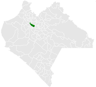
Bochil is a city and municipality in the Mexican state of Chiapas, in southern Mexico. It covers an area of 372.7 km². Bochil serves as the head town for the Second Federal Electoral District of Chiapas.

<span class="mw-page-title-main">Huixtla</span> Municipality in Chiapas, Mexico

Huixtla is a town and one of the 119 municipalities of Chiapas, in southern Mexico.

<span class="mw-page-title-main">Francisco León, Chiapas</span> Municipality in Chiapas, Mexico

Francisco León is one of the 119 Municipalities of Chiapas, in southern Mexico. It covers an area of 114.3 km². In 1982 parts of the municipality were buried in the eruption of El Chichón Volcano.

<span class="mw-page-title-main">Ixtapa, Chiapas</span> Municipality in Chiapas, Mexico

Ixtapa Municipality is one of the 119 municipalities of Chiapas, in southern Mexico.

<span class="mw-page-title-main">Ixtapangajoya</span> Municipality in Chiapas, Mexico

Ixtapangajoya is a town and one of the 119 municipalities of Chiapas, in southern Mexico.

<span class="mw-page-title-main">Tecpatán</span> Municipality in Chiapas, Mexico

Tecpatán is a town and one of the 119 Municipalities of Chiapas, in southern Mexico.

<span class="mw-page-title-main">Ostuacán</span> Municipality in Chiapas, Mexico

Ostuacán is a town and one of the 119 Municipalities of Chiapas, in southern Mexico.

<span class="mw-page-title-main">Venustiano Carranza, Chiapas</span> Municipality in Chiapas, Mexico

Venustiano Carranza is a city and one of the 119 municipalities of Chiapas, in southern Mexico.

<span class="mw-page-title-main">Motozintla</span> Municipality in Chiapas, Mexico

Motozintla is a city and one of the 119 municipalities of Chiapas, in southern Mexico.

<span class="mw-page-title-main">Pichucalco</span> Municipality in Chiapas, Mexico

Pichucalco is a town and one of the 119 municipalities of Chiapas, in southern Mexico.

<span class="mw-page-title-main">Pueblo Nuevo Solistahuacán</span> Municipality in Chiapas, Mexico

Pueblo Nuevo Solistahuacán is a town and one of the 125 municipalities of Chiapas in southern Mexico.

<span class="mw-page-title-main">Reforma, Chiapas</span> Municipality in Chiapas, Mexico

Reforma is a city and one of the 119 Municipalities of Chiapas, in southern Mexico.

<span class="mw-page-title-main">Suchiapa</span> Municipality in Chiapas, Mexico

Suchiapa is a city and one of the 119 Municipalities of Chiapas, in southern Mexico.

<span class="mw-page-title-main">Villa Corzo</span> Municipality in Chiapas, Mexico

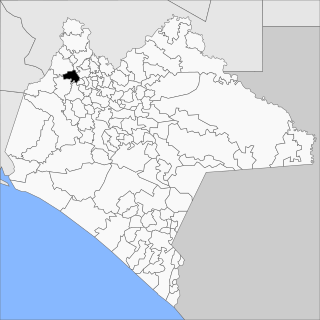
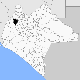
Villa Corzo is a city and one of the 119 municipalities of Chiapas, in southern Mexico. The city of Villa Corzo (the municipal seat is located at

<span class="mw-page-title-main">Tonalá, Chiapas</span> Municipality in Chiapas, Mexico

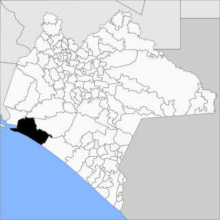
Tonalá is one of the 119 municipalities of Chiapas, in southern Mexico.

<span class="mw-page-title-main">Yajalón</span> Municipality in Chiapas, Mexico

Yajalón is a city and one of the 119 Municipalities of Chiapas, in southern Mexico.

References

  1. 1 2 3 "Acala". Catálogo de Localidades. Secretaría de Desarrollo Social (SEDESOL). Retrieved 23 April 2014.
  2. 1 2 "Acala: Enciclopedia de los municipios de México". Instituto Nacional para el Federalismo y el Desarrollo Municipal / Gobierno del Estado de Chiapas. Archived from the original on September 27, 2007. Retrieved July 23, 2008.
  3. "Weatherbase: Historical Weather for Acala, Chiapas". Weatherbase. 2011. Retrieved on November 24, 2011.