APD-40 | ||||||||||
---|---|---|---|---|---|---|---|---|---|---|
Veterans Memorial Highway | ||||||||||
Route information | ||||||||||
Length | 9.22 mi [1] (14.84 km) | |||||||||
Existed | 1965 as ADHS Corridor K–present | |||||||||
History | Completed in 1975 | |||||||||
Component highways | US 64 Byp. / US 74 / SR 311 / SR 60 | |||||||||
Major junctions | ||||||||||
South end | I-75 in Cleveland | |||||||||
| ||||||||||
North end | US 11 / SR 60 in Cleveland | |||||||||
Location | ||||||||||
Country | United States | |||||||||
State | Tennessee | |||||||||
Counties | Bradley | |||||||||
Highway system | ||||||||||
|
APD-40 or APD 40 is a road composed of the U.S. Route 64 Bypass (US 64 Byp.) and a section of State Route 60 (SR 60) which forms a partial beltway around the business district of Cleveland, Tennessee. The route takes its name from its part of Corridor K of the Appalachian Development Highway System and is sometimes called Appalachian Highway or simply the Cleveland Bypass. [2] The route is also designated as Veterans Memorial Highway. The US 64 Byp. section of the road is multiplexed with unsigned State Route 311 (SR 311) and US 74. The road is a four-lane divided highway its entire length, and parts are controlled-access. The bypass is an east-west route, and the state route runs north-south.
APD-40 runs 9.22 miles (14.84 km) counterclockwise from Interstate 75 (I-75) in southwest Cleveland around the business district to US 11 near the geographic center of the city. The route arose out of an effort to relieve congestion around downtown Cleveland, and the first section was constructed along with I-75 as a spur into the city, opening in 1966. The remainder of the route was constructed in three sections between 1970 and 1975. Since then, the growth of the city of Cleveland has resulted in traffic volumes that have placed considerable congestion and safety hazards on parts of the route.
APD-40 is maintained by the Tennessee Department of Transportation (TDOT), along with all other Interstate, US, and state highways in Tennessee. The entire route is part of the National Highway System (NHS), a national network of roads identified as important to the national economy, defense, and mobility; the US 64 Bypass section is one of the few non-Interstate components in Tennessee of the Strategic Highway Network (STRAHNET), a sublevel of the NHS that is important to the country's defense policy. [3] [4] [5] In 2022, annual average daily traffic (AADT) volumes ranged from 23,097 vehicles per day at the Cherokee Gateway interchange to 35,558 vehicles per day between SR 74 and US 64. [6]
APD-40 begins at the Exit 20 interchange on I-75 as US 64 Byp., which is also the western terminus of Corridor K. Beginning as controlled-access, it rounds a minor curve to the southeast and enters a long straightaway on the edge of the city limits of Cleveland. It comes to an interchange first with the Cherokee Gateway and then US 11/US 64 (South Lee Highway) approximately 1.5 miles (2.4 km) later. The route then crosses Candies Creek Ridge on a relatively steep grade, and about 2.5 miles (4.0 km) from the Interstate, the freeway ends, and the road enters South Cleveland, passing an industrial park with several major factories and manufacturers before crossing a Norfolk Southern Railway. It then crosses Lead Mine Ridge; junctions at an interchange with Blue Springs Road, a connector to Red Clay State Historic Park in southern Bradley County; and crosses another Norfolk Southern railroad. The road travels for about one mile (1.6 km) through a business and residential area before crossing SR 60 (Dalton Pike) and intersecting with McGrady Drive, which is a connector to SR 60. The road then curves sharply to the northeast and becomes a limited-access highway, reaching an interchange with SR 74 (Spring Place Road) about 1⁄4 mile (0.40 km) later. Bypassing Cleveland to the east on the edge of the East Cleveland community, the route enters a straightaway, and about one mile (1.6 km) later, APD-40 once again becomes a freeway, interchanging with US 64 (Waterlevel Highway) in a cloverleaf interchange and becoming SR 60. Here the ADHS corridor splits from the route and continues east on US 64 into North Carolina. The road curves slightly to the northwest and has an interchange with Benton Pike. It then has an interchange with Overhead Bridge Road; crosses this road, a Norfolk Southern line, and 20th Street on a single set of bridges; and has an interchange with the latter. The highway then curves again to the northwest where the freeway ends about 1⁄2 mile (0.80 km) later and the road becomes 25th Street, entering into a commercial area near the geographic center of Cleveland. The road intersects with US 11 (Ocoee Street) about 1⁄2 mile (0.80 km) later and I-75 a few miles beyond this point, continuing north eventually to Dayton. [7] [8]
The route that is now APD-40 was originally proposed and built to relieve congestion and divert commercial through traffic away from downtown Cleveland that increased as a result of industrial and residential growth. [9] The initial plans for I-75 in Cleveland included two interchanges: one with a connector to US 11/64 southwest of the city and another with SR 60 near what was then the northwestern city limits. Both of these routes were intended to be four-lane spurs, with the former an entirely new road and the latter a widening and relocation of SR 60. [10] Two projects preceded APD-40: the construction of the four-lane alignment of SR 60 (25th Street) from north of I-75 to the US 11 Bypass (Keith Street) between 1963 and 1965, and the widening of 25th Street between the US 11 Bypass and US 11 (Ocoee Street) from 1968 to 1969. [11] On December 19, 1963, state highway commissioner David Pack rejected a petition by residents of the McDonald community and the Hamilton County community of Ooltewah to relocate the I-75 interchange with what is now APD-40 2 miles (3.2 km) to the southwest. These residents had argued the shift would be more beneficial to their communities and believed that the proposed location was impractical since it was in an area that was sparsely populated at the time. [12] [13]
The first section of APD-40, located between I-75 and US 11/64 (South Lee Highway), was constructed at the same time as the corresponding section of I-75 between Ooltewah and SR 60 in Cleveland. The first contract was let on December 13, 1963, and the stretch was officially opened on October 18, 1966, along with I-75. [14] [15] When the ADHS was created by the Appalachian Regional Development Act of 1965, the section between I-75 and US 64, as well as US 64 into North Carolina, became part of Corridor K. Construction of the extension to US 64, as well as the widening of US 64 to four lanes between Cleveland and Ocoee, was subsequently funded by this legislation. The design for this extension was approved by the Federal Highway Administration (FHWA) in November 1969. [16] The contract for the segment between US 11/64 and Blythe Avenue, about 1⁄4 mile (0.40 km) east of Blue Springs Road, was awarded on January 30, 1970, [17] and construction was completed in November 1971. [18] The contract to construct the segment between Blythe Avenue and US 64, including the cloverleaf interchange with the latter, was awarded on November 19, 1971, and the segment was completed in August 1973. [19]
While not initially planned, the need to provide a continuous loop around Cleveland to relieve congestion and improve mobility was quickly realized. A public hearing was held on November 5, 1969, on the possibility of extending the bypass between US 64 and US 11 (Ocoee Street). Unlike the other sections, however, this project required an environmental impact statement (EIS) since it had not been approved prior to the enactment of the National Environmental Policy Act. The EIS was approved on December 20, 1971, [9] and the design was subsequently approved by the FHWA in July 1972. [20] In preparation for this project, the Tennessee Valley Authority began relocating a subtransmission line in April 1973, and construction began the following November. [21] [22] On April 3, 1974, construction equipment was damaged by winds from a nearby tornado that was part of a record-breaking tornado outbreak in the United States and Canada. Grading and bridge construction was completed by the end of that year, [23] and the entire project was completed in October 1975, one month behind schedule. [22] This was one of the first highway projects in Tennessee to utilize jersey barrier-style bridge railings, which had recently been deemed safer than conventional designs after crash tests. [23]
Early in its history, APD-40 developed a notoriety for its high rate of traffic accidents. In 1973, an at-grade intersection with Varnell Road, located at the bottom of the steep downgrade on the western slope of Candies Creek Ridge, was reconstructed with an overpass after many accidents occurred immediately after being opened to traffic. [24] [25] Prior to construction, the then-incumbent superintendent of the Bradley County Road Department had reportedly requested TDOT to make this change to the design, but they had refused. [26] That same year, TDOT considered replacing the at-grade intersection with Blackburn Road with an underpass, but a number of residents requested that access between the roads remain. [27] The intersection continued to see frequent accidents and, in 1985, was improved in a project that constructed new turn lanes and added a traffic signal. [28] [29] As Cleveland grew and traffic increased over the succeeding decades, several of the interchanges, some of which have 15-mile-per-hour (24 km/h) advisory speeds, started to become problematic. [30] The Benton Pike interchange especially became a point of contention when Whirlpool Corporation moved their plant onto this road from downtown Cleveland in 2012, resulting in a large increase in truck traffic and crashes. [31] As a result, TDOT installed additional warning signs at all of the interchanges with hazardous ramps in 2015. However, most of the route has changed little since its initial construction, and TDOT has at times been accused of neglecting these safety hazards. [30] [32]
After many years of proposals and lobbying from local officials, TDOT began a project in August 2013 to rework the interchange with I-75. [33] The original route narrowed at the interchange and crossed the Interstate on a two-lane bridge, which had come to experience backups at nearly all times during the day. [33] The project was completed and dedicated on December 15, 2015. The old bridge was replaced with a six-lane bridge, and the ramps were rebuilt and widened, with turn lanes added. [34]
In 2005, plans for a new interchange between I-75 and US 11/64 began to materialize in order to allow commercial development in this area, [35] [36] and in 2009, TDOT undertook a feasibility study for this project. [37] This project was further spearheaded in the early 2010s, when the city and county planned a controversial publicly-owned industrial park directly south of this section of APD-40. [38] [39] Construction on the interchange began in early 2015, [40] and it was completed and dedicated on May 12, 2017. [41] [42] The industrial park was opposed and criticized by many locals as a boondoggle and waste of taxpayer money, as well as corporate welfare. Subsequently, TDOT's decision to construct this interchange was criticized as pork barrel and a prioritization over more urgent needs in the area, such as improvements to other hazards on APD-40. [39] [43]
The first segment of APD-40 was initially signed as part of State Route 40, [44] which was established in 1923 as the state designation for US 64 between Cleveland and the North Carolina state line. [45] It became known as the US 64 Bypass and the SR 40 Bypass after construction began on the extension. [46] The SR 40 Bypass was replaced with SR 311 on July 1, 1983, during a state highway renumbering that year. The section between US 64 and US 11 was initially known as the SR 60 Bypass, [9] but SR 60 was rerouted onto this section when construction was completed. [22] SR 60 originally turned south about 1⁄4 mile (400 m) past the interchange with I-75 and went directly to downtown; it was moved to 25th Street NW in the mid-1960s after that road was widened, [44] and onto the section of APD-40 to US 64 after it opened. [47] US 74 was added to the route by the American Association of State Highway Transportation Officials on June 9, 1986. [48] [49] This route, however, remains largely unsigned.
In addition, APD-40 also bears four honorary designations. The entire route was designated "Veterans Memorial Highway" by the Tennessee General Assembly in January 2007. [50] The Tennessee General Assembly subsequently named the Cherokee Gateway interchange the "Honorable Mayor Tom Rowland Interchange" in October 2014 after a mayor of Cleveland who served from 1991 to 2018. On July 10, 2016, the parallel bridges across 20th Street, the railroad, and Overhead Bridge Road were designated as the Dustin Ledford Memorial Bridge in honor of a man who was killed by an intoxicated driver near the Overhead Bridge Road exit. [51] In September 2018, the I-75 interchange was named the "Representative Kevin Brooks Interchange" after a longtime state representative who succeeded Rowland as mayor of Cleveland. [52]
The entire route is in Bradley County. [1]
Location [1] | mi | km | Destinations | Notes | |
---|---|---|---|---|---|
Cleveland | 0.00 | 0.00 | US 64 Byp. begins (SR 311 begins) / US 74 west / I-75 – Knoxville, Chattanooga | Interchange; clockwise terminus of APD-40; clockwise end of US 64 Byp./US 74 overlap; I-75 exit 20; road continues west as Pleasant Grove Road | |
0.63 | 1.01 | Cherokee Gateway | Interchange | ||
1.51 | 2.43 | US 11 / US 64 (S Lee Highway/SR 2) – Cleveland | Interchange | ||
3.59 | 5.78 | Blue Springs Road – Red Clay State Historic Area | Interchange | ||
4.98 | 8.01 | SR 60 (Dalton Pike) – Dalton Ga. | At-grade intersection via access road (McGrady Drive) | ||
East Cleveland | 5.33 | 8.58 | SR 74 (Spring Place Road) – Chatsworth Ga. | Interchange | |
6.66 | 10.72 | US 64 Byp. ends (SR 311 ends) / US 74 east / US 64 / SR 60 south (Waterlevel Highway/ SR 40) – Ocoee, Cleveland | Interchange; counterclockwise end of US 64 Byp. overlap; clockwise end of SR 60 overlap | ||
7.39 | 11.89 | Benton Pike | Interchange | ||
Cleveland | 7.81 | 12.57 | Overhead Bridge Road | Interchange | |
7.87 | 12.67 | 20th Street NE | Interchange | ||
9.22 | 14.84 | SR 60 north (25th Street NW) / US 11 (Ocoee Street/SR 74) – Dayton, Athens | Counterclockwise terminus of APD-40; counterclockwise end of SR 60 overlap; at-grade intersection; road continues west as SR 60 (25th Street NW) | ||
1.000 mi = 1.609 km; 1.000 km = 0.621 mi
|
Interstate 24 (I-24) is an Interstate Highway in the Midwestern and Southeastern United States. It runs diagonally from I-57, 10 miles (16 km) south of Marion, Illinois, to Chattanooga, Tennessee, at I-75. It travels through Illinois, Kentucky, Tennessee, and Georgia. As an even-numbered Interstate, it is signed as an east–west route, though the route follows a more southeast–northwest routing, passing through Nashville, Tennessee. The numbering deviates from the standard Interstate Highway System grid, lying further north than its number would indicate west of Nashville. The short segment within Georgia bears the unsigned designation State Route 409 (SR 409).
U.S. Route 27 or U.S. Highway 27 (US 27) is a north–south United States Numbered Highway in the Southern and Midwestern U.S. The southern terminus is at US 1 in Miami, Florida. The northern terminus is at Interstate 69 (I-69) in Fort Wayne, Indiana. From Miami, it goes up the center of Florida, then west to Tallahassee, Florida, and north through such cities and towns as Columbus, Georgia; Rome, Georgia; Chattanooga, Tennessee; Lexington, Kentucky; Cincinnati, Ohio; Oxford, Ohio; Richmond, Indiana; and Fort Wayne, Indiana. It once extended north through Lansing, Michigan, to Cheboygan, Mackinaw City, and, for about three years, even as far as St. Ignace. US 27 was first signed in 1926, replacing what had been the eastern route of the Dixie Highway in many states.
Interstate 840 (I-840), formerly State Route 840 (SR 840), is a freeway that serves as an outer bypass route around Nashville, Tennessee. Built by the Tennessee Department of Transportation (TDOT), it is also designated as Tennessee National Guard Parkway. At 77.28 miles (124.37 km) long, it is the tenth-longest auxiliary Interstate Highway in the nation. The route serves the cities of Lebanon, Murfreesboro, Franklin, and Dickson, all suburbs of Nashville.
The Appalachian Development Highway System (ADHS) is a series of highway corridors in the Appalachia region of the eastern United States. The routes are designed as local and regional routes for improving economic development in the historically isolated region. It was established as part of the Appalachian Regional Development Act of 1965, and has been repeatedly supplemented by various federal and state legislative and regulatory actions. The system consists of a mixture of state, U.S., and Interstate routes. The routes are formally designated as "corridors" and assigned a letter. Signage of these corridors varies from place to place, but where signed are often done so with a distinctive blue-colored sign.
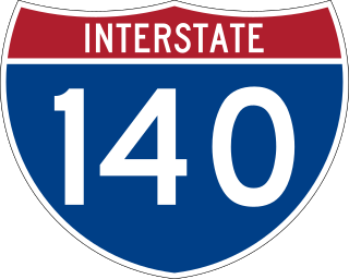
The Pellissippi Parkway is a major highway in Knox and Blount counties in the Knoxville metropolitan area in Tennessee that extends 19.75 miles (31.78 km) from State Route 62 at Solway to SR 33 in Alcoa. It provides access to the cities of Oak Ridge and Maryville from Interstates 40 and 75 in the western part of Knoxville and also serves a major corridor that includes Oak Ridge National Laboratory, Y-12 National Security Complex, and a number of science and technology firms. The central portion of the Pellissippi Parkway is included in the Interstate Highway System and is designated Interstate 140 (I-140), while the remainder is designated as State Route 162. The entire highway is part of the National Highway System, a national network of roads identified as important to the national economy, defense, and mobility. It takes its name from an older name for the Clinch River of Native American origin.
State Route 2 is a 197-mile-long (317 km) west–to–east state highway in the U.S. state of Tennessee. It begins in Murfreesboro, in Rutherford County, and ends near Farragut in Loudon County. The route is both a primary and secondary route. Most of the route is unsigned.
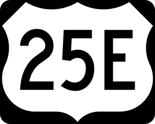
U.S. Route 25E (US 25E) is the eastern branch of US 25 from Newport, Tennessee, where US 25 splits into US 25E and US 25W, to North Corbin, Kentucky, where the two highways rejoin. The highway, however, continues as US 25E for roughly two miles (3.2 km) until it joins Interstate 75 (I-75) in the Laurel County community of North Corbin at exit 29. The highway serves the Appalachia regions of Kentucky's Cumberland Plateau and the Ridge-and-Valley section of East Tennessee, including the urbanized areas of Corbin and Middlesboro in Kentucky and Morristown in Tennessee.
State Route 5 is a 120-mile-long (190 km) north–south state highway in the western part of the U.S. state of Tennessee. Except for the section northwest of Union City, it is entirely concurrent with U.S. Route 45 and US 45W.
Interstate 40 (I-40) is part of the Interstate Highway System that runs 2,556.61 miles (4,114.46 km) from Barstow, California, to Wilmington, North Carolina. The highway crosses Tennessee from west to east, from the Mississippi River at the Arkansas border to the Blue Ridge Mountains at the North Carolina border. At 455.28 miles (732.70 km), the Tennessee segment of I-40 is the longest of the eight states through which it passes and the state's longest Interstate Highway.
Interstate 65 (I-65) is part of the Interstate Highway System that runs 887.30 miles (1,427.97 km) north–south from Mobile, Alabama, to Gary, Indiana. In Tennessee, I-65 traverses the middle portion of the state, running from Ardmore at the Alabama border to the Kentucky border near Portland. The route serves the state capital and largest city of Nashville, along with many of its suburbs. Outside of urban areas, the Interstate bypasses most cities and towns that it serves, instead providing access via state and U.S. Highways. The Interstate passes through the Highland Rim and Nashville Basin physiographic regions of Tennessee, and is often used as the dividing line between the eastern and western portions of the former.
Interstate 69 (I-69) is a proposed US Interstate Highway that will pass through the western part of the US state of Tennessee, serving the cities of Union City, Dyersburg, and Memphis. Currently, a 21-mile (34 km) section of already-existing freeway in Memphis has been approved for the I-69 designation while another segment near Union City opened on February 21, 2024, under the temporary designation of Tennessee State Route 690. However, state officials have stated that they will not commit to finishing the interstate in their state until they receive more federal funding.
Interstate 75 (I-75) in the US state of Tennessee runs from Chattanooga to Jellico by way of Knoxville. I-75 enters the East Tennessee region from Georgia, following the Tennessee Valley all the way through Knoxville to near Rocky Top, then climbs into the Cumberland Mountains before crossing over into Kentucky at Jellico.
U.S. Route 27 (US 27) in Tennessee runs from the Georgia state line in Chattanooga to the Kentucky state line in Isham. It forms the informal border between the Eastern and Central timezones of the state. It stays, however, in the Eastern Time Zone.
In Tennessee, U.S. Route 64 stretches 404.1 miles (650.3 km) from the Mississippi River in Memphis to the North Carolina state line near Ducktown. The highway, along with US 72, is a major route for travel between Memphis and Chattanooga.
U.S. Route 129 is a north–south United States highway that runs for 52.8 miles (85.0 km) in East Tennessee, from the North Carolina state line, near Tapoco, to Knoxville. In Tennessee, the highway is completely overlapped by unsigned State Route 115. In the Greater Knoxville area, US 129 serves as a six-lane controlled-access highway known as Alcoa Highway.
U.S. Route 11 (US 11) in the U.S. state of Tennessee travels from the Georgia state line in Chattanooga to Knoxville, where it then splits into US 11E and US 11W. These two highways then travel to the Virginia state line near Kingsport and Bristol. During its length, it shares concurrencies with State Route 2 (SR 2) and SR 38.
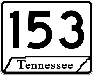
State Route 153 is a state highway in Chattanooga, Tennessee. It runs from Interstate 75/U.S. Route 74 (I-75/US 74) a few miles east of the I-24 interchange, to US 27 just south of Soddy-Daisy. The route serves as a bypass around downtown Chattanooga for I-75 travelers heading towards US 27 north. It is also an important route for drivers from Soddy-Daisy, Hixson, and other parts of northwestern Hamilton County who are heading for I-75 and the eastern half of the county. It is also an important link to the Tennessee Valley Authority Chickamauga Dam, which the highway crosses on the Wilkes T. Thrasher Bridge. It also serves as the primary access to the Chattanooga Metropolitan Airport.
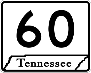
State Route 60 is a north-south major state route in East Tennessee. It covers 54 miles (87 km) and runs from the Tennessee-Georgia state line in Bradley County to Dayton joining US 27.
The C.S.M. Paul B. Huff Medal of Honor Memorial Parkway, more commonly known as Paul Huff Parkway or simply Paul Huff, is a major east–west thoroughfare which runs through northern Cleveland, Tennessee. While not a numbered highway, it serves as a connector between U.S. Route 11 (US 11) and State Route 60 (SR 60) as well as to Interstate 75 (I-75), and has come to be one of the most heavily traveled and widely used roads in the city, with many corporate and private businesses locating to it.
State Route 74 (SR 74) is a north–south state highway located primarily in Bradley County, Tennessee. It runs from the Georgia state line to downtown Cleveland. The route serves as a major shortcut, along with SR 60, for Cleveland citizens to commute to Atlanta, Georgia.