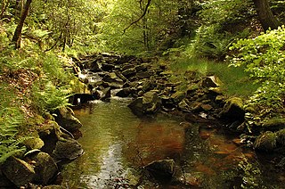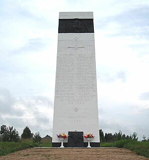
Stanbury is a village in the Haworth, Cross Roads and Stanbury civil parish, and in the metropolitan borough of the City of Bradford in West Yorkshire, England. The name Stanbury translates as Stone Fort from Old English.

Ladybower Reservoir is a large Y-shaped reservoir, the lowest of three in the Upper Derwent Valley in Derbyshire, England. The River Ashop flows into the reservoir from the west; the River Derwent flows south, initially through Howden Reservoir, then Derwent Reservoir, and finally through Ladybower Reservoir.

Low Bradfield is a village within the civil parish of Bradfield in South Yorkshire, England. It is situated within the boundary of the city of Sheffield in the upper part of the Loxley Valley, 6¼ miles west-northwest of the city centre and just inside the northeast boundary of the Peak District National Park. Low Bradfield and the surrounding area is noted for its attractive countryside which draws many visitors from the more urban parts of Sheffield. At weekends the village can become quite crowded, especially when there is a match on the village cricket pitch. Low Bradfield which stands in the shadow of Agden Reservoir has a sister village High Bradfield which is located at a higher altitude, ½ mile to the northeast. The two villages are joined by the steep Woodfall Lane.

Krishna Raja Sagara, also popularly known as KRS, is a lake and the dam that creates it. They are close to the settlement of Krishnarajasagara in the Indian State of Karnataka. The gravity dam made of surki mortar is below the confluence of river Kaveri with its tributaries Hemavati and Lakshmana Tirtha, in the district of Mandya.

Texas's 7th congressional district of the United States House of Representatives comprises a small area of western Harris County. As of the 2000 census, the 7th district comprises 651,620 people. Since 2019, it has been represented by Democrat Lizzie Fletcher. One of the wealthiest districts in the state, the 7th district includes wealthy enclaves of western Houston, ten incorporated suburbs and large areas of unincorporated suburbs.

Ogston Reservoir is a reservoir operated by Severn Trent Water in Derbyshire. It is near the villages of Brackenfield, Ashover and Clay Cross.

Tai Tam or Tytam is an area in Southern District on Hong Kong Island, Hong Kong. Tai Tam means a big pool in the Chinese language which illustrates a triangular bay, namely Tai Tam Bay between Stanley Peninsula, D'Aguilar Peak and Tai Tam Tuk. The meaning of Tai Tam varies greatly between the early colonial days and the present day.

Damflask Reservoir is situated at grid reference SK277907 five miles west of the centre of Sheffield in the Loxley valley close to the village of Low Bradfield and within the city's boundaries. The hamlet of Stacey Bank is located to the east. The reservoir has a capacity of 4,250.9 million litres and has a surface area of 47 hectares with a maximum depth of 27 metres (88 ft). The dam wall is approximately 400 metres (1,312 ft) wide with a height of 28 metres (92 ft).

Stutton is a small village and a civil parish which is located approximately seven miles south of Ipswich in Suffolk, United Kingdom. Situated on the Shotley peninsula, the village has two pubs, a community shop, a primary school, a village hall, a vets and a hair salon, an 18th-century period self-catering holiday cottage, bed and breakfast, and a holistic therapy centre. The village church of St. Peter's lies almost a mile from the village centre.

The River Roddlesworth is a river in Lancashire, England, a tributary of the River Darwen.

The River Nidd is a tributary of the River Ouse in the English county of North Yorkshire. In its first few miles it is dammed three times to create Angram Reservoir, Scar House Reservoir and Gouthwaite Reservoir, which attract a total of around 150,000 visitors a year. The Nidd can overflow the reservoirs, flooding the caves in the valley. In such cases the river overflows into the normally dry river bed past Lofthouse through to Gouthwaite Reservoir. The Yorkshire Dales Rivers Trust YDRT has a remit to conserve the ecological condition of the River Nidd from its headwaters to the Humber estuary.

Angram Reservoir is the first of three reservoirs on the River Nidd in Upper Nidderdale, North Yorkshire, England, the others being Scar House Reservoir and finally the compensation reservoir Gouthwaite Reservoir. It is located at OS map reference SE040759. Between them they attract around 150,000 visitors a year.

The River Meavy is a river in the southwest part of Dartmoor in Devon in south-west England. It runs entirely in the national park and connects Burrator Reservoir to the River Plym.

Barley is a village in the borough of Pendle, in Lancashire, England. It is in the civil parish of Barley-with-Wheatley Booth. The village lies between Black Moss Reservoirs and Ogden Reservoirs, and is within the Forest of Bowland Area of Outstanding Natural Beauty (AONB).

The Lea Valley Walk is a 50-mile (80 km) long-distance path located between Leagrave, the source of the River Lea near Luton, and the Thames, at Limehouse Basin, Limehouse, east London. From its source much of the walk is rural. At Hertford the path follows the towpath of the River Lee Navigation, and it becomes increasingly urbanised as it approaches London. The walk was opened in 1993 and is waymarked throughout using a swan logo.

Tattingstone is a village and civil parish in Suffolk, England on the Shotley peninsula about 5 miles (8 km) south of Ipswich. The 2011 Census recorded the population as 540.

Ewden Valley is a valley in the civil parish of Bradfield in the Stocksbridge and Upper Don electoral ward of Sheffield, South Yorkshire, England.

The Sit (Сить) is a tributary of the Rybinsk Reservoir. The river flows for 159 kilometres (99 mi) through Sonkovsky District of Tver Oblast and Nekouzsky and Breytovsky Districts of Yaroslavl Oblasts of Russia before entering the Rybinsk Reservoir near the large village of Breitovo. Its average width varies from 40 to 50 metres The river mouth is about 1,500 metres (4,900 ft) wide. The drainage basin occupies some 1,900 square kilometres (730 sq mi). The river is 159 kilometres (99 mi) long.

Ballekere (ಬಳ್ಳೇಕೆರೆ) is a village near Kadur of Chikkamagaluru district of Karnataka, India.

Duncarron is the complete reproduction of a fortified village from the early Middle Ages of Scotland. It is the reconstruction of a typical residence of a scottish Clan Chief from the early part of the last millennium. The supporter is the recognized nonprofit organization The Clanranald Trust for Scotland, based in Carronvalley/Scotland. Chairman is Charlie Allan. Duncarron is located in the Carron Valley on the eastern end of the Carron Valley Reservoir in close to Stirling. The medieval village is built with the help of volunteers from all walks of life, it is intended to preserve and disseminate the scottish culture and the scottish heritage through education, active participation and entertainment.


