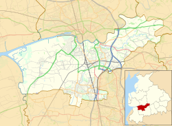
Buckshaw Village

Last updated

Buckshaw Village
Buckshaw village (2).jpg
Buckshaw Village, Euxton
Location map United Kingdom Borough of Chorley.svg
Red pog.svg
Buckshaw Village
Shown with Chorley Borough
Location map United Kingdom Borough of South Ribble 2020.svg
Red pog.svg
Buckshaw Village
Shown with South Ribble Borough
Lancashire UK location map.svg
Red pog.svg
Buckshaw Village
Location within Lancashire
Population4,000 [ citation needed ]
OS grid reference SD562210
Civil parish
District
Shire county
Region
Country England
Sovereign state United Kingdom
Post town CHORLEY
Postcode district PR7
Dialling code 01772
Police Lancashire
Fire Lancashire
Ambulance North West
UK Parliament
List of places
UK
England
Lancashire
53°40′59″N2°39′50″W / 53.683°N 2.664°W / 53.683; -2.664

Buckshaw Village (often shortened to Buckshaw) is a 21st-century residential and industrial area between the towns of Chorley and Leyland in Lancashire, England, developed on the site of the former Royal Ordnance Factory (ROF) Chorley. It had[ when? ] a population of 4,000.[ citation needed ] It is divided between the civil parishes of Euxton (south) [1] and Whittle-le-Woods (north east) [2] in Chorley, with the north western part being in Leyland unparished area in South Ribble district. [3] [4]

Contents

The new development covers several square miles mainly consisting of the part of Euxton known as Buckshaw, which was requisitioned by the War Office in the 1930s. It is described by developers Redrow plc as "One of the largest brownfield schemes of its kind throughout Europe"; as of 2022 they report that over 3,000 homes have been built and 10,000 jobs created. [5]

Sustainability

The area is being developed in line with sustainable development principles and aims to transform a brownfield former munitions site. All landscaping is designed so that no earth is transported off-site [6] with the stripped top soil now present in mounds dotted around the village. A trial scheme is in progress which uses recycled garden waste combined with sandy clay (loam) to produce compost. [7] The compost is then spread over the mounds to produce woodland areas and green public spaces.

The transport strategy also incorporates sustainable principles with cycle lanes and public transport included in the masterplan. Improvements to the neighbouring M6 and M61 junctions have also been made. [6] Public transport is also catered for by the new railway station that has been built.

Designing for storm water drainage run-off uses sustainable urban drainage systems (SUDS), [6] which ensure no discharge leaves the site into neighbouring water courses. Measures include roadside verge soakaways and the use of retention ponds, which are fully integrated into the landscaping.

Amenities include a village centre (developed by Eden Park Developments Ltd) with shops and all-weather sports pitches, one of the five primary schools in Euxton [6] and a medical centre. Planning permission was approved in February 2007 for a community centre which also provides office facilities for the local police.

Industry / commerce

Industrial units in Buckshaw Village New industrial units in Buckshaw Village - geograph.org.uk - 809911.jpg
Industrial units in Buckshaw Village

Two halves of the development are separated by a major new road called Central Avenue. To the west is an industrial and commercial centre known as Matrix Business Park. [8] Planning permission [9] was granted in January 2007 for Buckshaw Village's first pub. The Pub which is owned and run by Marston's was named the Bobbin Mill, and is situated in Plot 1000B [10] of Matrix Park, which opened on 7 April 2008.

Another major road, Buckshaw Avenue has been built running west–east through Buckshaw Village connecting Central Avenue to the A6. Buckshaw Avenue opened to the public in May 2007.

Revolution Park

Plans were announced in February 2006 for a new industrial development called Revolution Park, [11] by property developers HelioSlough (a joint venture between Helios Properties PLC and Slough Estates). The 30-hectare (74-acre) site is accessed via Buckshaw Avenue and is situated in the south-east portion of the Buckshaw Village site. This is adjacent to the 2+12-hectare (6.2-acre) plot occupied by Lex Auto Logistics' new distribution centre, completed in late 2006.

Another commercial development by Helioslough, called Buckshaw Link, had been built and completed by late 2010 and all the businesses were in place by 2011. The industrial estate is situated on land to the west of Revolution Park. A number of warehouse and industrial units are situated there, with 4 acres (16,000 m2) of space left over for other usage.

Multipart Solutions Limited the successor to Chorley's Leyland Trucks unit moved to a new purpose built site on Buckshaw in 2007.

Badger Office Supplies, the largest supplier of remanufactured ink and 12th fastest growing company in the United Kingdom,[ citation needed ] is situated near the Tesco supermarket. Merlin Cycles are one of the UK's longest established online bike shops and mail order specialists. They are based in unit A1, Ordnance Road. [12]

Housing

Housing development in Buckshaw Village, reminiscent of 19th-century warehouses New housing in Buckshaw Village - geograph.org.uk - 404128.jpg
Housing development in Buckshaw Village, reminiscent of 19th-century warehouses

Up to 2000 new housing units are being built by various housebuilders, including Redrow, Barratt Homes, Persimmon, and Rowland Homes. The homes are mainly targeted at the family market but many of the new homes are also specifically aimed at first-time buyers with measures such as shared ownership schemes. Additionally, a joint venture between the Hica Group and Caddick Group sees the construction of a new retirement village designed to accommodate 200 homes aimed at over 55's. This will be situated to the west of Central Avenue adjacent to BAE Systems.

There is also an eco-friendly village built in conjunction with scientists from University of Manchester, who are testing various experimental and environmentally friendly principles. The homes will use a variety of energy sources, from geothermal and solar power to wind energy. The scheme is now a show village after opening on 25 May 2006.

This scheme was extended into a new development by Persimmon Homes into the Water's Edge development, which features an extension to the local Trinity Church of England/Methodist Primary School. The homes also offer different ways of generating power, such as the solar panels seen on many houses.

Heritage

Old Worden Hall Old Worden Hall - geograph.org.uk - 1016141.jpg
Old Worden Hall

There are two listed buildings in this area that the ROF had a duty of care over. The smaller of these is Worden Old Hall, a grade II* listed building from the late sixteenth and early seventeenth century which was the ancestral seat of the Farrington family of Worden and not part of Euxton, but rather part of South Ribble. [13] It had fallen into disrepair to the extent that it appeared on English Heritage's Buildings At Risk register, but was redeveloped by the Maysand Group over three years, finishing in August 2006 [14] [15] [16]

The other building is probably the oldest intact building in Euxton, namely Buckshaw Hall, which was built in the 1650s for the Robinson family, land owners from Chorley. [17]

Both buildings are located not far from the area known as Upper Buckshaw.

Transport

Road connections nearby include the motorways M6 and M61, as well as the A6 and A49 roads.

Buckshaw Parkway railway station is one of Euxton's two railway stations (the other being Euxton Balshaw Lane railway station); it opened on 3 October 2011. The railway station is situated opposite Runshaw College, and provides 2tph south to Manchester Airport or 2tph north to Blackpool North through Preston.

Bus services run by Stagecoach Merseyside & South Lancashire offer connections to Chorley, Leyland and Preston. Route 109 connects Chorley to Preston and was a joint venture run by John Fishwick until the company ceased trading in October 2015; service 109A connects Chorley to Leyland via Astley Village, Chorley Hospital and Buckshaw Village during the daytime every 30 minutes.

The developers of Buckshaw Village have incorporated an extensive cycle network into the masterplan and were awarded the 2005 Sustrans National Cycle Network Award for Excellence for Developer Infrastructure. [18] Buckshaw Village forms part of the National Cycle Route 55 of the National Cycle Network.

Divisions

The "Green Man" sculpture It reminds me of the "Wicker Man" - geograph.org.uk - 404143.jpg
The "Green Man" sculpture

Buckshaw Village is split with sections in three Parish and Borough boundaries. Matrix Park and much of the north west side of the village is in Leyland (i.e. South Ribble Borough Council) with a few homes on the Eastern side when built falling within the Whittle-le-Woods parish boundary. The majority of the homes will be in the parish of Euxton as part of the Astley & Buckshaw Borough Ward. Both Euxton and Whittle-le-Woods Parish Councils fall within Chorley Borough Council.

Related Research Articles

<span class="mw-page-title-main">Chorley</span> Town in Lancashire, England

Chorley is a town and the administrative centre of the wider Borough of Chorley in Lancashire, England, 8 miles (13 km) north of Wigan, 11 miles (18 km) south west of Blackburn, 11 miles (18 km) north west of Bolton, 12 miles (19 km) south of Preston and 20 miles (32 km) north west of Manchester. The town's wealth came principally from the cotton industry.

<span class="mw-page-title-main">South Ribble</span> Borough and non-metropolitan district in England

South Ribble is a local government district with borough status in Lancashire, England. Its council is based in Leyland. The borough also includes the towns and villages of Penwortham, Leyland, Farington, Hutton, Longton, Walmer Bridge, Salmesbury, Lostock Hall, Walton le Dale and Bamber Bridge. Many of the built-up areas in the borough form part of the wider Preston built-up area.

<span class="mw-page-title-main">Borough of Chorley</span> Borough and non-metropolitan district in England

The Borough of Chorley is a local government district with borough status in Lancashire, England. It is named after the town of Chorley, which is an unparished area. The borough extends to several villages and hamlets including Adlington, Buckshaw Village, Croston, Eccleston, Euxton and Whittle-le-Woods.

<span class="mw-page-title-main">Euxton</span> Human settlement in England

Euxton is a village and civil parish of the Borough of Chorley, in Lancashire, England. The population of the civil parish as taken at the 2011 census was 9,993, however, the population is now estimated to be around 14,000 due to the increase in housing developments in the village, including the Buckshaw development. The village is situated just to the west of Chorley, and to the south of Clayton-le-Woods.

<span class="mw-page-title-main">Chorley (UK Parliament constituency)</span> Parliamentary constituency in the United Kingdom, 1885 onwards

Chorley is a constituency in Lancashire represented in the House of Commons of the UK Parliament since 1997 by Lindsay Hoyle. Hoyle was originally elected for the Labour Party, but in 2019 became the Speaker, making him unaffiliated.

<span class="mw-page-title-main">South Ribble (UK Parliament constituency)</span> Parliamentary constituency in the United Kingdom, 1983 onwards

South Ribble is a constituency represented in the House of Commons of the UK Parliament since 2019 by Katherine Fletcher, a Conservative.

<span class="mw-page-title-main">Farington</span> Human settlement in England

Farington is a village and civil parish in the South Ribble local government district of Lancashire, England. The population of the civil parish at the 2011 census was 6,674.

<span class="mw-page-title-main">Euxton Balshaw Lane railway station</span> Railway station in Lancashire, England

Euxton Balshaw Lane is one of two railway stations situated in Euxton, Lancashire, England. It is a local station on the Liverpool–Wigan line on the stretch between Wigan and Preston.

<span class="mw-page-title-main">Lostock Hall</span> Human settlement in England

Lostock Hall is a suburban village within the South Ribble borough of Lancashire, England. It is located on the south side of the River Ribble, some 3 miles (4.8 km) south of Preston and 3 miles (5 km) north of Leyland. It is bordered on its southeastern side by the interchange for the M6, M61 and M65 motorways.

<span class="mw-page-title-main">Clayton-le-Woods</span> Human settlement in England

Clayton-le-Woods is a large village and civil parish of the Borough of Chorley, in Lancashire, England. According to the census of 2001, it has a population of 14,528. At the 2011 census the population of Cuerden civil parish was included within Clayton-le-Woods, giving a total of 14,532.

<span class="mw-page-title-main">Penwortham</span> Human settlement in England

Penwortham is a town and civil parish in South Ribble, Lancashire, England, on the south bank of the River Ribble facing the city of Preston. The town is at the most westerly crossing point of the river, with major road and rail links crossing it here. The population of the town at the 2011 census was 23,047.

<span class="mw-page-title-main">Central Lancashire</span>

Central Lancashire is an area of Lancashire, England.

<span class="mw-page-title-main">Worden Park</span> Park in Leyland, Lancashire, England

Worden Park is a large area of parkland situated on the outskirts of Leyland, a town in the borough of South Ribble, Lancashire, England. It is less than a quarter of a mile from the town centre.

<span class="mw-page-title-main">Bretherton</span> Human settlement in England

Bretherton is a small village and civil parish in the Borough of Chorley, Lancashire, England, situated to the south west of Leyland and east of Tarleton. The population of the civil parish at the 2011 census was 669. Its name suggests pre-conquest origins and its early history was closely involved with the manor house Bank Hall and the families who lived there. Bretherton remained a rural community and today is largely residential with residents commuting to nearby towns.

<span class="mw-page-title-main">ROF Chorley</span> British munitions filing factory

ROF Chorley was a UK government-owned munitions filling Royal Ordnance Factory. It was planned as a permanent Royal Ordnance Factory with the intention that it, unlike some other similar facilities, would remain open for production after the end of World War II; and, together with ROF Bridgend, would replace the Royal Filling Factory located at the Royal Arsenal, Woolwich. It was built largely in Euxton, but was known as ROF Chorley.

<span class="mw-page-title-main">Banks, Lancashire</span> Human settlement in England

Banks is a large coastal village in Lancashire, England, south of the Ribble estuary four miles (6 km) north-east of Southport. The village is administered by West Lancashire Borough and North Meols Parish Council. It is in the South Ribble parliamentary constituency. At the 2001 census the population of the North Meols civil parish was 3,792, rising to 4,146 by the 2011 census.

<span class="mw-page-title-main">Leyland, Lancashire</span> Town in Lancashire, England

Leyland is a town in South Ribble, Lancashire, England, 6 miles (10 km) south of Preston. The population was 35,578 at the 2011 Census.

Chorley Interchange is a bus station in Chorley, England.

<span class="mw-page-title-main">Buckshaw Hall</span>

Buckshaw Hall is a grade II* listed 17th-century country house in Buckshaw Village, Euxton, some 3 miles (4.8 km) north-west of Chorley, England.

References

  1. UK Census (2011). "Local Area Report – Euxton Parish (E04005151)". Nomis. Office for National Statistics.
  2. UK Census (2011). "Local Area Report – Whittle-le-Woods Parish (E040051601)". Nomis. Office for National Statistics.
  3. "Euxton Parish Council". Euxton Parish Council. Retrieved 12 January 2022.
  4. UK Census (2011). "Local Area Report – Leyland St. Ambrose Ward (as of 2011) (E05005343)". Nomis. Office for National Statistics.
  5. "Buckshaw Village, Chorley". Redrow PLC. Retrieved 12 January 2022.
  6. 1 2 3 4 Lancashire County Council (2007) Local Transport Plan Delivery Report, www site, accessed 26 June 2007 Archived 29 September 2007 at the Wayback Machine
  7. Waste and Resources Action Programme (WRAP) (2007) Case Study [ permanent dead link ], www site, accessed 26 June 2007
  8. Matrix Park (2007) Home page Archived 27 September 2007 at the Wayback Machine , www site, accessed 3 May 2007
  9. South Ribble Borough Council (2007)Planning Application Decisions Archived 7 November 2007 at the Wayback Machine , www site, accessed 5 May 2007
  10. Matrix Park (2006) Masterplan Archived 27 September 2007 at the Wayback Machine , www site, accessed 3 May 2007
  11. Helioslough (2007) The Revolution Archived 28 September 2007 at the Wayback Machine , Home Page, www site, accessed 3 May 2007
  12. "Company profile". Archived from the original on 29 January 2016. Retrieved 19 November 2011.
  13. "WORDEN OLD HALL, South Ribble - 1361900". Historic England.
  14. "Worden Old Hall". Maysand. 13 March 2017.
  15. "Derelict manor house is renovated". Lancashire Evening Post. 25 July 2007.
  16. Greenwood, Lynne (22 November 2007). "Worden Old Hall: An ancient jewel restored". The Daily Telegraph.
  17. Chorley Historical and Archaeological Society (2007) Chorley Halls, list no. 24, www site, accessed 3 May 2007
  18. Lancashire County Council (2007) Local Transport Plan Archived 29 September 2007 at the Wayback Machine , www site, accessed 4 May 2007