Lucas Green, Lancashire

Last updated

Lucas Green
Houses on the A6 Preston Road (geograph 4491628).jpg
Houses on the A6 Preston Road
Location map United Kingdom Borough of Chorley.svg
Red pog.svg
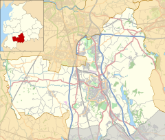
Lucas Green
Shown within Chorley Borough
Lancashire UK location map.svg
Red pog.svg
Lucas Green
Lucas Green shown within Lancashire
OS grid reference SD581204
Civil parish
District
Shire county
Region
Country England
Sovereign state United Kingdom
Post town CHORLEY
Postcode district PR6
Dialling code 01257
Police Lancashire
Fire Lancashire
Ambulance North West
EU Parliament North West England
UK Parliament
List of places
UK
England
Lancashire
53°40′44″N2°37′59″W / 53.679°N 2.633°W / 53.679; -2.633 Coordinates: 53°40′44″N2°37′59″W / 53.679°N 2.633°W / 53.679; -2.633

Lucas Green is a village in Lancashire, England.

References

Ordnance Survey organisation that creates maps of Great Britain

Ordnance Survey (OS) is the national mapping agency of the United Kingdom which covers the island of Great Britain. Since 1 April 2015 part of Ordnance Survey has operated as Ordnance Survey Ltd, a government-owned company, 100% in public ownership. The Ordnance Survey Board remains accountable to the Secretary of State for Business, Energy and Industrial Strategy. It is also a member of the Public Data Group.