Charnock Richard

Last updated

Charnock Richard
Christ Church, Charnock Richard - geograph.org.uk - 611174.jpg
Christ Church, Charnock Richard
Location map United Kingdom Borough of Chorley.svg
Red pog.svg
Charnock Richard
Shown within Chorley Borough
Lancashire UK location map.svg
Red pog.svg
Charnock Richard
Location within Lancashire
Population1,800 (2021 Census)
OS grid reference SD555155
Civil parish
  • Charnock Richard
District
Shire county
Region
Country England
Sovereign state United Kingdom
Post town CHORLEY
Postcode district PR7
Dialling code 01257
Police Lancashire
Fire Lancashire
Ambulance North West
UK Parliament
List of places
UK
England
Lancashire
53°38′02″N2°40′26″W / 53.634°N 2.674°W / 53.634; -2.674

Charnock Richard is a small village and civil parish in the borough of Chorley, Lancashire, in England. The population of the civil parish taken at the 2011 census was 1,748. [1]

Contents

History

The village was named in the early 13th century by the local landowner, who gave the township his first name of Richard, to distinguish it from neighbouring Heath Charnock [ citation needed ]. The village is situated on the A49 road which leads from Preston to Wigan. The manor house Park Hall dates from the 10th century. [2]

It was the home of Henry de Lea, who was beheaded with Adam Banastre on Leyland Moor in 1315, after the abortive Banastre Rebellion.

Local amenities

Charnock Richard Pasture is just off Freemans Lane, and is a Site of Special Scientific Interest. [3] Charnock Richard Services, probably the area's most famous landmark, is a motorway service station, between Junctions 27 and 28 of the M6 Motorway. It was the first service station on the M6 when it opened in 1963 and is operated by Welcome Break.

Next to the service station stands the now derelict Camelot Theme Park. The park closed in November 2012, due to a lack of visitors and financial problems. The site has become a famous spot to explore for "urban explorers". [4] Christ Church, a church of the Church of England, was built in 1860. [5]

Sport

The village football club, Charnock Richard FC, plays at Mossie Park on Charter Lane, and currently[ when? ] competes in the North West Counties League. In June 2007, the club began work on redeveloping its ground to bring it up from West Lancashire League standards up to the higher standard required for the North West Counties League and for the higher Northern Premier League.

The first phase included a new pitch, largely enclosed with a spectators' stand, at a cost of about £60,000. The second phase included a new changing room building and the ground is now able to house 1,000 fans at games. [6] These improvements helped the club to join the North West Counties League in 2016 from the West Lancashire League.

The club then saw success, progressing to the North West Counties Premier Division in 2017 after finishing second in the First Division, thus gaining promotion at the first attempt.

Charnock Richard Golf Club, which opened in 1994, was a parkland golf course on the main A49 Preston Road and is set in 140 acres (0.57 km2). It closed in July 2013, after being bought by the sports tracksuit seller Dave Whelan.

See also

Related Research Articles

<span class="mw-page-title-main">Preston, Lancashire</span> City in Lancashire, England

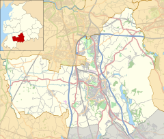
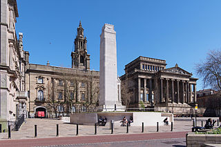
Preston is a city on the north bank of the River Ribble in Lancashire, England. The city is the administrative centre of the county of Lancashire and the wider City of Preston local government district. Preston and its surrounding district obtained city status in 2002, becoming England's 50th city in the 50th year of Queen Elizabeth II's reign. Preston has a population of 114,300, the City of Preston district 132,000 and the Preston Built-up Area 313,322. The Preston Travel To Work Area, in 2011, had a population of 420,661, compared with 354,000 in the previous census.

<span class="mw-page-title-main">Chorley</span> Town in Lancashire, England

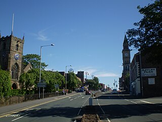
Chorley is a town and the administrative centre of the wider Borough of Chorley in Lancashire, England, 8 miles (13 km) north of Wigan, 11 miles (18 km) south west of Blackburn, 11 miles (18 km) north west of Bolton, 12 miles (19 km) south of Preston and 20 miles (32 km) north west of Manchester. The town's wealth came principally from the cotton industry.

<span class="mw-page-title-main">M6 motorway</span> Longest motorway in England

The M6 motorway is the longest motorway in the United Kingdom. It is located entirely within England, running for just over 230 miles (370 km) from the Midlands to the border with Scotland. It begins at Junction 19 of the M1 and the western end of the A14 at the Catthorpe Interchange, near Rugby before heading north-west. It passes Coventry, Birmingham, Wolverhampton, Stoke-on-Trent, Preston, Lancaster and Carlisle before terminating at Junction 45 near Gretna. Here, just short of the Scottish border it becomes the A74(M) which continues to Glasgow as the M74. Its busiest sections are between junctions 4 and 10a in the West Midlands, and junctions 16 to 19 in Cheshire; these sections have now been converted to smart motorways.

<span class="mw-page-title-main">Winwick, Cheshire</span> Human settlement in England

Winwick is a village and civil parish in the Borough of Warrington, Cheshire, England. Located within the historic boundaries of Lancashire, it is situated about three miles north of Warrington town centre, nearby is junction 22 of the M6 and Junction 9 of the M62. Winwick also borders Newton-le-Willows and Burtonwood.

<span class="mw-page-title-main">Adlington, Lancashire</span> Village and civil parish in Lancashire, England

Adlington is a village and civil parish in the Borough of Chorley in Lancashire, England, near the West Pennine Moors. It is 3 miles south of Chorley. It became a separate parish in 1842 then grew into a township around the textile and coal mining industries until these closed in the 1960s. It had a population of 5,270 at the 2001 census, and risen to 6,010 at the 2011 census. The Leeds and Liverpool Canal runs through the village, where it holds White Bear Marina, the largest marina on the Canal.

<span class="mw-page-title-main">Borough of Chorley</span> Borough and non-metropolitan district in England

The Borough of Chorley is a local government district with borough status in Lancashire, England. It is named after the town of Chorley, which is an unparished area. The borough extends to several villages and hamlets including Adlington, Buckshaw Village, Croston, Eccleston, Euxton and Whittle-le-Woods.

<span class="mw-page-title-main">Coppull</span> Human settlement in England

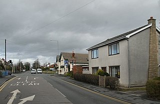
Coppull is a village and civil parish in Lancashire, England. It is part of the Borough of Chorley, lies around 300 feet (91 m) above sea level. Its population is around 8,000, having been counted at 8,300 in the 2021Census. It is bounded by Whittle Brook, Clancutt Brook, the River Yarrow, Eller Brook, Hic-Bibi Brook and Stars Brook. Coppull is located between Chorley and Standish, Greater Manchester, to the east of the A49 road near Charnock Richard.

<span class="mw-page-title-main">Euxton</span> Human settlement in England

Euxton is a village and civil parish of the Borough of Chorley, in Lancashire, England. The population of the civil parish as taken at the 2011 census was 9,993, however, the population is now estimated to be around 14,000 due to the increase in housing developments in the village, including the Buckshaw development. The village is situated just to the west of Chorley, and to the south of Clayton-le-Woods.

<span class="mw-page-title-main">Standish, Greater Manchester</span> Human settlement in England

Standish is a village in the Metropolitan Borough of Wigan, Greater Manchester, England. Within the boundaries of the historic county of Lancashire, it is on the A49 road between Chorley and Wigan, near Junction 27 of the M6 motorway. The population of the village was 13,278 in the 2011 census.

<span class="mw-page-title-main">Charnock Richard MSA</span> Motorway service area in Lancashire, England

Charnock Richard Services is a motorway service area between Junctions 27 and 28 of the M6 in England. The services are in the Lancashire borough of Chorley and were the first on the M6 when they opened in 1963. Originally operated by Trust House Forte, the services are currently operated by Welcome Break.

<span class="mw-page-title-main">Eccleston, Lancashire</span> Village and civil parish in England

Eccleston is a village and civil parish of the Borough of Chorley in Lancashire, England. It is beside the River Yarrow, and was formerly an agricultural and later a weaving settlement.

<span class="mw-page-title-main">Clayton-le-Woods</span> Human settlement in England

Clayton-le-Woods is a large village and civil parish of the Borough of Chorley, in Lancashire, England. According to the census of 2001, it has a population of 14,528. At the 2011 census the population of Cuerden civil parish was included within Clayton-le-Woods, giving a total of 14,532.

<span class="mw-page-title-main">Clayton Brook</span> Human settlement in England

Clayton Brook is a large residential estate in Lancashire, between the city of Preston and the town of Chorley. It forms part of the Clayton-le-Woods civil parish, and is in the Clayton-le-Woods North ward of the borough of Chorley.

<span class="mw-page-title-main">Buckshaw Village</span> Residential and industrial area in Lancashire, England

Buckshaw Village is a 21st-century residential and industrial area between the towns of Chorley and Leyland in Lancashire, England, developed on the site of the former Royal Ordnance Factory (ROF) Chorley. It had a population of 4,000. It is divided between the civil parishes of Euxton (south) and Whittle-le-Woods in Chorley, with the north western part being in Leyland unparished area in South Ribble district.

<span class="mw-page-title-main">Bretherton</span> Human settlement in England

Bretherton is a small village and civil parish in the Borough of Chorley, Lancashire, England, situated to the south west of Leyland and east of Tarleton. The population of the civil parish at the 2011 census was 669. Its name suggests pre-conquest origins and its early history was closely involved with the manor house Bank Hall and the families who lived there. Bretherton remained a rural community and today is largely residential with residents commuting to nearby towns.

<span class="mw-page-title-main">Cuerden</span> Human settlement in England

Cuerden is a village and civil parish of the Borough of Chorley, in Lancashire, England. It is situated between Bamber Bridge and Leyland, and had a population of 77 in 2001. At the 2011 census the population was included within Clayton-le-Woods civil parish.

Chorley Interchange is a bus station in Chorley, England.

<span class="mw-page-title-main">Heath Charnock</span> Human settlement in England

Heath Charnock is a small village and civil parish of the Borough of Chorley in Lancashire, England. According to the United Kingdom Census 2001 it has a population of 2,065, reducing to 2,026 at the 2011 Census.

<span class="mw-page-title-main">Transport in Preston</span>

Preston is a city in Lancashire, around 50 kilometres (31 mi) north-west of Manchester.

<span class="mw-page-title-main">Charnock Richard F.C.</span> Association football club in England

Charnock Richard Football Club is a football club based in Charnock Richard, near Chorley, Lancashire, England. They are currently members of the North West Counties League Premier Division and play at Mossie Park.

References

  1. UK Census (2011). "Local Area Report – Charnock Richard Parish (E04005145)". Nomis. Office for National Statistics . Retrieved 26 March 2021.
  2. "Charnock Richard". Chorley Council. 2008. Archived from the original on 27 September 2007. Retrieved 22 January 2008.
    - "Parish Council Details: Charnock Richard Parish Council". Lancashire Parish Portal. Lancashire County Council. 2008. Archived from the original on 28 March 2008. Retrieved 22 January 2008.
  3. "SSSI unit information: Charnock Richard Pasture - Unit 1". English Nature. 2002. Archived from the original on 26 September 2007. Retrieved 22 January 2008.
  4. "Charnock Richard Services". The Motorway Services Trivia Site. Archived from the original on 18 January 2008. Retrieved 22 January 2008.
    - "Services List: Charnock Richard information". Motorway Services Online. Retrieved 22 January 2008.
  5. "Christ Church, Charnock Richard - Church of England". GENUKI. Retrieved 22 January 2008.
  6. "Charnocks £120,000 grounds revamp starts". Lancashire Evening Post . 14 June 2007. Archived from the original on 22 April 2013. Retrieved 7 September 2007.