
Gurdaspur district is a district in the Majha region of the state of Punjab, India. Gurdaspur is the district headquarters. It internationally borders Narowal District of the Pakistani Punjab, the Punjab districts of Amritsar, Pathankot, Kapurthala and Hoshiarpur. Two main rivers Beas and Ravi passes through the district. The Mughal emperor Akbar is said to have been enthroned in a garden near Kalanaur, a historically important town in the district. The district is at the foothills of the Himalayas.
Abdal is a rank of forty Sufi saints in Islamic metaphysics and mysticism.

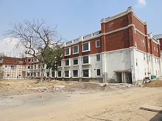
Patiala district is one of the twenty two districts in the state of Punjab in north-west India.

Ludhiana District is one of the 22 districts in the state of Punjab in northwest India. It is the largest district of Punjab, by both area and population. Ludhiana city, the district headquarters, is the hub of industry in Punjab. The main industries are bicycle parts and hosiery. Ludhiana is the biggest city of the state. It has eight tehsils, seven sub-tehsils and twelve development blocks. As of 2018, Total Population of Punjab is estimated to be 30,452,879.

Lahore Division is an administrative division of Punjab Province, Pakistan. Before 2000 it comprised four Districts - Kasur, Lahore, Nankana Sahib District and Sheikhupura. Under the reforms of 2000, this tier of government was abolished, but in 2000 divisions were restored. However, the restored Lahore Division has only comprised Kasur and Lahore Districts; a new division, Sheikhupura Division was created to comprise Nankana Sahib and Sheikhupura Districts.
Fatehgarh Churian is a city and a municipal council in Gurdaspur district in the state of Punjab, India.

Majitha is a town and a municipal council in Amritsar district in the Indian state of Punjab. The 2011 Census of India recorded 14,503 people resident in the town.
Rajasansi is a town and a nagar panchayat in Amritsar district in the Indian state of Punjab.

Tarn Taran district is one of the districts in the Majha region of Punjab, India. The main cities are Tarn Taran Sahib and Patti. The City of Taran Taran is a holy place for Sikhs.

Punjab is a state in northern India. Forming part of the larger Punjab region of the Indian subcontinent, the state is bordered by the Indian states of Jammu and Kashmir to the north, Himachal Pradesh to the east, Haryana to the south and southeast, Rajasthan to the southwest, and the Pakistani province of Punjab to the west. The state covers an area of 50,362 square kilometres, 1.53% of India's total geographical area. It is the 20th-largest Indian state by area. With 27,704,236 inhabitants at the 2011 census, Punjab is the 16th-largest state by population, comprising 22 districts. Punjabi is the most widely spoken and official language of the state. The main ethnic group are the Punjabis, with Sikhs (58%) and Hindus (38%). The state capital is Chandigarh, a Union Territory and also the capital of the neighbouring state of Haryana. The five tributary rivers of the Indus River from which the region took its name are Sutlej, Ravi, Beas, Chenab and Jhelum Rivers; Sutlej, Ravi and Beas are part of the Indian Punjab.
Baba Bakala is a historical town and tehsil in the Amritsar district in Punjab, India. It is known as the location of Gurdwara Baba Bakala Sahib.
Chak Sahbu is a small village in Jalandhar District of Punjab State, India. The village is administrated by Sarpanch who is elected representative of village. It is located 49 km towards East from Jalandhar, 14 km from Phillaur and 119 km from Chandigarh. The nearest census town and marketplace is located 1 km in Apra, Punjab. The nearest train station is situated 13.9 km away in Phillaur, nearest domestic airport is at Ludhiana and the nearest international airport is 143 km away in Amritsar.
Atta is a village in Phillaur tehsil of Jalandhar District of Punjab State, India. It is situated on national highway 1 and located 2.2 km away from Goraya, 18 km from Phillaur, 45.8 km from Jalandhar, and 112 km from state capital Chandigarh. The village is administrated by Sarpanch who is elected representative of village.
Khanpur is a medium size village in Phillaur tehsil of Jalandhar District of Punjab State, India. The village is administrated by Sarpanch who is elected representative of village. It is situated on Phillaur-Apra road and located 3.8 km away from Nagar, 3 km from census town Apra, 54 km from Jalandhar and 121 km from state capital Chandigarh. Khanpur has postal head office in Dayalpur which is 8 km away from the village.
Bainapur is a small size village in Phillaur tehsil of Jalandhar district of Punjab State, India. It is located 25 km away from Phillaur, 5.8 km from Nurmahal, 27.7 km from district headquarter Jalandhar and 147 km from state capital Chandigarh. The village is administrated by a sarpanch who is an elected representative of village as per Panchayati raj (India).
Killi is a village in Shahkot in Jalandhar district of Punjab State, India. It is located 4 kilometres (2.5 mi) from Shahkot, 22 kilometres (14 mi) from Nakodar, 46 kilometres (29 mi) from district headquarter Jalandhar and 177 kilometres (110 mi) from state capital Chandigarh. The village is administrated by a sarpanch who is an elected representative of village as per Panchayati raj (India).
Lasuri is a village in Shahkot in Jalandhar district of Punjab State, India. It is located 7 kilometres (4.3 mi) from Shahkot, and 52 kilometres (32 mi) from the district headquarter Jalandhar. The village is administrated by a sarpanch who is an elected representative of village as per Panchayati raj (India).
Baghela is a village in Nakodar in Jalandhar district of Punjab State, India. It is located 19 kilometres (12 mi) from sub district headquarter and 44 kilometres (27 mi) from district headquarter. The village is administrated by Sarpanch an elected representative of the village as per Panchayati raj (India).


