Absecon Highlands, New Jersey | |
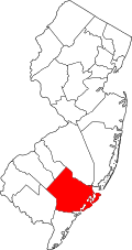
---|---|
Location in Atlantic County Location in New Jersey | |
Coordinates: 39°26′33″N74°28′40″W / 39.44250°N 74.47778°W | |
Country | United States |
State | New Jersey |
County | Atlantic |
Township | Galloway |
Area | |
• Total | 2.44 sq mi (6.31 km2) |
• Land | 1.95 sq mi (5.06 km2) |
• Water | 0.48 sq mi (1.25 km2) |
Elevation | 3 ft (0.9 m) |
Population (2020) | |
• Total | 1,414 |
• Density | 723.64/sq mi (279.46/km2) |
Time zone | UTC−05:00 (Eastern (EST)) |
• Summer (DST) | UTC−04:00 (EDT) |
ZIP Code | 08205 (Absecon) |
Area code | 609 |
FIPS code | 34-00160 [2] |
GNIS feature ID | 2804146 [3] |
Absecon Highlands is an unincorporated community and census-designated place (CDP) [4] in Atlantic County, in the U.S. state of New Jersey. It is in the eastern part of the county, in southern Galloway Township. It is bordered to the south by the city of Absecon and to the east by Reeds Bay, a tidal water body the connects to the Atlantic Ocean through Broad Creek and Absecon Inlet. The CDP includes the neighborhoods of Absecon Highlands, Seaview Estates, Seaview Park, Conovertown, and Holly Brook. [5]
U.S. Route 9 (New York Road) is the main road through the community; it leads north 7 miles (11 km) to the Garden State Parkway in Port Republic and south through Absecon 4 miles (6 km) to the Atlantic City Expressway in Pleasantville.
The community was first listed as a CDP prior to the 2020 census. [3]
Census | Pop. | Note | %± |
---|---|---|---|
2020 | 1,414 | — | |
U.S. Decennial Census [6] 2020 [7] |
Race / Ethnicity | Pop 2020 [7] | % 2020 |
---|---|---|
White alone (NH) | 941 | 66.55% |
Black or African American alone (NH) | 70 | 4.95% |
Native American or Alaska Native alone (NH) | 1 | 0.07% |
Asian alone (NH) | 125 | 8.84% |
Pacific Islander alone (NH) | 1 | 0.07% |
Some Other Race alone (NH) | 4 | 0.28% |
Mixed Race/Multi-Racial (NH) | 73 | 5.16% |
Hispanic or Latino (any race) | 199 | 14.07% |
Total | 1,414 | 100.00% |
Collings Lakes is an unincorporated community and census-designated place (CDP) located within Buena Vista Township in Atlantic County, in the U.S. state of New Jersey. As of the 2010 United States Census, the CDP's population was 1,706.
Ashland is an unincorporated community and census-designated place (CDP) located within Cherry Hill, in Camden County, in the U.S. state of New Jersey. As of the 2010 United States Census, the CDP's population was 8,302.
Barnegat is an unincorporated community and census-designated place (CDP) located within Barnegat Township, in Ocean County, in the U.S. state of New Jersey. As of the 2010 United States census, the CDP's population was 2,817.
Toms River is an unincorporated community and census-designated place (CDP) located within and constituting the mainland portion of Toms River Township, in Ocean County, in the U.S. state of New Jersey. As of the 2020 United States census, the CDP's population was 92,830, its highest decennial count ever and an increase of 4,039 (+4.5%) from the 88,791 recorded at the 2010 census, which in turn reflected an increase of 2,464 (+2.9%) from the 86,327 counted in the 2000 census. The Toms River CDP is the county seat of Ocean County. The area is named for Toms River, whose estuary flows through the community and empties into Barnegat Bay.
Waretown is an unincorporated community and census-designated place (CDP) located within Ocean Township, in Ocean County, in the U.S. state of New Jersey. As of the 2010 United States Census, the CDP's population was 1,569. Waretown is home to Albert Music Hall.
Auburn is an unincorporated community and census-designated place (CDP) in Salem County, in the U.S. state of New Jersey. It includes the Auburn section of Oldmans Township and extends southeast to include rural and semi-suburban land in Pilesgrove Township.
Asbury is an unincorporated community and census-designated place (CDP) located within Franklin Township in Warren County, in the U.S. state of New Jersey, that was created as part of the 2010 United States Census. As of the 2010 Census, the CDP's population was 273.
Elwood is an unincorporated community and census-designated place (CDP) located within Mullica Township in Atlantic County, in the U.S. state of New Jersey. As of the 2010 United States Census, the CDP's population was 1,437. At previous censuses, the area was listed by the U.S. Census Bureau as the Elwood-Magnolia CDP. The area is served as United States Postal Service ZIP Code 08217.
Burleigh is an unincorporated community and census-designated place (CDP) located within Middle Township in Cape May County, in the U.S. state of New Jersey; Until the 2000 census the area had been part of the Whitesboro-Burleigh CDP, which was split in 2010 into separate CDPs for Burleigh and Whitesboro. As of the 2010 United States Census, the CDP's population was 725.
Robertsville is a census-designated place and unincorporated community located within Marlboro Township, in Monmouth County, in the U.S. state of New Jersey. At the 2010 census, the CDP's population was 11,297.
Barclay Farm is an unincorporated community and census-designated place (CDP) located within Cherry Hill, in Camden County, in the U.S. state of New Jersey, that had been part of the Barclay-Kingston CDP until 2000, which was split to form the CDPs of Barclay and Kingston Estates as of the 2010 Census. Until the 2000 census, Barclay was included as part of the Barclay-Kingston CDP. As of the 2010 United States Census, the CDP's population was 4,428.
Bargaintown is an unincorporated community and census-designated place (CDP) located within Egg Harbor Township, in Atlantic County, in the U.S. state of New Jersey. The Egg Harbor Township municipal building is located in Bargaintown, about 0.25 mi (0.40 km) east of the Garden State Parkway.
Allamuchy is an unincorporated community and census-designated place (CDP) located within Allamuchy Township, in Warren County, in the U.S. state of New Jersey. As of the 2020 United States census, its population was 208, an increase from the 74 counted in the 2010 census.
Cologne is an unincorporated community and census-designated place located within Galloway Township, in Atlantic County, New Jersey, United States. Cologne is located on U.S. Route 30, about 2.5 miles (4.0 km) southeast of Egg Harbor City. Cologne has a post office with ZIP code 08213.
Arrowhead Lake is an unincorporated community and census-designated place (CDP) in Cumberland County, in the U.S. state of New Jersey. It is in the northwestern part of the county, in the northern part of Stow Creek Township. A small artificial lake is in the northwestern part of the CDP, with a residential neighborhood on its southern shore.
Carlls Corner is a census-designated place (CDP) in Cumberland County, in the U.S. state of New Jersey. It is in the northern part of the county, in Upper Deerfield Township. It is bordered at its southwest corner by the city of Bridgeton, the county seat.
Regency at Monroe is a gated community and census-designated place (CDP) in Monroe Township, Middlesex County, in the U.S. state of New Jersey. It is in the eastern part of the township, bordered by Mounts Mills Road to the north, Spotswood-Englishtown Road to the east, and Buckelew Avenue to the southwest. It is 7 miles (11 km) northwest of Freehold, 15 miles (24 km) south-southeast of New Brunswick, and 22 miles (35 km) northeast of Trenton.
Renaissance at Monroe is a planned community and census-designated place (CDP) in Monroe Township, Middlesex County, in the U.S. state of New Jersey. It is in the southwest part of the township, bordered to the east by Monroe Manor and to the east by East Windsor Township in Mercer County. New Jersey Route 33 forms the northern edge of the community; it is 1.5 miles (2.4 km) west to Exit 8 on the New Jersey Turnpike and 11 miles (18 km) east to Freehold.
Bedminster is an unincorporated community and census-designated place (CDP) comprising the primary community in Bedminster Township, Somerset County, in the U.S. state of New Jersey. It was first listed as a CDP prior to the 2020 census.
Cranford is a census-designated place (CDP) comprising the downtown part of Cranford Township, Union County, in the U.S. state of New Jersey. It was first listed as a CDP prior to the 2020 census with a population of population was 2,032.