Murcia is a city in south-eastern Spain, the capital and most populous city of the autonomous community of the Region of Murcia, and the seventh largest city in the country. It had a population of 460,349 inhabitants in 2021. The total population of the metropolitan area is 672,773 in 2020, covering an urban area of 1,230.9 km2. It is located on the Segura River, in the southeast of the Iberian Peninsula. It has a climate with hot summers, mild winters, and relatively low precipitation.

Cádiz is a province of southern Spain, in the southwestern part of the autonomous community of Andalusia. It is the southernmost part of mainland Spain, as well as the southernmost part of continental Europe.

Villavicencio is a city and municipality in Colombia. The capital of Meta Department, it was founded on April 6, 1840. The municipality had a population of 531,275 in 2018. The city is located at 4°08'N, 73°40'W, 75 km southeast of the Colombian capital city of Bogotá (DC) by the Guatiquía River. It is the most important commercial center in the Llanos Orientales of Colombia.
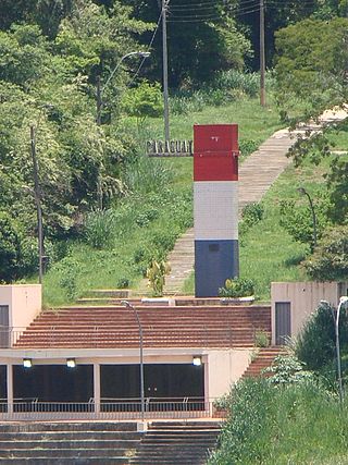
Presidente Franco is a district and city of the Alto Paraná Department, Paraguay. Aside from being the oldest city in Alto Paraná Department, it is a place of rich exports of fruits and vegetables. Also, Presidente Franco is well known for Saltos del Monday, a 45 m tall and 120 m wide waterfall, Eastern Paraguay.

Abejorral is a town and municipality in Antioquia Department, Colombia. Part of the subregion of Eastern Antioquia. It borders to the north with the municipalities of Montebello, La Ceja and La Unión, to the east with municipality of Sonsón, to the south with the department of Caldas and to the west with the municipalities of Santa Bárbara y Montebello.

Jardín, often mistakingly referred to as El Jardín, is a town and municipality in the southwest region of Antioquia, Colombia. It is bounded by the Andes, Jericó, and Támesis municipalities to the north and the Caldas department to the south. The municipality is located between the San Juan river, which is called Docató by the natives, and a branch of the Western Cordillera. Jardín is identified by its preserved colonial architecture, lush vegetation, and abundant rivers and streams.

San Luis is a municipality in Colombia, located in the department of Antioquia. It is limited in the north by the municipalities of San Carlos and Puerto Nare, in the east by the municipality of Puerto Triunfo, in the south by the municipality of San Francisco and in the west by the municipalities of Cocorná and Granada.
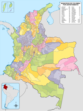
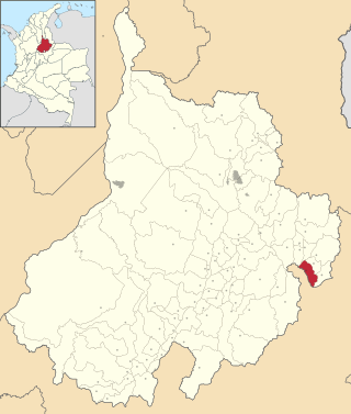
The Municipalities of Colombia are decentralized subdivisions of the Republic of Colombia. Municipalities make up most of the departments of Colombia with 1,122 municipalities (municipios). Each one of them is led by a mayor (alcalde) elected by popular vote and represents the maximum executive government official at a municipality level under the mandate of the governor of their department which is a representative of all municipalities in the department; municipalities are grouped to form departments.

Totana is a municipality in the Region of Murcia in Spain. It has a population of 32008. The local economy is largely dependent on agriculture and related industries. It has a railway station providing a service on the Cercanías Murcia/Alicante commuter line, providing connections to Alicante and Murcia.

Ciudad Valles is the second-largest city in the Mexican state of San Luis Potosí. It is located in the eastern part of the state, in the cultural region of Huasteca. The city is also the municipal seat of the surrounding municipality of the same name. The city had a 2014 census population of 176,935.
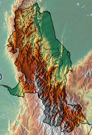
The department of Norte de Santander in northwestern Colombia, and its capital, Cúcuta, contains several rivers. The rivers are mostly part of the Maracaibo Lake basin, with the southeastern section located in the Magdalena River basin. Important fluvial elements are the Zulia, Catatumbo and Pamplonita Rivers. The entity in charge of taking care of these hydrology of Norte de Santander is Corponor.
San Blas is both a municipality and municipal seat located on the Pacific coast of Mexico in Nayarit.
Capitanejo is a town and municipality in the Santander Department of north eastern Colombia. It is one of the towns in the province of García Rovira on the banks of the Chicamocha River. It is located 197 km from the departmental capital, Bucaramanga and 35 km from Málaga Capital of the province. and 189 km from the city of Tunja; and 136 km from Duitama "Troncal central del Norte" highway. Route 55

Vista Hermosa is a town and municipality in the Meta Department, Colombia. That is located approximately 6 hours from Bogotá D.C. It has fully paved access roads that allow a quick movement to the urban area and the visualization of its beautiful landscapes that live up to its name.

The contribution of travel and tourism to GDP was US$5,880.3bn in 2016. Tourism generated 556,135 jobs in 2016. Foreign tourist visits were predicted to have risen from 0.6 million in 2007 to 4 million in 2017. Responsible tourism became a peremptory need for Colombia because it minimizes negative social, economic and environmental impacts and makes positive contributions to the conservation of natural and cultural heritage.

Alhama de Murcia is a Spanish municipality in the autonomous community of the Region of Murcia. It is located in the north of the southern half of the region. The municipality shares borders with Librilla in its north, Murcia in its northeast, Fuente Álamo de Murcia in its east, Mazarrón in its south, Totana in its west and Mula in its northwest.

Torre-Pacheco is a municipality in the autonomous community of Murcia in southeastern Spain. It covers an area of 189.4 km² and its population in 2019 was 35,676. The only high ground in the municipality is Cabezo Gordo hill, the location of the protected Sima de las Palomas archeological site. The town has one secondary education institution, the I.E.S. Gerardo Molina.

Palenque is a city and municipality located in the north of the state of Chiapas, Mexico. The city was named almost 200 years before the nearby Mayan ruins were discovered in the 18th century. The area has a significant indigenous population, mostly of the Ch'ol people, a Mayan descendant. The city is the only urban area in a municipality of over 600 communities, and is surrounded by rainforest. Deforestation has had dramatic effects on the local environment, with howler monkeys occasionally seen in the city as they seek food. While most of the municipality's population is economically marginalized, working in agriculture, the Palenque archeological site is one of the most important tourist attractions for the area and the state of Chiapas. It is the poorest major city in the state of Chiapas.

Gravatal is a municipality in the state of Santa Catarina in the South region of Brazil.

Lake Suesca is a natural water body situated on the Altiplano Cundiboyacense, belonging to the municipalities of Suesca and Cucunubá in the department of Cundinamarca, Colombia. The basin has a semi-elliptical shape that extends on a north–south axis, with roughly 6 kilometres (3.7 mi) length and 2 kilometres (1.2 mi) width. The average depth is 8 metres (26 ft). It is located in the Eastern Ranges, on the anticlinal of Nemocón, in the northeast of the department, at an altitude of 2,800 metres (9,200 ft).