Adams Township, Cambria County, Pennsylvania

Last updated
Adams Township,
Cambria County,
Pennsylvania
JOHNSTOWN FLOOD NATIONAL MEMORIAL.jpg
Map of Adams Township, Cambria County, Pennsylvania Highlighted.png
Map of Cambria County, Pennsylvania highlighting Adams Township
Map of Pennsylvania highlighting Cambria County.svg
Map of Cambria County, Pennsylvania
Country United States
State Pennsylvania
County Cambria
IncorporatedJanuary 5, 1870
Area
[1]
  Total46.20 sq mi (119.66 km2)
  Land46.08 sq mi (119.36 km2)
  Water0.12 sq mi (0.31 km2)
Population
 (2010)
  Total5,972
  Estimate 
(2016) [2]
5,694
  Density123.56/sq mi (47.71/km2)
Time zone UTC-5 (Eastern (EST))
  Summer (DST) UTC-4 (EDT)
Area code 814
FIPS code 42-021-00308
Website www.adamstwpcambria.com

Adams Township in Cambria County, Pennsylvania, United States, is a township that is part of the Johnstown, Pennsylvania Metropolitan Statistical Area. The population was 5,972 at the 2010 census, [3] down from 6,495 at the 2000 census.

Contents

History

The Johnstown Flood National Memorial was listed on the National Register of Historic Places in 1966. The South Fork Fishing and Hunting Club Historic District was listed in 1986. [4]

Geography

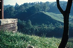
Adams Township is located in the southeast corner of Cambria County at 40.392581, -78.542633, [5] approximately 12 miles (19 km) east of Johnstown. According to the United States Census Bureau, the township has a total area of 46.2 square miles (119.7 km2), of which 46.1 square miles (119.4 km2) is land and 0.12 square miles (0.3 km2), or 0.26%, is water. [3] The elevation rises to more 2,860 feet (870 m) above sea level in the southeastern part of the township, on Pot Ridge near the crest of the Allegheny Front.

Communities

Census-designated places

Census-designated places are geographical areas designated by the U.S. Census Bureau for the purposes of compiling demographic data. They are not actual jurisdictions under Pennsylvania law. Other unincorporated communities, such as villages, may be listed here as well.

Unincorporated communities

Recreation

A portion of the Gallitzin State Forest (Babcock Division), a section of the Johnstown Flood National Memorial and a portion of the Pennsylvania State Game Lands Number 26 are located in the township. [6] [7]

Demographics

Historical population
CensusPop.
2000 6,495
2010 5,972−8.1%
2020 5,752−3.7%
2021 (est.)5,722 [8] −0.5%
U.S. Decennial Census [9]

As of the census [10] of 2000, there were 6,495 people, 2,521 households, and 1,913 families residing in the township. The population density was 139.6 people per square mile (53.9/km2). There were 2,642 housing units at an average density of 56.8/sq mi (21.9/km2). The racial makeup of the township was 98.89% White, 0.05% African American, 0.18% Native American, 0.12% Asian, 0.08% Pacific Islander, 0.15% from other races, and 0.52% from two or more races. Hispanic or Latino of any race were 0.75% of the population.

There were 2,521 households, out of which 31.1% had children under the age of 18 living with them, 63.4% were married couples living together, 9.2% had a female householder with no husband present, and 24.1% were non-families. 21.9% of all households were made up of individuals, and 11.4% had someone living alone who was 65 years of age or older. The average household size was 2.56 and the average family size was 2.96.

In the township the population was spread out, with 22.8% under the age of 18, 7.4% from 18 to 24, 27.3% from 25 to 44, 26.1% from 45 to 64, and 16.3% who were 65 years of age or older. The median age was 40 years. For every 100 females there were 96.1 males. For every 100 females age 18 and over, there were 92.1 males.

The median income for a household in the township was $32,442, and the median income for a family was $38,353. Males had a median income of $30,044 versus $20,606 for females. The per capita income for the township was $15,967. About 8.0% of families and 10.8% of the population were below the poverty line, including 14.3% of those under age 18 and 15.2% of those age 65 or over.

See also

Related Research Articles

<span class="mw-page-title-main">Barr Township, Cambria County, Pennsylvania</span> Township in Pennsylvania, United States

Barr Township is a township in Cambria County, Pennsylvania, United States. As of the 2020 census, the township population was 2,057. It is part of the Johnstown, Pennsylvania Metropolitan Statistical Area.

<span class="mw-page-title-main">Beaverdale, Pennsylvania</span> Census-designated place in Pennsylvania, United States

Beaverdale is an unincorporated community and census-designated place (CDP) in Cambria County, Pennsylvania, United States. The population was 1,035 at the 2010 census. Prior to that time, the CDP was known as Beaverdale-Lloydell.

<span class="mw-page-title-main">Blacklick Township, Cambria County, Pennsylvania</span> Township in Pennsylvania, United States

Blacklick Township is a township in Cambria County, Pennsylvania, United States. The population was 1,880 at the 2020 census. It is part of the Johnstown, Pennsylvania Metropolitan Statistical Area.

<span class="mw-page-title-main">Cambria Township, Cambria County, Pennsylvania</span> Township in Pennsylvania, United States

Cambria Township is a township in Cambria County, Pennsylvania, United States. The population was 5,781 at the 2020 census. It is part of the Johnstown, Pennsylvania Metropolitan Statistical Area and geographically surrounds the borough of Ebensburg, the Cambria County seat.

<span class="mw-page-title-main">Chest Township, Cambria County, Pennsylvania</span> Township in Pennsylvania, United States

Chest Township is a township in Cambria County, Pennsylvania, United States. The population was 458 at the 2020 census. It is part of the Johnstown, Pennsylvania Metropolitan Statistical Area.

<span class="mw-page-title-main">Conemaugh Township, Cambria County, Pennsylvania</span> Township in Pennsylvania, United States

Conemaugh Township is a township in Cambria County, Pennsylvania, United States. The population was 1,943 at the 2020 census. It is part of the Johnstown, Pennsylvania Metropolitan Statistical Area.

<span class="mw-page-title-main">Croyle Township, Cambria County, Pennsylvania</span> Township in Pennsylvania, United States

Croyle Township is a township in Cambria County, Pennsylvania, United States. It is part of the Johnstown, Pennsylvania Metropolitan Statistical Area. The population was 2,339 at the 2010 census.

<span class="mw-page-title-main">East Taylor Township, Cambria County, Pennsylvania</span> Township in Pennsylvania, United States

East Taylor Township is a township in Cambria County, Pennsylvania, United States, The population was 2,726 at the 2010 census, unchanged since the 2000 census. It is part of the Johnstown, Pennsylvania Metropolitan Statistical Area.

<span class="mw-page-title-main">Elder Township, Cambria County, Pennsylvania</span> Township in Pennsylvania, United States

Elder Township is a township in Cambria County, Pennsylvania, United States, about 24 miles (39 km) northwest of Altoona. As of the 2010 census, the township had a population of 1,038. It is part of the Johnstown, Pennsylvania Metropolitan Statistical Area.

<span class="mw-page-title-main">Jackson Township, Cambria County, Pennsylvania</span> Township in Pennsylvania, United States

Jackson Township is a township in Cambria County, Pennsylvania, United States. The population was 4,392 at the 2010 census, down from 4,925 at the 2000 census. It is part of the Johnstown, Pennsylvania Metropolitan Statistical Area.

<span class="mw-page-title-main">Lower Yoder Township, Cambria County, Pennsylvania</span> Township in Pennsylvania, United States

Lower Yoder Township is a township in Cambria County, Pennsylvania, United States. The population was 2,699 at the 2010 census, down from 3,029 at the 2000 census. It is part of the Johnstown, Pennsylvania Metropolitan Statistical Area.

<span class="mw-page-title-main">Middle Taylor Township, Cambria County, Pennsylvania</span> Township in Pennsylvania, United States

Middle Taylor Township is a township in Cambria County, Pennsylvania, United States. The population was 727 at the 2010 census. It is part of the Johnstown, Pennsylvania Metropolitan Statistical Area.

<span class="mw-page-title-main">Portage Township, Cambria County, Pennsylvania</span> Township in Pennsylvania, United States

Portage Township is a township in Cambria County, Pennsylvania, United States. It surrounds the borough of Portage. The township population was 3,640 at the 2010 census. It is part of the Johnstown, Pennsylvania Metropolitan Statistical Area.

<span class="mw-page-title-main">Richland Township, Cambria County, Pennsylvania</span> Township in Pennsylvania, United States

Richland Township is a township in Cambria County, Pennsylvania, United States. The population was 12,814 at the 2010 census. It is part of the Johnstown, Pennsylvania Metropolitan Statistical Area.

<span class="mw-page-title-main">Stonycreek Township, Cambria County, Pennsylvania</span> Township in Pennsylvania, United States

Stonycreek Township is a township in Cambria County, Pennsylvania, United States. The population was 2,844 at the 2010 census, down from 3,204 at the 2000 census. It is part of the Johnstown, Pennsylvania Metropolitan Statistical Area.

<span class="mw-page-title-main">Summerhill Township, Cambria County, Pennsylvania</span> Township in Pennsylvania, United States

Summerhill Township is a township in Cambria County, Pennsylvania, United States. The population was 2,467 at the 2010 census. It is part of the Johnstown, Pennsylvania Metropolitan Statistical Area.

<span class="mw-page-title-main">Upper Yoder Township, Cambria County, Pennsylvania</span> Township in Pennsylvania, United States

Upper Yoder Township is a township in Cambria County, Pennsylvania, United States. The population was 5,449 at the 2010 census. It is part of the Johnstown, Pennsylvania Metropolitan Statistical Area.

<span class="mw-page-title-main">West Carroll Township, Cambria County, Pennsylvania</span> Township in Pennsylvania, United States

West Carroll Township is a township in Cambria County, Pennsylvania, United States and consists of the communities of Bakerton, Barnes, Carrolltown Road, Elmora and St. Benedict. The population was 1,296 at the 2010 census. It is part of the Johnstown, Pennsylvania Metropolitan Statistical Area.

<span class="mw-page-title-main">West Taylor Township, Cambria County, Pennsylvania</span> Township in Pennsylvania, United States

West Taylor Township is a township in Cambria County, Pennsylvania, United States. The population was 795 at the 2010 census. It is part of the Johnstown, Pennsylvania Metropolitan Statistical Area.

<span class="mw-page-title-main">White Township, Cambria County, Pennsylvania</span> Township in Pennsylvania, United States

White Township is a township in Cambria County, Pennsylvania, United States. The population was 836 at the 2010 census. It is part of the Johnstown, Pennsylvania Metropolitan Statistical Area.

References

  1. "2016 U.S. Gazetteer Files". United States Census Bureau. Retrieved Aug 13, 2017.
  2. "Population and Housing Unit Estimates" . Retrieved June 9, 2017.
  3. 1 2 "Geographic Identifiers: 2010 Demographic Profile Data (G001): Adams township, Cambria County, Pennsylvania". U.S. Census Bureau, American Factfinder. Archived from the original on February 13, 2020. Retrieved March 20, 2015.
  4. "National Register Information System". National Register of Historic Places . National Park Service. July 9, 2010.
  5. "US Gazetteer files: 2010, 2000, and 1990". United States Census Bureau. 2011-02-12. Retrieved 2011-04-23.
  6. https://viewer.nationalmap.gov/advanced-viewer/ The National Map, retrieved 3 October 2018
  7. Pennsylvania State Game Lands Number 26, retrieved 3 October 2018
  8. "Adams Township, Cambria County, Pennsylvania". census.gov. Retrieved July 7, 2022.
  9. "Census of Population and Housing". Census.gov. Retrieved June 4, 2016.
  10. "U.S. Census website". United States Census Bureau . Retrieved 2008-01-31.

Coordinates: 40°14′45″N78°42′29″W / 40.24583°N 78.70806°W / 40.24583; -78.70806