Tunnelhill, Pennsylvania

Last updated
Tunnelhill, Pennsylvania
Perspective view of east portal, looking WSW. Allegheny tunnel at left; Gallitzin tunnel (HAER no. PA-516) at right jpg.jpg
Eastern portals of the Gallitzin Tunnel in Tunnelhill
Blair County Pennsylvania Incorporated and Unincorporated areas Tunnelhill Highlighted.svg
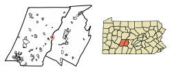
Location of Tunnelhill in Blair County, Pennsylvania.
USA Pennsylvania location map.svg
Red pog.svg
Tunnelhill
Coordinates: 40°28′39″N78°32′29″W / 40.47750°N 78.54139°W / 40.47750; -78.54139
Country United States
State Pennsylvania
Counties Blair and Cambria
Incorporated1876
Government
  TypeBorough Council
Area
[1]
  Total0.49 sq mi (1.28 km2)
  Land0.49 sq mi (1.28 km2)
  Water0.00 sq mi (0.00 km2)
Elevation
[2]
2,323 ft (708 m)
Population
 (2020) [3]
  Total315
  Density636.36/sq mi (245.79/km2)
Time zone UTC-5 (Eastern (EST))
  Summer (DST) UTC-4 (EDT)
Zip code
16641
Area code 814
FIPS code 42-77808
GNIS feature ID1217320 [2]

Tunnelhill is a borough that is located in Cambria and Blair counties in Pennsylvania, United States. [4] [5] The population was 363 at the 2010 census. Of these, 245 were in Cambria County, and 118 were in Blair County. It is part of the Altoona, PA Metropolitan Statistical Area. Tunnelhill is named after the many railroad tunnels of the Pennsylvania Railroad near here known as the Gallitzin Tunnels.

Contents

Geography

Tunnelhill is located at 40°28′39″N78°32′29″W / 40.47750°N 78.54139°W / 40.47750; -78.54139 (40.477501, -78.541363). [6]

According to the United States Census Bureau, the borough has a total area of 0.5 square mile (1.2 km2), all land.

Tunnelhill has the third-highest elevation among towns in Pennsylvania, at 2300 feet. [7]

Demographics

Historical population
CensusPop.Note
1880 224
1890 730225.9%
1900 674−7.7%
1910 661−1.9%
1920 619−6.4%
1930 69011.5%
1940 625−9.4%
1950 535−14.4%
1960 463−13.5%
1970 5089.7%
1980 5131.0%
1990 365−28.8%
2000 40912.1%
2010 363−11.2%
2020 315−13.2%
U.S. Decennial Census [8]

As of the census [9] of 2000, there were 409 people, 178 households, and 100 families living in the borough. The population density was 844.4 inhabitants per square mile (326.0/km2). There were 188 housing units at an average density of 388.1 per square mile (149.8/km2). The racial makeup of the borough was 98.78% White, 0.24% Native American, 0.24% Asian, 0.24% Pacific Islander, and 0.49% from two or more races.

There were 178 households, out of which 23.0% had children under the age of 18 living with them, 42.1% were married couples living together, 8.4% had a female householder with no husband present, and 43.8% were non-families. 38.8% of all households were made up of individuals, and 21.9% had someone living alone who was 65 years of age or older. The average household size was 2.27 and the average family size was 3.09.

In the borough the population was spread out, with 19.8% under the age of 18, 8.1% from 18 to 24, 23.7% from 25 to 44, 24.0% from 45 to 64, and 24.4% who were 65 years of age or older. The median age was 44 years. For every 100 females there were 88.5 males. For every 100 females age 18 and over, there were 87.4 males.

The median income for a household in the borough was $22,604, and the median income for a family was $34,500. Males had a median income of $23,500 versus $16,250 for females. The per capita income for the borough was $13,042. About 10.4% of families and 16.9% of the population were below the poverty line, including 22.2% of those under age 18 and 10.3% of those age 65 or over.

Related Research Articles

<span class="mw-page-title-main">Barr Township, Pennsylvania</span> Township in Pennsylvania, United States

Barr Township is a township in Cambria County, Pennsylvania, United States. As of the 2020 census, the township population was 2,057. It is part of the Johnstown, Pennsylvania Metropolitan Statistical Area.

<span class="mw-page-title-main">Blacklick Township, Cambria County, Pennsylvania</span> Township in Pennsylvania, United States

Blacklick Township is a township in Cambria County, Pennsylvania, United States. The population was 1,880 at the 2020 census. It is part of the Johnstown, Pennsylvania Metropolitan Statistical Area.

<span class="mw-page-title-main">Carrolltown, Pennsylvania</span> Borough in Pennsylvania, United States

Carrolltown is a borough in Cambria County, Pennsylvania, United States. The population was 853 at the 2010 census, down from 1,049 at the 2000 census. It is part of the Johnstown, Pennsylvania Metropolitan Statistical Area.

<span class="mw-page-title-main">Croyle Township, Cambria County, Pennsylvania</span> Township in Pennsylvania, United States

Croyle Township is a township in Cambria County, Pennsylvania, United States. It is part of the Johnstown, Pennsylvania Metropolitan Statistical Area. The population was 2,339 at the 2010 census.

<span class="mw-page-title-main">Daisytown, Pennsylvania</span> Borough in Pennsylvania, United States

Daisytown is a borough in Cambria County, Pennsylvania, United States. It is part of the Johnstown, Pennsylvania Metropolitan Statistical Area. The population was 326 at the 2010 census.

<span class="mw-page-title-main">Dale, Pennsylvania</span> Borough in Pennsylvania, United States

Dale is a borough in Cambria County, Pennsylvania, United States. It is part of the Johnstown, Pennsylvania Metropolitan Statistical Area. The population was 1,234 at the 2010 census, down from 1,503 at the 2000 census.

<span class="mw-page-title-main">Ehrenfeld, Pennsylvania</span> Borough in Pennsylvania, United States

Ehrenfeld is a borough in Cambria County, Pennsylvania, United States. It is part of the Johnstown, Pennsylvania Metropolitan Statistical Area. The population was 228 at the 2010 census.

<span class="mw-page-title-main">Elder Township, Cambria County, Pennsylvania</span> Township in Pennsylvania, United States

Elder Township is a township in Cambria County, Pennsylvania, United States, about 24 miles (39 km) northwest of Altoona. As of the 2010 census, the township had a population of 1,038. It is part of the Johnstown, Pennsylvania Metropolitan Statistical Area.

<span class="mw-page-title-main">Gallitzin Township, Cambria County, Pennsylvania</span> Township in Pennsylvania, United States

Gallitzin Township is a township in Cambria County, Pennsylvania, United States. The township nearly surrounds, but is a separate entity from, Gallitzin borough. As of the 2010 census, the township population was 1,324. It is part of the Johnstown, Pennsylvania Metropolitan Statistical Area.

<span class="mw-page-title-main">Geistown, Pennsylvania</span> Borough in Pennsylvania, United States

Geistown is a borough in Cambria County, Pennsylvania, United States. It is part of the Johnstown, Pennsylvania Metropolitan Statistical Area. The population was 2,467 at the 2010 census.

<span class="mw-page-title-main">Loretto, Pennsylvania</span> Borough in Pennsylvania, United States

Loretto is a borough in Cambria County, Pennsylvania, United States. As of the 2010 census it had a population of 1,302. Like the rest of Cambria County, it is part of the Johnstown, Pennsylvania Metropolitan Statistical Area. Loretto is the home of Saint Francis University.

<span class="mw-page-title-main">Richland Township, Cambria County, Pennsylvania</span> Township in Pennsylvania, United States

Richland Township is a township in Cambria County, Pennsylvania, United States. The population was 12,814 at the 2010 census. It is part of the Johnstown, Pennsylvania Metropolitan Statistical Area.

<span class="mw-page-title-main">Scalp Level, Pennsylvania</span> Borough in Pennsylvania, United States

Scalp Level is a borough in Cambria County, Pennsylvania, United States. It is part of the Johnstown, Pennsylvania Metropolitan Statistical Area. The population was 778 at the 2010 census.

<span class="mw-page-title-main">South Fork, Pennsylvania</span> Borough in Pennsylvania, United States

South Fork is a borough in Cambria County, Pennsylvania, United States. It is part of the Johnstown, Pennsylvania Metropolitan Statistical Area. The population was 928 at the 2010 census, down from 1,138 at the 2000 census.

<span class="mw-page-title-main">Southmont, Pennsylvania</span> Borough in Pennsylvania, United States

Southmont is a borough in Cambria County, Pennsylvania, United States. It is part of the Johnstown, Pennsylvania Metropolitan Statistical Area. The population was 2,284 at the 2010 census. It was incorporated in 1919 out of Upper Yoder Township.

<span class="mw-page-title-main">Spring Hill, Pennsylvania</span>

Spring Hill is a census-designated place (CDP) in Cambria County, Pennsylvania, United States. The population was 839 at the 2010 census, down from 970 at the 2000 census.

<span class="mw-page-title-main">Stonycreek Township, Cambria County, Pennsylvania</span> Township in Pennsylvania, United States

Stonycreek Township is a township in Cambria County, Pennsylvania, United States. The population was 2,844 at the 2010 census, down from 3,204 at the 2000 census. It is part of the Johnstown, Pennsylvania Metropolitan Statistical Area.

<span class="mw-page-title-main">Washington Township, Cambria County, Pennsylvania</span> Township in Pennsylvania, United States

Washington Township is a township in Cambria County, Pennsylvania, United States. As of the 2010 census, the township population was 875. It is part of the Johnstown, Pennsylvania Metropolitan Statistical Area.

<span class="mw-page-title-main">West Carroll Township, Cambria County, Pennsylvania</span> Township in Pennsylvania, United States

West Carroll Township is a township in Cambria County, Pennsylvania, United States and consists of the communities of Bakerton, Barnes, Carrolltown Road, Elmora and St. Benedict. The population was 1,296 at the 2010 census. It is part of the Johnstown, Pennsylvania Metropolitan Statistical Area.

<span class="mw-page-title-main">Franklin, Cambria County, Pennsylvania</span> Borough in Pennsylvania, United States

Franklin is a borough in Cambria County, Pennsylvania, United States. It is part of the Johnstown, Pennsylvania Metropolitan Statistical Area. At the 2010 census the borough population was 323, down from 442 at the 2000 census.

References

  1. "ArcGIS REST Services Directory". United States Census Bureau. Retrieved October 16, 2022.
  2. 1 2 U.S. Geological Survey Geographic Names Information System: Tunnelhill, Pennsylvania
  3. "Census Population API". United States Census Bureau. Retrieved Oct 12, 2022.
  4. Geographic Names Information System, United States Geological Survey (August 30, 1990). "Geographic Names Information System Feature Detail Report: Borough of Tunnelhill" . Retrieved 2007-05-19.
  5. "TUNNELHILL COMMUNITY PROFILE". ePodunk Inc. Retrieved 2007-05-18.
  6. "US Gazetteer files: 2010, 2000, and 1990". United States Census Bureau. 2011-02-12. Retrieved 2011-04-23.
  7. Highest Elevation of Towns in Pennsylvania
  8. "Census of Population and Housing". Census.gov. Retrieved June 4, 2016.
  9. "U.S. Census website". United States Census Bureau . Retrieved 2008-01-31.