Cross Keys, Pennsylvania | |
|---|---|
| Coordinates: 40°26′45″N78°25′46″W / 40.44583°N 78.42944°W | |
| Country | United States |
| State | Pennsylvania |
| County | Blair |
| Township | Allegheny |
| Area | |
• Total | 0.26 sq mi (0.68 km2) |
| • Land | 0.26 sq mi (0.68 km2) |
| • Water | 0 sq mi (0.00 km2) |
| Elevation | 1,011 ft (308 m) |
| Population | |
• Total | 435 |
| • Density | 1,656.9/sq mi (639.75/km2) |
| Time zone | UTC-5 (Eastern (EST)) |
| • Summer (DST) | UTC-4 (EDT) |
| ZIP Code | 16635 (Duncansville) |
| Area codes | 814/582 |
| FIPS code | 42-17368 |
| GNIS feature ID | 2805481 [2] |
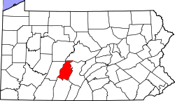
Cross Keys is an unincorporated community and census-designated place (CDP) in Blair County, Pennsylvania, United States. It was first listed as a CDP prior to the 2020 census. [2]


