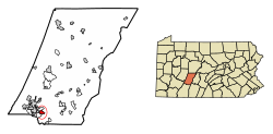
Geistown, Pennsylvania | |
---|---|
Borough | |
Coordinates: 40°17′40″N78°52′26″W / 40.29444°N 78.87389°W | |
Country | United States |
State | Pennsylvania |
County | Cambria |
Settled | 1812 |
Incorporated | 1930 |
Government | |
• Type | Borough council |
Area | |
• Total | 1.07 sq mi (2.77 km2) |
• Land | 1.07 sq mi (2.77 km2) |
• Water | 0.00 sq mi (0.00 km2) |
Elevation | 1,857 ft (566 m) |
Population | |
• Total | 2,363 |
• Density | 2,208.41/sq mi (852.88/km2) |
Time zone | UTC-5 (Eastern (EST)) |
• Summer (DST) | UTC-4 (EDT) |
Area code | 814 |
FIPS code | 42-28720 |
GNIS feature ID | 1215023 [2] |
Website | www |
Geistown is a borough in Cambria County, Pennsylvania, United States. It is part of the Johnstown, Pennsylvania Metropolitan Statistical Area. The population was 2,467 at the 2010 census. [4]
Geistown is located in southwestern Cambria County at 40°17′40″N78°52′26″W / 40.29444°N 78.87389°W (40.294325, -78.873968). [5] Downtown Johnstown is 4 miles (6 km) to the northwest.
According to the United States Census Bureau, the borough has a total area of 1.0 square mile (2.7 km2), all land. [4]
Census | Pop. | Note | %± |
---|---|---|---|
1930 | 871 | — | |
1940 | 1,037 | 19.1% | |
1950 | 2,148 | 107.1% | |
1960 | 3,186 | 48.3% | |
1970 | 3,633 | 14.0% | |
1980 | 3,304 | −9.1% | |
1990 | 2,749 | −16.8% | |
2000 | 2,555 | −7.1% | |
2010 | 2,467 | −3.4% | |
2020 | 2,363 | −4.2% | |
Sources: [6] [7] [8] [3] |
As of the census [7] of 2000, there were 2,555 people, 1,105 households, and 749 families residing in the borough. The population density was 2,364.1 people per square mile (912.8 people/km2). There were 1,160 housing units at an average density of 1,073.3 per square mile (414.4/km2). The racial makeup of the borough was 97.69% White, 0.39% African American, 0.04% Native American, 1.37% Asian, 0.04% from other races, and 0.47% from two or more races. Hispanic or Latino of any race were 0.31% of the population.
There were 1,105 households, out of which 25.2% had children under the age of 18 living with them, 57.4% were married couples living together, 7.9% had a female householder with no husband present, and 32.2% were non-families. 29.7% of all households were made up of individuals, and 15.0% had someone living alone who was 65 years of age or older. The average household size was 2.30 and the average family size was 2.85.
In the borough the population was spread out, with 21.1% under the age of 18, 5.8% from 18 to 24, 24.1% from 25 to 44, 26.2% from 45 to 64, and 22.8% who were 65 years of age or older. The median age was 44 years. For every 100 females there were 87.0 males. For every 100 females age 18 and over, there were 84.5 males.
The median income for a household in the borough was $33,646, and the median income for a family was $47,049. Males had a median income of $32,478 versus $22,134 for females. The per capita income for the borough was $21,002. About 4.0% of families and 6.5% of the population were below the poverty line, including 5.3% of those under age 18 and 8.6% of those age 65 or over.
Brownstown is a borough in Cambria County, Pennsylvania, United States. The population was 744 at the 2010 census. It is part of the Johnstown, Pennsylvania Metropolitan Statistical Area and also part of Johnstown's urban area.
Belmont is an unincorporated community and census-designated place (CDP) in Cambria County, Pennsylvania, United States. The population was 2,784 at the 2010 census.
Blacklick Township is a township in Cambria County, Pennsylvania, United States. The population was 1,880 at the 2020 census. It is part of the Johnstown, Pennsylvania Metropolitan Statistical Area.
Cambria Township is a township in Cambria County, Pennsylvania, United States. The population was 5,781 at the 2020 census. It is part of the Johnstown, Pennsylvania Metropolitan Statistical Area and geographically surrounds the borough of Ebensburg, the Cambria County seat.
Carrolltown is a borough in Cambria County, Pennsylvania, United States. The population was 853 at the 2010 census, down from 1,049 at the 2000 census. It is part of the Johnstown, Pennsylvania Metropolitan Statistical Area.
Conemaugh Township is a township in Cambria County, Pennsylvania, United States. The population was 1,943 at the 2020 census. It is part of the Johnstown, Pennsylvania Metropolitan Statistical Area.
Daisytown is a borough in Cambria County, Pennsylvania, United States. The population was 326 at the 2010 census.
Dale is a borough in Cambria County, Pennsylvania, United States. It is part of the Johnstown, Pennsylvania Metropolitan Statistical Area. The population was 1,234 at the 2010 census, down from 1,503 at the 2000 census.
East Conemaugh is a borough in Cambria County, Pennsylvania, United States. It is part of the Johnstown, Pennsylvania Metropolitan Statistical Area. The population was 1,220 at the 2010 census.
Elder Township is a township in Cambria County, Pennsylvania, United States, about 24 miles (39 km) northwest of Altoona. As of the 2010 census, the township had a population of 1,038. It is part of the Johnstown, Pennsylvania Metropolitan Statistical Area.
Ferndale is a borough in Cambria County, Pennsylvania, United States. It is part of the Johnstown, Pennsylvania Metropolitan Statistical Area. The population was 1,636 at the 2010 census, down from 1,834 at the 2000 census.
Lorain is a borough in Cambria County, Pennsylvania, United States. It is part of the Johnstown, Pennsylvania Metropolitan Statistical Area. The population was 759 at the 2010 census.
Loretto is a borough in Cambria County, Pennsylvania, United States. As of the 2010 census it had a population of 1,302. Like the rest of Cambria County, it is part of the Johnstown, Pennsylvania, Metropolitan Statistical Area. Loretto is the home of Saint Francis University.
Richland Township is a township in Cambria County, Pennsylvania, United States. The population was 12,814 at the 2010 census. It is part of the Johnstown, Pennsylvania Metropolitan Statistical Area.
Sankertown is a borough in Cambria County, Pennsylvania, United States. It is part of the Johnstown, Pennsylvania Metropolitan Statistical Area. The population was 675 at the 2010 census.
South Fork is a borough in Cambria County, Pennsylvania, United States. It is part of the Johnstown, Pennsylvania Metropolitan Statistical Area. The population was 928 at the 2010 census, down from 1,138 at the 2000 census.
Southmont is a borough in Cambria County, Pennsylvania, United States. It is part of the Johnstown, Pennsylvania Metropolitan Statistical Area. The population was 2,284 at the 2010 census. It was incorporated in 1919 out of Upper Yoder Township.
Stonycreek Township is a township in Cambria County, Pennsylvania, United States. The population was 2,844 at the 2010 census, down from 3,204 at the 2000 census. It is part of the Johnstown, Pennsylvania Metropolitan Statistical Area.
Upper Yoder Township is a township in Cambria County, Pennsylvania, United States. The population was 5,449 at the 2010 census. It is part of the Johnstown, Pennsylvania Metropolitan Statistical Area.
Franklin is a borough in Cambria County, Pennsylvania, United States. It is part of the Johnstown, Pennsylvania Metropolitan Statistical Area. At the 2010 census the borough population was 323, down from 442 at the 2000 census.