Adventurers' Land

Last updated

Adventurers' Land
Site of Special Scientific Interest
Adventurers' Land 2.jpg
Location Cambridgeshire
Grid reference TF 361 019 [1]
InterestGeological
Area10.1 hectares [1]
Notification 1989 [1]
Location map Magic Map

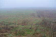
Adventurers' Land is a 10.1-hectare (25-acre) geological Site of Special Scientific Interest (SSSI) north of March in Cambridgeshire. [1] [2] It is a Geological Conservation Review site. [3]

The site is described by Natural England as important for the study of changes in Holocene sea levels. There are five peat levels dating to between 6,400 and 1,850 years BP, and the earliest represents the oldest directly dated transgression of the sea into the Fens. Part of the site is also in the Nene Washes biological SSSI. [4]

A public footpath along the north bank of the River Nene from Guyhirn goes through the site, which has been filled in and no geology is visible.

Related Research Articles

<span class="mw-page-title-main">Nene Washes</span>

Nene Washes is a 1,522-hectare (3,760-acre) biological Site of Special Scientific Interest on the bank of the River Nene east of Peterborough in Cambridgeshire. It is also a Ramsar internationally important wetland site, a Special Area of Conservation, a Special Protection Area and a Nature Conservation Review site. An area of 280 hectares is managed by the Royal Society for the Protection of Birds. The total area of the Ramsar site is 1,517 hectares.

<span class="mw-page-title-main">Deben Estuary</span>

Deben Estuary is a 981.1-hectare (2,424-acre) biological Site of Special Scientific Interest (SSSI) covering the River Deben and its banks 12 kilometres from its mouth north of Felixstowe to Woodbridge in Suffolk. It is a Ramsar internationally important wetland site and a Special Protection Area under the European Union Directive on the Conservation of Wild Birds. It is also in the Suffolk Coast and Heaths Area of Outstanding Natural Beauty. It partly overlaps two geological SSSIs, Ferry Cliff, Sutton and Ramsholt Cliff.

<span class="mw-page-title-main">Roswell Pits</span>

Roswell Pits is an 8 hectare nature reserve on the eastern outskirts of Ely in Cambridgeshire. It is managed by the Environment Agency. It is part of the Ely Pits and Meadows Site of Special Scientific Interest (SSSI)) and Geological Conservation Review site. The SSSI designation for both biological and geological interest. The site was formerly managed by the Wildlife Trust for Bedfordshire, Cambridgeshire and Northamptonshire.

<span class="mw-page-title-main">West Hoathly SSSI</span>

West Hoathly SSSI is a 0.7-hectare (1.7-acre) geological Site of Special Scientific Interest in Sharpthorne in West Sussex. It is a Geological Conservation Review site.

<span class="mw-page-title-main">Biddenham Pit</span>

Biddenham Pit is a gravel pit and Site of Special Scientific Interest (SSSI), 0.41 hectares in size located in Biddenham, Bedfordshire. The pit was notified to Bedford Borough Council and Bedfordshire County Council under the Wildlife and Countryside Act (1981) in 1988, and is also a Geological Conservation Review site. The site is owned by Persimmon Homes and Kier Homes, with management advice given by Natural England.

Harefield Pit is a 1.8-hectare geological Site of Special Scientific Interest in Harefield in the London Borough of Hillingdon. It occupies much of a partially filled-in chalk quarry. It has two entries in the Geological Conservation Review database.

<span class="mw-page-title-main">Bierton Clay Pit</span>

Bierton Clay Pit is a 0.07-hectare (0.17-acre) geological Site of Special Scientific Interest in Bierton in Buckinghamshire. It is listed by the Joint Nature Conservation Committee as a Geological Conservation Review site.

<span class="mw-page-title-main">Stone SSSI, Buckinghamshire</span>

Stone SSSI is a 0.12-hectare (0.30-acre) geological Site of Special Scientific Interest in Stone in Buckinghamshire. It is listed by the Joint Nature Conservation Committee as a Geological Conservation Review site.

<span class="mw-page-title-main">South Lodge Pit</span>

South Lodge Pit is a 0.5-hectare (1.2-acre) geological Site of Special Scientific Interest in Taplow in Buckinghamshire. It is a Geological Conservation Review site.

<span class="mw-page-title-main">Ardleigh Gravel Pit</span> Site in Essex, UK

Ardleigh Gravel Pit is a 1.2-hectare (3.0-acre) geological Site of Special Scientific Interest south of Ardleigh in Essex. It is a Geological Conservation Review site.

<span class="mw-page-title-main">River Ter SSSI</span>

The River Ter SSSI is a stretch of the River Ter and its banks south of Great Leighs in Essex which has been designated a geological Site of Special Scientific Interest. It is a Geological Conservation Review site.

<span class="mw-page-title-main">Upware South Pit</span>

Upware South Pit is a 1.1-hectare (2.7-acre) geological Site of Special Scientific Interest (SSSI) north of Upware in Cambridgeshire. It is a Geological Conservation Review site.

<span class="mw-page-title-main">Shippea Hill SSSI</span>

Shippea Hill SSSI is a 27.6-hectare (68-acre) geological Site of Special Scientific Interest east of Ely in Cambridgeshire, England. It is a Geological Conservation Review site.

<span class="mw-page-title-main">One Barrow Plantation</span>

One Barrow Plantation is a 1.8 hectares geological Site of Special Scientific Interest (SSSI) south-west of Shepshed in Leicestershire. It is a Geological Conservation Review site. Part of the site is in the Blackbrook Reservoir biological SSSI.

<span class="mw-page-title-main">Bawsey SSSI</span> Geological Site of Special Scientific Interest east of Kings Lynn in Norfolk

Bawsey is a 2.6-hectare (6.4-acre) geological Site of Special Scientific Interest east of Kings' Lynn in Norfolk. It is a Geological Conservation Review site.

<span class="mw-page-title-main">Wiggenhall St Germans SSSI</span>

Wiggenhall St Germans SSSI is a 5.2-hectare (13-acre) geological Site of Special Scientific Interest south of King's Lynn in Norfolk. It is a Geological Conservation Review site.

<span class="mw-page-title-main">Setchey SSSI</span>

Setchey SSSI is a 33.4-hectare (83-acre) geological Site of Special Scientific Interest south of King's Lynn in Norfolk. It is a Geological Conservation Review site.

<span class="mw-page-title-main">Stanford Training Area SSSI</span> British Army training and nature conservation site

Stanford Training Area SSSI is part of the British Army Stanford Training Area. It is a 4,678-hectare (11,560-acre) biological and geological Site of Special Scientific Interest north of Thetford in Norfolk. It is a Nature Conservation Review site and part of it is a Geological Conservation Review site. It is also part of the Breckland Special Area of Conservation and Special Protection Area.

<span class="mw-page-title-main">Wretton SSSI</span>

Wretton SSSI is a 20.6-hectare (51-acre) geological Site of Special Scientific Interest north-east of Downham Market in Norfolk. It is a Geological Conservation Review site.

References

  1. 1 2 3 4 "Designated Sites View: Adventurers' Land". Sites of Special Scientific Interest. Natural England. Retrieved 25 November 2016.
  2. "Map of Adventurers' Land". Sites of Special Scientific Interest. Natural England. Retrieved 25 November 2016.
  3. "Adventurers' Land (Quaternary of East Anglia)". Joint Nature Conservation Committee. Retrieved 4 December 2016.
  4. "Adventurers' Land citation" (PDF). Sites of Special Scientific Interest. Natural England. Archived from the original (PDF) on 4 March 2016. Retrieved 25 November 2016.

Coordinates: 52°35′53″N0°00′29″E / 52.598°N 0.008°E / 52.598; 0.008