The Tian Shan, also known as the Tengri Tagh or Tengir-Too, meaning the Mountains of Heaven or the Heavenly Mountain, is a large system of mountain ranges located in Central Asia. The highest peak in the Tian Shan is Jengish Chokusu, at 7,439 metres (24,406 ft) high. Its lowest point is the Turpan Depression, which is 154 m (505 ft) below sea level.

Charyn Canyon is a canyon on the Sharyn River in Kazakhstan. The canyon is roughly 154 kilometres (96 mi) in length. It is part of the Charyn National Park, and is located within the territory of the Uygur District, Raiymbek District and Enbekshikazakh District. Over time, the canyon has gained colorful formations of varying shapes and sizes. Though it is much smaller than the Grand Canyon, it has been described as being equally impressive.

Almaty Region is a region of Kazakhstan, located in the southeastern part of the country, with a population of 2,059,200. Its capital is Taldykorgan city, which has a population of 175,200.

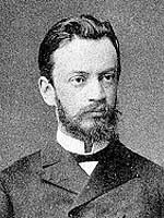
Pyotr Petrovich Semyonov or Semenov was a Russian geographer and statistician who managed the Russian Geographical Society for more than 40 years. He gained international fame for his pioneering exploration of the Tian Shan mountains. He was decreed to change his surname to "Semyonov of Tian Shan" at the age of 79.
Grigory Grum-Grshimailo was a Russian entomologist best known for his expeditions to Central Asia, western Mongolia and Tuva, and the Russian Far East. In literature his name is sometimes spelled as Grigor Efimowitsch Grumm-Grzhimailo or Grigory Yefimovich Grumm-Grzhimaylo.

Talǵar District is a district of Almaty Region in Kazakhstan. The administrative center of the district is the town of Talǵar. It consists of an alluvial apron formed by the Talǵar River, extending northwards from the glacier peaks of the Trans-Ili Alatau, an extension of the northern flanks of the Tien Shan Mountains. Population: 184,834 ; 170,221 ; 132,692.

The Lake Issyk also known as Issyk Lake is a lake in Kazakhstan fed by the Issyk River. It should not be confused with the Issyk-Kul Lake in neighboring Kyrgyzstan.

The Charyn is a river in the Almaty Province of Kazakhstan. It flows through the Charyn National Park and merges into the Ili River, which is considered to be the largest artery of Lake Balkhash. The Charyn is 427 kilometres (265 mi) long, and has a drainage basin of 7,720 square kilometres (2,980 sq mi). It runs through the territory of Kegen and Uighur regions, forming the Charyn Canyon.

The Aksu-Zhabagly Nature Reserve is the oldest nature reserve in Central Asia. It is located in the southern province of the Republic of Kazakhstan. It covers the north-western mountain chains of the Tian Shan. Its name is derived from the biggest river in the area, the Aksu, and the mountain chain Zhabagly which is located in the northern part of the area.

The Kyrgyz Ala-Too also known as Kyrgyz Alatau, Kyrgyz Range, and Alexander Range is a large range in the North Tien-Shan. It stretches for a total length of 454 km from the west-end of Issyk-Kul to the town Taraz in Kazakhstan. It runs in the east-west direction, separating Chuy Valley from Kochkor Valley, Suusamyr Valley, and Talas Valley. Talas Ala-Too Range adjoins the Kyrgyz Ala-Too in vicinity of Töö Ashuu Pass. The western part of Kyrgyz Ala-Too serves as a natural border between Kyrgyzstan and Kazakhstan.

Big Almaty Lake is natural alpine reservoir. It is located in the Trans-Ili Alatau mountains, 15 km south from the center of Almaty in Kazakhstan. The lake is 2511 meters above sea level.

Charyn National Park officially, Charyn Canyon National Nature Park is a national park in Kazakhstan, stretching along the Charyn River, including Charyn Canyon. The Canyon, with its thinly stratified red sedimentary rock, it is said to resemble the Grand Canyon in the US; it is however smaller - 50 km from end to end. About 125,050 hectares in size, the park occupies portions of Enbekshikazakh District, Raiymbek District, and Uygur District of Almaty Region. It is about 200 km east of the city of Almaty. The park was established in 2004 to protect the geological attractions of the canyon, the ecological fragility of the river and desert system, and surrounding archaeological sites; portions are also set aside for recreation.

Zhongar-Alatau National Park, also Jungar Alatau, or Dzungurian Alatau, was created in 2010 to protect the unique ecology of the Dzungarian Alatau, an isolated, glaciated mountain range in Kazakhstan, on the southeastern border with China. One stated reason for creating the park is to protect forests of wild fruit trees, including apricots, barberry, cherries, and currants. Approximately 1% of the land area of the park is forested with Sievers Apple trees, which are the progenitors of all cultured apple varieties in the world. The park is 300 km long (west-to-east), and spreads across Aksu District, Sarkand District and Alakol District of Almaty Region, 300 km northeast of the regional city of Almaty.
Kok Zhailau is a plateau in the territory of the Ile-Alatau State National Natural Park located at an altitude of 2251.2 m. It is located between the Small and Big Almaty gorges, 10 km from the city of Almaty. The track is located 1450-1740 m above sea level. Almati, ski resort Shymbulak, the Medeu, and Big Almaty peak can be seen from the plateau.

The Chilik is a major flowing river in the Almaty Region in the Republic of Kazakhstan, one of the largest left tributaries of the Ili, and the main waterway of southeastern Kazakhstan. The Bartogay reservoir has been created on the river, from where the Great Almaty canal begins.
The waterfall is located in a deep and narrow rock canyon in Kazakhstan, 400 meters from the main gorge. The canyon has a narrow possibility that it is necessary to move along the riverbed. A stream of water escapes from the rock wall at a height of about 20 meters. In terms of its height, water consumption and power, the Big Shymbulak waterfall is comparable to the Medvezhy waterfall in the Turgen gorge. Heavy spring precipitation also helps to increase the power of the waterfall, compared with the summer or autumn period, it is not easy to get close to the waterfall, in a few seconds you get soaked to the skin, and all this thanks to water dust. But if you cross the river, then there is not a large observation deck on the hill, where it is relatively dry. Flowing down, the water dug a deep bath at the bottom of the gorge, up to 2 meters deep. The water in this reservoir is very cold even on the hottest day, as it has a glacial origin. Spruce forests in the gorge are absent throughout its entire length. In the lower belt grows apricot and shrubs, barberry, rose hips, and other Shrubs are very prickly. For multi-day hikes, this is a big minus — the lack of firewood. Shrub vegetation is present on the slopes up to the heights of 2200–2400 m of the confluence with the Maybulak river.
Boguty mountains are also called "Red mountains". They are widely popular among tourists and day trips are made here. The mountains also attract the attention of mountain bikers and Jeepers. The color of these mountains is unusual – from light beige to gray, from light pink to red-brick color. If you move deeper into the Ulken Boguta range, you can see a fascinating picture: on an area of two by two square kilometers, like the colors on an artist's palette, hills of ash, brick, maroon, emerald, purple and fiery red are mixed. It is not only the contrast of colors that surprises, but also the quirkiness of the forms that nature has carefully sculpted.
The Wooden Lake is a reservoir in the Almaty Region of Kazakhstan. The reservoir was formed presumably at the end of the nineteenth century, or at the beginning of the last century. The westernmost branch of the Sharyn river is supported by sand moving from the river, so the trees end up in the water. Hence the name of the lake – "Wooden".
The Aktau Mountains are in the Almaty region of Kazakhstan.