Al-Hadar مدينة الحضر | |
|---|---|
Village | |
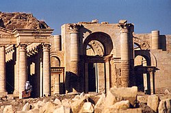 One of the ancient gates of Hatra | |
 Interactive map of Al-Hadar | |
 Al-Hadar Location in Iraq | |
| Coordinates: 35°34′22″N42°43′51″E / 35.572888°N 42.73088°E | |
| Country | |
| Governorate | Nineveh Governorate |
| District | Al-Hadar District |
| District centre | Al-Hadar District |
| Elevation | 145 m (476 ft) |
| Population (2014) | |
• Total | 21,801 |
| Time zone | UTC+03:00 (AST) |
| Country calling code | +964 |
Al-Hadar is an Iraqi city located 80 km southwest of Mosul. It is believed that the city was founded at the beginning of the 2nd century BC. It currently serves as the administrative center of Al-Hadar District in Nineveh Governorate.
Contents
The ancient ruins of Hatra lie 2 km northwest of the modern settlement. The settlement's population and nearby villages greatly shrank by 2012 due to deforestation. [1]

On April 26, 2017, the ruins were recaptured by Iraqi soldiers and PMF militia forces from Islamic State terrorists who had previously captured the area encompassing the ancient city along the course of their illegal occupation of Iraqi territories in early 2014.

