Al-Mazra'a ash-Sharqiya

Last updated

Contents

al-Mazra'a ash-Sharqiya
Arabic transcription(s)
   Arabic المزرعة الشرقيّة
Yabrud266.jpg
Yabrud in front, al-Mazra'a ash-Sharqiya behind
Palestine location map wide.png
Red pog.svg
al-Mazra'a ash-Sharqiya
Location of al-Mazra'a ash-Sharqiya within Palestine
Coordinates: 32°00′12″N35°16′23″E / 32.00333°N 35.27306°E / 32.00333; 35.27306
Palestine grid 175/156
State State of Palestine
Governorate Ramallah and al-Bireh
Government
  Type Municipality
Elevation
[1]
937 m (3,074 ft)
Population
 (2017) [2]
  Total
4,063
Name meaning"The eastern sown land" [3]

al-Mazra'a ash-Sharqiya (Arabic : المزرعة الشرقيّة) is a Palestinian town in the Ramallah and al-Bireh Governorate, located northeast of Ramallah in the northern West Bank. According to the Palestinian Central Bureau of Statistics (PCBS), the town had a population of 4,063 inhabitants in 2017. [2]

Geographic location

The village is one of the towns in the Ramallah and Al-Bireh area, located 13 kilometers (8.1 mi) to the northeast of Ramallah. It sits at about 937 meters above sea level. To the north is Sinjil and Turmus Ayya, to the east is Khirbet Abu Falah and Kafr Malik, to the south is Deir Jarir, to the south and west is Silwad, and to the west is Jilijliya. [1]

History

Al-Mazra'a ash-Sharqiya has been identified as the Crusader village named Mezera, and the possible site of a Crusader church. [4] In 1112, Arnulf, the Latin Patriarch of Jerusalem granted the tithes of Mezera to the abbey of St Mary. [5] In 1154 Mezera was mentioned in Crusader texts together with Tarphin . [6] In 1183 Patriarch Heraclius of Jerusalem settled a dispute regarding the tithes of the village. [7]

Ottoman era

In 1517, the village was included in the Ottoman empire with the rest of Palestine, and in the 1596 tax-records it appeared as Mazra'at Abu Tasa, located in the Nahiya of Jabal Quds of the Liwa of Al-Quds. The population was 29 households, all Muslim. They paid a fixed tax rate of 33.3% on agricultural products, which included wheat, barley, olive trees, vineyards and fruit trees, occasional revenues, goats and beehives; a total of 3,500 akçe. [8] [9]

In 1838 el-Mezra'ah was noted as a Muslim village, part of Beni Murrah district, located north of Jerusalem. [10]

An Ottoman village list of about 1870 showed that “el-Mezraa” had 177 houses and a population of 641, though the population count included men, only. It also noted that it is located south of Turmus Ayya. [11] [12]

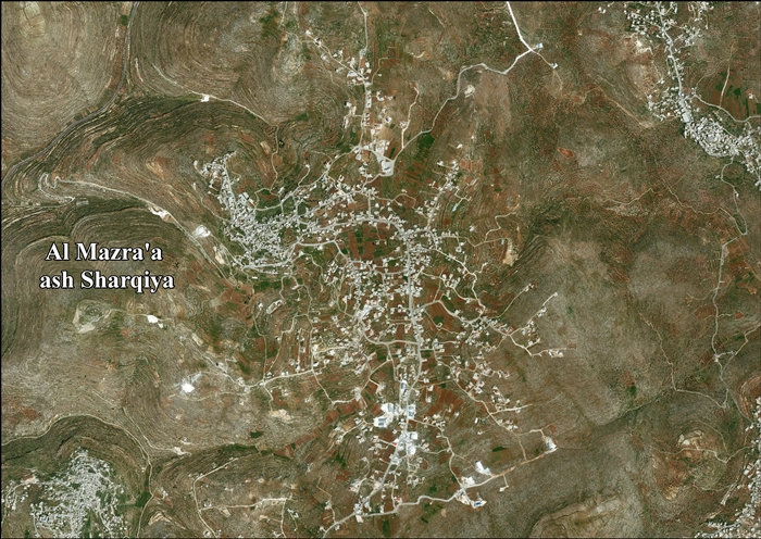
In 1882, the PEF's Survey of Western Palestine described Al-Mazra'a ash-Sharqiya as: "A large village on a hill-top, the hill-sides covered with vineyards; there are also olives and figs. The houses are of stone and adobe." [13]

In 1896 the population of Mezraa, located in the Beni Murra region, was estimated to be about 801 persons. [14]

British Mandate era

In the 1922 census of Palestine, conducted by the British Mandate authorities, al-Mazra'a ash-Sharqiya had a population of 824 Muslims, [15] increasing in the 1931 census to 1,191, still all Muslims, in a total of 247 houses. [16]

In the 1945 statistics the population was 1,400 Muslim, [17] while the total land area was 16,333 dunams, according to an official land and population survey. [18] Of this, 7,082 were allocated for plantations and irrigable land, 3,831 for cereals, [19] while 91 dunams were classified as built-up (urban) areas. [20]

Jordanian era

In the wake of the 1948 Arab–Israeli War, and after the 1949 Armistice Agreements, Al-Mazra'a ash-Sharqiya came under Jordanian rule.

The Jordanian census of 1961 found 1,929 inhabitants here. [21]

Post-1967

Since the Six-Day War in 1967, Al-Mazra'a ash-Sharqiya has been under Israeli occupation.

After the 1995 accords, 10.1% of village land was classified as Area A, 71% as Area B, the remaining 18.9% as Area C. The Israelis have confiscated village land for the construction of Israeli bypass roads, to various Israeli military bases. [22]

The town's many enormous and elaborate mansions have led it to be called the "Miami of the West Bank", according to the BBC. The wealth is not from local sources, but from the Palestinian diaspora. [23] [24]

Footnotes

  1. 1 2 Al Mazra’a ash Sharqiya Town Profile, ARIJ, pp. 4-5
  2. 1 2 Preliminary Results of the Population, Housing and Establishments Census, 2017 (PDF). Palestinian Central Bureau of Statistics (PCBS) (Report). State of Palestine. February 2018. pp. 64–82. Retrieved 2023-10-24.
  3. Palmer, 1881, p. 239
  4. Pringle, 1998, pp. 29-30
  5. Delaborde, 1880, p. 21, No.1; Röhricht, 1893, RRH, pp. 14-15, No. 67; both cited in Pringle, 1998, p. 29
  6. Röhricht, 1887, pp. 213-214; cited in Finkelstein, 1997, p. 582
  7. Delaborde, 1880, pp. 89-90, No. 42; Röhricht, 1893, RRH, p. 167, No. 631; both cited in Pringle, 1998, p. 30
  8. Hütteroth and Abdulfattah, 1977, p. 118
  9. Note that Toledano, 1984, p. 296, did not identify Mazra'at Abu Tasa with Al-Mazra'a ash-Sharqiya, but had it instead located at 35°08′35″E 31°57′15″N. He further noted that the place was not mentioned in the 1525-6 or 1538-1539 registers.
  10. Robinson and Smith, 1841, vol 3, Appendix 2, p. 125
  11. Socin, 1879, p. 157 It was noted in the Beni Murrah district
  12. Hartmann, 1883, p. 115, also noted 177 houses
  13. Conder and Kitchener, 1882, SWP II, p. 292
  14. Schick, 1896, p. 122
  15. Barron, 1923, Table VII, Sub-district of Ramallah, p. 17
  16. Mills, 1932, p. 50.
  17. Government of Palestine, Department of Statistics, 1945, p. 26
  18. Government of Palestine, Department of Statistics. Village Statistics, April, 1945. Quoted in Hadawi, 1970, p. 65
  19. Government of Palestine, Department of Statistics. Village Statistics, April, 1945. Quoted in Hadawi, 1970, p. 112
  20. Government of Palestine, Department of Statistics. Village Statistics, April, 1945. Quoted in Hadawi, 1970, p. 162
  21. Government of Jordan, Department of Statistics, 1964, p. 24
  22. Al Mazra’a ash Sharqiya Town Profile, ARIJ, pp. 19-20
  23. West Bank's own slice of America, 30 July 2007, BBC
  24. "AOL Video - Serving the best video content from AOL and around the web".

Bibliography

Related Research Articles

<span class="mw-page-title-main">Turmus Ayya</span> Palestinian village in Ramallah and al-Bireh Governorate, West Bank

Turmus Ayya is a Palestinian town located in the Ramallah and al-Bireh Governorate in the West Bank, in Palestine. According to the Palestinian Central Bureau of Statistics (PCBS), it had a population of 2,464 in 2017. A large percentage of the residents are Palestinian binationals with US citizenship.

<span class="mw-page-title-main">Rantiya</span> Place in Jaffa, Mandatory Palestine

Rantiya was a Palestinian village, located 16 kilometers east of Jaffa. During the British Mandate in Palestine, in 1945 it had a population of 590 inhabitants.

<span class="mw-page-title-main">Beitunia</span> Municipality type B in Ramallah and al-Bireh, State of Palestine

Beitunia, also Bitunya, is a Palestinian city located 3 kilometers (1.9 mi) west of Ramallah and 14 kilometers (8.7 mi) north of Jerusalem, in the Ramallah and al-Bireh Governorate of Palestine, in the central West Bank. According to the Palestinian Central Bureau of Statistics, the city had a population of 26,604 in 2017, making it the third largest locality in its governorate after al-Bireh and Ramallah.

<span class="mw-page-title-main">Sinjil</span> Palestinian town in Ramallah and al-Bireh Governorate, West Bank

Sinjil is a Palestinian town northeast of Ramallah in the Ramallah and al-Bireh Governorate of the State of Palestine, in the central West Bank.

<span class="mw-page-title-main">Deir Jarir</span> West Bank town in Ramallah and al-Bireh Governorate

Deir Jarir is a Palestinian town in the Ramallah and al-Bireh Governorate of the State of Palestine, in the central West Bank, located twelve kilometers northeast of Ramallah. It is situated on a hilltop overlooking the Jordan Valley at an elevation of 900 metres. According to the Palestinian Central Bureau of Statistics (PCBS), Deir Jarir had a population of 4,469 inhabitants in 2017.

<span class="mw-page-title-main">Abwein</span> Village in the West Bank, State of Palestine

Abwein is a Palestinian village in the Ramallah and al-Bireh Governorate of the State of Palestine, located about 37 kilometers north of Ramallah, in the northern West Bank. According to the Palestinian Central Bureau of Statistics, Abwein's population was 3,496 in 2017.

Ajjul is a Palestinian village in the Ramallah and al-Bireh Governorate in the northern West Bank, located north of Ramallah. There are two archaeological sites or khirbets to the east of the village. One of the khirbets is dedicated to a former resident of Ajjul, Sheikh Abdul. Ajjul is governed by a village council of three members.

<span class="mw-page-title-main">Kafr 'Aqab</span> Municipality type C in East Jerusalem

Kafr 'Aqab is the northernmost Palestinian Arab neighborhood in East Jerusalem. It is part of the area annexed and included in municipal Jerusalem following its occupation by Israel in 1967. This area includes an additional approximate 64 km2 (25 sq mi) of the West Bank, including territory which previously included 28 villages and areas of the Bethlehem and Beit Jala municipalities. Although the Jerusalem Law did not use the term, the Israeli Supreme Court interpreted the law as an effective annexation of East Jerusalem. The United Nations Security Council condemned the attempted change in status to Jerusalem and ruled the law "null and void" in United Nations Security Council Resolution 478.

<span class="mw-page-title-main">Deir Abu Mash'al</span> Municipality type C in Ramallah and al-Bireh, State of Palestine

Deir Abu Mash'al is a Palestinian village in the Ramallah and al-Bireh Governorate of the State of Palestine, located 24 kilometers (15 mi) west of Ramallah in the northern West Bank. According to the Palestinian Central Bureau of Statistics (PCBS), the village had a population of 4,233 inhabitants in 2017.

<span class="mw-page-title-main">Kafr Malik</span> Municipality type C in Ramallah and al-Bireh, State of Palestine

Kafr Malik is a Palestinian town in the Ramallah and al-Bireh Governorate of the State of Palestine, located 17 kilometers Northeast of Ramallah in the northern West Bank. According to the Palestinian Central Bureau of Statistics (PCBS), the town had a population of 2,946 inhabitants in 2017.

<span class="mw-page-title-main">Al-Janiya</span> Municipality type D in Ramallah and al-Bireh, State of Palestine

Al-Janiya is a Palestinian village in the Ramallah and al-Bireh Governorate located 8 kilometers northwest of Ramallah in the northern West Bank. According to the Palestinian Central Bureau of Statistics (PCBS), the village had a population of 1,296 inhabitants by 2017.

<span class="mw-page-title-main">Beit Surik</span> Municipality type D in Jerusalem, State of Palestine

Beit Surik is a Palestinian village in the Jerusalem Governorate, located 12 kilometers Northwest of Jerusalem in the northern West Bank. According to the Palestinian Central Bureau of Statistics, the town had a population of 4,025 in 2017.

<span class="mw-page-title-main">Ein Qiniya</span> Local Development Committee in Ramallah and al-Bireh, State of Palestine

Ein Qiniya or 'Ayn Kiniya is a Palestinian village in the northern West Bank, located 7 kilometers (4.3 mi) northwest of Ramallah and part of the Ramallah and al-Bireh Governorate of the State of Palestine. Ein Qiniya has existed since the Roman-era of rule in Palestine. The village is very small with no public structures or institutions and is governed by a local development committee. Ein Qiniya is regionally notable for being a spring and autumn time picnic resort.

<span class="mw-page-title-main">Beit 'Anan</span> Municipality type C in Jerusalem, State of Palestine

Beit 'Anan is a Palestinian village in the Quds Governorate, located northwest of Jerusalem. In 2017, it had a population of 4,210. Some residents of Beit 'Anan hold Israeli identity cards, while others hold Palestinian identity cards.

<span class="mw-page-title-main">Al-Qubeiba, Jerusalem</span> Municipality type C in Jerusalem, State of Palestine

Al-Qubeiba is a Palestinian town in the Jerusalem Governorate of Palestine, located 2 kilometers northwest of Jerusalem in the central West Bank. According to the Palestinian Central Bureau of Statistics in 2017, the village had a population of 3,876. Al-Qubeiba lies at an altitude of 783m to 795m above sea-level. It is located in a conflict area near the border with Israel between Ramallah and Jerusalem. The settlement of Giv'on HaHadashah lies 5 km southeast of al-Qubeiba. It is surrounded by the town of Biddu (east), Beit 'Anan (northwest), Qatanna (southwest), and Kharayib Umm al-Lahim (west). Unlike the surrounding region, al-Qubeiba has large areas covered with pine and olive trees.

<span class="mw-page-title-main">Ein Siniya</span> Local Development Committee in Ramallah and al-Bireh, State of Palestine

Ein Siniya is a small Palestinian village in the Ramallah and al-Bireh Governorate, 10 kilometers (6.2 mi) north of Ramallah, and approximately 1km northeast from Jifna. It lies in a valley surrounded with olive and fig-terraces.

<span class="mw-page-title-main">Al-Mazra'a al-Qibliya</span> Municipality type C in Ramallah and al-Bireh, State of Palestine

Al-Mazra'a al-Qibliya is a Palestinian village in the Ramallah and al-Bireh Governorate. The village had a population of 5,180 in 2017.

<span class="mw-page-title-main">Al-Ram</span> Municipality type B in Jerusalem, State of Palestine

Al-Ram, also transcribed as Al-Ramm, El-Ram, Er-Ram, and A-Ram, is a Palestinian town which lies northeast of Jerusalem, just outside the city's municipal border. The village is part of the built-up urban area of Jerusalem, the Atarot industrial zone and Beit Hanina lie to the west, and Neve Yaakov borders it on the south, with a built-up area of 3,289 dunums. According to the Palestinian Central Bureau of Statistics, a-Ram had a population of 15,814 in 2017. The head of A-Ram's village council estimates that 58,000 people live there, more than half of them holding Israeli identity cards.

Jibiya is a Palestinian village in the Ramallah and al-Bireh Governorate. It was founded after the 16th century. It is mentioned in text from 1697.

<span class="mw-page-title-main">Jiljilyya</span> Municipality type D in Ramallah and al-Bireh, State of Palestine

Jiljilyya is a Palestinian village in the Ramallah and al-Bireh Governorate in the northern West Bank.