Al-Mazra'a al-Qibliya

Last updated
Al-Mazra'a al-Qibliya
Arabic transcription(s)
   Arabic المزرعه القبليّه
Mazraa7780.JPG
Al-Mazra'a al-Qibliya
Palestine location map wide.png
Red pog.svg
Al-Mazra'a al-Qibliya
Location of Al-Mazra'a al-Qibliya within Palestine
Coordinates: 31°57′13″N35°09′33″E / 31.95361°N 35.15917°E / 31.95361; 35.15917
Palestine grid 164/151
State State of Palestine
Governorate Ramallah and al-Bireh
Government
  Type Municipality
  Head of MunicipalityAbdullah Ladadwa
Area
  Total15,500  dunams (15.5 km2 or 6.0 sq mi)
Population
 (2017) [1]
  Total5,180
  Density330/km2 (870/sq mi)
Name meaningMezeirat el Kibliyeh; the southern sown land [2]
Website www.alzeitona-mun.org

Al-Mazra'a al-Qibliya is a Palestinian village in the Ramallah and al-Bireh Governorate. The village had a population of 5,180 in 2017. [1]

Contents

In 2005 it merged with the village of Abu Shukheidim to form the town of Al-Zaitounah.

History

Pottery sherds from the Byzantine era and the early Ottoman period have been found here. [3] Finkelstein and Lederman argue that Röhricht's identification of the village with the Medieval site of Mezrea, mentioned in a Frankish text related to the area, should be disregarded in light of these findings. [4]

Ottoman era

The village was incorporated into the Ottoman Empire in 1517 with all of Palestine, and in 1596 it appeared in the Ottoman tax registers as Qibliyya, being in the nahiya (subdistrict) of Quds, part of the liwa (district) of Quds. It had a population of 8 households, all Muslims. The villagers paid a fixed tax rate of 33.3% on various agricultural products, including wheat, barley, summer crops, olive trees, goats and/or beehives, in addition to "occasional revenues"; a total of 2,190 akçe. [5] Pottery sherds from the early Ottoman era have also been found here. [3]

In 1838, it was noted as a Muslim village, el-Mezra'ah, in the Bani Harith district, north of Jerusalem. [6]

An Ottoman village list of about 1870 showed that Mezra'a had 111 houses and a population of 428, though the population count included men, only. [7] [8]

In 1882, the PEF's Survey of Western Palestine described Mezeirat el Kibliyeh as: "a good sized village on low ground, among olives". [9]

In 1896 the population of 'Mezraa in Bani Harit was estimated to be about 1,569 persons. [10]

British Mandate

In the 1922 census of Palestine, conducted by the British Mandate of Palestine, there were 492 people living in Al Mizra'a al-Qibliyeh, all Muslims, [11] rising to 799 Muslims in the 1931 census, in a total of 162 houses. [12]

In 1945 statistics the population was 860, all Muslims, [13] while the total land area was 13,240 dunams, according to an official land and population survey. [14] Of this, 6,483 were plantations and irrigable land, 1,847 for cereals, [15] while 34 dunams were classified as built-up areas. [16]

Jordanian era

In the wake of the 1948 Arab–Israeli War, and after the 1949 Armistice Agreements, Al-Mazra'a al-Qibliya came under Jordanian rule.

The Jordanian census of 1961 found 1,349 inhabitants. [17]

Post-1967

Since the Six-Day War in 1967, Al-Mazra'a al-Qibliya has been under Israeli occupation.

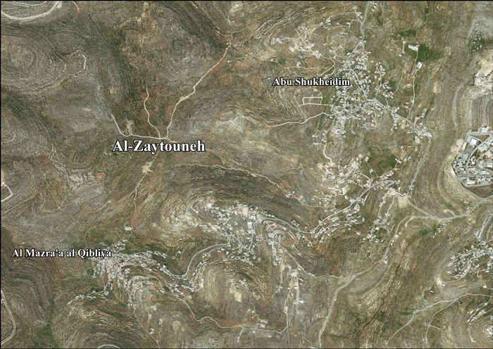
After the 1995 accords, 54.2% of Al-Zaitounah land was defined as Area B, while the remaining 45.8% was defined as Area C. Israel has confiscated 308 dunams of land from Al-Zaitounah in order to construct two Israeli settlements, Talmon and Nahl'iel. [18]

Israeli settlers have started encroaching on Al-Mazra'a al-Qibliya land, especially the hilltop named Khirbet Na’alan. On October 15, 2018, the settlers entered the village in the night and damaged 28 cars, drawing Stars of David on them and writing “Death to the Arabs.” On October 26, 2018, in an altercation between villagers and Israeli settlers, the Israel Border Police, without warning, started shooting the Palestinian villagers. 9 Palestinians were wounded, 2 were killed; Uthman Labawda, 33 years old and the father of 4, and Mohammed Ibrahim Shreitah, the father of 2. [19]

Related Research Articles

<span class="mw-page-title-main">Ein Yabrud</span> Municipality type C in Ramallah and al-Bireh, State of Palestine

Ein Yabrud is a Palestinian town in the Ramallah and al-Bireh Governorate in the central West Bank. It is located approximately 7 km northeast of the city of Ramallah and its elevation is 800 m. According to the Palestinian Central Bureau of Statistics (PCBS) the town had a population of 2,515 in 2017.

<span class="mw-page-title-main">Beitunia</span> Municipality type B in Ramallah and al-Bireh, State of Palestine

Beitunia, also Bitunya, is a Palestinian city located 3 kilometers (1.9 mi) west of Ramallah and 14 kilometers (8.7 mi) north of Jerusalem, in the Ramallah and al-Bireh Governorate of Palestine, in the central West Bank. According to the Palestinian Central Bureau of Statistics, the city had a population of 26,604 in 2017, making it the third largest locality in its governorate after al-Bireh and Ramallah.

<span class="mw-page-title-main">Abwein</span> Village in the West Bank, State of Palestine

Abwein is a Palestinian village in the Ramallah and al-Bireh Governorate of the State of Palestine, located about 37 kilometers north of Ramallah, in the northern West Bank. According to the Palestinian Central Bureau of Statistics, Abwein's population was 3,496 in 2017.

<span class="mw-page-title-main">Dura al-Qar'</span> Municipality type D in Ramallah and al-Bireh, State of Palestine

Dura al-Qar' or Dura al-Qari'a is a Palestinian town in the central West Bank, part of the Ramallah and al-Bireh Governorate. According to the Palestinian Central Bureau of Statistics, Dura al-Qar' had a population of 3,032 inhabitants in 2017.

<span class="mw-page-title-main">Beitillu</span> Municipality type C in Ramallah and al-Bireh, State of Palestine

Beitillu is a Palestinian town located in the Ramallah and al-Bireh Governorate in the northern West Bank, 19 kilometers Northwest of Ramallah. According to the Palestinian Central Bureau of Statistics, it had a population of 3,465 in 2017.

<span class="mw-page-title-main">Abu Qash</span> Municipality type C in Ramallah and al-Bireh, State of Palestine

Abu Qash is a Palestinian village located in the Ramallah and al-Bireh Governorate in the northern West Bank, located north of Ramallah and south of the Birzeit University. According to the 2017 census conducted by the Palestinian Central Bureau of Statistics, it had a population of 2,237.

<span class="mw-page-title-main">Saffa, Ramallah</span> Town in the West Bank, State of Palestine

Saffa is a Palestinian town in the Ramallah and al-Bireh Governorate, located west of Ramallah in the northern West Bank. According to the Palestinian Central Bureau of Statistics (PCBS), the town had a population of 4,374 inhabitants in 2017.

<span class="mw-page-title-main">Deir as-Sudan</span> Municipality type C in Ramallah and al-Bireh, State of Palestine

Deir as-Sudan is a Palestinian town in the Ramallah and al-Bireh Governorate, located 20 kilometers Northwest of Ramallah in the northern West Bank. According to the Palestinian Central Bureau of Statistics (PCBS), the town had a population of approximately 2,159 inhabitants in 2017.

<span class="mw-page-title-main">Al-Mazra'a ash-Sharqiya</span> Municipality type C in Ramallah and al-Bireh, State of Palestine

al-Mazra'a ash-Sharqiya is a Palestinian town in the Ramallah and al-Bireh Governorate, located northeast of Ramallah in the northern West Bank. According to the Palestinian Central Bureau of Statistics (PCBS), the town had a population of 4,063 inhabitants in 2017.

<span class="mw-page-title-main">Kafr Malik</span> Municipality type C in Ramallah and al-Bireh, State of Palestine

Kafr Malik is a Palestinian town in the Ramallah and al-Bireh Governorate of the State of Palestine, located 17 kilometers Northeast of Ramallah in the northern West Bank. According to the Palestinian Central Bureau of Statistics (PCBS), the town had a population of 2,946 inhabitants in 2017.

<span class="mw-page-title-main">Jammala</span> Municipality type C in Ramallah and al-Bireh, State of Palestine

Jammala is a Palestinian town in the Ramallah and al-Bireh Governorate, located 18 kilometers Northwest of Ramallah in the northern West Bank. According to the Palestinian Central Bureau of Statistics (PCBS), the town had a population of 1,664 inhabitants in 2017.

<span class="mw-page-title-main">Deir Ibzi</span> Municipality type C in Ramallah and al-Bireh, State of Palestine

Deir Ibzi is a Palestinian town in the Ramallah and al-Bireh Governorate, located west of Ramallah in the northern West Bank. According to the Palestinian Central Bureau of Statistics, the town had a population of 2,590 inhabitants in 2017.

<span class="mw-page-title-main">Ein 'Arik</span> Municipality type D in Ramallah and al-Bireh, State of Palestine

Ein 'Arik is a Palestinian town in the Ramallah and al-Bireh Governorate, located 7 kilometers west of Ramallah in the northern West Bank.

<span class="mw-page-title-main">Surda</span> Municipality type C in Ramallah and al-Bireh, State of Palestine

Surda is a Palestinian town in the Ramallah and al-Bireh Governorate, located northeast of Ramallah in the northern West Bank. According to the Palestinian Central Bureau of Statistics (PCBS), the town had a population of 1,308 inhabitants in 2017.

<span class="mw-page-title-main">Ein Qiniya</span> Local Development Committee in Ramallah and al-Bireh, State of Palestine

Ein Qiniya or 'Ayn Kiniya is a Palestinian village in the northern West Bank, located 7 kilometers (4.3 mi) northwest of Ramallah and is a part of the Ramallah and al-Bireh Governorate. Ein Qiniya has existed since the Roman-era of rule in Palestine. The village is very small with no public structures or institutions and is governed by a local development committee. Ein Qiniya is regionally notable for being a spring and autumn time picnic resort.

<span class="mw-page-title-main">Burham, Ramallah</span> Local Development Committee in Ramallah and al-Bireh, State of Palestine

Burham is a Palestinian village in the Ramallah and al-Bireh Governorate located twelve kilometers north of Ramallah. The largest nearby town is Bir Zeit located to the southeast. The average elevation of Burham is 680 meters above sea level. The village was established during the Byzantine Empire rule over Palestine.

<span class="mw-page-title-main">Ein Siniya</span> Local Development Committee in Ramallah and al-Bireh, State of Palestine

Ein Siniya is a small Palestinian village in the Ramallah and al-Bireh Governorate, 10 kilometers (6.2 mi) north of Ramallah, and approximately 1km northeast from Jifna. It lies in a valley surrounded with olive and fig-terraces.

<span class="mw-page-title-main">Yabrud, Ramallah</span> Municipality type D in Ramallah and al-Bireh, State of Palestine

Yabrud is a Palestinian village in the Ramallah and al-Bireh Governorate in the central West Bank. It is located approximately 13 km northeast of the city of Ramallah and its elevation is 790 m. According to the Palestinian Central Bureau of Statistics (PCBS) 2017 census, the town had a population of 575.

<span class="mw-page-title-main">Abu Shukheidim</span> Municipality type C in Ramallah and al-Bireh, State of Palestine

Abu Shukheidim was a Palestinian village in the Ramallah and al-Bireh Governorate.

Jibiya is a Palestinian village in the Ramallah and al-Bireh Governorate. It was founded after the 16th century. It is mentioned in text from 1697.

References

  1. 1 2 Preliminary Results of the Population, Housing and Establishments Census, 2017 (PDF). Palestinian Central Bureau of Statistics (PCBS) (Report). State of Palestine. February 2018. pp. 64–82. Retrieved 2023-10-24.
  2. Palmer, 1881, p. 239
  3. 1 2 Finkelstein et al, 1997, p.392
  4. Finkelstein, Israel; Lederman, Zvi; Bunimovitz, Shlomo (1997). Finkelstein, Israel; Lederman, Zvi (eds.). Highlands of Many Cultures. Jerusalem: Institute of Archaeology of Tel Aviv University Publications Section. p. 392. ISBN   965-440-007-3.
  5. Hütteroth and Abdulfattah, 1977, p. 112
  6. Robinson and Smith, 1841, vol 3, 2nd appendix, p. 124
  7. Socin, 1879, p. 158 It was also noted to be in the Beni Harit district
  8. Hartmann, 1883, p. 126, noted 112 houses
  9. Conder and Kitchener, 1882, SWP II, p. 294
  10. Schick, 1896, p. 122
  11. Barron, 1923, Table VII, Sub-district of Ramallah, p. 17
  12. Mills, 1932, p. 50.
  13. Government of Palestine, Department of Statistics, 1945, p. 26
  14. Government of Palestine, Department of Statistics. Village Statistics, April, 1945. Quoted in Hadawi, 1970, p. 65
  15. Government of Palestine, Department of Statistics. Village Statistics, April, 1945. Quoted in Hadawi, 1970, p. 112
  16. Government of Palestine, Department of Statistics. Village Statistics, April, 1945. Quoted in Hadawi, 1970, p. 162
  17. Government of Jordan, 1964, p. 24
  18. AL-Zaytouneh Town Profile, ARIJ, p. 18
  19. Struggle over quiet hill claims lives of two Palestinians, shot by Israeli troops at close range, Gideon Levy, November 29, 2018, Haaretz

Bibliography