Alabama City, Alabama

Last updated

Alabama City
Gadsden
Former City
Wall St & Sansom Ave Gadsden Oct 2014.jpg
Wall St & Sansom Ave, Alabama City, Gadsden, Oct 2014
USA Alabama location map.svg
Red pog.svg
Alabama City
Location within the state of Alabama
Usa edcp location map.svg
Red pog.svg
Alabama City
Alabama City (the United States)
Coordinates: 34°01′20.4″N86°02′43.9″W / 34.022333°N 86.045528°W / 34.022333; -86.045528
Country United States
State Alabama
County Etowah
Elevation
551 ft (168 m)
Time zone UTC-6 (Central Time)
  Summer (DST) UTC-5 (CDT)
ZIP code
35904
Area code 938
GNIS feature ID0112955

Alabama City is a former city and now a neighborhood within the city of Gadsden in Etowah County, Alabama, United States. It was equidistant between Gadsden and Attalla, Alabama, approximately 2 1/2 miles west of downtown Gadsden.

Contents

History

Founded by Captain James Madison Elliott, Jr. (1854-1914), [1] it was incorporated by a special act of the state legislature in 1891. William Gardner was appointed the first mayor and the city was divided into 4 wards, represented by aldermen C.A. Clayton, C.F. Norris, R.V. Wilson and Abihu Christopher. At the time, it consisted of about 3,000 acres (roughly 5 square miles) between Little Wills Creek and Black Creek. A post office was established as well, and it had about 50 residents.

Captain Elliott's ambitious vision for his new city was to see both neighboring Gadsden and Attalla merging into Alabama City, with intentions of becoming the major industrial hub of Northeast Alabama.

In 1895, the city landed its first major factory, a cotton mill built by the Dwight Manufacturing Company of Chicopee, Massachusetts. Its second major factory, the Alabama Steel and Wire Company (later Gulf State Steel), was opened in 1902. Railroad lines also ran through the city, including the Southern Railroad, Nashville, Chattanooga and St. Louis Railroad and Louisville and Nashville Railroads. In 1912, a streetcar line was constructed by Elliott's company.

Inspired by Birmingham's 1910 merger that transformed it into a major city, in 1914, an effort to merge Alabama City into its smaller neighbor of Attalla failed. Its failure was due in part to the efforts of Gadsden leaders and also due to Captain Elliott's objections in that he did not want Attalla to "swallow" his city, but for it to "swallow" Attalla. Elliott died that year.

By 1915, a thriving commercial district had grown up around 7th Avenue, which became known as "Little Wall Street". A major fire in 1927 damaged or destroyed many structures along Wall Street and Meighan Avenue. The city hall and post office were among the casualties. Although the city was still growing and began to rebuild, it never would recover fully from the loss, especially as neighboring Gadsden flourished. The Depression would also compound the damage to the city, causing many businesses to close. Alabama City ultimately voted to merge into Gadsden on July 13, 1932.

Demographics

Alabama City (1900-1930)

Historical population
CensusPop.Note
1900 2,429
1910 4,31377.6%
1920 5,43225.9%
1930 8,54457.3%
U.S. Decennial Census [2]

Alabama City first appeared on the 1900 U.S. Census as an incorporated city. [3] It returned until 1930, before merging into neighboring Gadsden in 1932. It was the 15th largest city in Alabama in 1930. [4]

Historic demographics

Census
Year
Population &
Racial
Majority [lower-alpha 1]
State
Place
Rank
County
Place
Rank
WhiteBlack
1900 [lower-alpha 2] [5] 2,429 (-) [lower-alpha 3] [lower-alpha 4] 28th (-)2nd (-)
1910 [6] 4,313 ↑18th2nd X [lower-alpha 5] 4,256 ↑ 98.7%57 (-) 1.3%
1920 [7] 5,432 ↑16th [lower-alpha 6] 2nd X5,190 ↑ 95.5%242 ↑ 4.5%
1930 [8] 8,54415th2nd X8,071 ↑ 94.5%4735.5%

Alabama City Precinct (1900-1950)

Historical population
CensusPop.Note
1900 2,429
1910 5,663133.1%
1920 7,12125.7%
1930 10,95853.9%
1940 12,58514.8%
1950 17,91542.4%
U.S. Decennial Census [2]

The 29th precinct of Etowah County (1900-1950) also bore the name of Alabama City. Note that both the city and precinct population in 1900 was identical, but the precinct also included areas not within the city limits and reported a larger population figure beginning in 1910. In 1960, [9] the precinct was merged, as part of a larger reorganization of counties, into the census division of Gadsden.

Related Research Articles

<span class="mw-page-title-main">Etowah County, Alabama</span> County in Alabama, United States

Etowah County is a county located in the northeastern part of the U.S. state of Alabama. As of the 2020 census the population was 103,436. Its county seat is Gadsden. Its name is from a Cherokee word meaning "edible tree". In total area, it is the smallest county in Alabama, but one of the most densely populated. Etowah County comprises the Gadsden Metropolitan Statistical Area.

<span class="mw-page-title-main">Altoona, Alabama</span> Town in Alabama, United States

Altoona is a town in Etowah County in the U.S. state of Alabama. It is part of the Gadsden Metropolitan Statistical Area. At the 2020 census, the population was 948.

<span class="mw-page-title-main">Ashland, Alabama</span> City in and county seat of Clay County, Alabama

Ashland is a city in Clay County, Alabama, United States. The population was 2,037 at the 2010 census. The city is the county seat of Clay County.

<span class="mw-page-title-main">Ariton, Alabama</span> Town in Alabama, United States

Ariton is a town in Dale County, Alabama, United States. At the 2020 census, the population was 662. It was incorporated in April 1906. The name is a blend of its two predecessor town names: Ariosto and Charlton.

<span class="mw-page-title-main">Attalla, Alabama</span> City in Alabama, United States

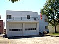
Attalla is a city in Etowah County, Alabama, United States. As of the 2010 census, the population was 6,048.

<span class="mw-page-title-main">Ardmore, Alabama</span> Town in Alabama, United States

Ardmore is a town in Limestone County, Alabama, United States, and is included in the Huntsville-Decatur Metro Area. The population was 1,321 at the 2020 census, It borders its sister city Ardmore, Tennessee.

<span class="mw-page-title-main">Athens, Alabama</span> City in and county seat of Limestone County, Alabama

Athens is a city in and the county seat of Limestone County, in the U.S. state of Alabama; it is included in the Huntsville-Decatur-Albertville, AL Combined Statistical Area. As of the 2020 census, the population of the city is 25,406.

Alma is an unincorporated community in Clarke County, Alabama, United States. The community was named for Alma Flinn, a local teacher.

Antioch is a small unincorporated community in Clarke County, Alabama, United States, located south of Grove Hill along US Highway 43. It has several small churches and a fire department.

Aimwell is an unincorporated community in Marengo County, Alabama, United States. Aimwell had a post office at one time, but it no longer exists.

Asbury is an unincorporated community located on Sand Mountain in eastern Marshall County, Alabama, United States. It is located about nine miles east of the county seat of Guntersville. The community was named after a Methodist church, which was named for one of the first Methodist Episcopal Church bishops, Francis Asbury.

Ai is an unincorporated community in Cleburne County, Alabama, United States.

Active is an unincorporated community in Bibb County, Alabama, United States.

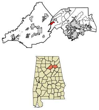
Anderson, also known as Anderson Crossroad or Anderson Crossing, is an unincorporated community in Etowah County, Alabama, United States, located 2 miles (3.2 km) northeast of Gadsden on U.S. Route 411. Although its boundaries aren't explicitly defined, as of 2010, it is located partly within the CDP of Tidmore Bend near the northeastern boundary of the adjacent CDP of Coats Bend.

Hamburg, also known as Hamburgh or Hamburg Station, is an unincorporated community in Perry County, Alabama, United States. A post office operated under the name Hamburg from 1833 to 1941.

Arguta is an unincorporated community in Dale County, Alabama, United States.

Asbury is an unincorporated community in Dale County, Alabama, United States.

Aldridge is an unincorporated community in Walker County, in the U.S. state of Alabama.

<span class="mw-page-title-main">Abbot Springs, Alabama</span> Unincorporated community in Alabama, United States

Abbot Springs is a settlement in Shelby County, Alabama, United States. While the community was once unincorporated, it is now part of eastern Westover. It lies less than 3 miles away from the town of Harpersville. It runs along a branch of Old Highway 280.

Austinville is a former town and now a neighborhood within the city of Decatur in Morgan County, Alabama, United States. It is about 3 miles south from downtown Decatur, centered on the junction of Danville Road and Carridale Street. It was incorporated as a town in 1907 and disincorporated and annexed into the city of Decatur in 1956.

References

Notes

  1. Note about colors: With the exception of Hispanic, Pacific Islander, Other, and 2 or More Races, the colors depicted refer to those historically ascribed to them (White (White/No background); Black (Brown); Native American (Red); Asian (Yellow)) and are there to be easily identified on said chart. No racism or malice of intent is meant to be implied by their usage.
  2. 1st year Alabama City reported on census
  3. (-)Indicates no immediate prior population figure or rank
  4. Racial demographics not reported for places of less than 2,500 on 1900 census.
  5. X Indicates no change in rank
  6. Tied for 16th place with Phenix City

References

  1. https://web.archive.org/web/20140813160528/http://pdfhost.focus.nps.gov/docs/nrhp/text/02000484.pdf National Register of Historic Places application form Section 8, Pages 12-21
  2. 1 2 "Census of Population and Housing". Census.gov. Retrieved June 4, 2016.
  3. United States Census Bureau. Population of States and Territories by Minor Civil Divisions: 1890 and 1900 (PDF) (Report). Retrieved April 25, 2023.
  4. United States Census Bureau. Composition and characteristics of Alabama (PDF) (Report). Retrieved April 25, 2023.
  5. http://www2.census.gov/prod2/decennial/documents/33405927v1ch05.pdf, 1900 AL Census
  6. http://www2.census.gov/prod2/decennial/documents/41033935v1-8ch1.pdf, 1910 AL Census
  7. http://www2.census.gov/prod2/decennial/documents/06229686v1-7ch01.pdf, 1920 AL Census
  8. http://www2.census.gov/prod2/decennial/documents/03815512v1ch02.pdf, 1930 AL Census
  9. "Number of Inhabitants - Alabama" (PDF). Archived (PDF) from the original on May 14, 2023. Retrieved May 28, 2023.

34°01′20.4″N86°02′43.9″W / 34.022333°N 86.045528°W / 34.022333; -86.045528